Stormy Weather Continues for the South
Special Stories
27 Feb 2019 7:40 AM
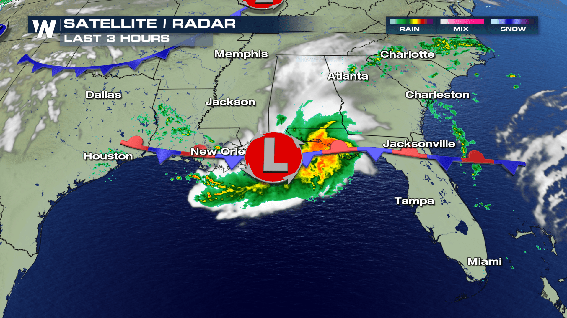
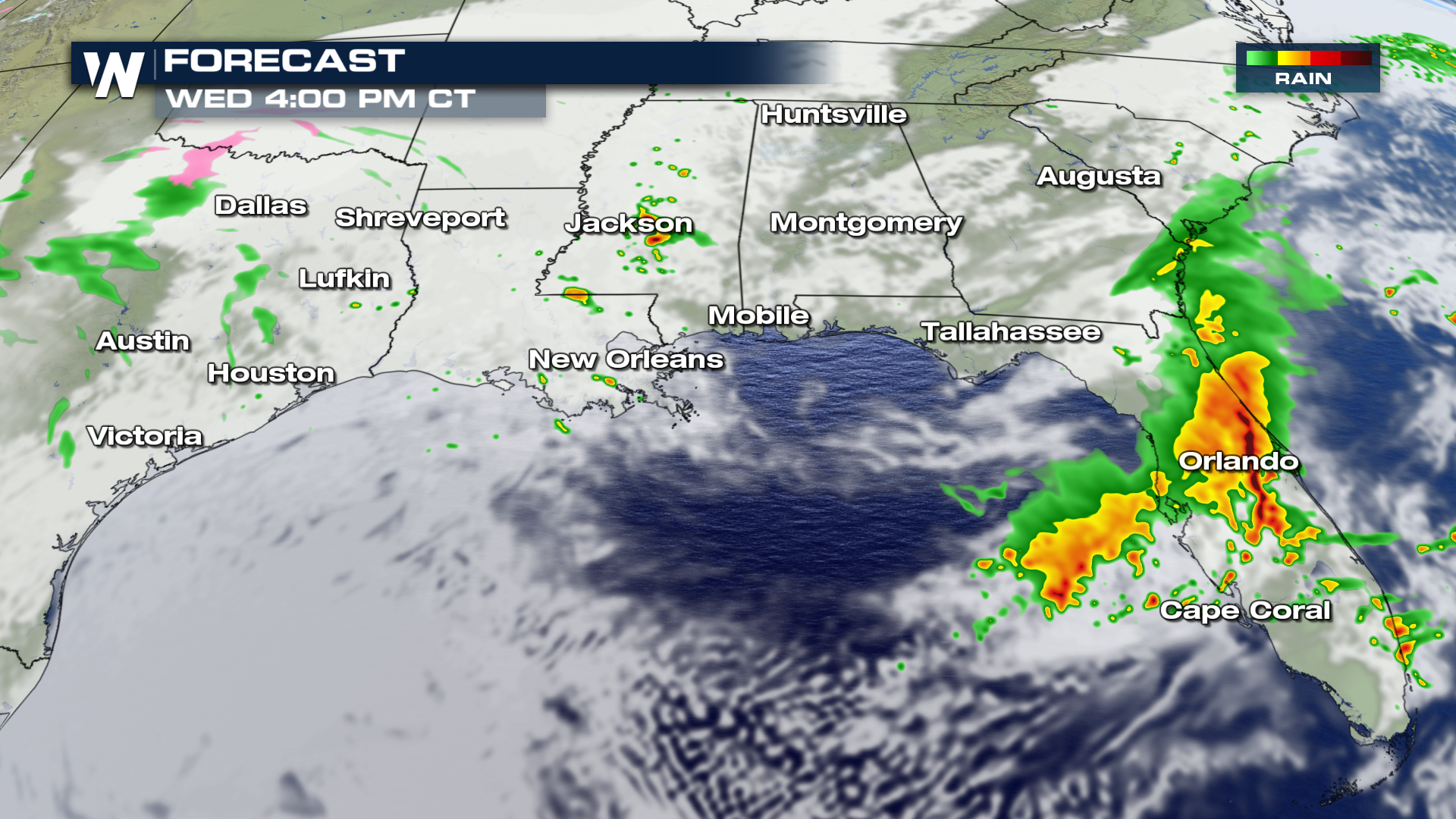
A few waves of energy will continue to impact areas of the southeast through the remainder of the week as moisture plumes into the region. Here is the forecast for Wednesday beginning at 9 AM - 4 PM, as scattered strong storms move from west to east into the evening hours.
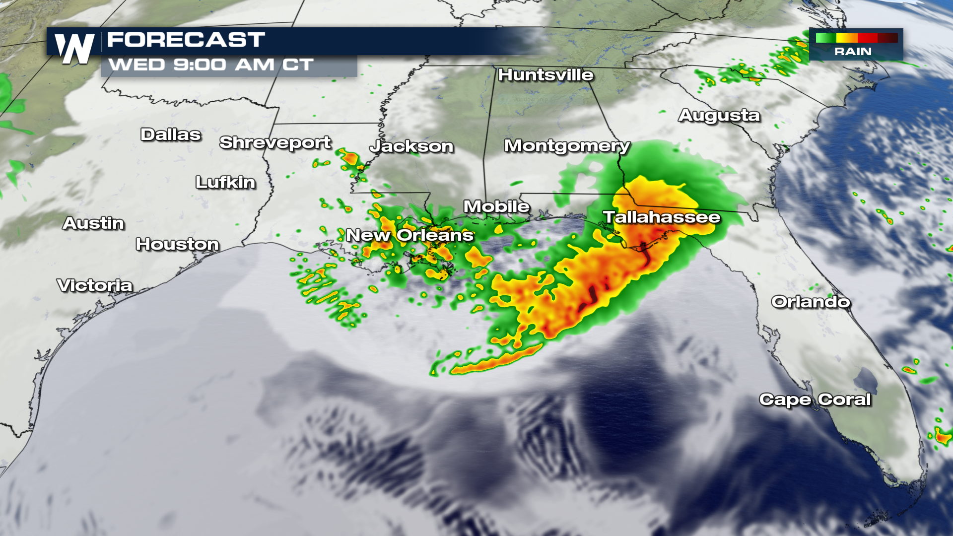
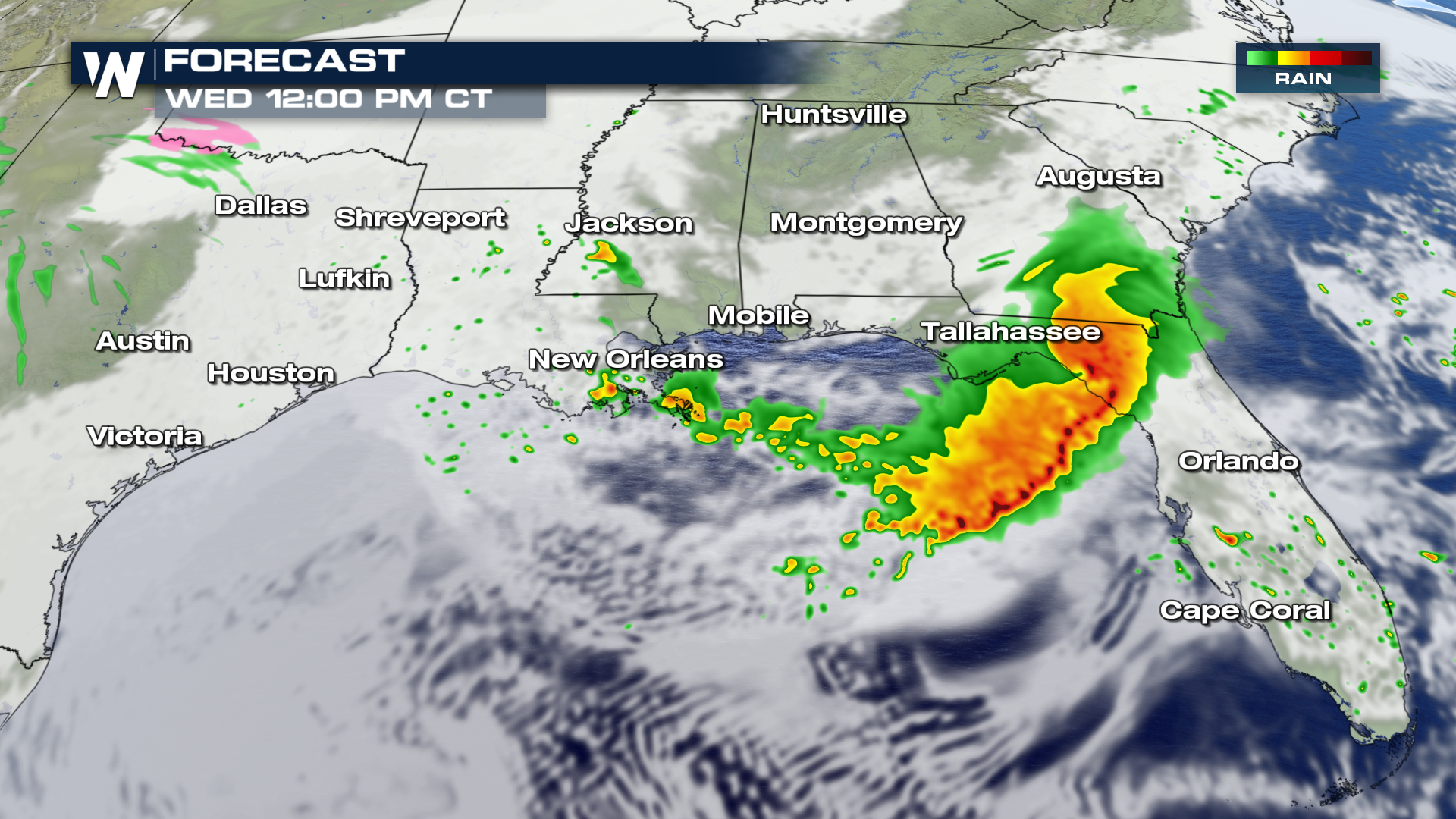
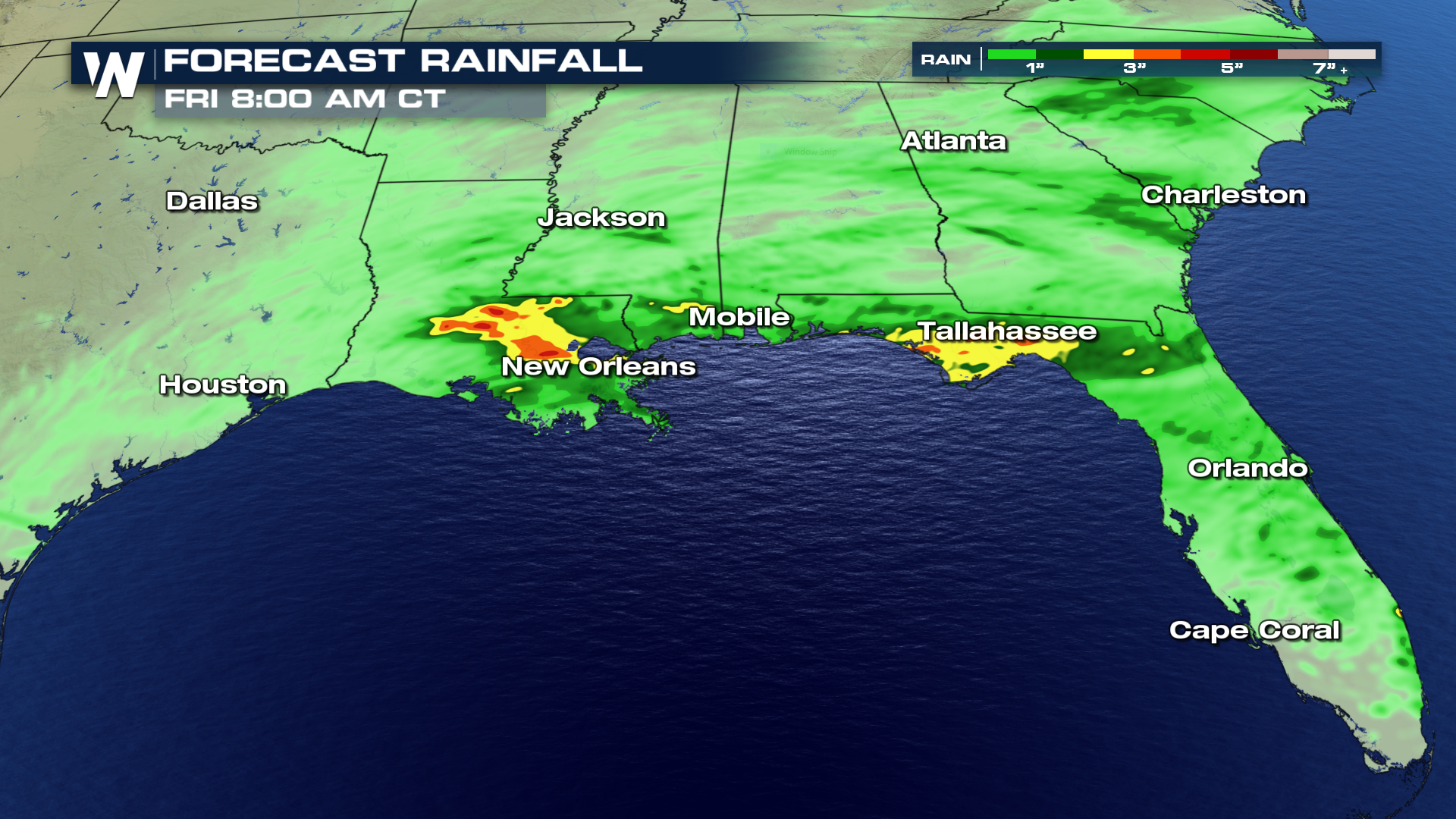
 There are a few areas of expected heavy rainfall, ranging from New Orleans through the Florida panhandle. Forecast models are hinting at 3", possibly up to 5" in the locally heaviest hit areas of rain.
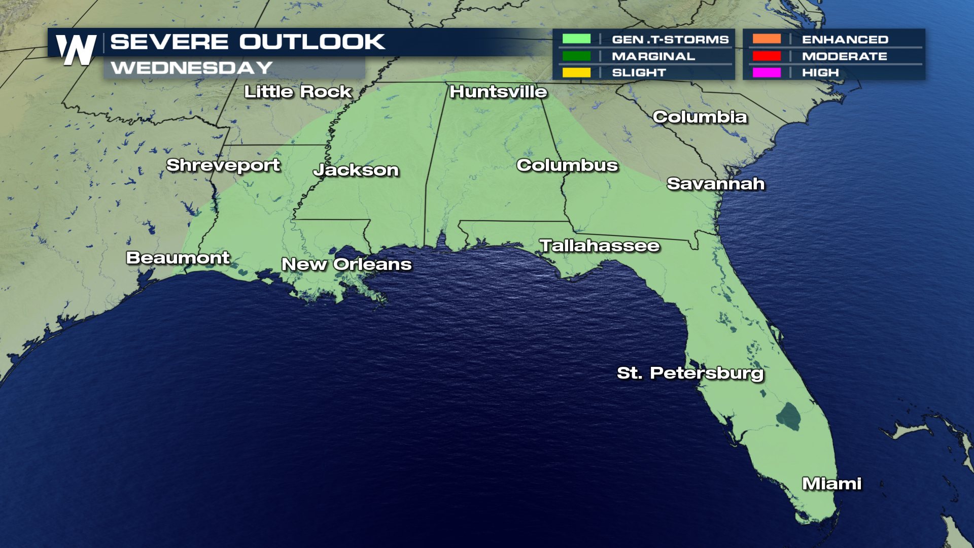
 Below is the forecast through the next 3 days for severe weather. Wednesday will see a chance for general scattered thunderstorms, with nothing expected to go severe.
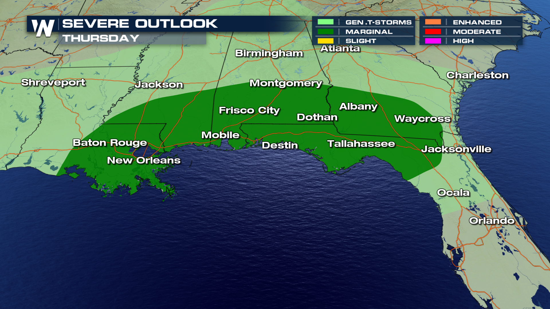
 Thursday will see a marginal threat for severe weather, mainly strong storms with gusty winds.
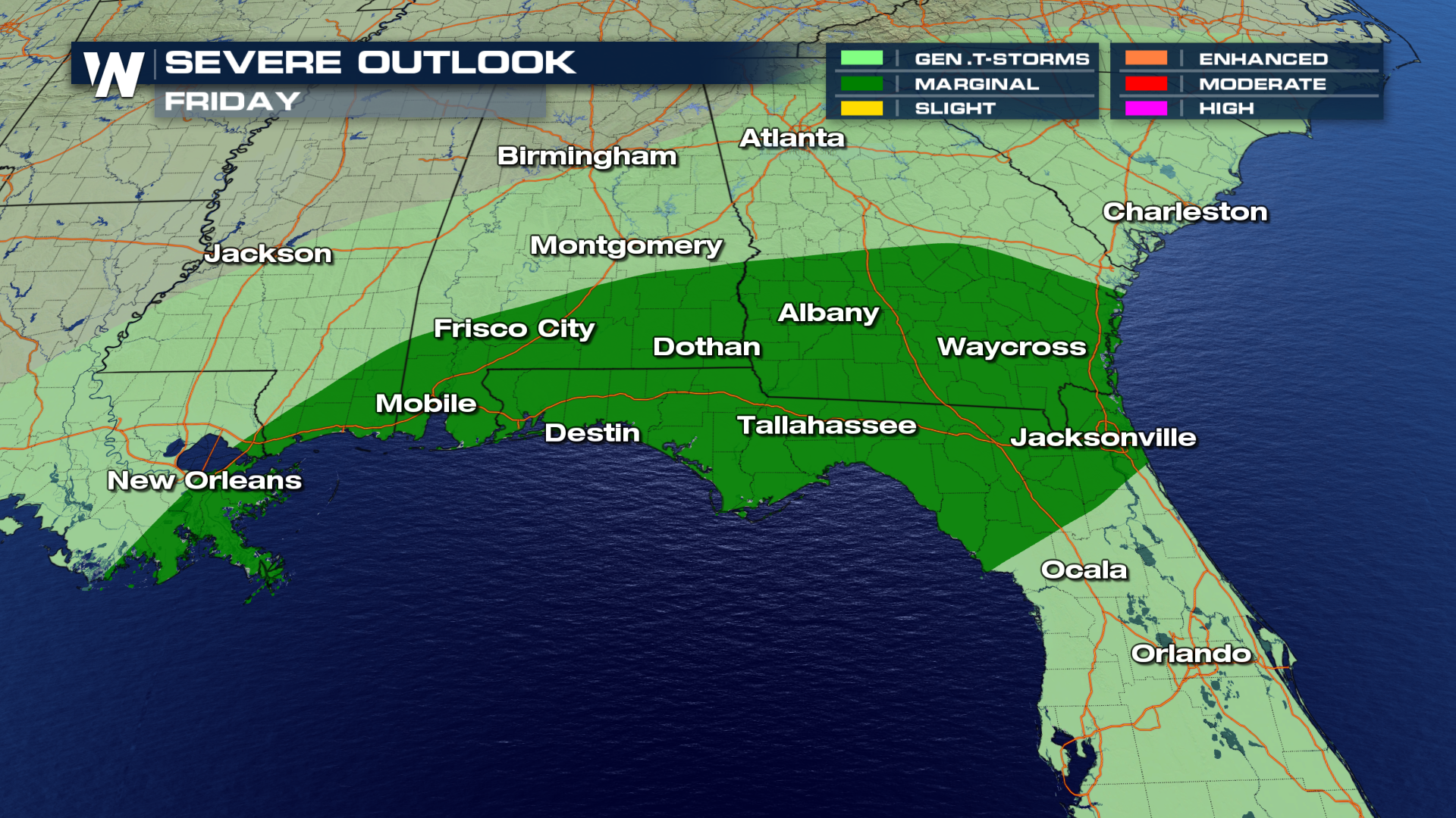
 The marginal threat for severe weather will continue into Friday for the same general area.
 For WeatherNation, I'm Meteorologist Greg Rule
There are a few areas of expected heavy rainfall, ranging from New Orleans through the Florida panhandle. Forecast models are hinting at 3", possibly up to 5" in the locally heaviest hit areas of rain.
Below is the forecast through the next 3 days for severe weather. Wednesday will see a chance for general scattered thunderstorms, with nothing expected to go severe.
Thursday will see a marginal threat for severe weather, mainly strong storms with gusty winds.
The marginal threat for severe weather will continue into Friday for the same general area.
For WeatherNation, I'm Meteorologist Greg Rule
All Weather News
More

Flooding, Severe Storms Target the Midwest Again
After an active week of storms across the nor
1 Aug 2026 1:40 AM


After Reaching Category 5, Genevieve Weakens in the Pacific
PacificFausto is now a post-tropical cyclone.
31 Jul 2026 1:30 AM

Flooding Risk Increases as Heavy Rain Targets the Tri-State Area
Tuesday, heavy rainfall moved across the Nort
30 Jul 2026 12:25 AM

Severe Weather: Energy From the Midwest Now in the Southeast
UPPER MIDWEST - Through Monday, dangerous tor
29 Jul 2026 10:30 PM