More Storms Along the Front Range

Monsoon driven thunderstorms are likely Sunday night and again Monday afternoon across Eastern Colorado, Eastern New Mexico, Kansas, Oklahoma, and Northwest Texas.
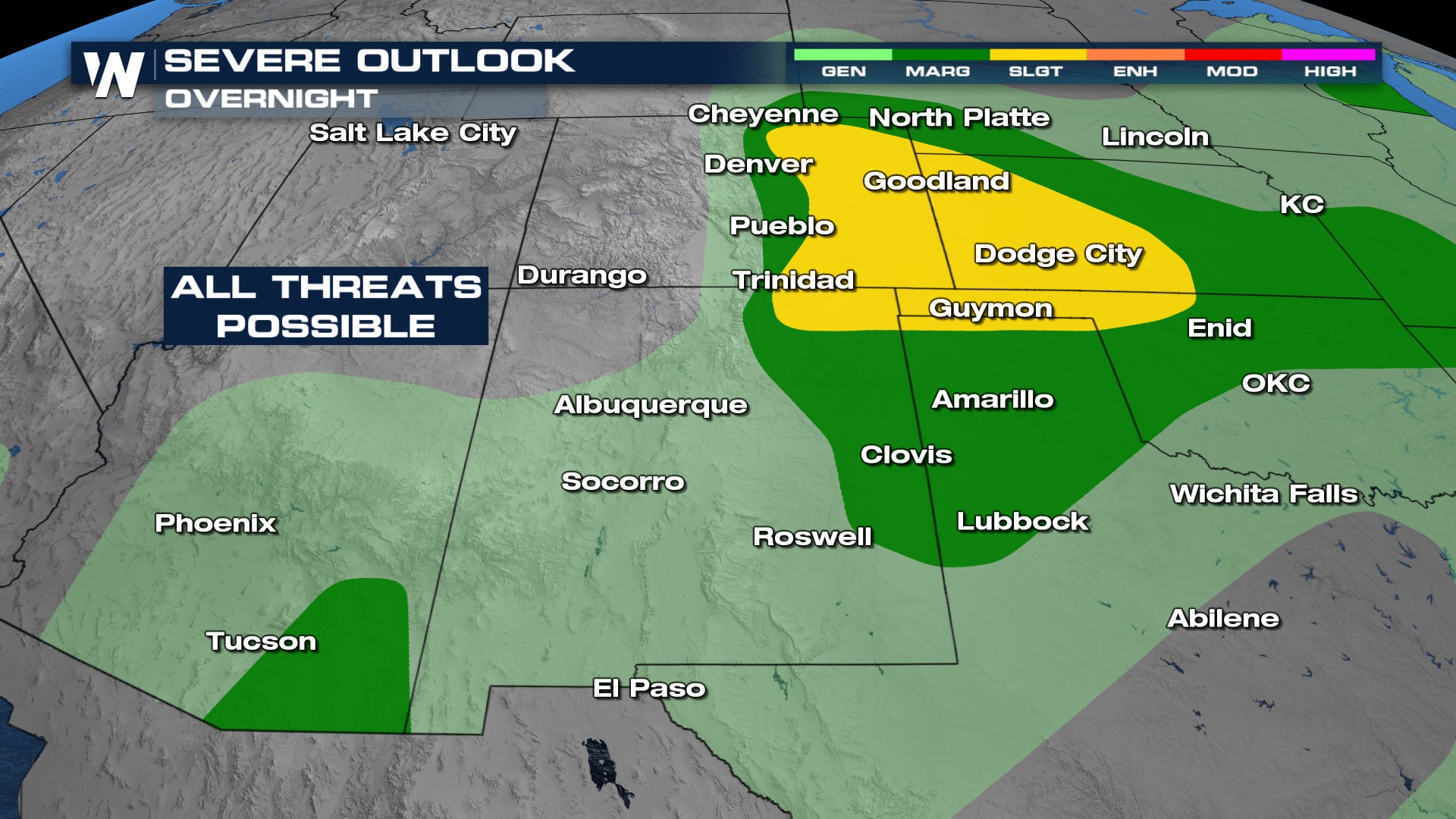
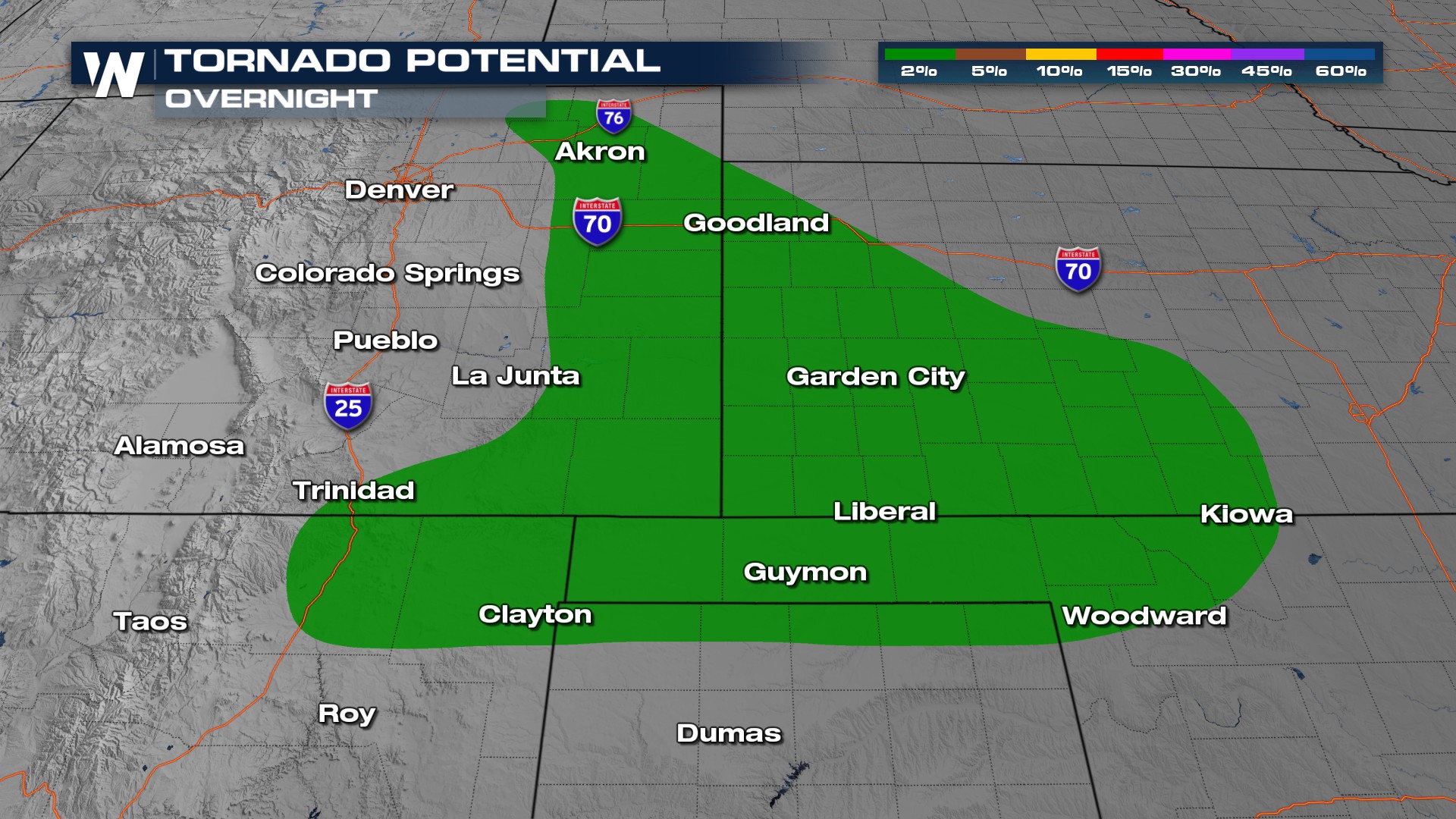
Severe Outlooks
The risk through Sunday night includes large hail and a 2% probability of tornadoes.
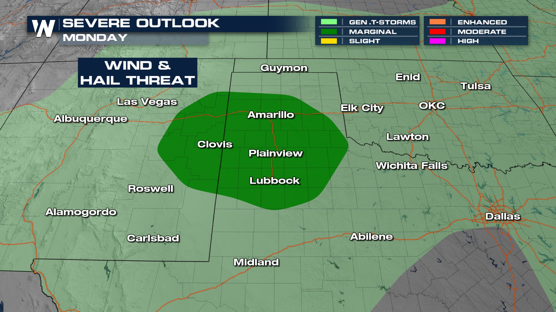
Monday's Severe Weather Risk
Afternoon thunderstorms develop off the Rockies and slide southeast into Northwest Texas. A marginal risk of severe weather is likely.
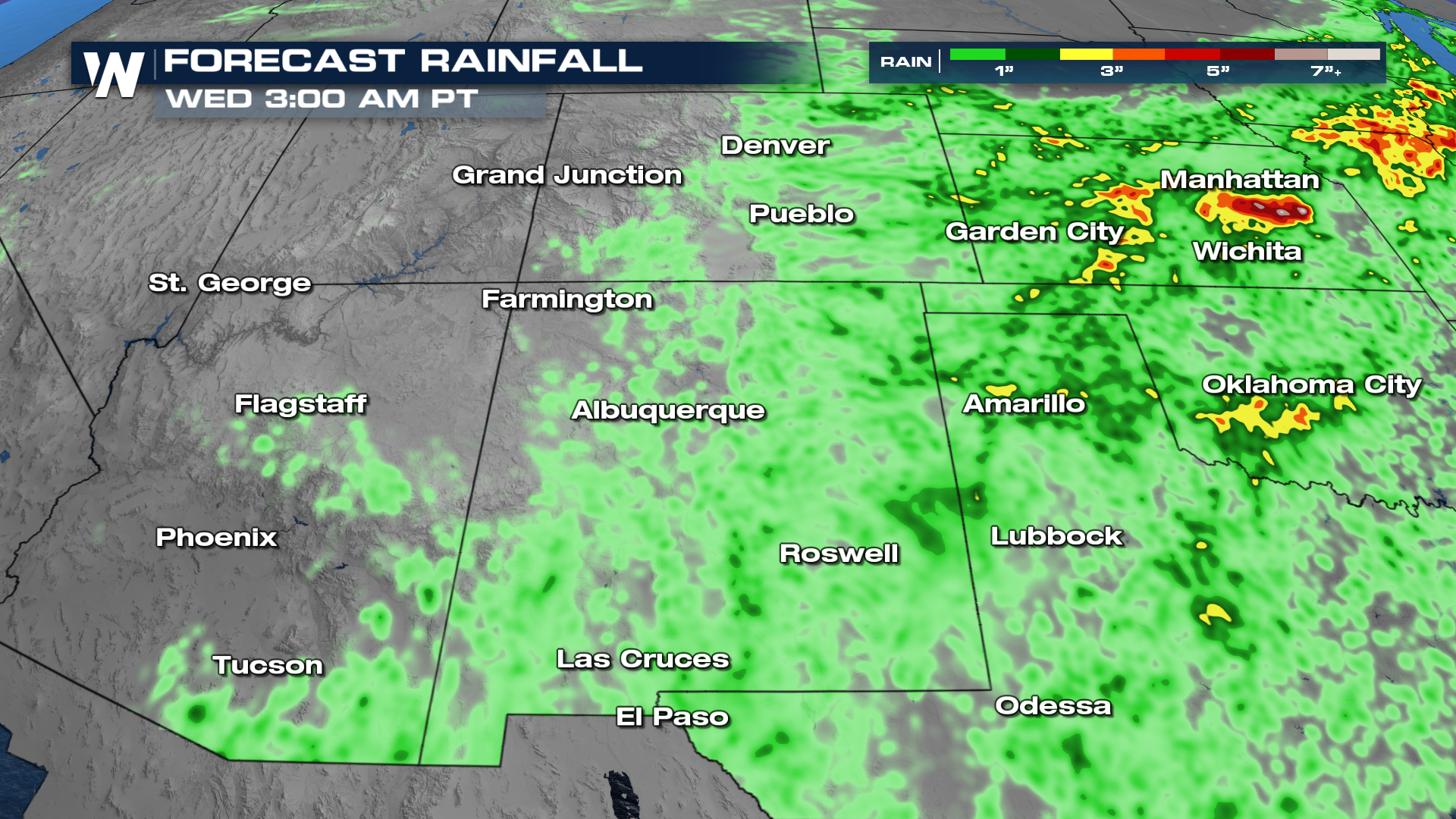
Forecast
Afternoons look active the next few days as storms initiate over the mountains before moving east from the late afternoon through the evening. Storms may persist overnight in the Plains, feeding on warm air and gulf moisture.
Downpours could be heavy enough to create flash flooding from Arizona to Kansas. Avoid low lying areas if a flash flood warning is issued for your area, or seek higher ground if you're in a flood prone location.