Study Looks at Landslides Created by Hurricane Maria
Special Stories
18 Mar 2019 9:01 AM
[The Geological Society of America] Hurricane Maria hit the island of Puerto Rico on September 20, 2017 and triggered more than 40,000 landslides in at least three-fourths of Puerto Rico's 78 municipalities. In an article from GSA Today, authors Erin Bessette-Kirton and colleagues write that "the number of landslides that occurred during this event was two orders of magnitude greater than those reported from previous hurricanes."
The authors, from the U.S. Geological Survey and the University of Puerto Rico, evaluate the extent and characteristics of Maria-induced landslides throughout Puerto Rico. They present an assessment of island-wide landslide density, which they compare, in conjunction with rainfall data, to tropical cyclone systems that have affected Puerto Rico since 1960. Additionally, they discuss the conditions specific to landsliding in Puerto Rico and examine the impact of environmental variables (e.g., rainfall, soil moisture, and geology) on observed variations in island-wide landsliding.
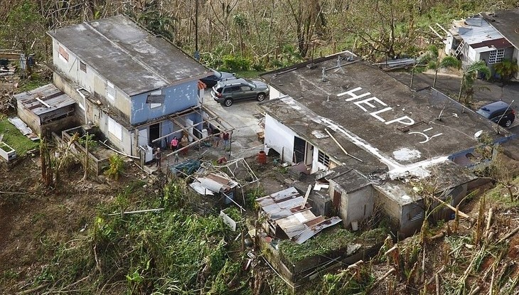
 [Damage in Puerto Rico from Hurricane Maria in September 2017. Image from U.S. Customs and Border Protection]
In their analysis, they show that the average rainfall from Hurricane Maria in mountainous areas was greater than that of any other hurricane or tropical storm in Puerto Rico since 1960.
An important aim of the study, the authors write, is to achieve a better understanding of the factors that cause landslides in Puerto Rico in order to enhance susceptibility analyses and risk management efforts.
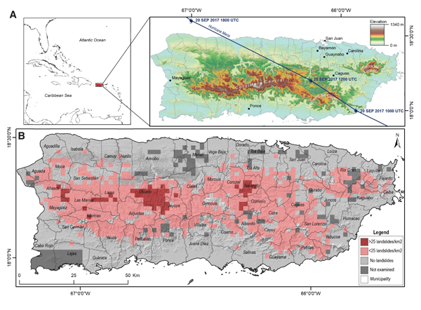
 [(Top)Topographic map of Puerto Rico showing the storm track of Hurricane Maria. (Bottom) Relative density of landslides mapped from the rapid classification of satellite and aerial imagery and site visits following Hurricane Maria]
Edited for WeatherNation by Meteorologist Mace Michaels
 [Damage in Puerto Rico from Hurricane Maria in September 2017. Image from U.S. Customs and Border Protection]
In their analysis, they show that the average rainfall from Hurricane Maria in mountainous areas was greater than that of any other hurricane or tropical storm in Puerto Rico since 1960.
An important aim of the study, the authors write, is to achieve a better understanding of the factors that cause landslides in Puerto Rico in order to enhance susceptibility analyses and risk management efforts.
 [(Top)Topographic map of Puerto Rico showing the storm track of Hurricane Maria. (Bottom) Relative density of landslides mapped from the rapid classification of satellite and aerial imagery and site visits following Hurricane Maria]
Edited for WeatherNation by Meteorologist Mace Michaels
[(Top)Topographic map of Puerto Rico showing the storm track of Hurricane Maria. (Bottom) Relative density of landslides mapped from the rapid classification of satellite and aerial imagery and site visits following Hurricane Maria]
Edited for WeatherNation by Meteorologist Mace MichaelsAll Weather News
More