Study Shows Hurricane Model Forecasts Improved with Hurricane Hunter Data
Special Stories
13 Jul 2022 1:00 AM
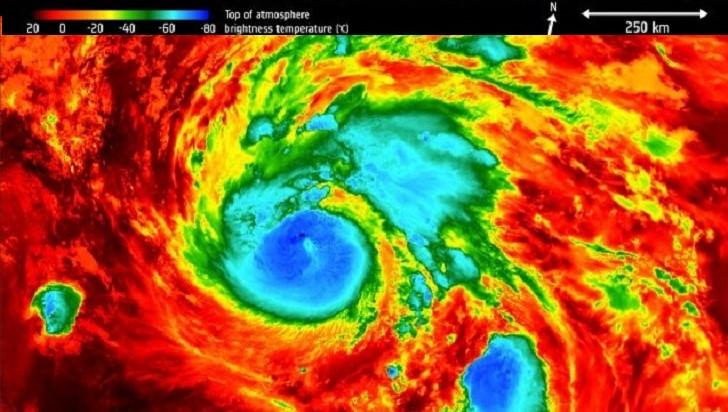
[Written by NOAA Hurricane Research Division] A new report shows data gathered from Hurricane Hunter missions into tropical cyclones substantially improves tropical cyclone track forecasts.
■ Summary:
Ingesting observations from Hurricane Hunter aircraft into computer models is known to improve forecasts of tropical cyclones. Among these observations are those from instruments that are released from the aircraft and report pressure, temperature, humidity, and wind velocity as they fall to the surface (known as dropwindsondes), and instruments aboard the aircraft that report the same data at the plane location.
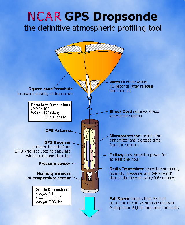
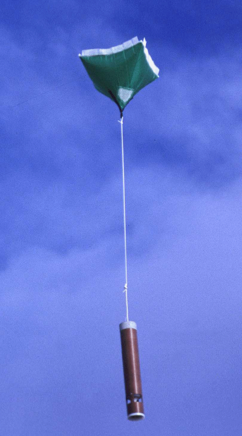 [A dropsonde. From NOAA]
Though all of these observations have been used in NOAA tropical cyclone models in the past, many have never before been used in NOAA’s global model, known as the Global Forecast System. This study reviews the impact of ingesting these additional data on the accuracy of tropical cyclone forecasts. Additional methods to measure forecast accuracy are proposed, since existing methods can be incomplete or even misleading.
[A dropsonde. From NOAA]
Though all of these observations have been used in NOAA tropical cyclone models in the past, many have never before been used in NOAA’s global model, known as the Global Forecast System. This study reviews the impact of ingesting these additional data on the accuracy of tropical cyclone forecasts. Additional methods to measure forecast accuracy are proposed, since existing methods can be incomplete or even misleading.
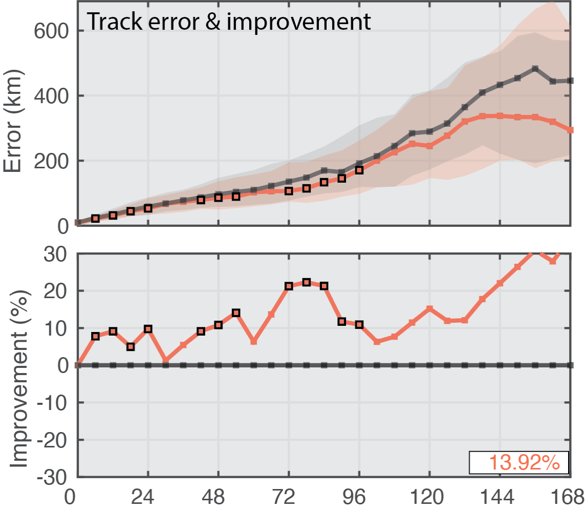
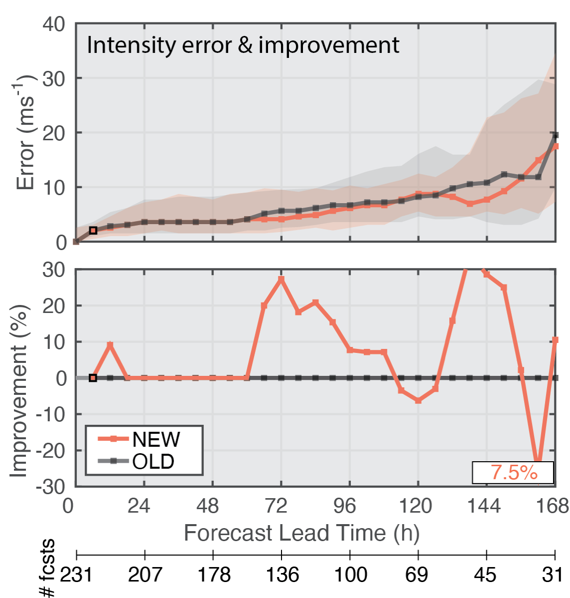
 The table images below show median track and intensity forecast errors with (NEW) and without (OLD) the added Hurricane Hunter aircraft data; there are as many cases with errors larger than the median as there are with errors smaller than the median. One half of all the error values fall within the shaded regions. The average percent improvement across all lead times is shown in the bottom right of panels. Square markers along the NEW lines indicate when there is a 95% chance that the model errors with the additional data are smaller than those without the additional data based on a statistical analysis of the results.
 ■ Important Conclusions:
Data from Hurricane Hunter aircraft substantially improve forecasts of where the tropical cyclone will go (track forecasts) through one week in NOAA’s Global Forecast System (above image).
The same data slightly improve how intense the tropical cyclone will be (intensity forecasts) in the same model (below image).
■ Important Conclusions:
Data from Hurricane Hunter aircraft substantially improve forecasts of where the tropical cyclone will go (track forecasts) through one week in NOAA’s Global Forecast System (above image).
The same data slightly improve how intense the tropical cyclone will be (intensity forecasts) in the same model (below image).
 The full text can be found at this link.
[A dropsonde. From NOAA]
Though all of these observations have been used in NOAA tropical cyclone models in the past, many have never before been used in NOAA’s global model, known as the Global Forecast System. This study reviews the impact of ingesting these additional data on the accuracy of tropical cyclone forecasts. Additional methods to measure forecast accuracy are proposed, since existing methods can be incomplete or even misleading.
The table images below show median track and intensity forecast errors with (NEW) and without (OLD) the added Hurricane Hunter aircraft data; there are as many cases with errors larger than the median as there are with errors smaller than the median. One half of all the error values fall within the shaded regions. The average percent improvement across all lead times is shown in the bottom right of panels. Square markers along the NEW lines indicate when there is a 95% chance that the model errors with the additional data are smaller than those without the additional data based on a statistical analysis of the results.
■ Important Conclusions:
Data from Hurricane Hunter aircraft substantially improve forecasts of where the tropical cyclone will go (track forecasts) through one week in NOAA’s Global Forecast System (above image).
The same data slightly improve how intense the tropical cyclone will be (intensity forecasts) in the same model (below image).
The full text can be found at this link.All Weather News
More
Severe Storms Target the Midwest to the Northeast
UPPER MIDWEST - Dangerous tornadoes have alre
28 Jul 2026 1:45 AM

Tropics: Fausto Heads towards Hawaii; Genevieve Cat 4 Hurricane
PacificHurricane Fausto continues to track we
28 Jul 2026 1:45 AM


Southeast Flood Risk Lingers Near Stalled Front
A stalled boundary over the Southeast will ke
25 Jul 2026 10:55 AM

Another Round of Storms Targets the Northeast
Tuesday brought severe weather again across p
23 Jul 2026 1:15 AM

Another Round of Severe Weather for the Upper Midwest and Great Lakes
The upper-level low train continues to keep t
21 Jul 2026 1:45 AM