Stunning NASA Images Show Smoke Across the Globe
Special Stories
29 Aug 2018 11:08 AM
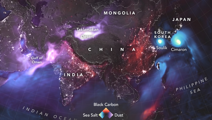
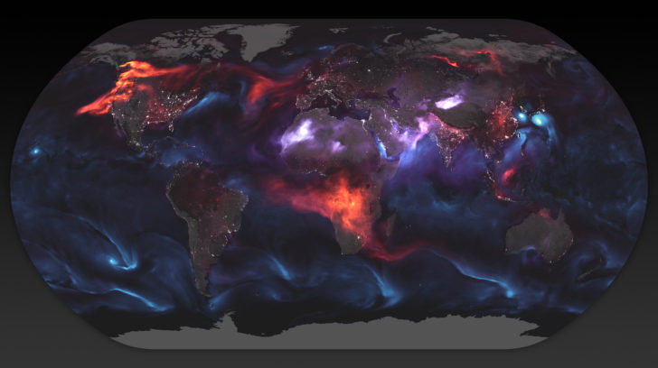
You don't usually correlate "smoke" with "beautiful," but these NASA images of GEOS FP model output for aerosols paint a colorful picture of the globe. This model data was taken on August 23, 2018 and the colors all represent different types of aerosols in the atmosphere.
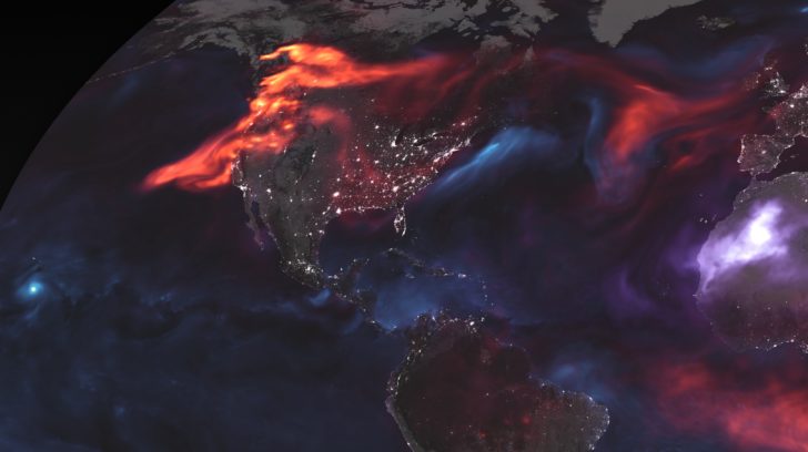
 Aerosols are tiny particles suspended in the air and we breath them in every day. They are all around us. One of the big ones impacting the U.S. is, of course, the smoke from the western wildfires. The smoke particles are shown in the red to orange to yellow shades.
 Look closely at western North America on the map and you can see it glowing red in these images. The smoke stretches all the way across the ocean.
 Other particles like dust and sea salt are also colored on the map. A unique way to view something we don't normally see.
For WeatherNation: Meteorologist Emily Roehler
 Aerosols are tiny particles suspended in the air and we breath them in every day. They are all around us. One of the big ones impacting the U.S. is, of course, the smoke from the western wildfires. The smoke particles are shown in the red to orange to yellow shades.
 Look closely at western North America on the map and you can see it glowing red in these images. The smoke stretches all the way across the ocean.
 Other particles like dust and sea salt are also colored on the map. A unique way to view something we don't normally see.
For WeatherNation: Meteorologist Emily Roehler
Other particles like dust and sea salt are also colored on the map. A unique way to view something we don't normally see.
For WeatherNation: Meteorologist Emily RoehlerAll Weather News
More