Summer Starts Saturday
Special Stories
31 May 2019 8:43 PM
Saturday, June 1 marks the first day of Meteorological Summer. While we still recognize the astronomical Summer Solstice coming up later in June in meteorology, we consider June first a fresh start on record keeping.
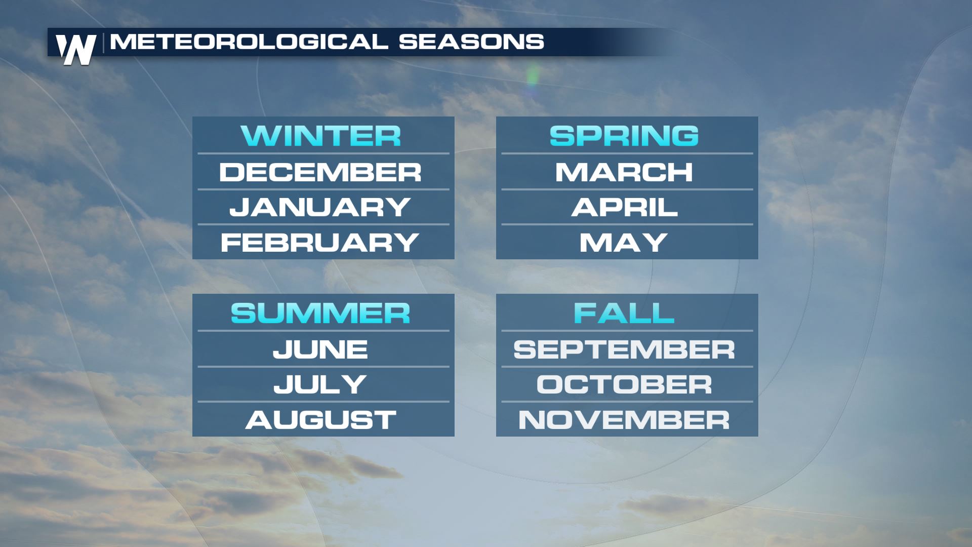 We do this to make it easier for record keeping. It's easier to compare seasons to climatology if we separate them into three-month chunks. We try to align them the best we can to the actual beginning of each season.
So how's the start of Meteorological Summer looking for your location?
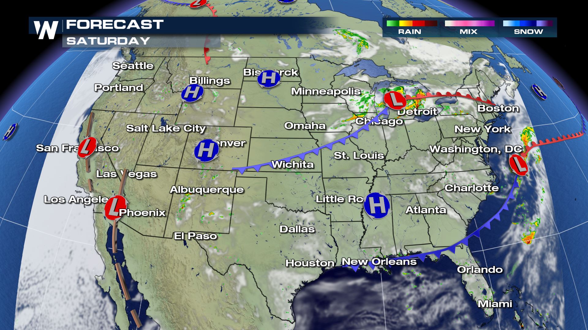 Saturday will feature a summer-like day across the central United States as it begins sunny, gets quite warm and then is followed by scattered severe thunderstorms! Areas along that blue line (cold front) will be wet Saturday afternoon as storms pop up.
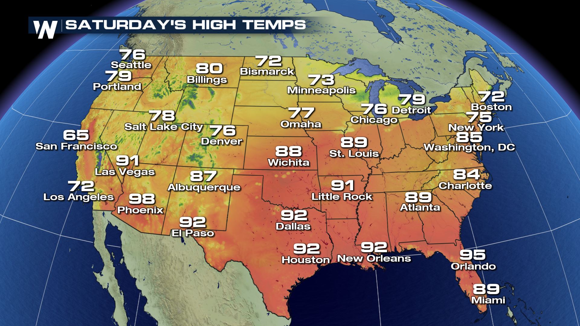 The southern tier of the U.S. will feel the most summer-like Saturday as high temperatures climb through the 80's and into the 90's. Areas closer to the Gulf Coast will feel near 100 degrees when considering the heat index.
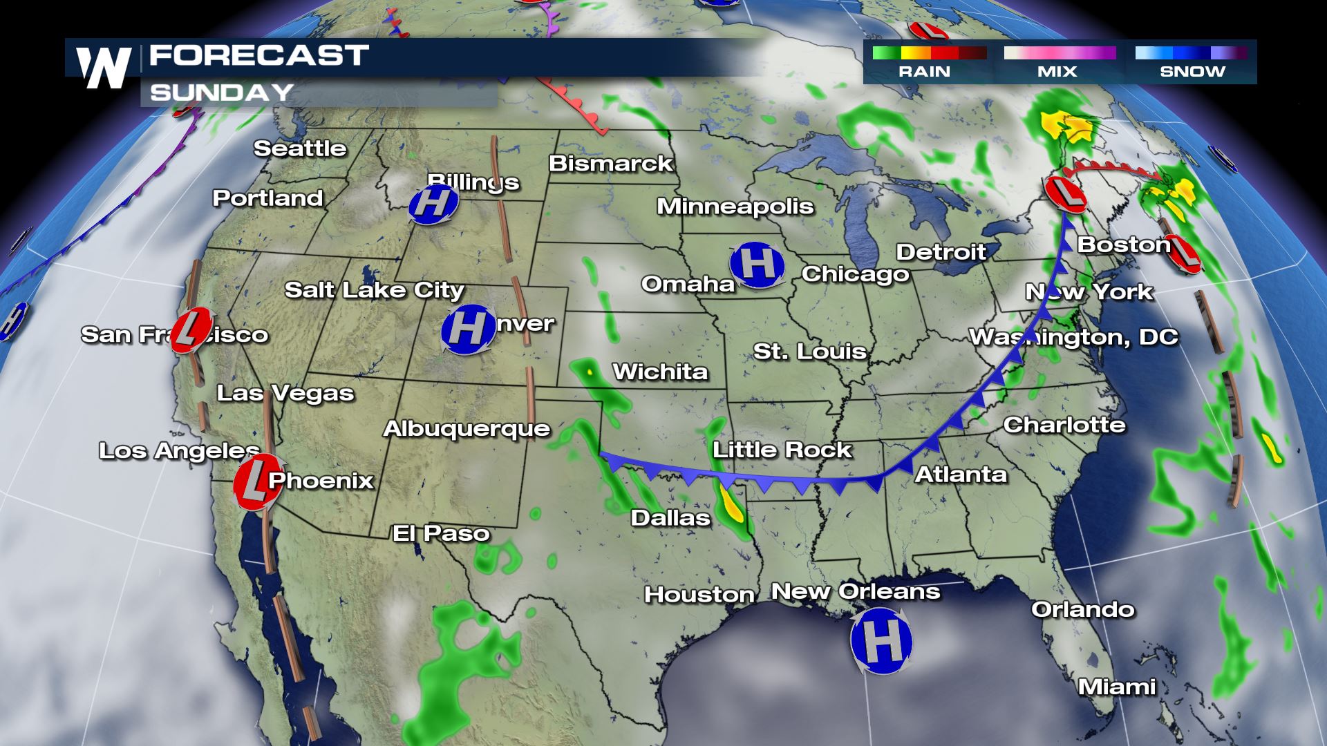 Sunday will feature slightly cooler, drier air for much of the Lower 48. The central U.S. will not be as stormy, however areas back to the west (through Cheyenne, Denver and El Paso) will still have to contend with scattered afternoon thunderstorms.
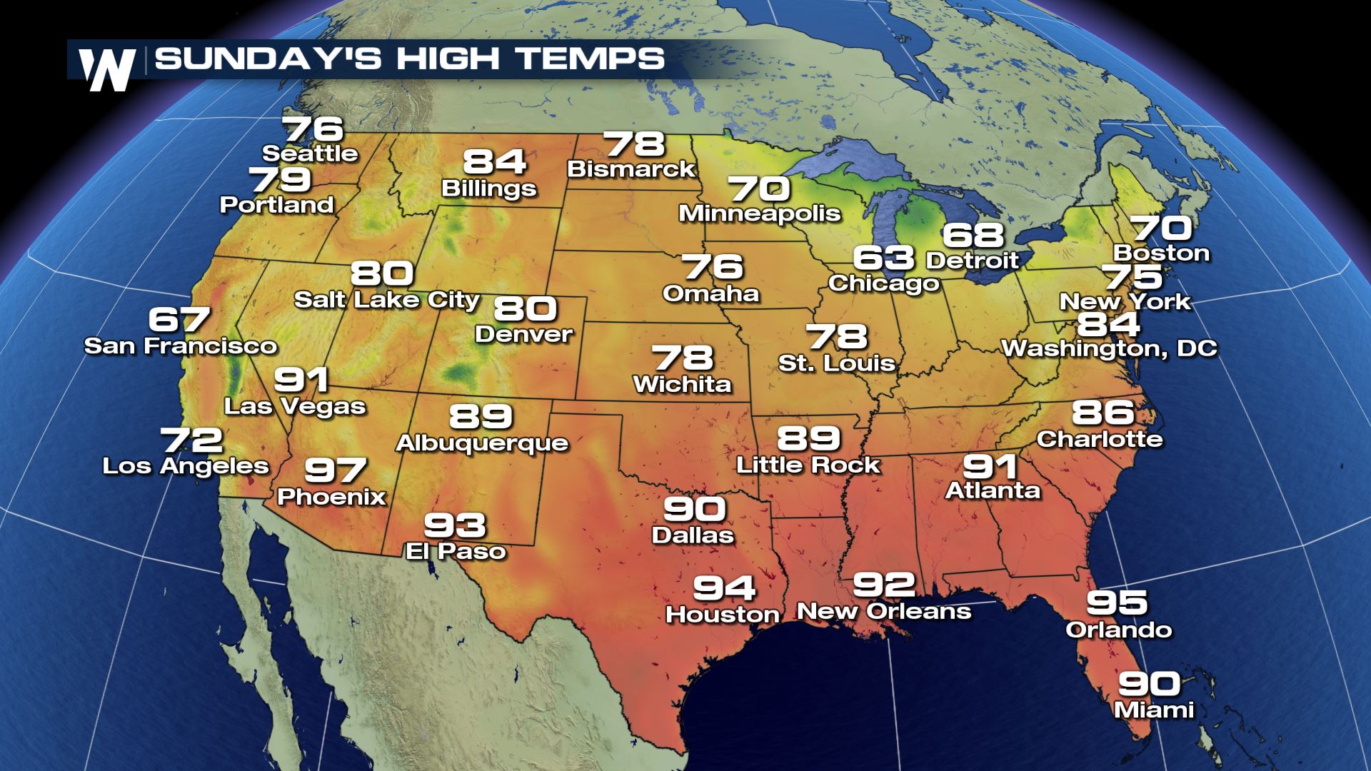 Sunday will feature a significant cool down for cities such as St. Louis, Wichita and Chicago. Meanwhile, it will stay quite toasty across much of the Gulf Coast states.
Happy Summer! Enjoy!
For WeatherNation, Meteorologist Steve Glazier
 We do this to make it easier for record keeping. It's easier to compare seasons to climatology if we separate them into three-month chunks. We try to align them the best we can to the actual beginning of each season.
So how's the start of Meteorological Summer looking for your location?
 Saturday will feature a summer-like day across the central United States as it begins sunny, gets quite warm and then is followed by scattered severe thunderstorms! Areas along that blue line (cold front) will be wet Saturday afternoon as storms pop up.
 The southern tier of the U.S. will feel the most summer-like Saturday as high temperatures climb through the 80's and into the 90's. Areas closer to the Gulf Coast will feel near 100 degrees when considering the heat index.
 Sunday will feature slightly cooler, drier air for much of the Lower 48. The central U.S. will not be as stormy, however areas back to the west (through Cheyenne, Denver and El Paso) will still have to contend with scattered afternoon thunderstorms.
 Sunday will feature a significant cool down for cities such as St. Louis, Wichita and Chicago. Meanwhile, it will stay quite toasty across much of the Gulf Coast states.
Happy Summer! Enjoy!
For WeatherNation, Meteorologist Steve Glazier
Sunday will feature a significant cool down for cities such as St. Louis, Wichita and Chicago. Meanwhile, it will stay quite toasty across much of the Gulf Coast states.
Happy Summer! Enjoy!
For WeatherNation, Meteorologist Steve GlazierAll Weather News
More