Sunday Severe Storm Chances in Texas
Top Stories
5 Jun 2021 11:30 AM
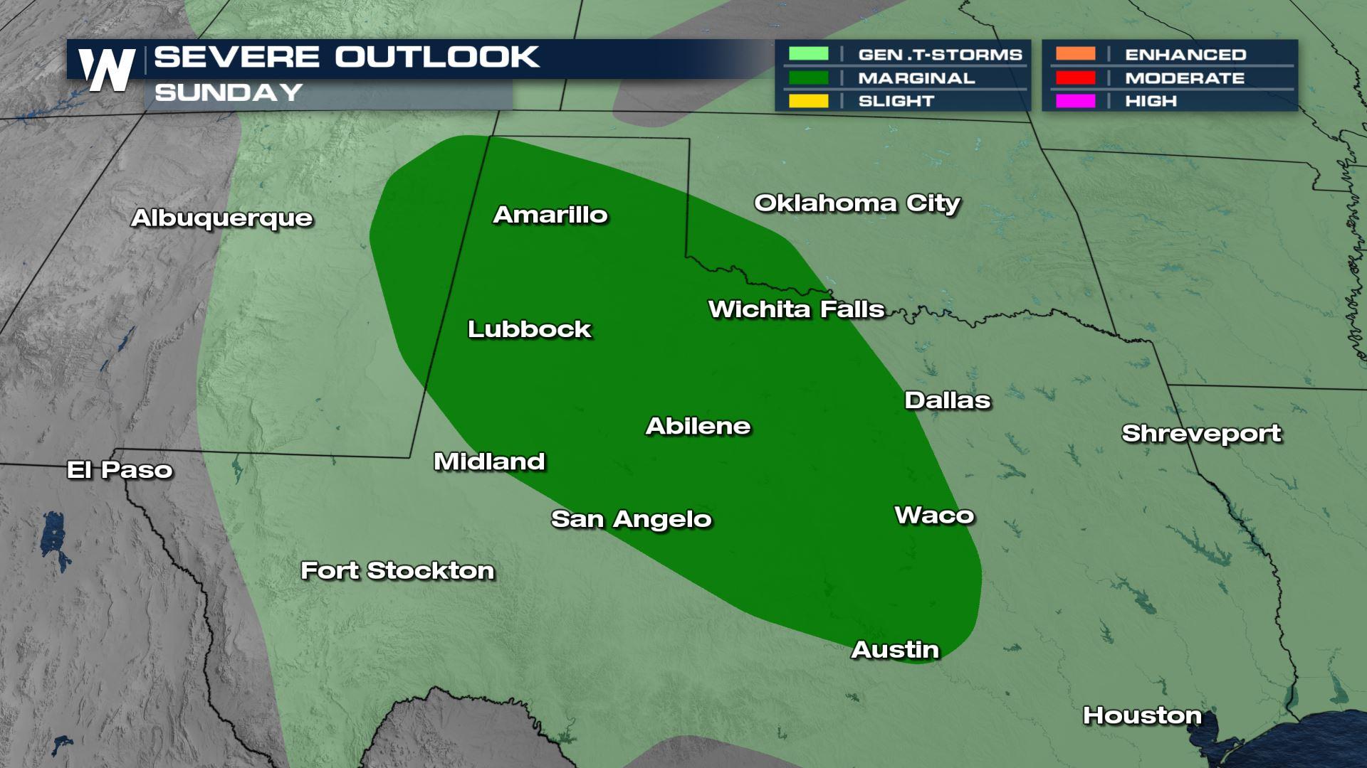
The stalling and weakening upper low forecast to bring considerable rain to southeast Texas, Louisiana, Mississippi and Arkansas this weekend will combine with energy coming off of the Rocky Mountains to bring isolated severe storms for parts of Texas tomorrow. There is a marginal risk of severe weather (level 1 out of 5) as shown above.
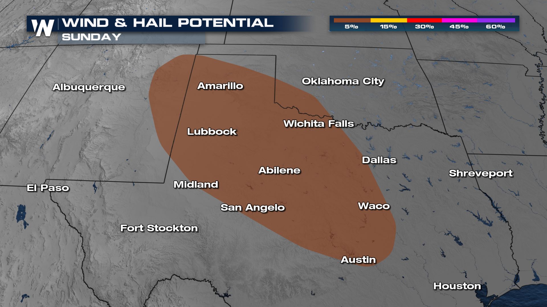
Gusty winds and large hail will be the biggest hazards with any storms that develop, along with heavy rain. There could be multiple rounds of storms Sunday into early Monday.
 Surface energy and moisture will be plentiful and combined with the lift from the upper low decaying over north central Texas and the wave of energy coming off the Rockies, numerous storms will form and become strong during peak heating hours.
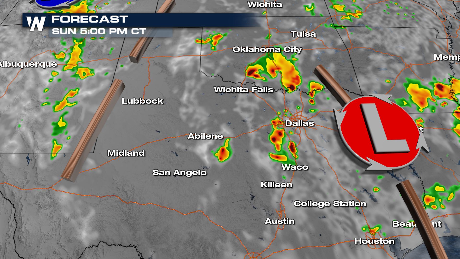
Scattered showers and storms will be lingering in central Texas and Oklahoma Sunday afternoon on the back side of the upper low. At the same time storms will start firing off the Rocky Mountains in New Mexico as an upper low develops there.
Surface energy and moisture will be plentiful and combined with the lift from the upper low decaying over north central Texas and the wave of energy coming off the Rockies, numerous storms will form and become strong during peak heating hours.
Scattered showers and storms will be lingering in central Texas and Oklahoma Sunday afternoon on the back side of the upper low. At the same time storms will start firing off the Rocky Mountains in New Mexico as an upper low develops there.
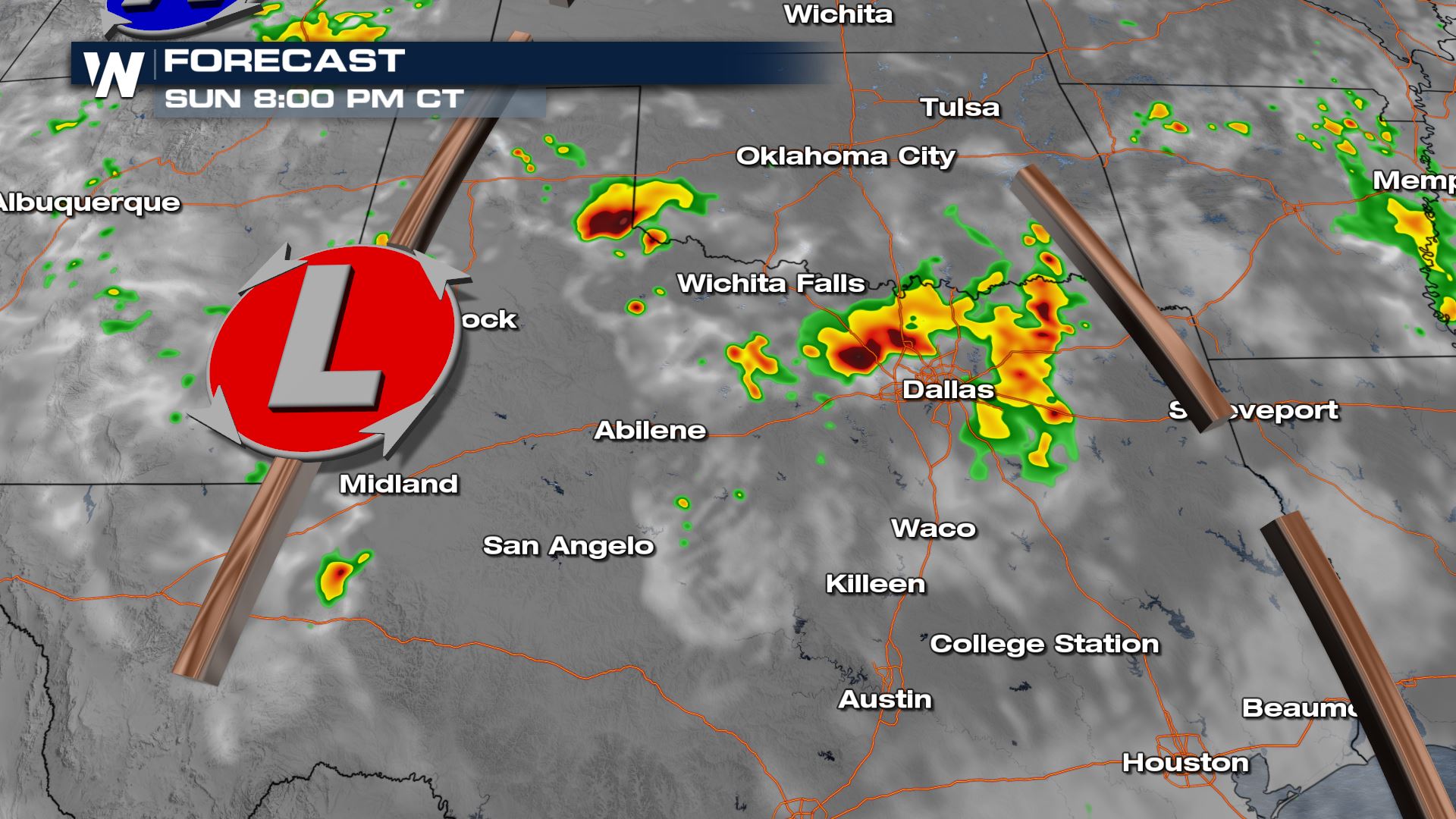
 The low will develop in the evening and a cluster of thunderstorms will bubble up. Gusty winds, large hail and heavy rain will be the biggest hazards.
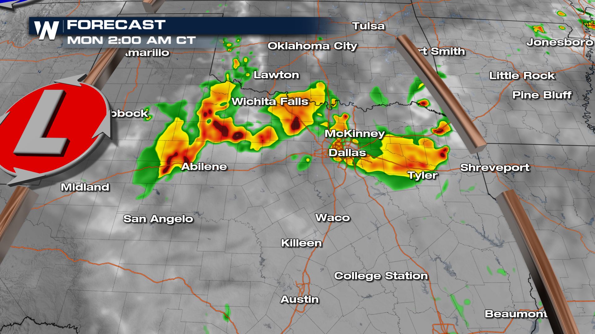
 Overnight the clusters of storms will rotate south and east through north central Texas. Areas along and north of I-20 will have the best chance for storms at this time along with heavy rain.
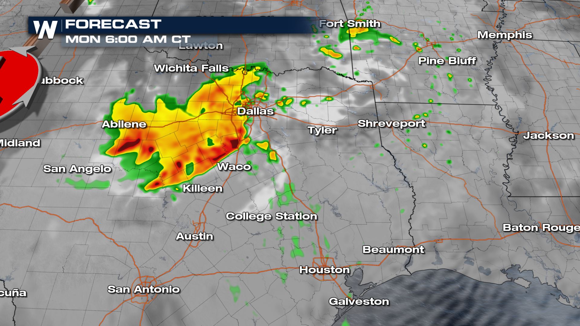
 By sunrise Monday the cluster of storms will have moved from I-20 toward I-35. Gusty winds and hail will be the biggest severe weather threat but a brief spin-up tornado can't be ruled out in any bowing segments along the line. Heavy rain will be ongoing as well.
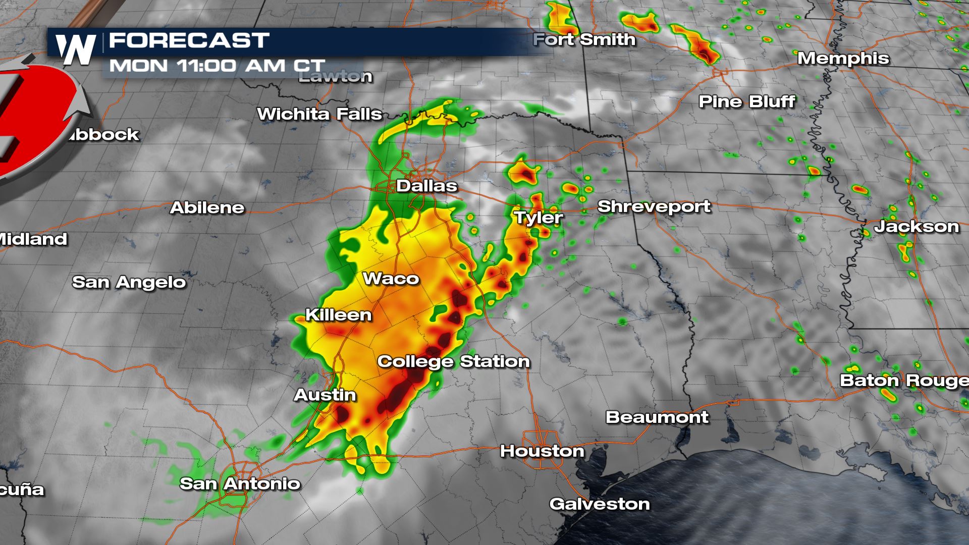
 The cluster of storms will continue to move east Monday morning. By midday it wll be approaching I-45 from the west. Gusty winds and hail will be the biggest concern, but if there are any individual storms that form in their own environment, a spin-up tornado would be possible. Bowing segments within the line could also contain a brief spin-up.
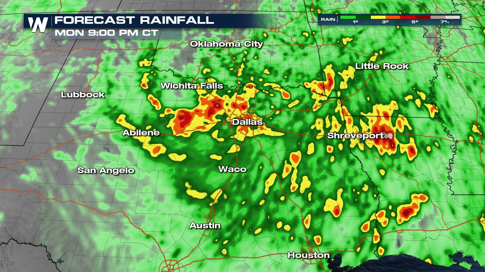
 The heavy rain will lead to impressive rain totals the next few days. 2-3" of widespread rain is expected with some pockets of rain in excess of 5" possible. Some urban flooding and flooding in usual spots is possible, but as of Saturday there are no flood alerts in place.
 Stay with WeatherNation for updates on this top weather story.
Surface energy and moisture will be plentiful and combined with the lift from the upper low decaying over north central Texas and the wave of energy coming off the Rockies, numerous storms will form and become strong during peak heating hours.
Scattered showers and storms will be lingering in central Texas and Oklahoma Sunday afternoon on the back side of the upper low. At the same time storms will start firing off the Rocky Mountains in New Mexico as an upper low develops there.
The low will develop in the evening and a cluster of thunderstorms will bubble up. Gusty winds, large hail and heavy rain will be the biggest hazards.
Overnight the clusters of storms will rotate south and east through north central Texas. Areas along and north of I-20 will have the best chance for storms at this time along with heavy rain.
By sunrise Monday the cluster of storms will have moved from I-20 toward I-35. Gusty winds and hail will be the biggest severe weather threat but a brief spin-up tornado can't be ruled out in any bowing segments along the line. Heavy rain will be ongoing as well.
The cluster of storms will continue to move east Monday morning. By midday it wll be approaching I-45 from the west. Gusty winds and hail will be the biggest concern, but if there are any individual storms that form in their own environment, a spin-up tornado would be possible. Bowing segments within the line could also contain a brief spin-up.
The heavy rain will lead to impressive rain totals the next few days. 2-3" of widespread rain is expected with some pockets of rain in excess of 5" possible. Some urban flooding and flooding in usual spots is possible, but as of Saturday there are no flood alerts in place.
Stay with WeatherNation for updates on this top weather story.All Weather News
More
Fronts Continue To Spark Severe Weather Across the Plains
A cold front that brought record lows to the
18 Jul 2025 10:40 PM

Extreme Heat Impacts for the East Coast & South
Extreme heat continues to impact several area
18 Jul 2025 10:05 PM

Flooding Threat Remains Elevated in the East
A cold front pushing through the Eastern Seab
18 Jul 2025 9:10 PM

EF-2 Firenado from the Deer Creek Fire in Utah
A fire tornado was spotted near La Sal, Utah
18 Jul 2025 7:30 AM

Tropical System Brings Flood Risk to the Central Gulf
Time has run out for notable tropical develop
18 Jul 2025 3:05 AM

Heavy Rain, Flooding Threat Returns to Florida
Keep the rain boots handy in Florida - heavy
13 Jul 2025 12:50 PM

Severe Storm Risk Pushes into the Great Lakes, Ohio Valley
Friday was another busy day with severe weath
12 Jul 2025 8:00 PM