Severe Storms for the Central Great Plains
Top Stories
26 Aug 2019 4:31 AM
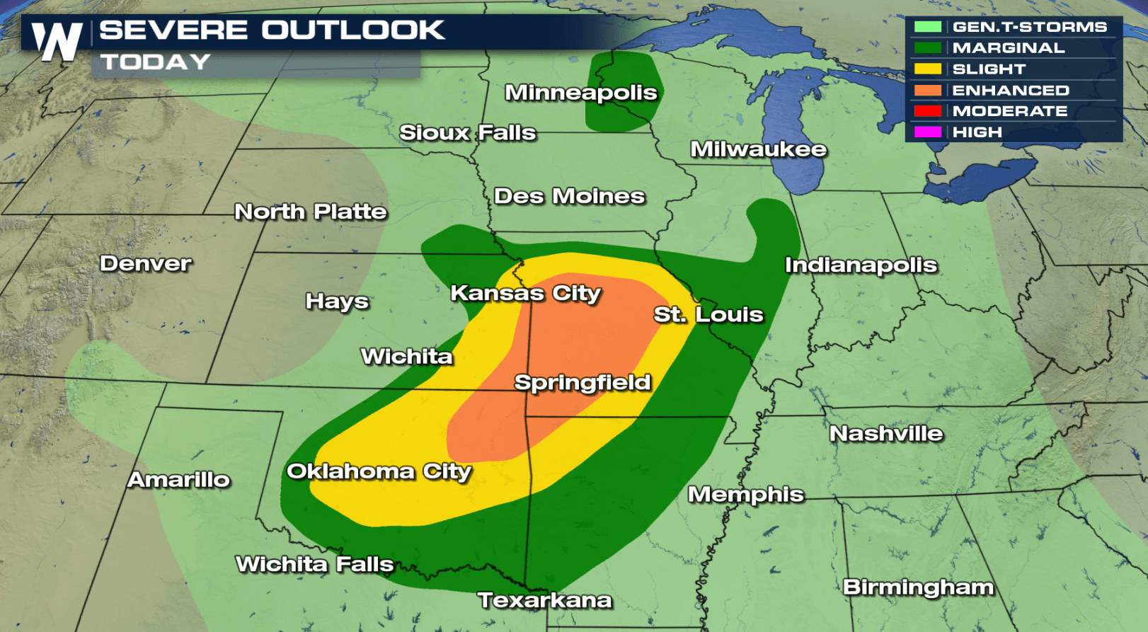
A frontal boundary moving through the Northern U.S. will bring the chance for severe thunderstorms over the Central Plains. These storms could contain large hail, damaging winds and isolated tornadoes. An enhanced risk for severe storms extends from Missouri to Oklahoma. Here is the latest forecast:
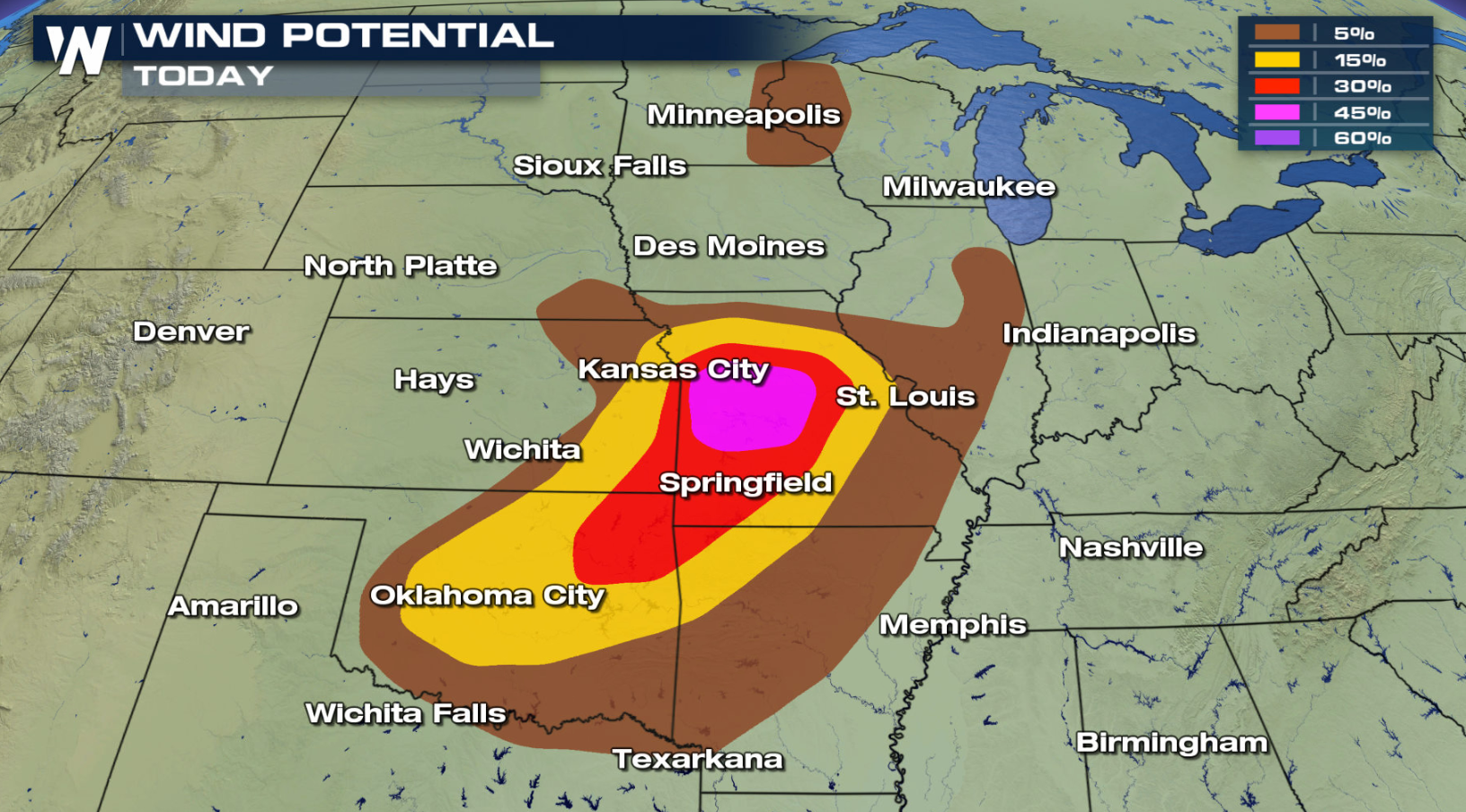
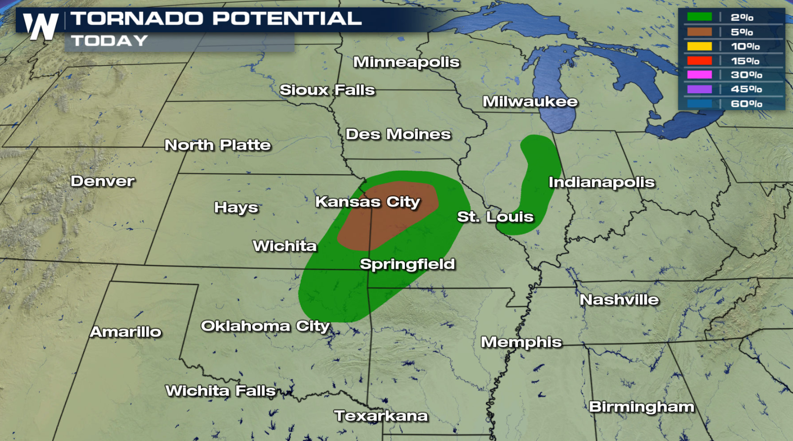
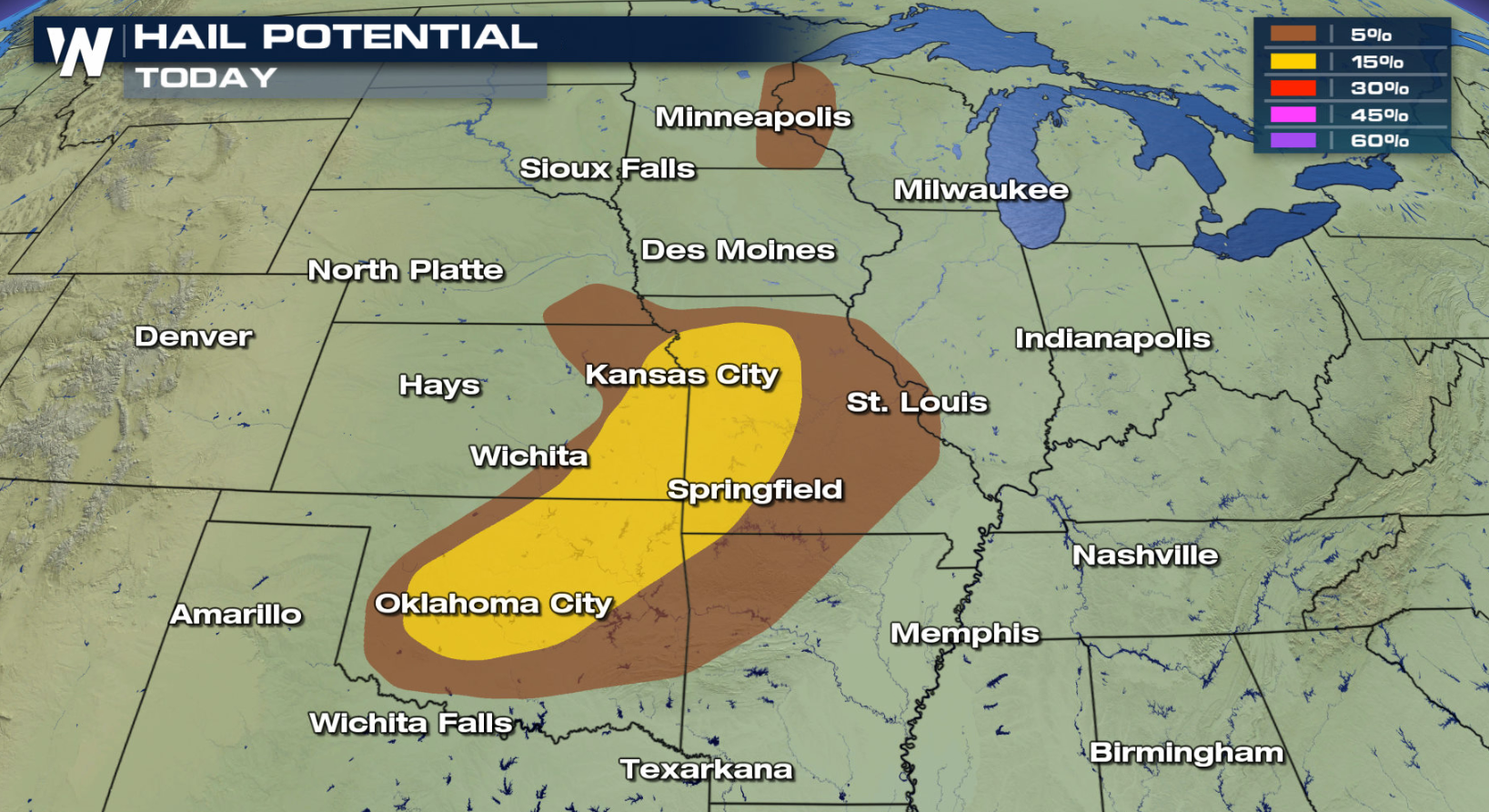 Damaging winds will be the highest risk with today's severe chances, but large hail and an isolated tornado will be possible. You want to be prepared in these areas today for severe storms impacting your outdoor activities.
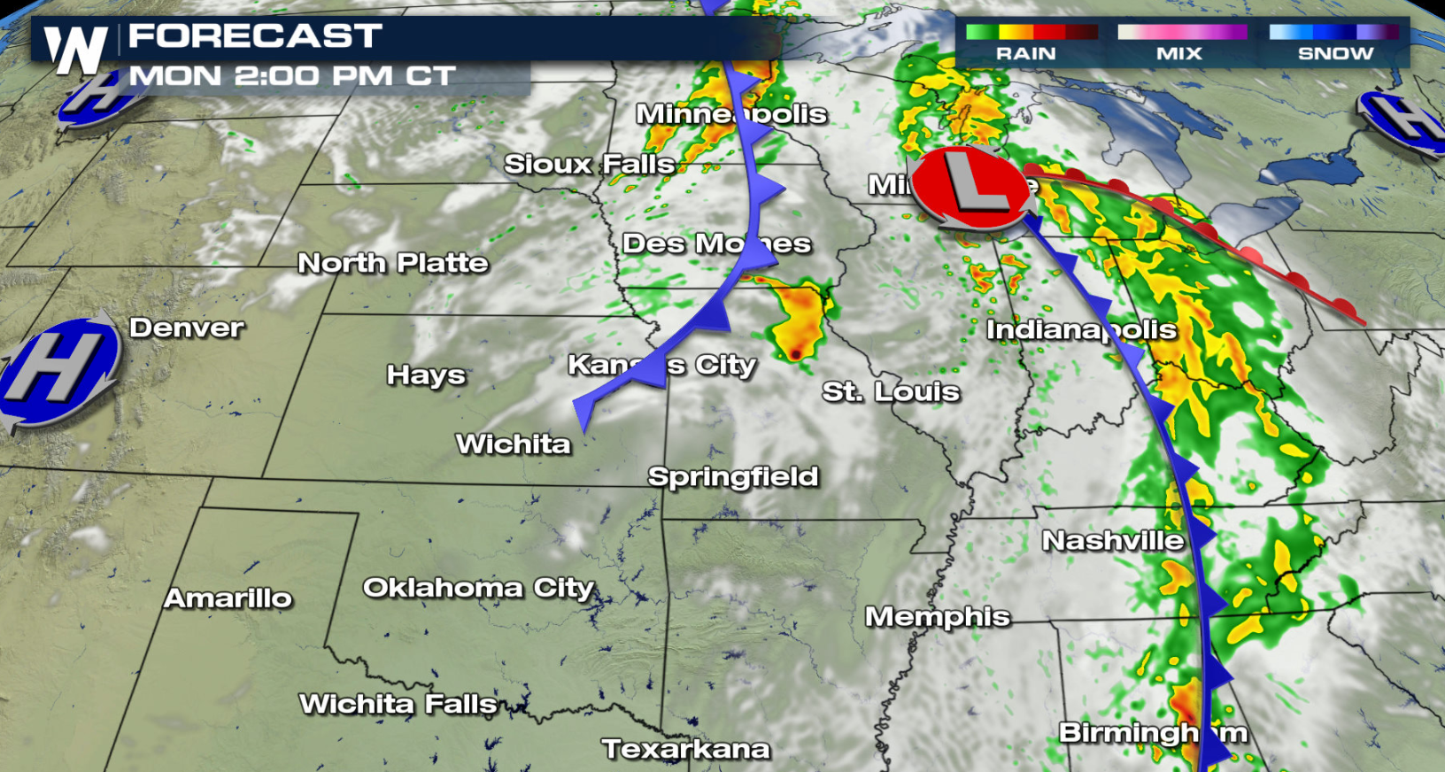
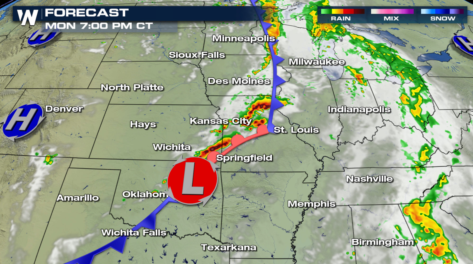
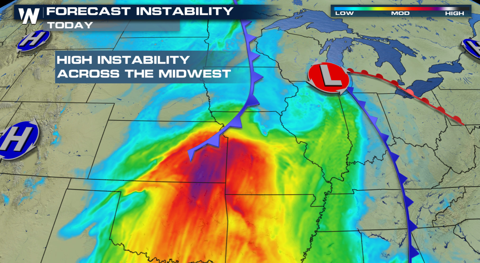
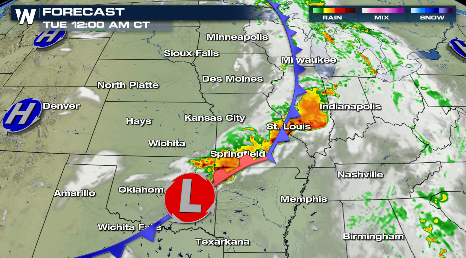 Storms will re-develop this afternoon in the Central Plains along a warm front, north of a low pressure center. As instability increases throughout the day, storms will become severe. Keep checking with WeatherNation for severe updates.
Severe Risks
Damaging winds will be the highest risk with today's severe chances, but large hail and an isolated tornado will be possible. You want to be prepared in these areas today for severe storms impacting your outdoor activities.
Forecast
Storms will re-develop this afternoon in the Central Plains along a warm front, north of a low pressure center. As instability increases throughout the day, storms will become severe. Keep checking with WeatherNation for severe updates.All Weather News
More
Severe Storms Target the Midwest to the Northeast
UPPER MIDWEST - Dangerous tornadoes have alre
28 Jul 2026 1:45 AM

Tropics: Fausto Heads towards Hawaii; Genevieve Cat 4 Hurricane
PacificHurricane Fausto continues to track we
28 Jul 2026 1:45 AM


Southeast Flood Risk Lingers Near Stalled Front
A stalled boundary over the Southeast will ke
25 Jul 2026 10:55 AM

Another Round of Storms Targets the Northeast
Tuesday brought severe weather again across p
23 Jul 2026 1:15 AM

Another Round of Severe Weather for the Upper Midwest and Great Lakes
The upper-level low train continues to keep t
21 Jul 2026 1:45 AM