Sunday Severe Weather Update
Top Stories
16 Aug 2020 3:25 PM
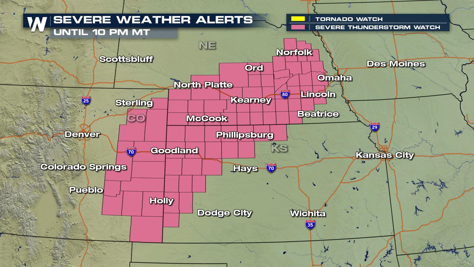
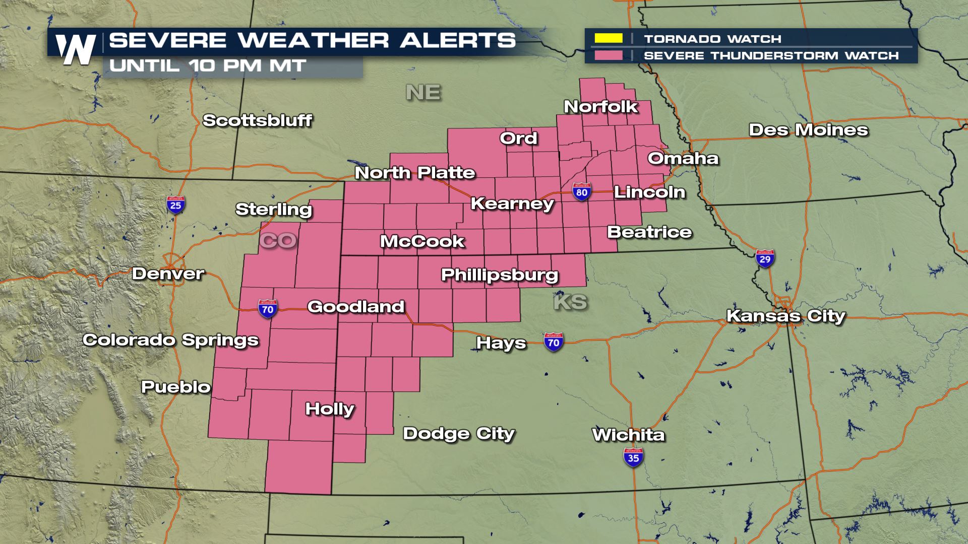
Ongoing scattered severe storms in the Central and Southern Plains are expected to continue to bring severe weather throughout the rest of the late afternoon and evening hours. Severe thunderstorm watches have been issued for portions of eastern Colorado, southern Nebraska, and northwestern Kansas until 10 PM MT with the threat of scattered large hail (up to 3" in diameter), damaging wind gusts (up to 80 mph), and a possible tornado or two within said discrete cells.
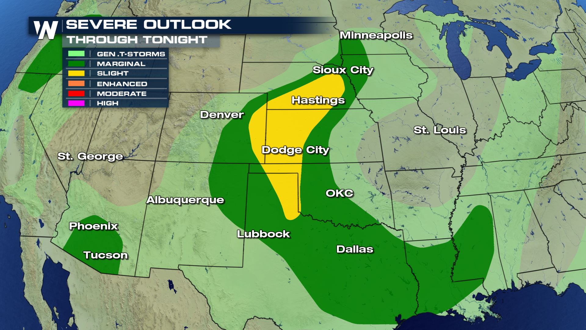 There is a large coverage area Sunday that may see severe storms. The slight risk (level 2 out of 5) has expanded to include more of the Texas panhandle where ongoing severe thunderstorms bring severe weather threats.
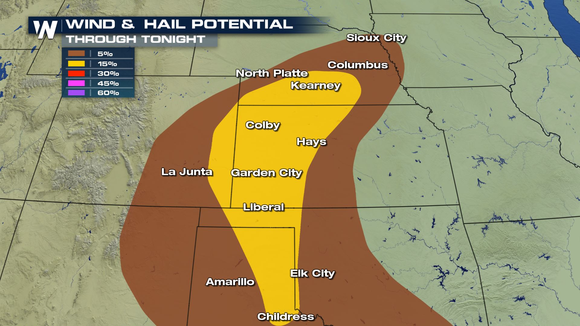 Isolated threats for damaging winds and large hail will be the main weather threats today. Some of the more scattered and discrete cells, also known as supercells, may cluster together and bring in the initial risk of very large to damaging hail. Should these cells cluster and organize, damaging wind gusts will become more significant later this evening. Up to 3" in diameter hail and wind gusts up to 80 mph are possible.
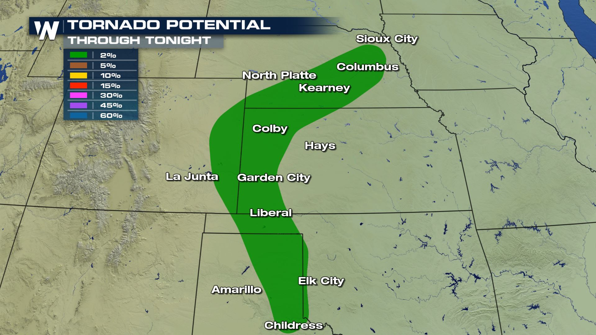 Not only are we dealing with a wind and hail threat, the tornado potential has increased as well for the areas shaded in green. This includes cities such as Kearney, Garden City, Norfolk, through Childress. The reason a brief tornado cannot be ruled out is is because low level easterly flow is helping to bring in some potential for updraft rotation, resulting in a low tornado threat.
 These cells move into Oklahoma overnight and could bring heavy rain to cities like Dallas by Monday morning.
Keep checking with WeatherNation for more updates on Sunday and Monday's storm chances.
These cells move into Oklahoma overnight and could bring heavy rain to cities like Dallas by Monday morning.
Keep checking with WeatherNation for more updates on Sunday and Monday's storm chances.
Severe Outlook
There is a large coverage area Sunday that may see severe storms. The slight risk (level 2 out of 5) has expanded to include more of the Texas panhandle where ongoing severe thunderstorms bring severe weather threats.
Severe Risks
Isolated threats for damaging winds and large hail will be the main weather threats today. Some of the more scattered and discrete cells, also known as supercells, may cluster together and bring in the initial risk of very large to damaging hail. Should these cells cluster and organize, damaging wind gusts will become more significant later this evening. Up to 3" in diameter hail and wind gusts up to 80 mph are possible.
Not only are we dealing with a wind and hail threat, the tornado potential has increased as well for the areas shaded in green. This includes cities such as Kearney, Garden City, Norfolk, through Childress. The reason a brief tornado cannot be ruled out is is because low level easterly flow is helping to bring in some potential for updraft rotation, resulting in a low tornado threat.
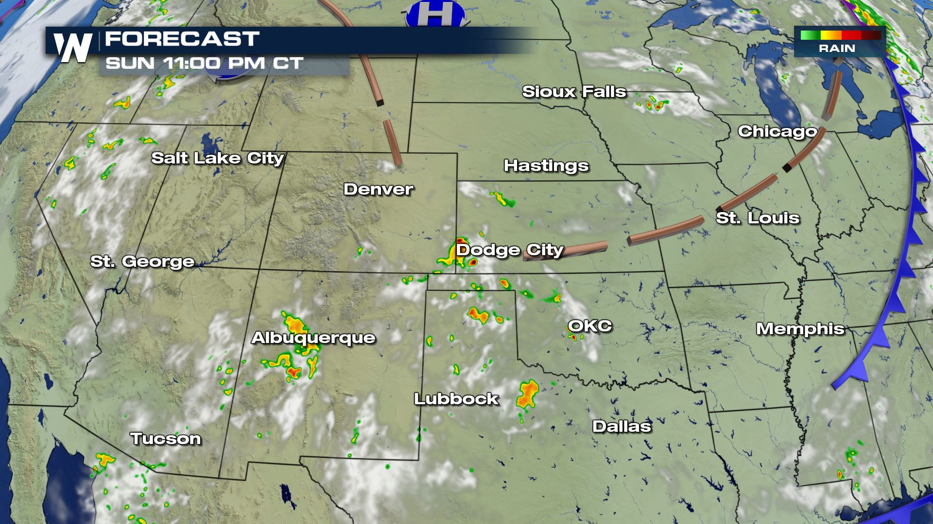
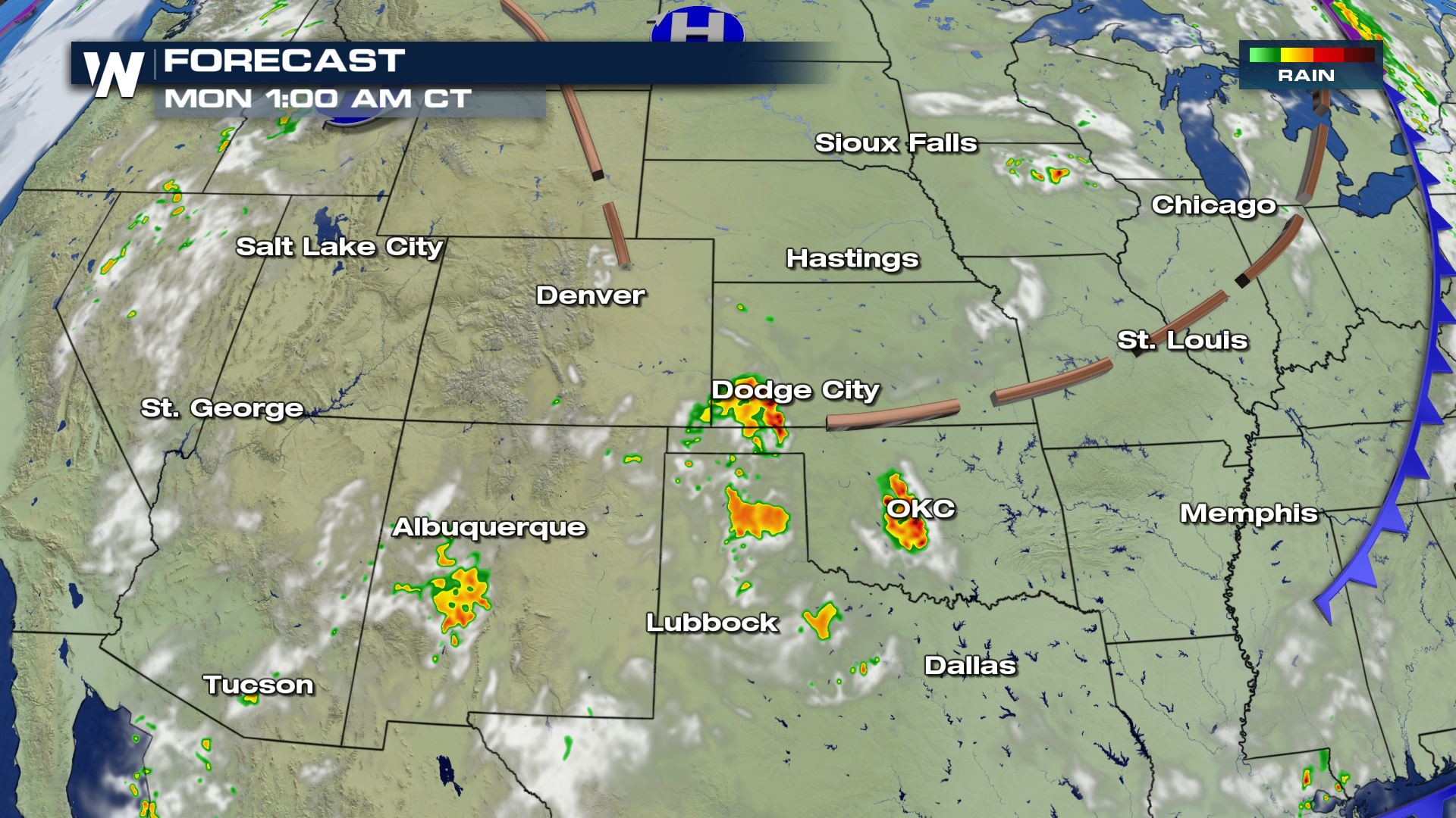
Forecast
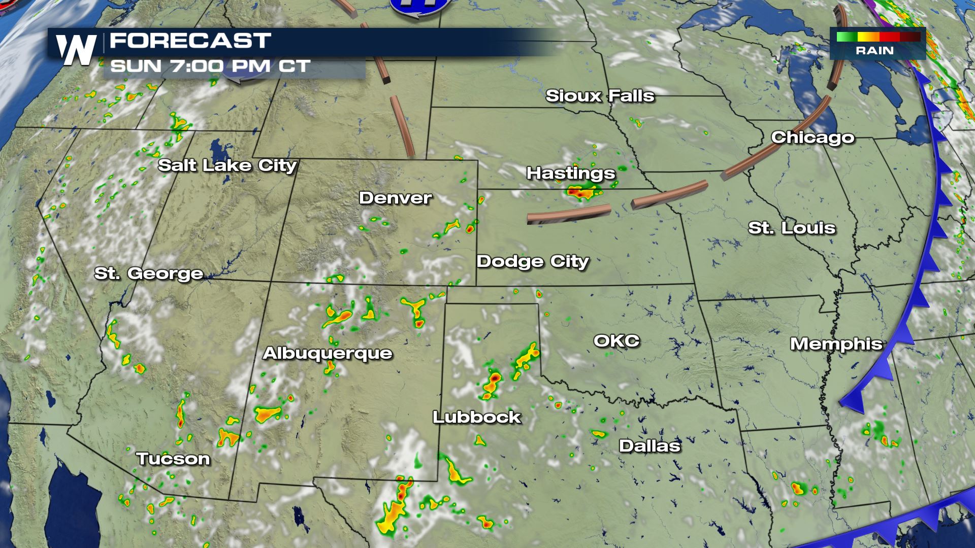
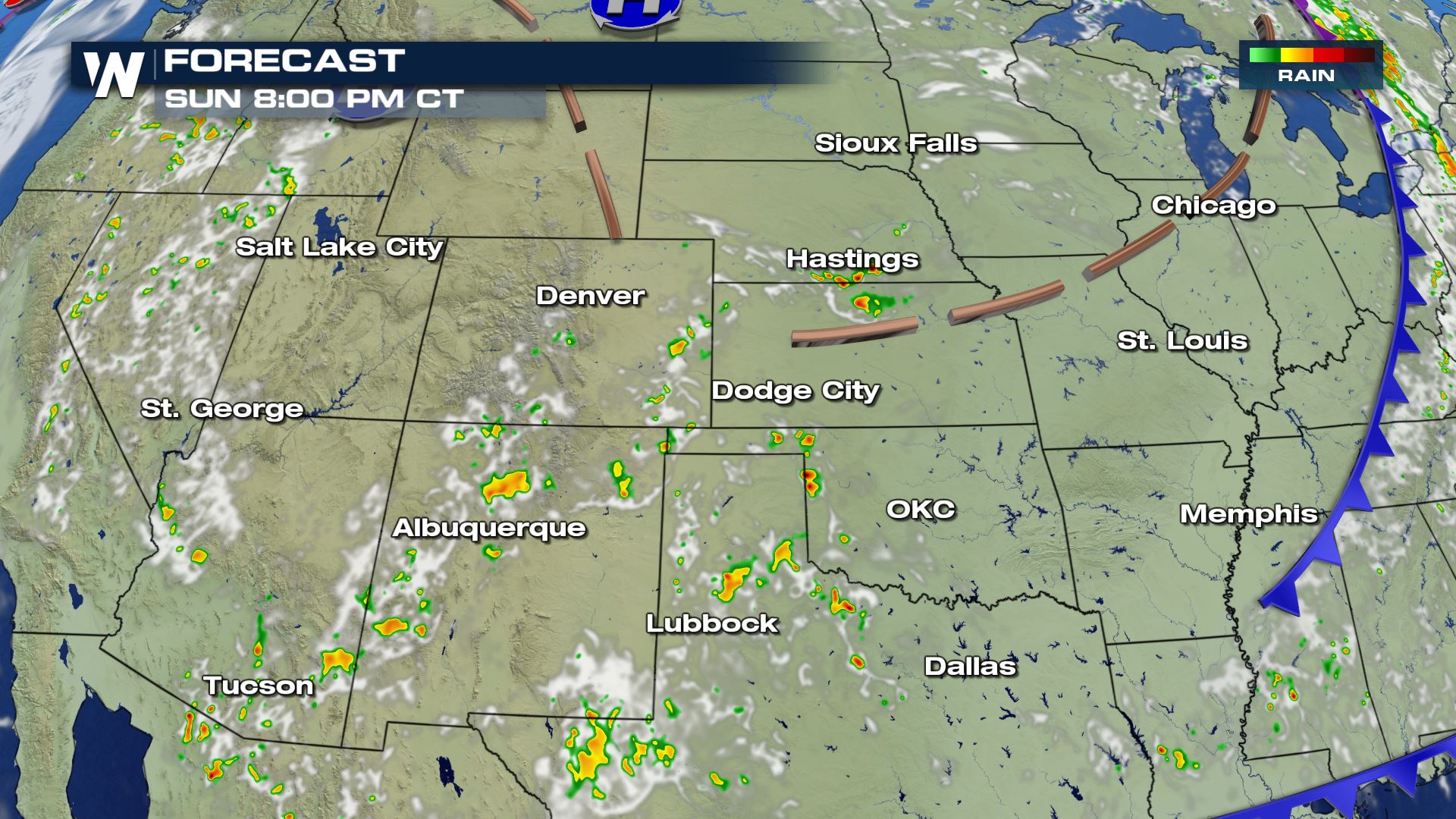
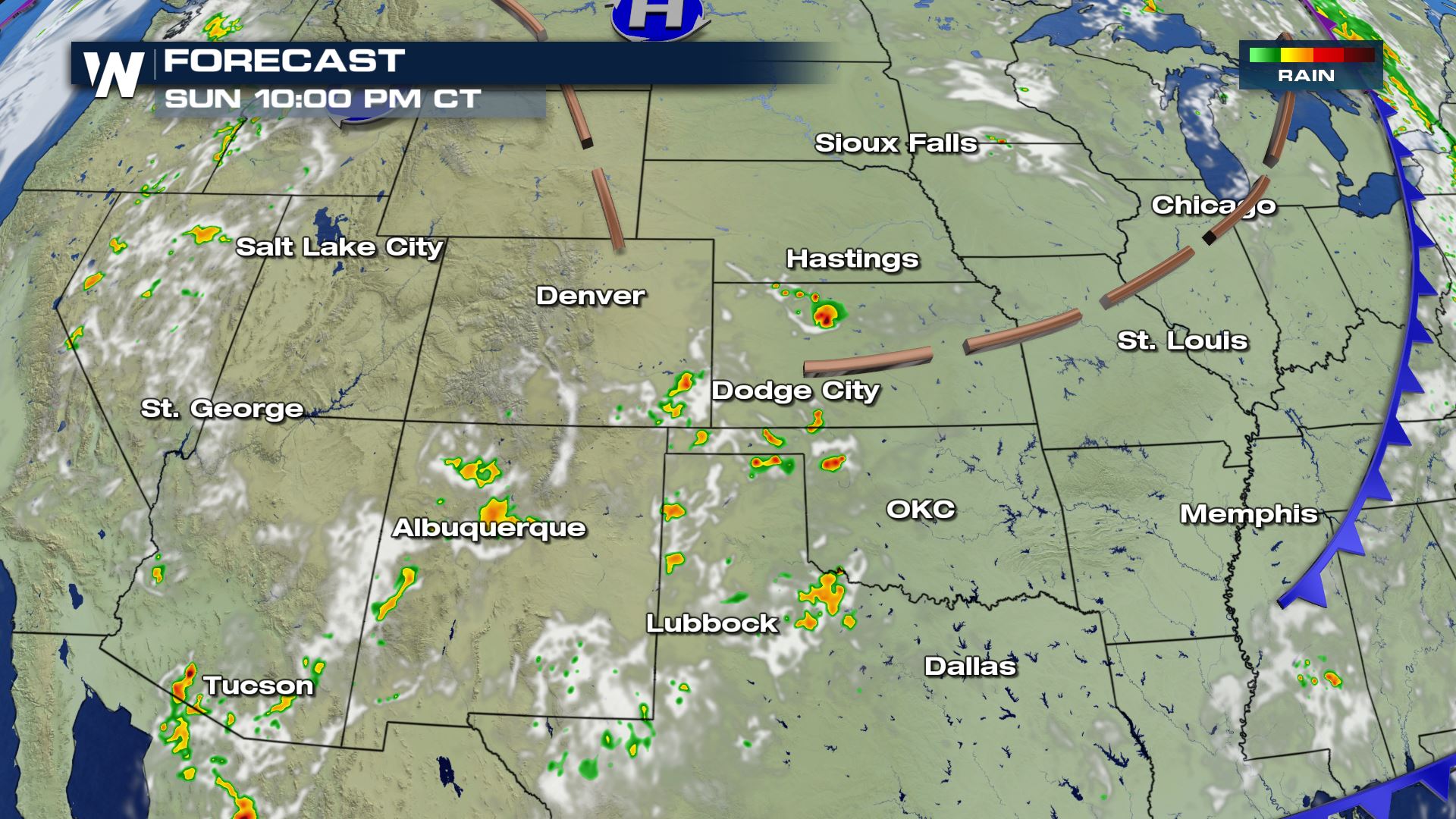
Ongoing supercells are more isolated but we may see some clustering of these storms that may become more organized later tonight.
These cells move into Oklahoma overnight and could bring heavy rain to cities like Dallas by Monday morning.
Keep checking with WeatherNation for more updates on Sunday and Monday's storm chances.
All Weather News
More
Wildfire Outbreak in the Pacific Northwest
SPOKANE, WA - On Saturday, August 1st, the Ol
3 Aug 2026 1:55 AM

More Storms for the East Through Monday
A low-pressure system that moved through the
3 Aug 2026 1:50 AM


After Reaching Category 5, Genevieve Weakens in the Pacific
PacificGenevieve formed last Friday south of
3 Aug 2026 12:30 AM

Flooding, Severe Storms Target the Midwest Again
After an active week of storms across the nor
1 Aug 2026 1:40 AM

Flooding Risk Increases as Heavy Rain Targets the Tri-State Area
Tuesday, heavy rainfall moved across the Nort
30 Jul 2026 12:25 AM

Severe Weather: Energy From the Midwest Now in the Southeast
UPPER MIDWEST - Through Monday, dangerous tor
29 Jul 2026 10:30 PM