Sunday Severe Weather Update
Special Stories
14 Oct 2018 2:57 AM
Severe storms are in the forecast today from southwest Texas into the Arklatex. Large hail, damaging winds and heavy rain will all be possible. We can't rule out some storms capable of producing and isolated tornado. Here is the very latest.
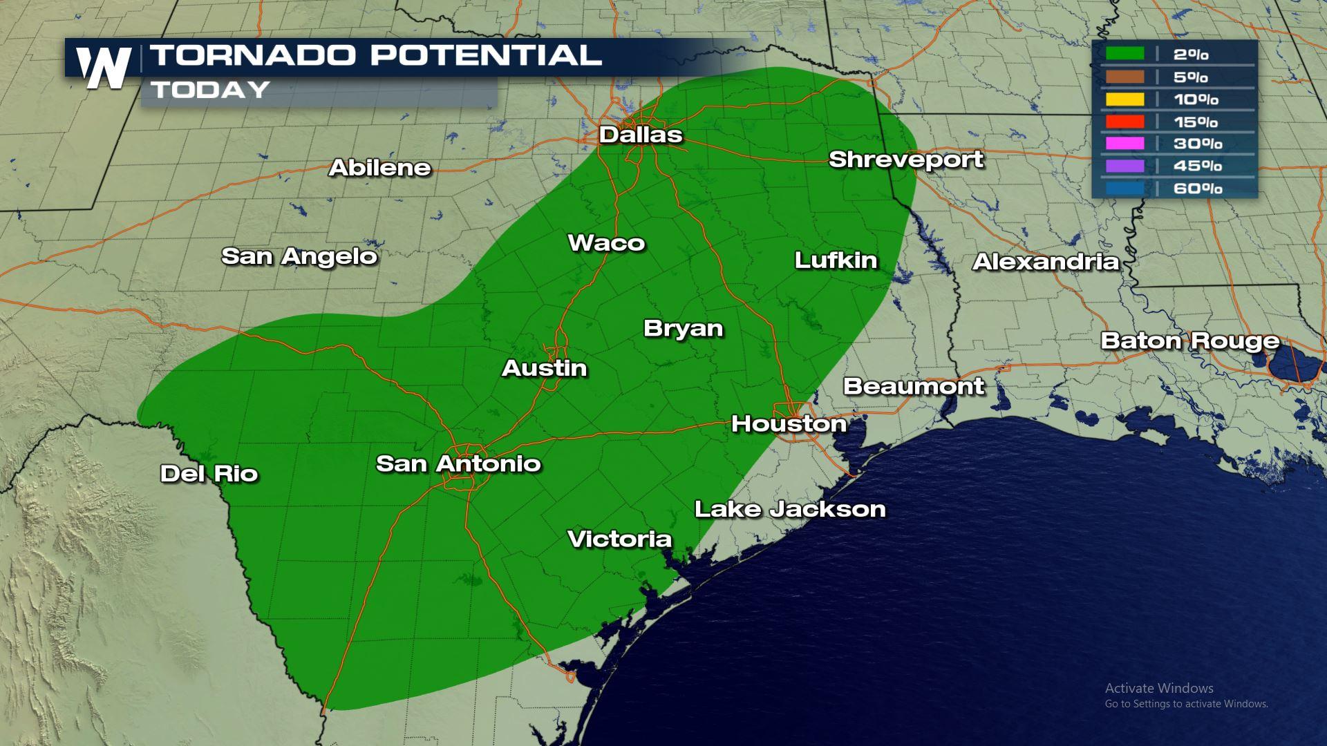
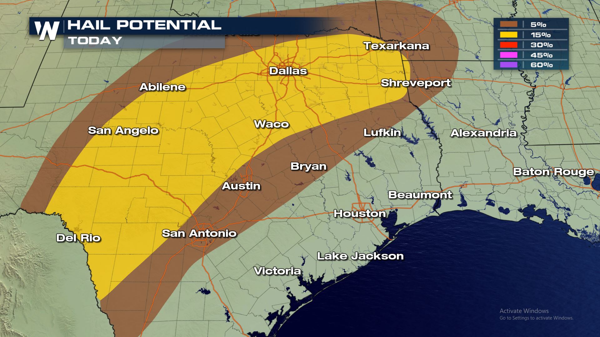
 A cold front will bring severe storms to the region with the highest risk of severe weather over most of western and northern Texas. These areas will need to be weather prepared for tornadoes, large hail and damaging winds.
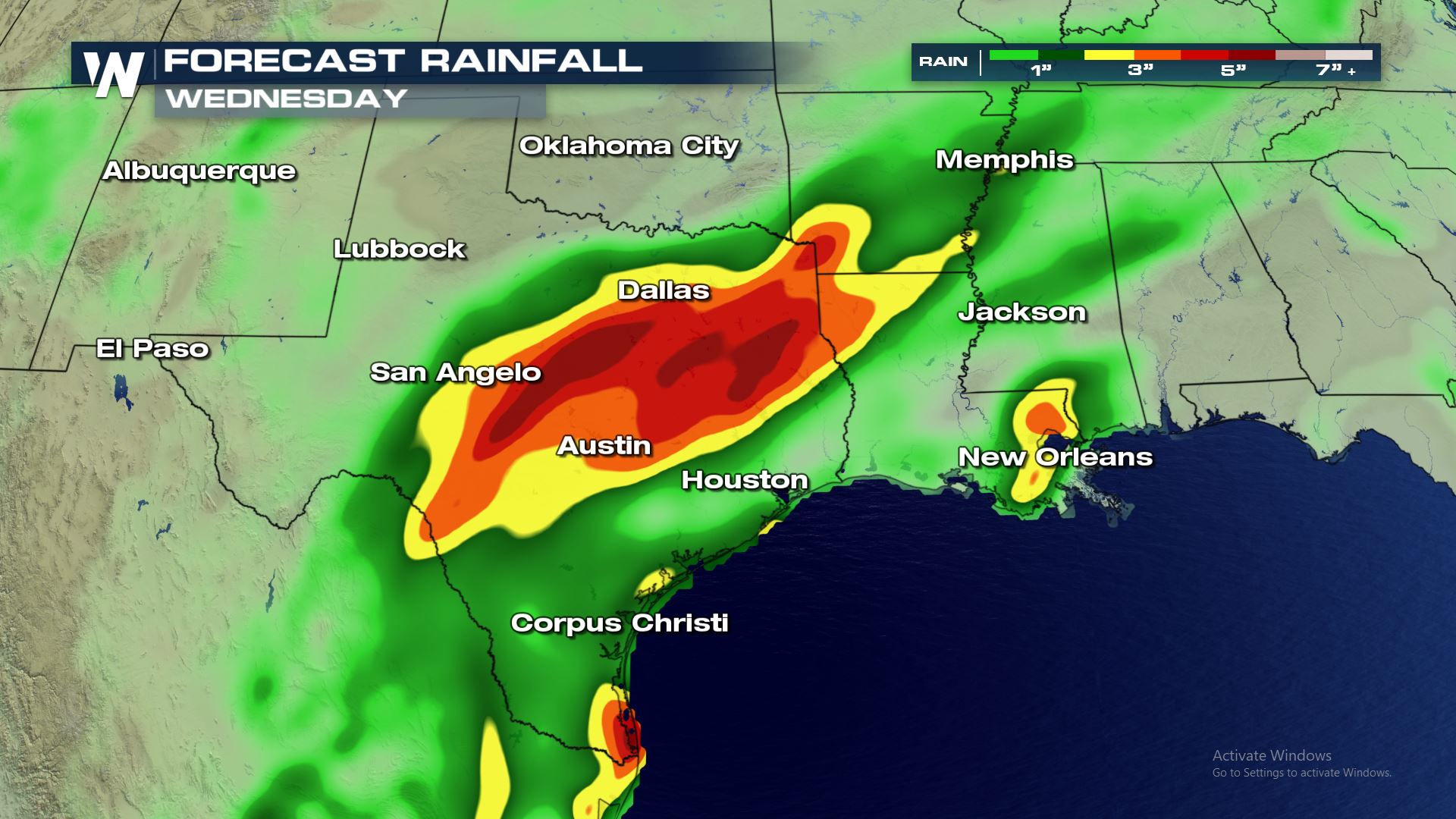
 All modes of severe weather will be in the forecast today. This includes the risk of torrential rainfall leading to flash flooding.
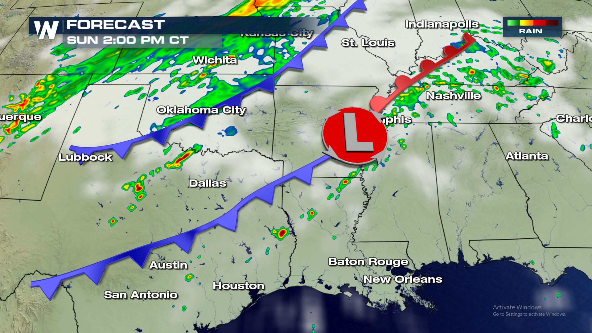
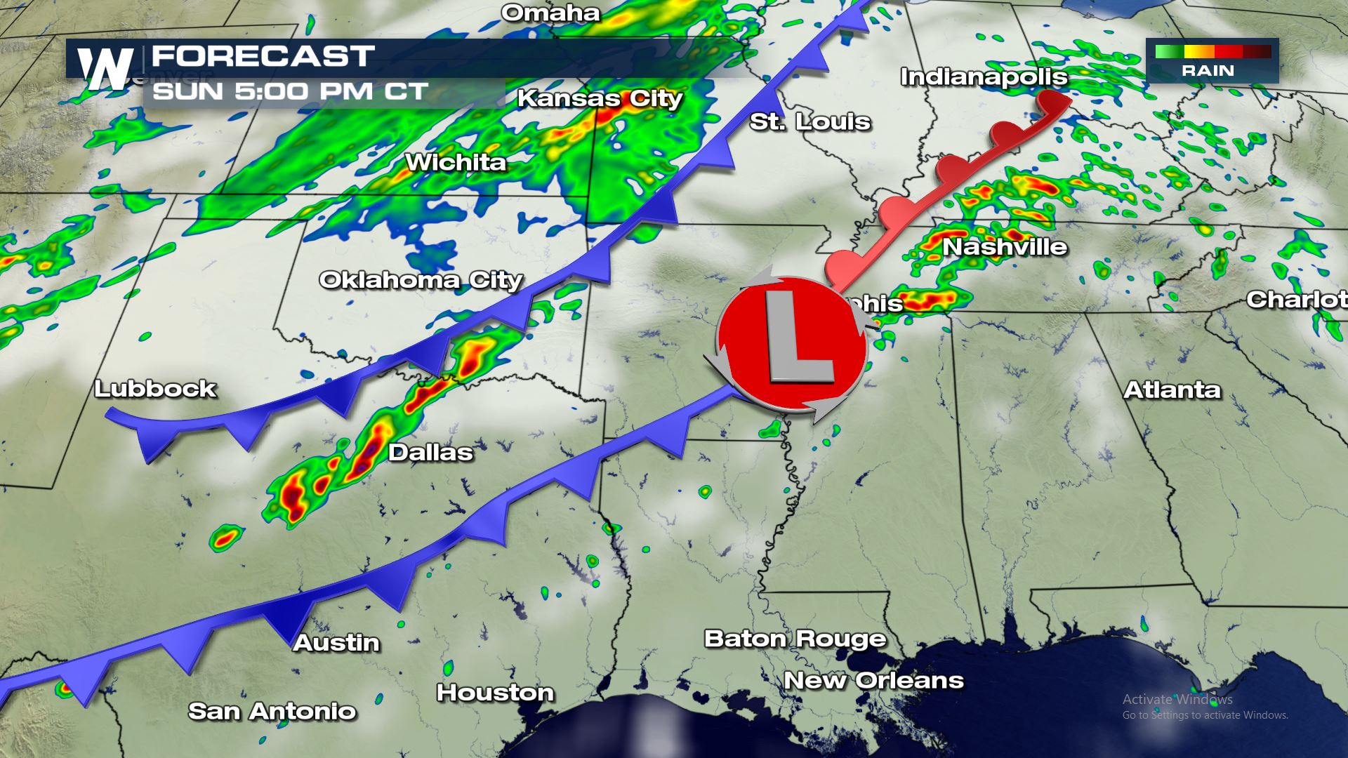 A cold front sweeping through the Lone Star State later today will be the focus for severe storms. The latest timing for the cold front will be the late afternoon and early evening.
Keep checking WeatherNation for the very latest updates.
A cold front sweeping through the Lone Star State later today will be the focus for severe storms. The latest timing for the cold front will be the late afternoon and early evening.
Keep checking WeatherNation for the very latest updates.
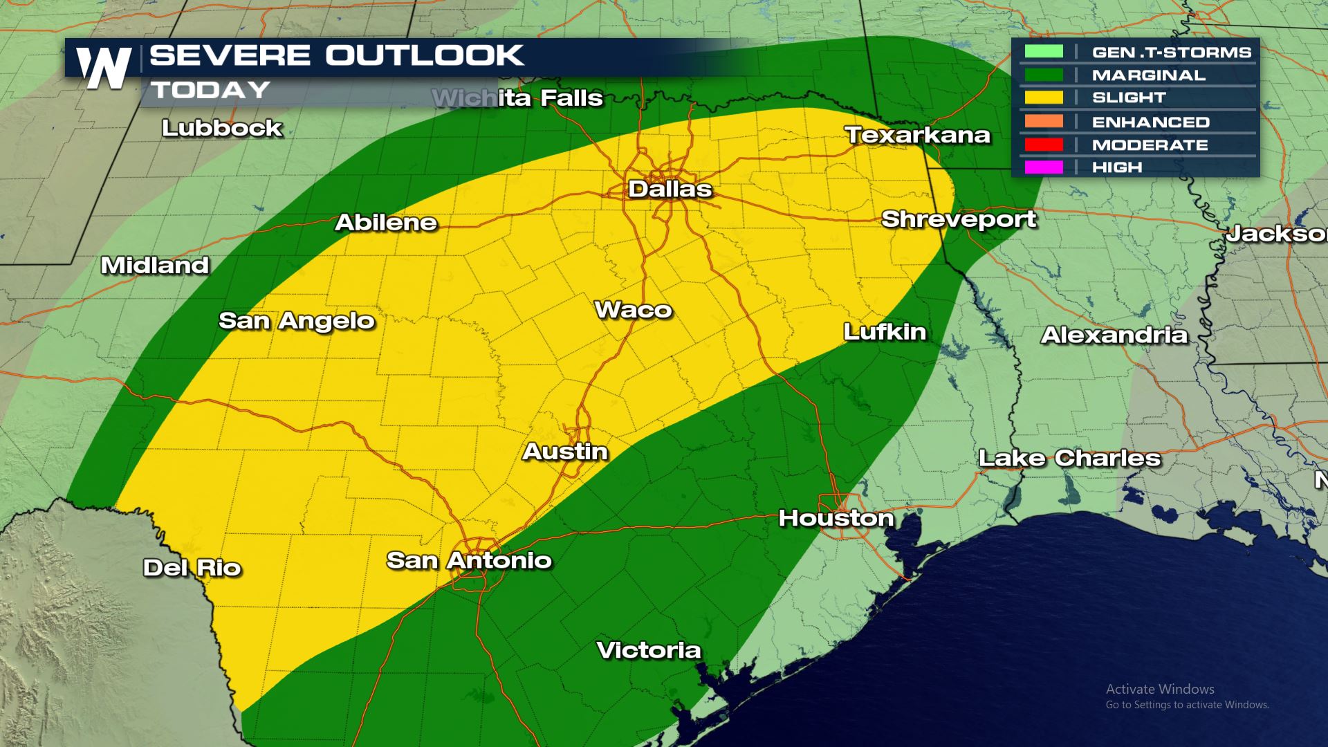
Severe Outlook
A cold front will bring severe storms to the region with the highest risk of severe weather over most of western and northern Texas. These areas will need to be weather prepared for tornadoes, large hail and damaging winds.
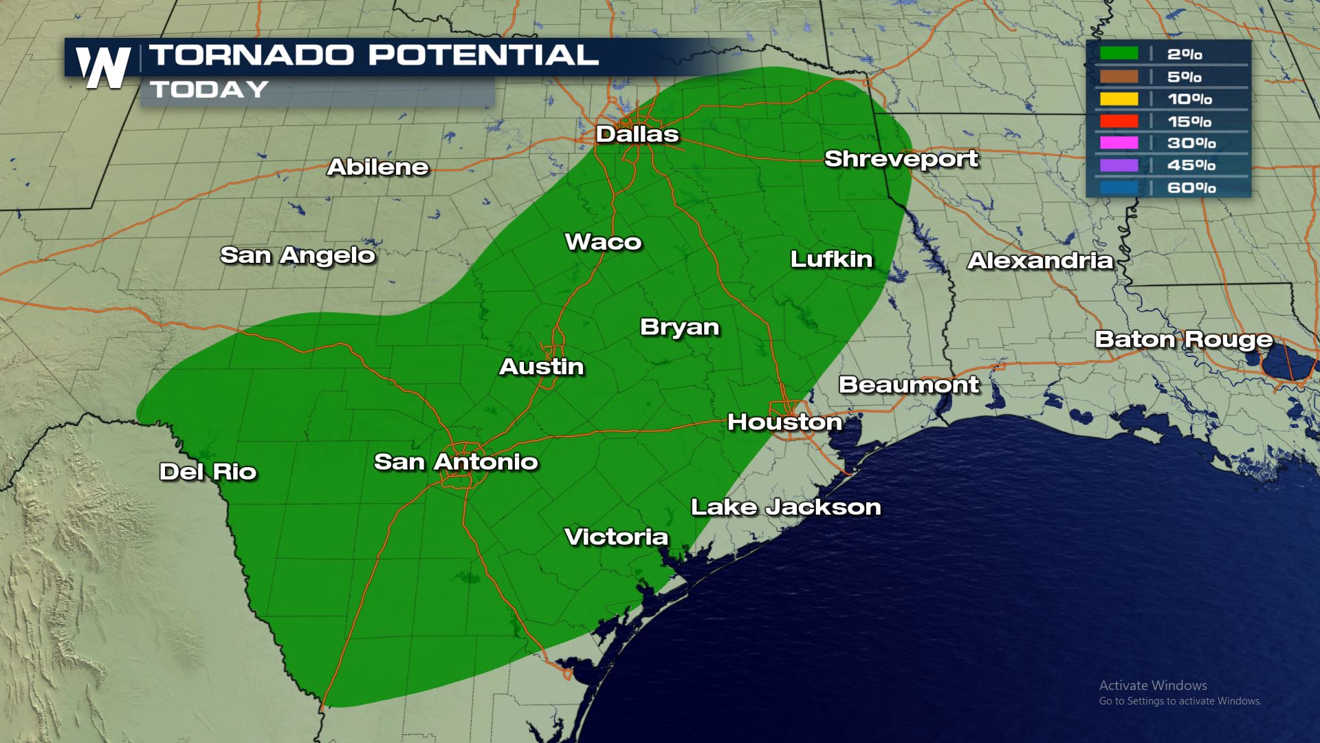
Severe Risks
All modes of severe weather will be in the forecast today. This includes the risk of torrential rainfall leading to flash flooding.
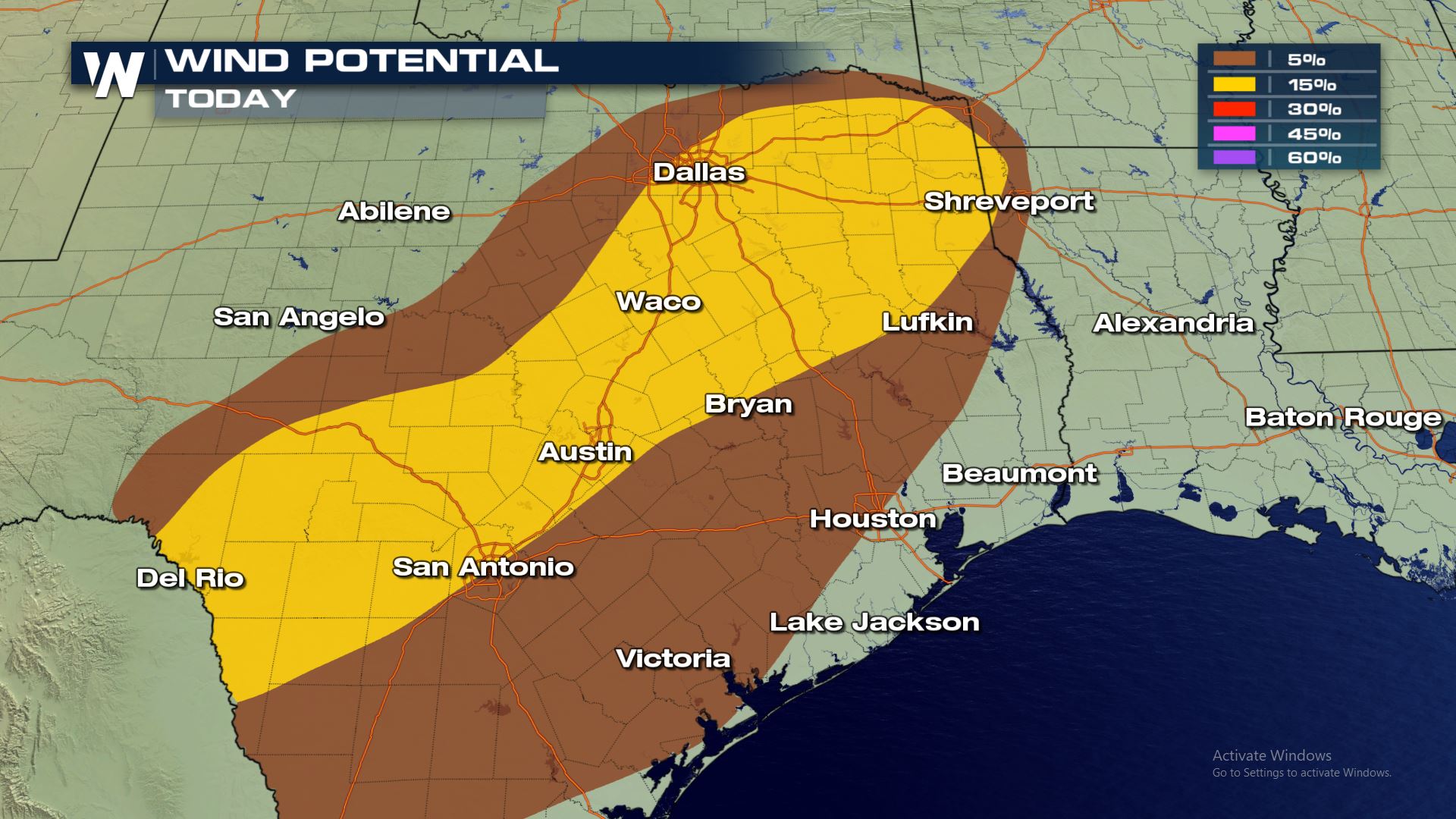
Forecast
A cold front sweeping through the Lone Star State later today will be the focus for severe storms. The latest timing for the cold front will be the late afternoon and early evening.
Keep checking WeatherNation for the very latest updates.All Weather News
More
Flooding Risk Increases as Heavy Rain Targets the Tri-State Area
Tuesday, heavy rainfall moved across the Nort
30 Jul 2026 12:25 AM


Genevieve Down to a Category 2 Hurricane
PacificFausto is now a post-tropical cyclone.
30 Jul 2026 12:00 AM

Severe Weather: Energy From the Midwest Now in the Southeast
UPPER MIDWEST - Through Monday, dangerous tor
29 Jul 2026 10:30 PM


Southeast Flood Risk Lingers Near Stalled Front
A stalled boundary over the Southeast will ke
25 Jul 2026 10:55 AM

Another Round of Storms Targets the Northeast
Tuesday brought severe weather again across p
23 Jul 2026 1:15 AM