Swath of Heavy Snow from the High Plains to the Great Lakes
Special Stories
8 Feb 2018 6:46 PM
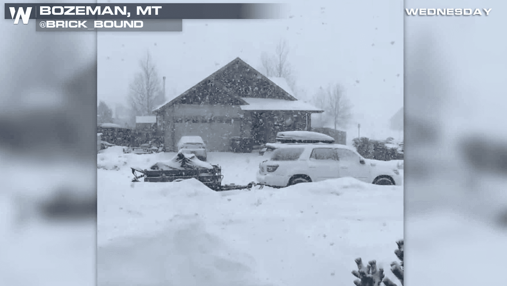
A swath of heavy snow will fall from Montana through Iowa into Ohio over the next few days. Winter Storm Warnings continue from the High Plains to Lake Erie. Some areas may see up to a foot of fresh snowfall.
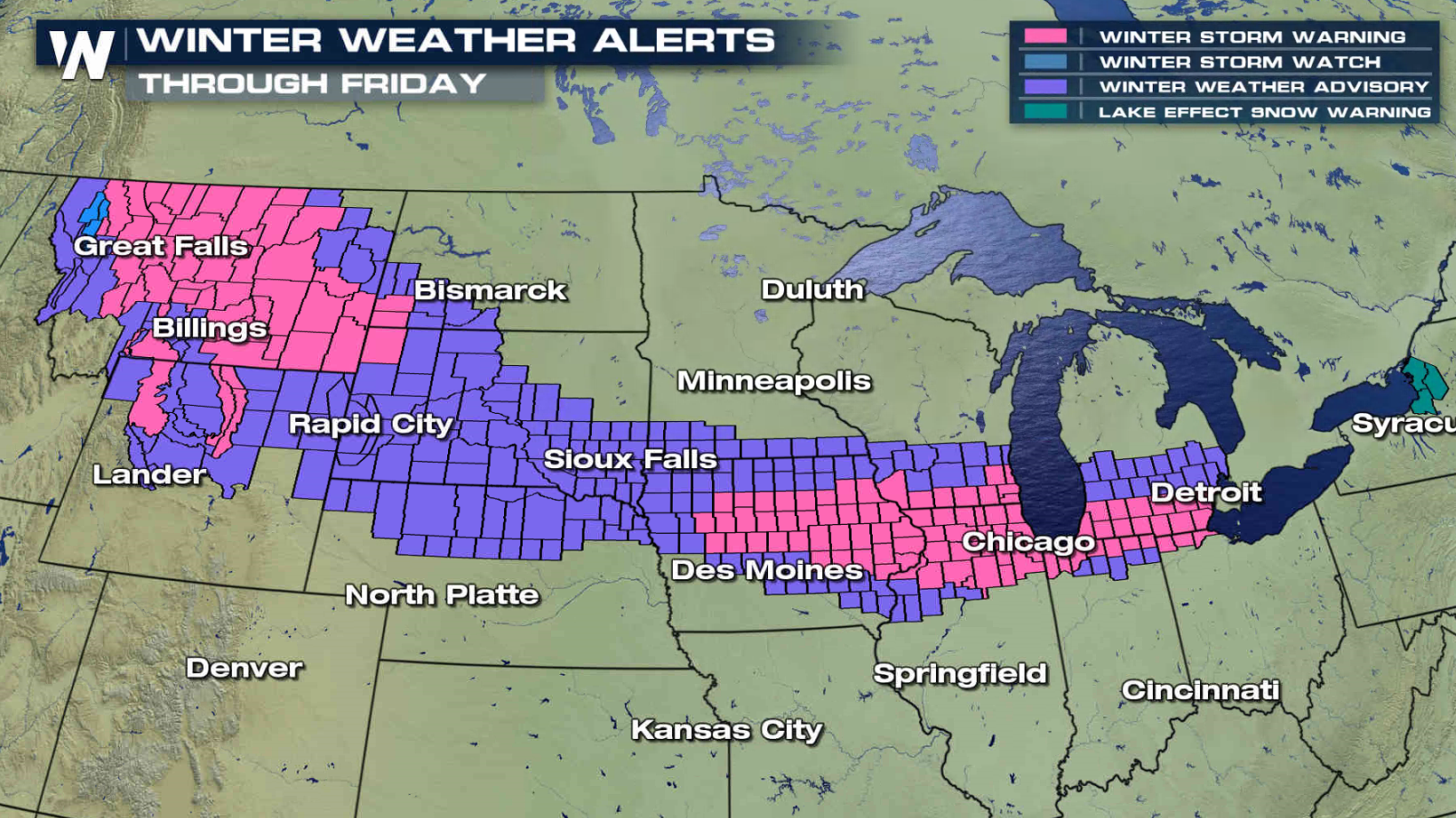
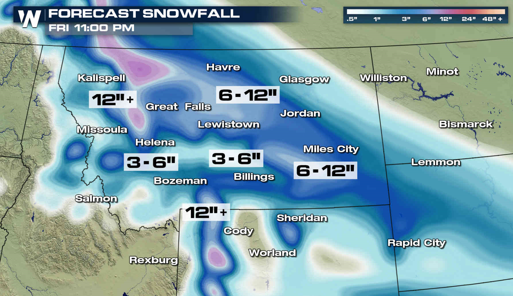
 A front extends along the Rockies Mountains through the Central Plains into the Ohio Valley. A series of low pressure centers riding along the front will produce the heavy snow. Accumulations will likely continue into the weekend.
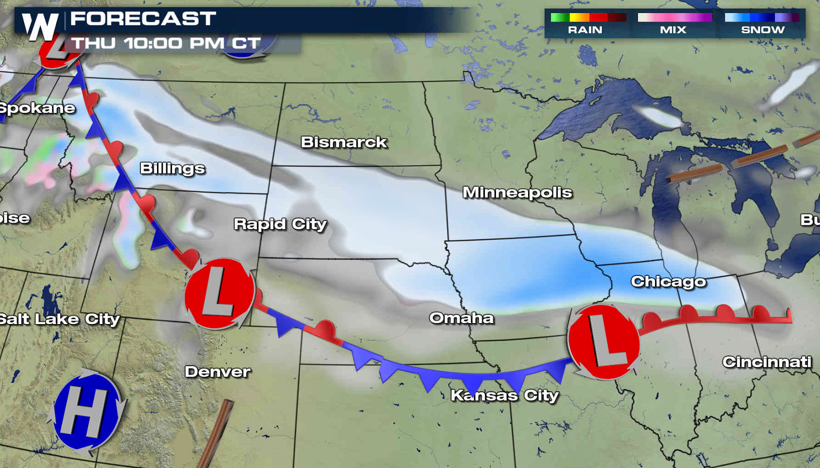
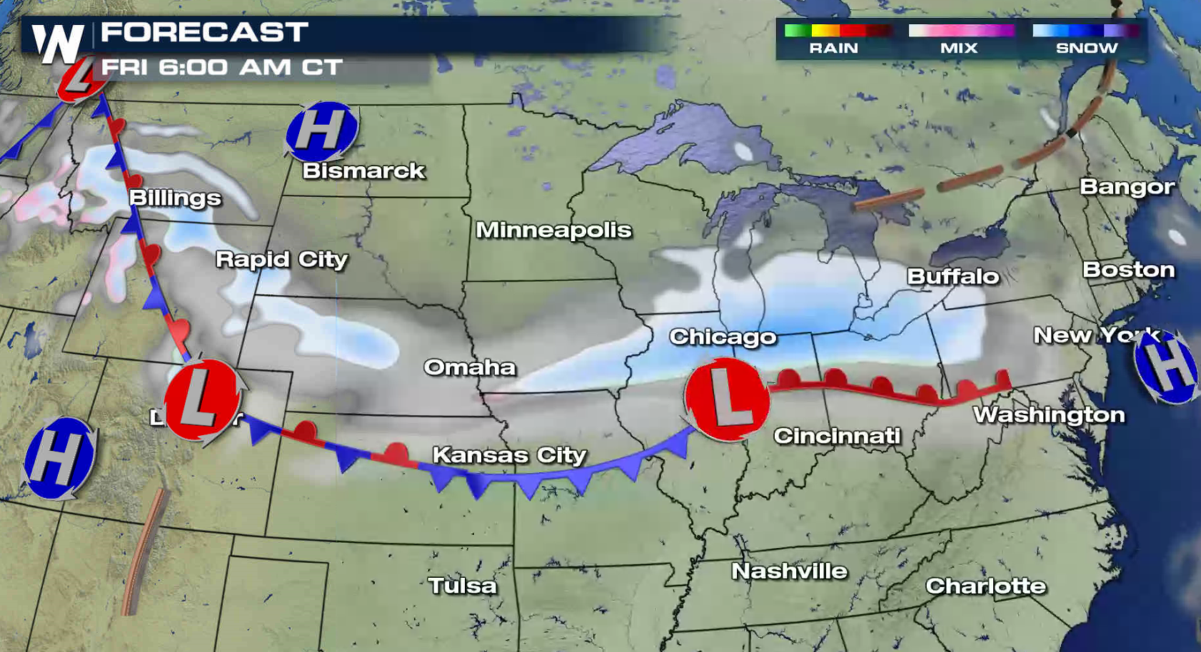
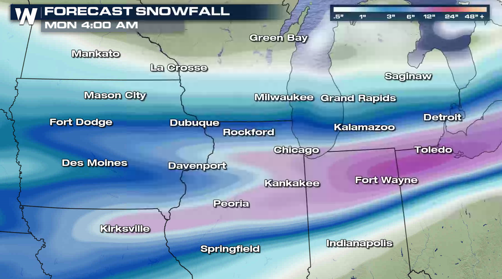
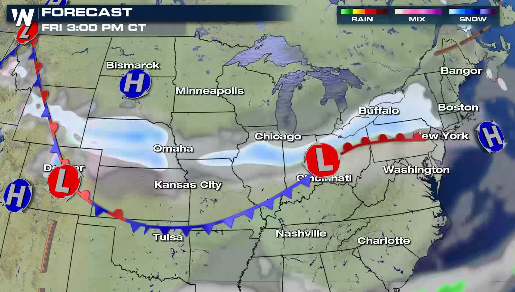 Snow will continue to fall through tonight into Friday from the Plains to the western Great Lakes. 8" to 12" are possible, especially near Lake Michigan.
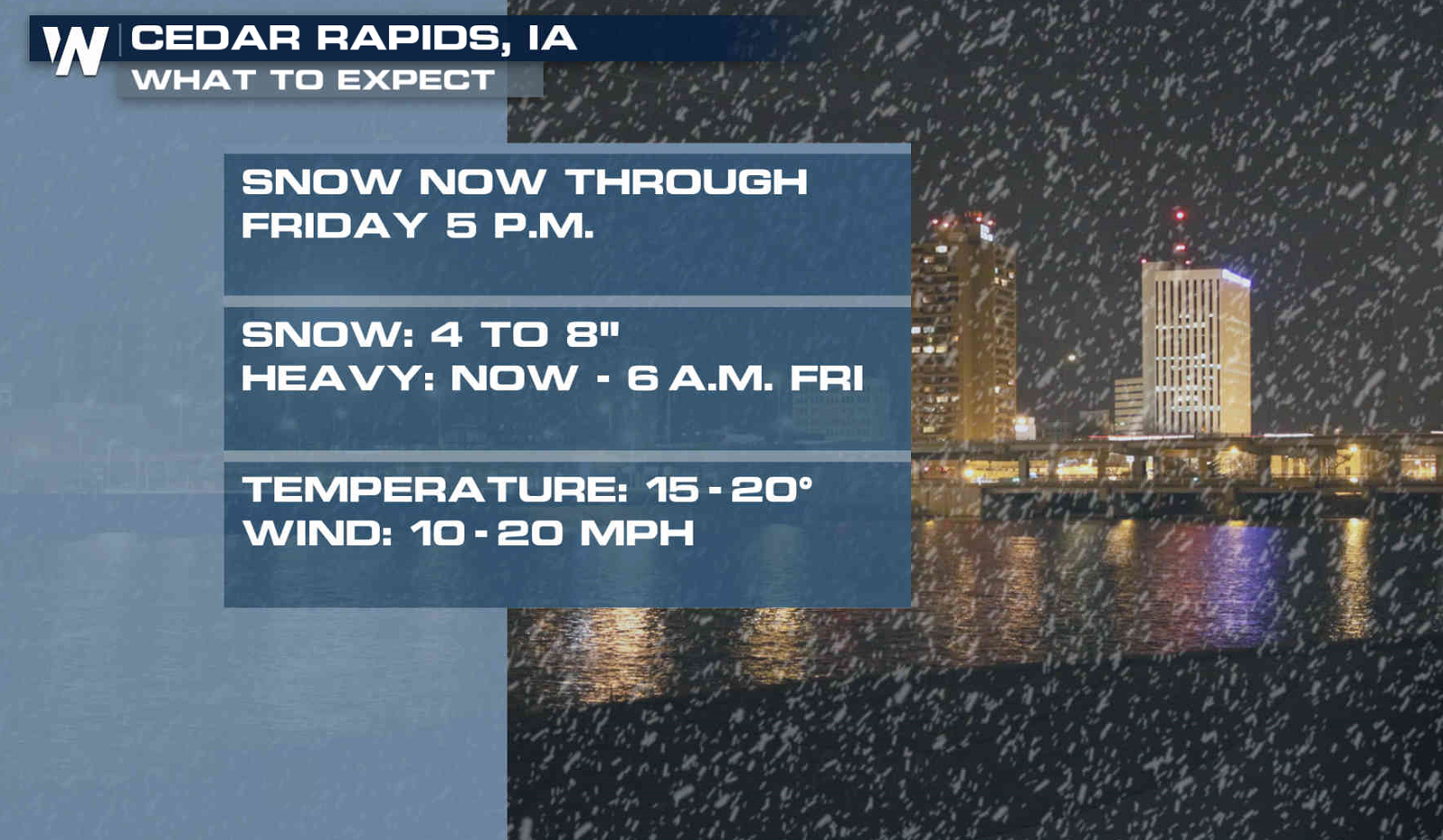
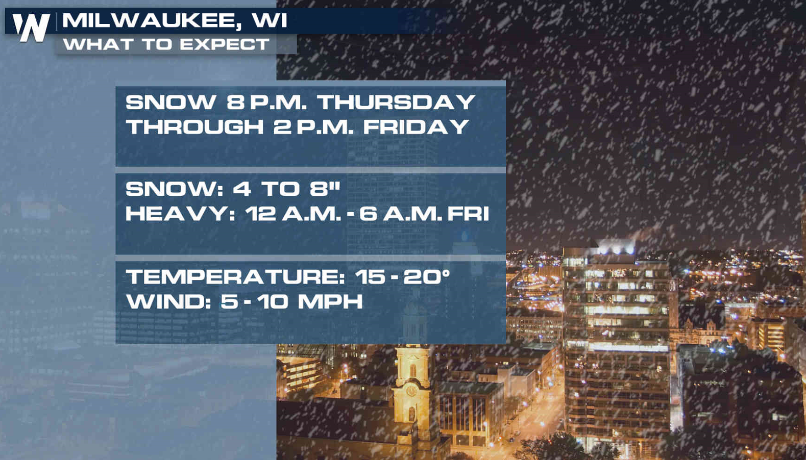
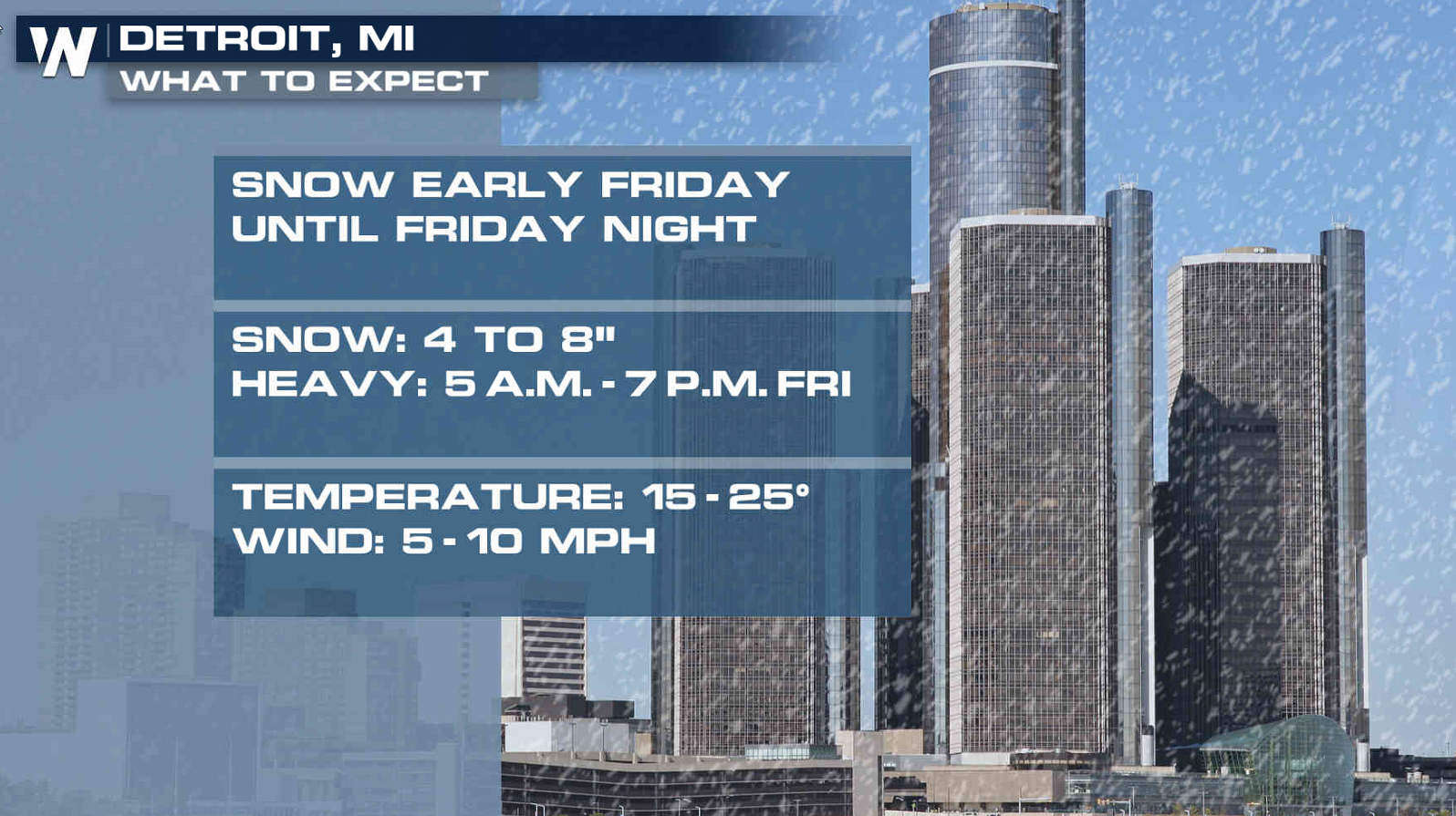
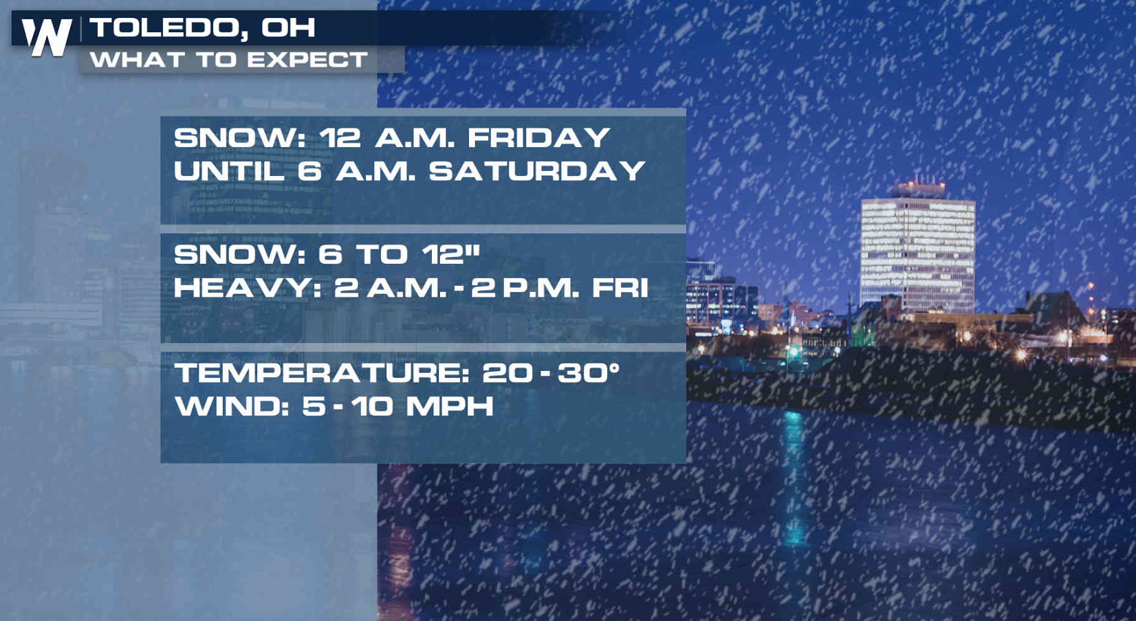
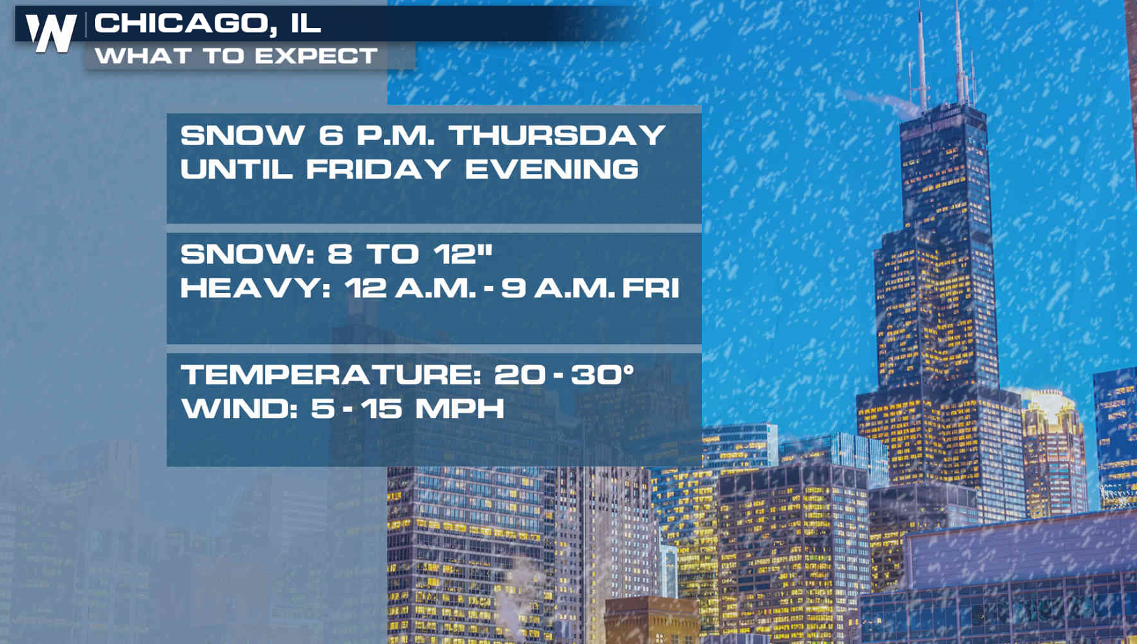 Snowfall will extend eastward to areas near Lake Erie throughout Friday. Accumulations will push into the Northeast this weekend.
A front extends along the Rockies Mountains through the Central Plains into the Ohio Valley. A series of low pressure centers riding along the front will produce the heavy snow. Accumulations will likely continue into the weekend.
Snow will continue to fall through tonight into Friday from the Plains to the western Great Lakes. 8" to 12" are possible, especially near Lake Michigan.
Snowfall will extend eastward to areas near Lake Erie throughout Friday. Accumulations will push into the Northeast this weekend.
All Weather News
More
Major River Flooding Causes Damage; Another Day of Storms in New Mexico
A powerful low pressure system has been movin
24 Oct 2026 5:35 PM

Hurricane Vance Swirling in the Pacific
After becoming a hurricane Friday, Vance quic
24 Oct 2026 5:30 PM

Warmer Than Average: Above-Normal Temperatures Across the Central U.S. This Week
WHAT TO EXPECTA ridge of high pressure linger
24 Oct 2026 5:30 PM

Sunny Day Flooding; King Tides Surge This Week
This week, the ocean is coming to low lying a
24 Oct 2026 5:25 PM


Several Fires Break Out in SoCal Last Week Amid Santa Ana Wind Event
Santa Ana winds helped several fires grow qui
19 Oct 2026 1:25 PM

Another Cold Morning Before Things Warm Back Up
Across portions of the Ohio Valley through th
19 Oct 2026 10:15 AM