Swath of Heavy Snow from the Upper Midwest to the Blue Ridge Mountains
Special Stories
22 Mar 2018 3:45 PM
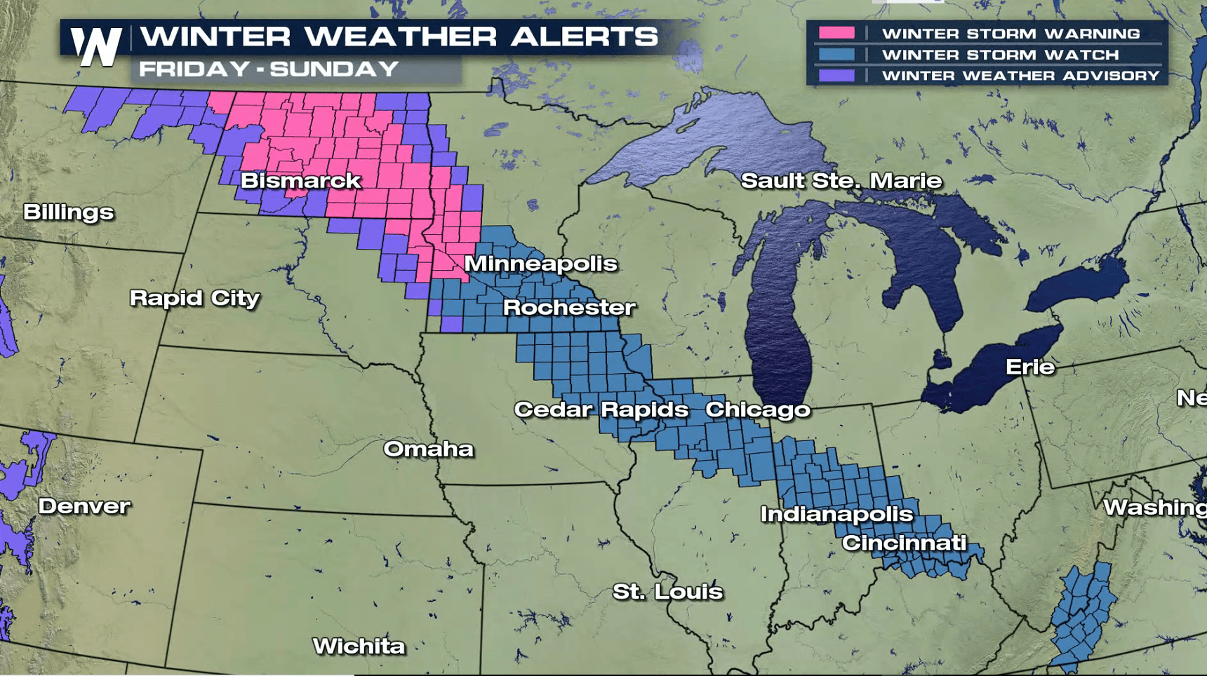
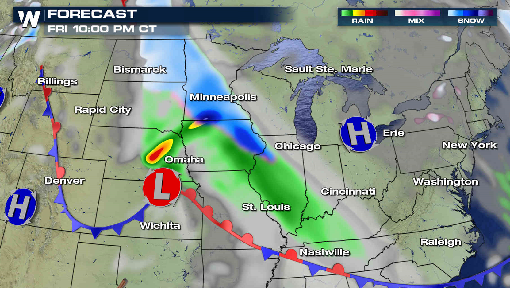
A fast moving low pressure center will put down a swath of heavy snow from the Upper Midwest and Corn Belt to the Blue Ridge Mountains Friday into Saturday. Winter weather alerts extend from North Dakota to Virginia. Most totals will be the 3" to 6" range, but isolated areas could see up to a foot of accumulation.

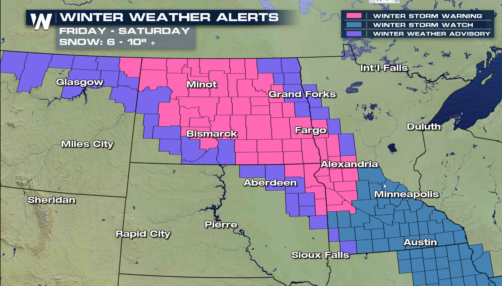
 The first wave of snow will move into North Dakota Friday morning, spreading south to Iowa by Friday night. Along with pockets of heavy snow, wind gusts of 30-40 mph will create blowing snow, reducing visibility.
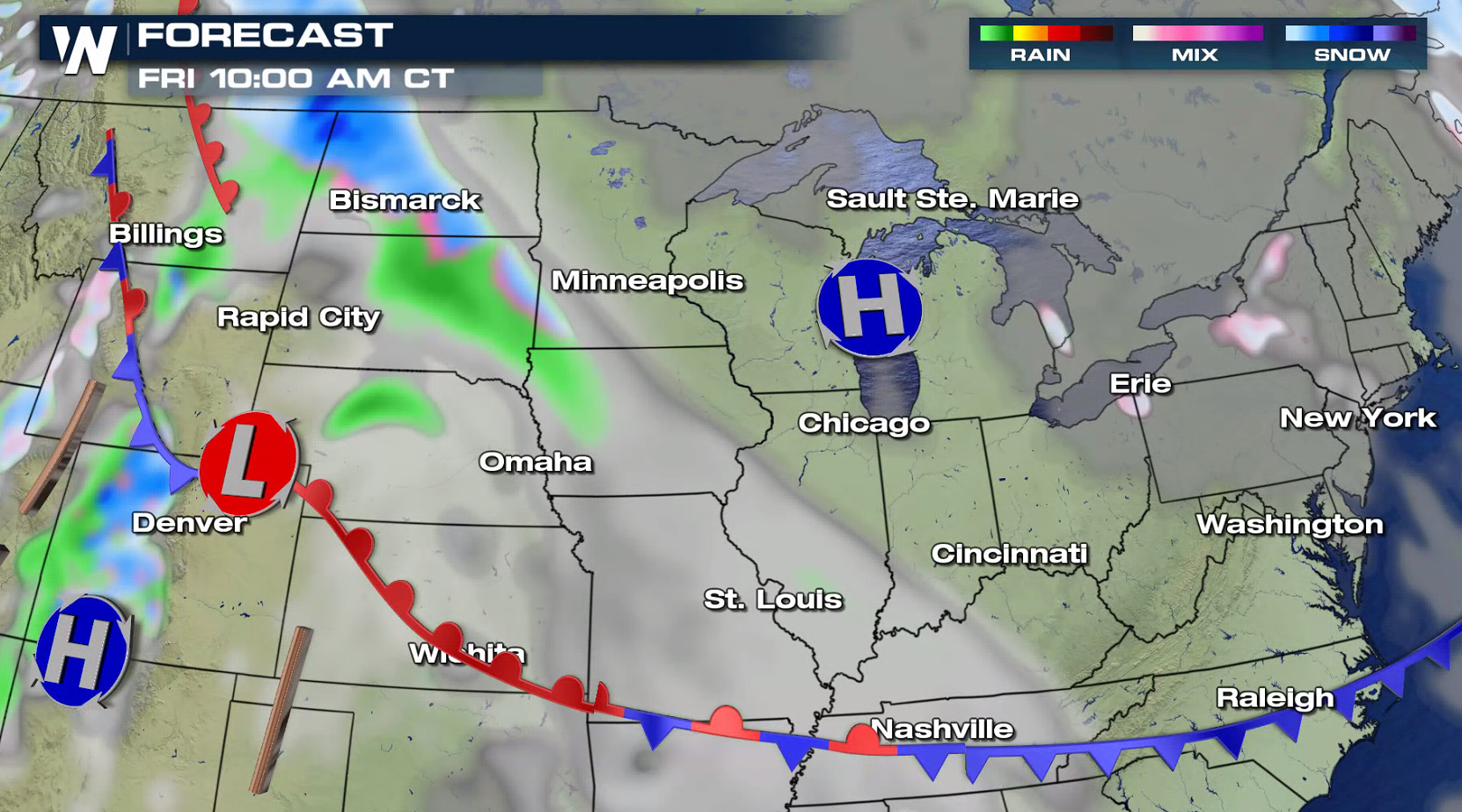
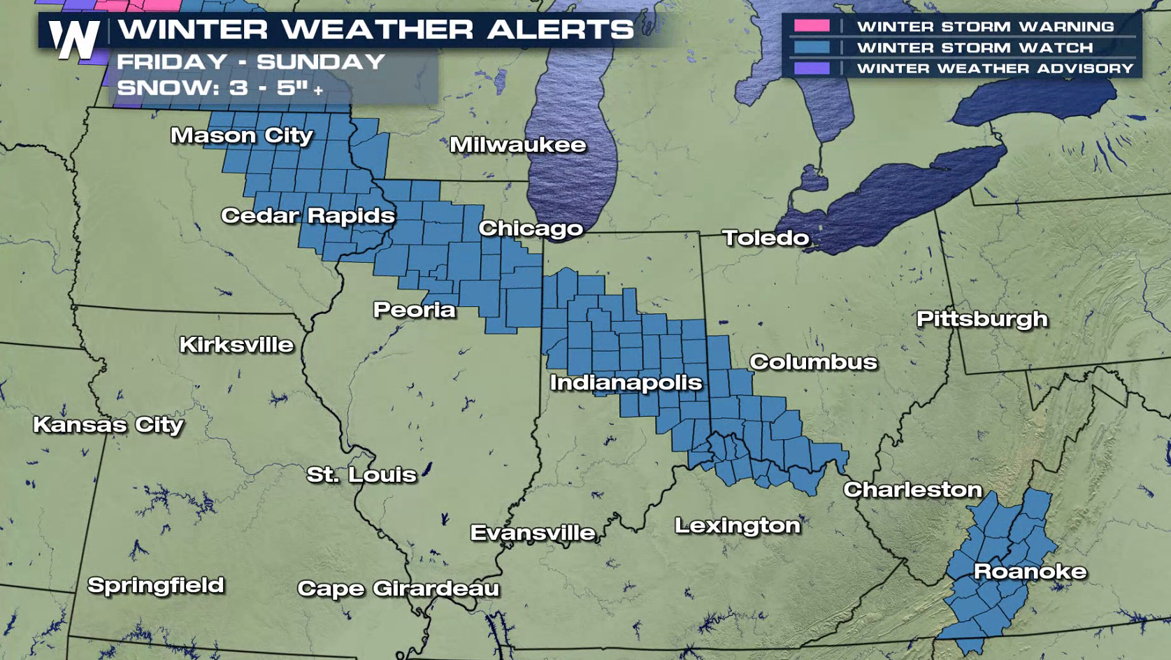
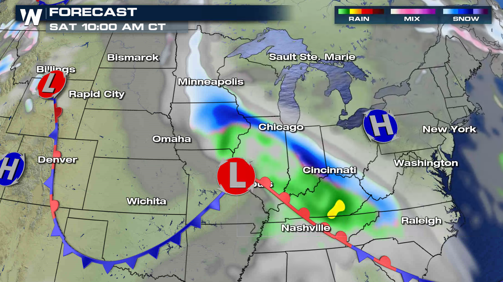
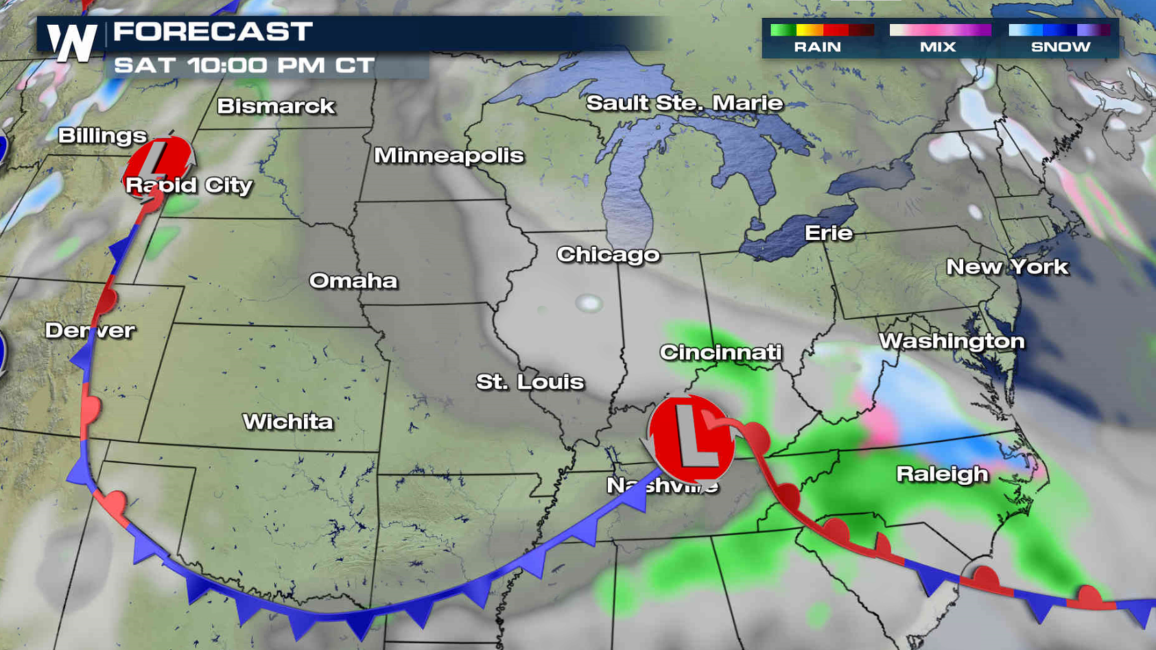
 The snow will push through the Ohio Valley Friday night. On Saturday, snowfall will move into the Middle Atlantic and the Outer Banks of North Carolina. The system moves out to sea Sunday, into the Atlantic Ocean.
 For WeatherNation: Meteorologist Mace Michaels
The first wave of snow will move into North Dakota Friday morning, spreading south to Iowa by Friday night. Along with pockets of heavy snow, wind gusts of 30-40 mph will create blowing snow, reducing visibility.
The snow will push through the Ohio Valley Friday night. On Saturday, snowfall will move into the Middle Atlantic and the Outer Banks of North Carolina. The system moves out to sea Sunday, into the Atlantic Ocean.
For WeatherNation: Meteorologist Mace MichaelsAll Weather News
More
Fronts Continue To Spark Severe Weather Across the Plains
A cold front that brought record lows to the
18 Jul 2025 10:40 PM

Extreme Heat Impacts for the East Coast & South
Extreme heat continues to impact several area
18 Jul 2025 10:05 PM

Flooding Threat Remains Elevated in the East
A cold front pushing through the Eastern Seab
18 Jul 2025 9:10 PM

EF-2 Firenado from the Deer Creek Fire in Utah
A fire tornado was spotted near La Sal, Utah
18 Jul 2025 7:30 AM

Tropical System Brings Flood Risk to the Central Gulf
Time has run out for notable tropical develop
18 Jul 2025 3:05 AM

Heavy Rain, Flooding Threat Returns to Florida
Keep the rain boots handy in Florida - heavy
13 Jul 2025 12:50 PM

Severe Storm Risk Pushes into the Great Lakes, Ohio Valley
Friday was another busy day with severe weath
12 Jul 2025 8:00 PM