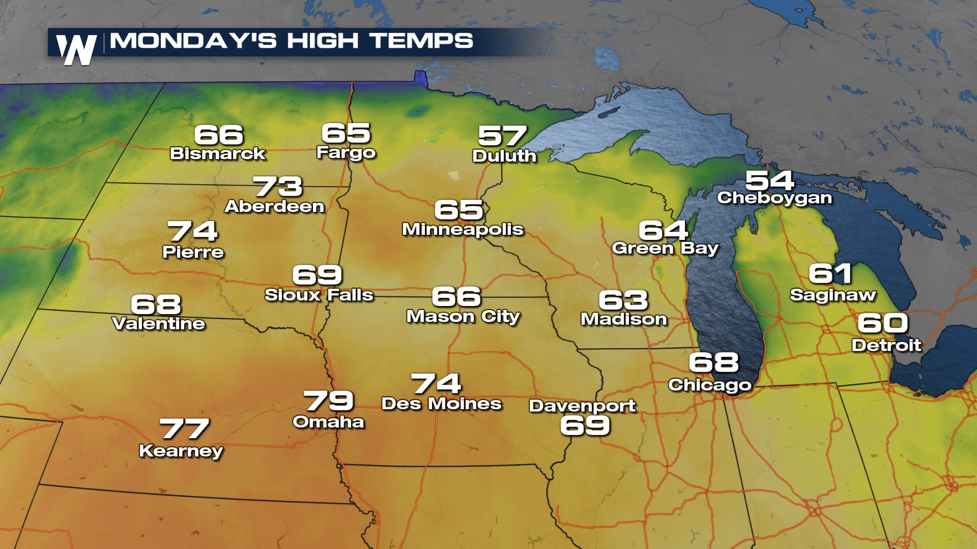
Spring-like Temperatures In the Central Plains

CENTRAL PLAINS - Warm temperatures return to the Plains this week thanks to ridging over the Gulf. This will lead to the potential for record breaking high temperatures across the Plains of Nebraska, the Dakotas, Minnesota, Iowa, Wisconsin, and MIchigan. Each red dot above represents a city that may break or tie a record high.
These temperatures will average 20-30 degrees above the normal for Monday afternoon.
 This warmth will continue through the work week (with one large exception) across our northern Plains cities. We should be averaging in the 40s this time of year.
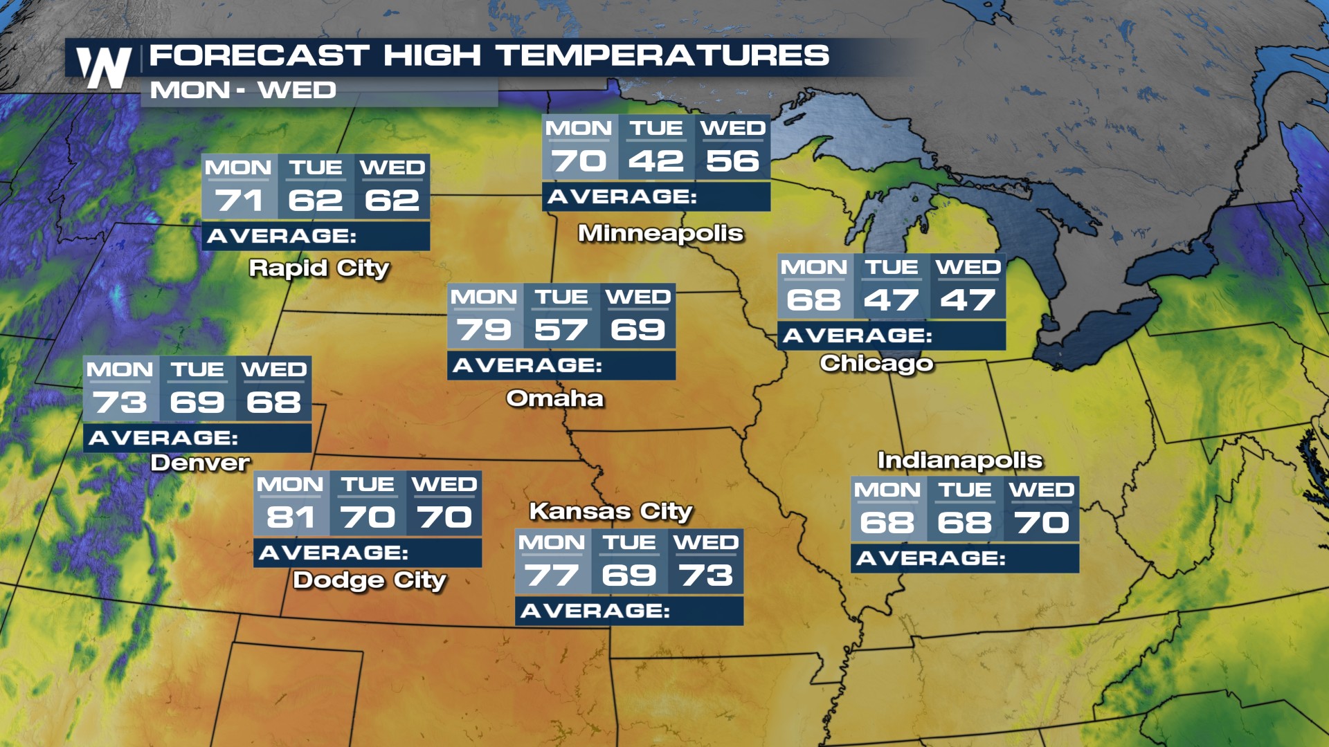 Watch what happens after highs today reach the 60's in the Dakotas. A sharp cold front drops through, shoving wind chill values back into the single digits Monday night into Tuesday morning.
For more details on our next best chance for precipitation be sure to join us on WeatherNation, we're always streaming!


