Threat for Severe Weather in the Upper Midwest and Plains into This Weekend
Special Stories
31 Aug 2018 12:40 PM
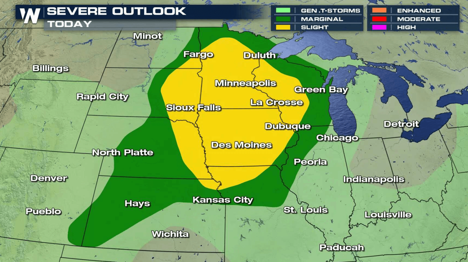
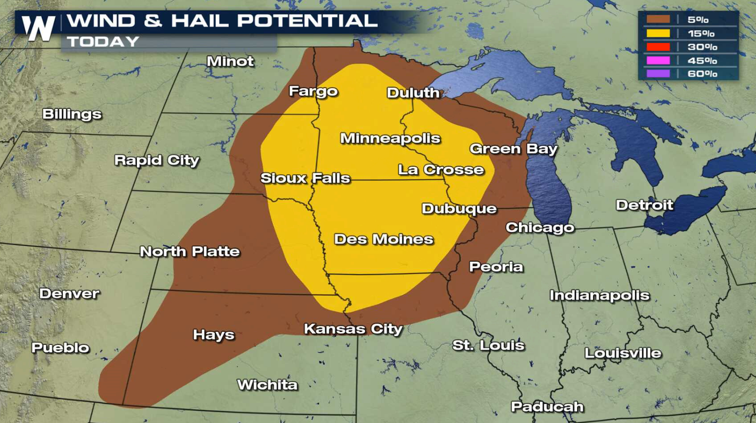
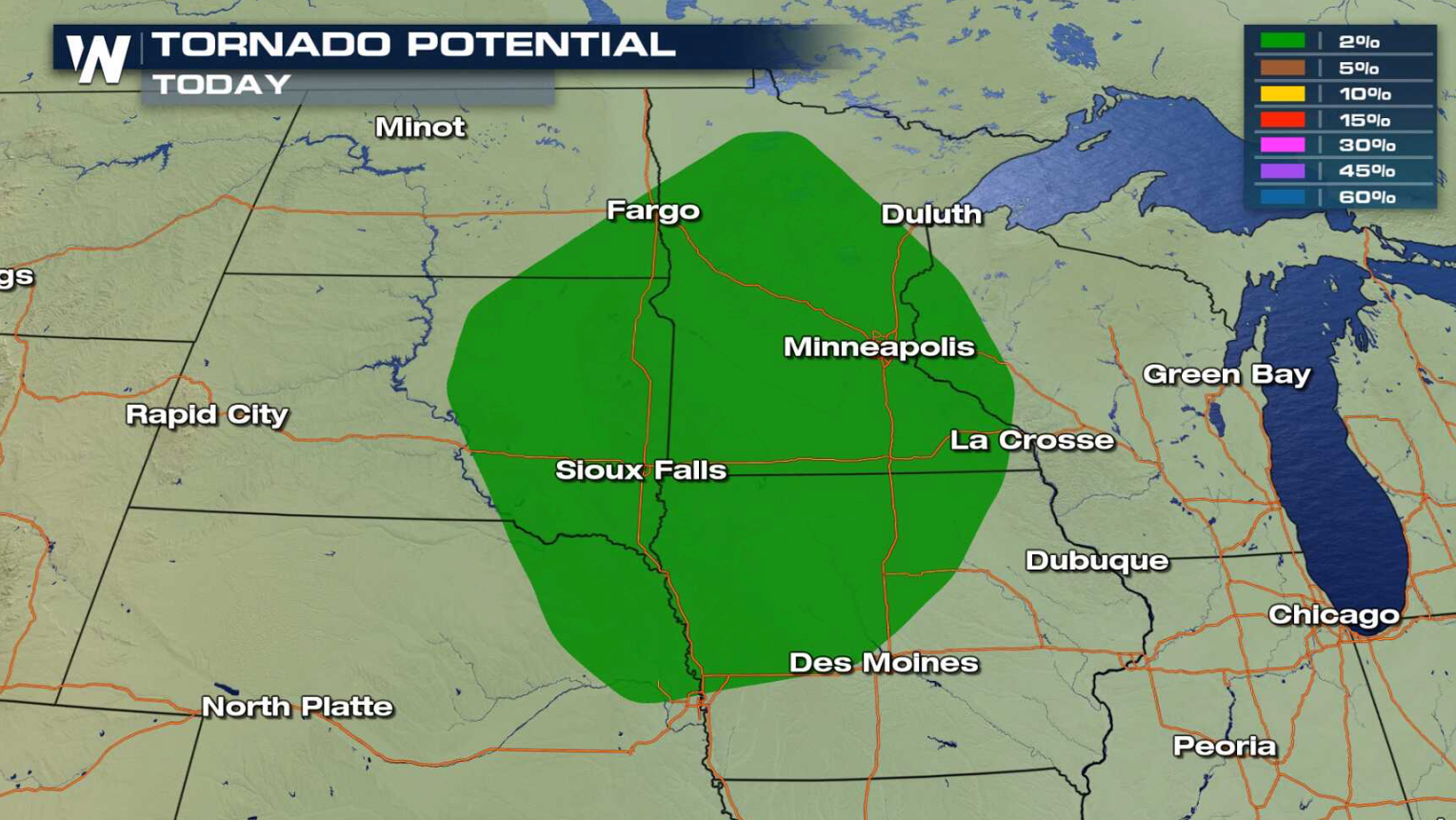
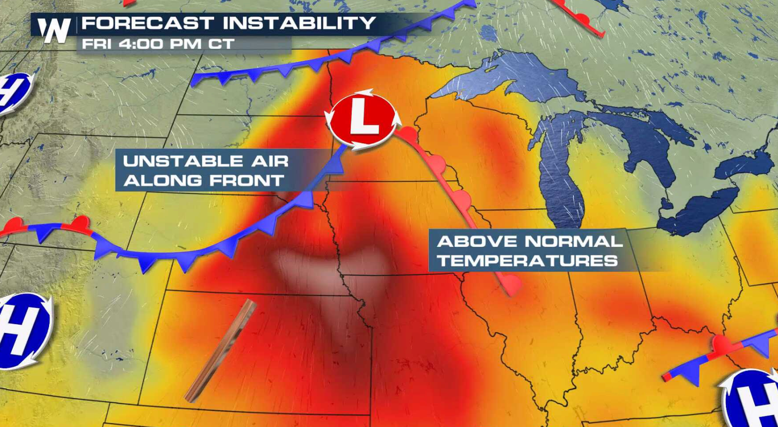
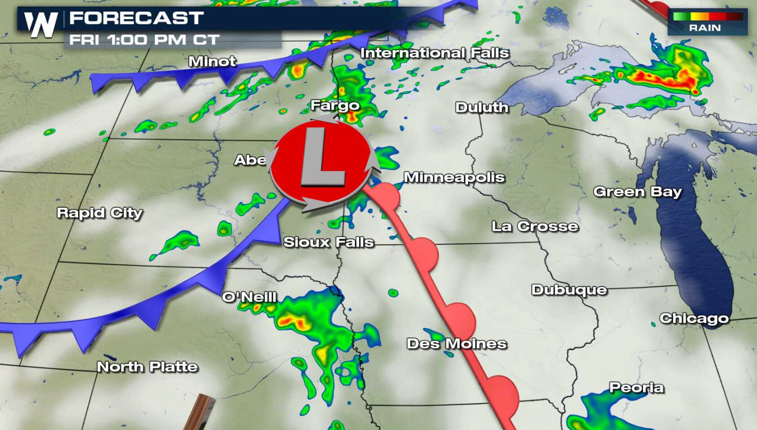
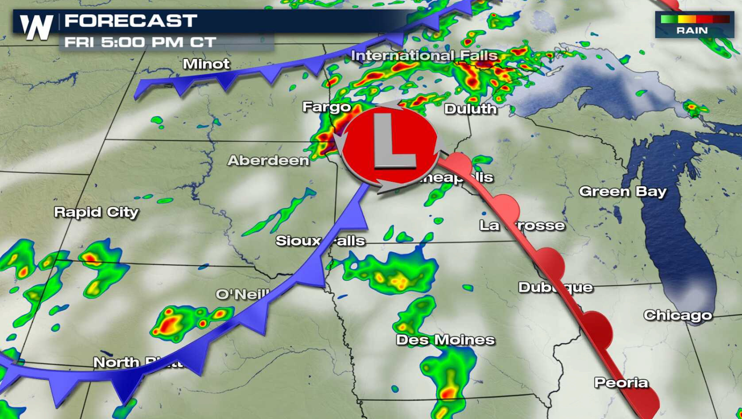
A storm system moving through the northern Plains today (Friday) will bring a chance for severe thunderstorms into this weekend. There is a slight risk for severe thunderstorms from northern Minnesota to Kansas City today. Wind and hail are the biggest concerns, with a low threat for a tornado.
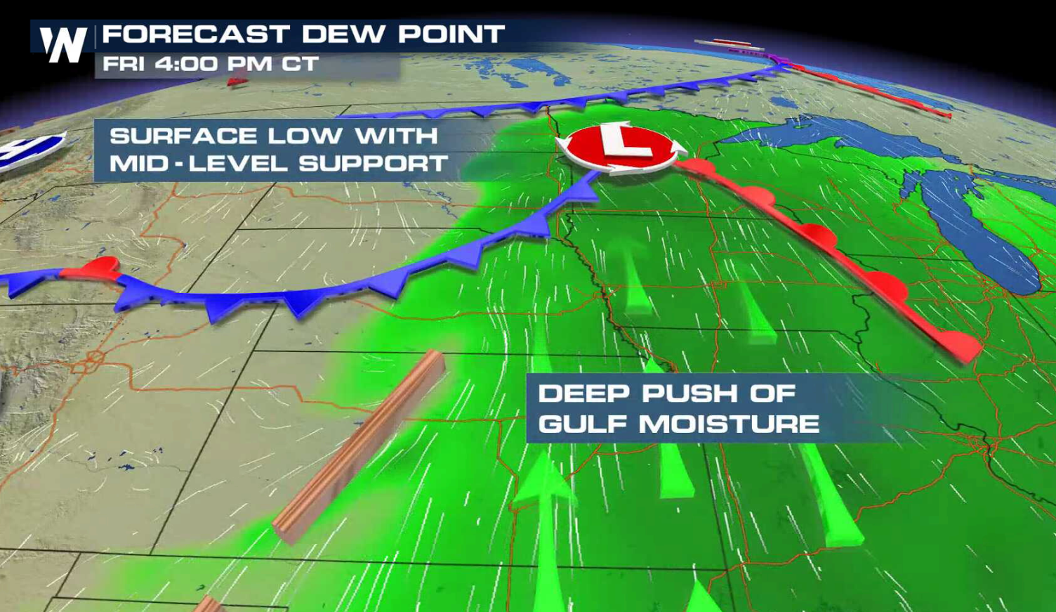
 Heat and humidity will be streaming into the system from the south. The atmosphere will be unstable ahead of a cold front and low pressure center, along with ample Jet Stream energy to support severe thunderstorms.
 Storms will increase across northern Minnesota throughout the day and become more widespread later tonight.
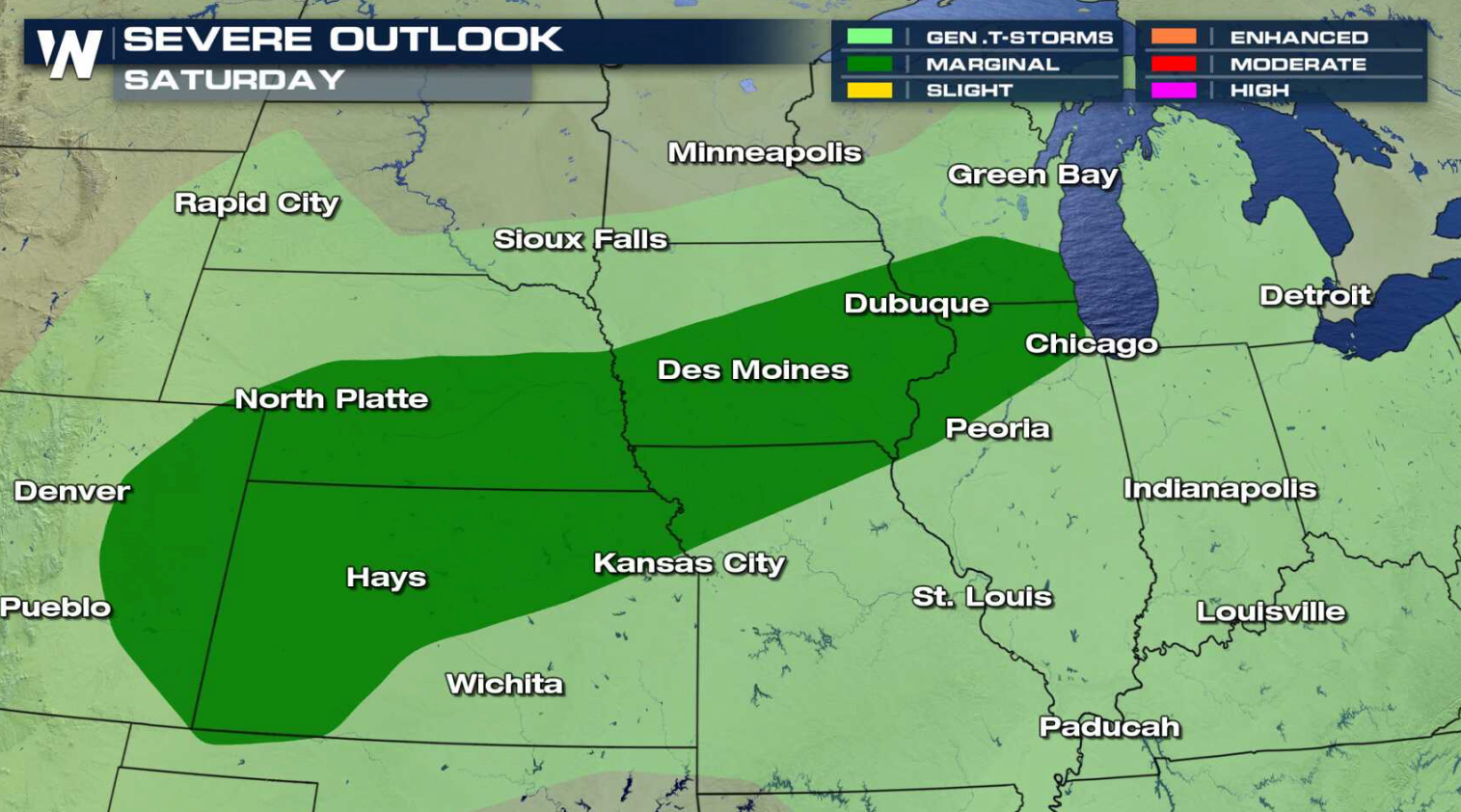
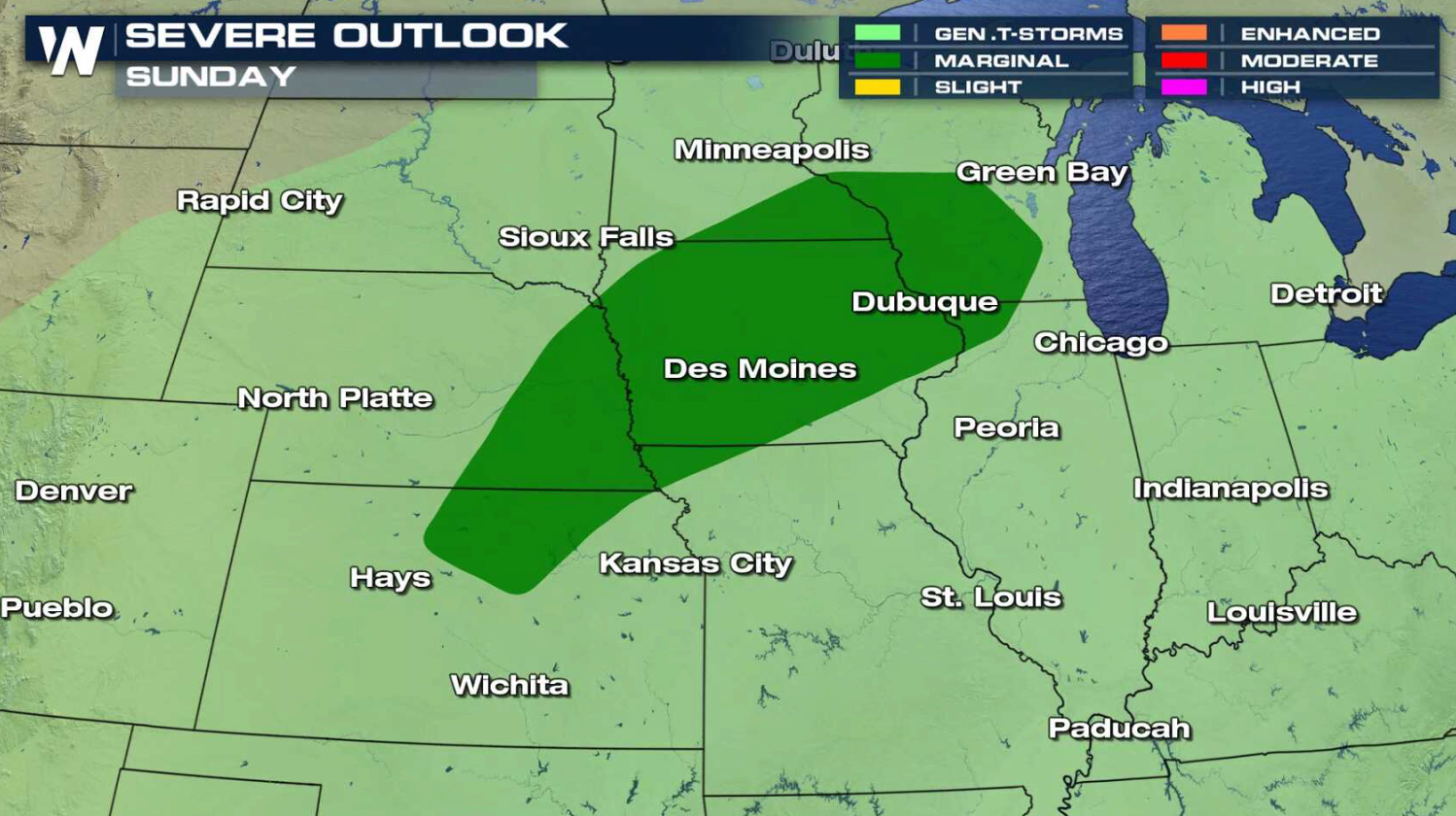
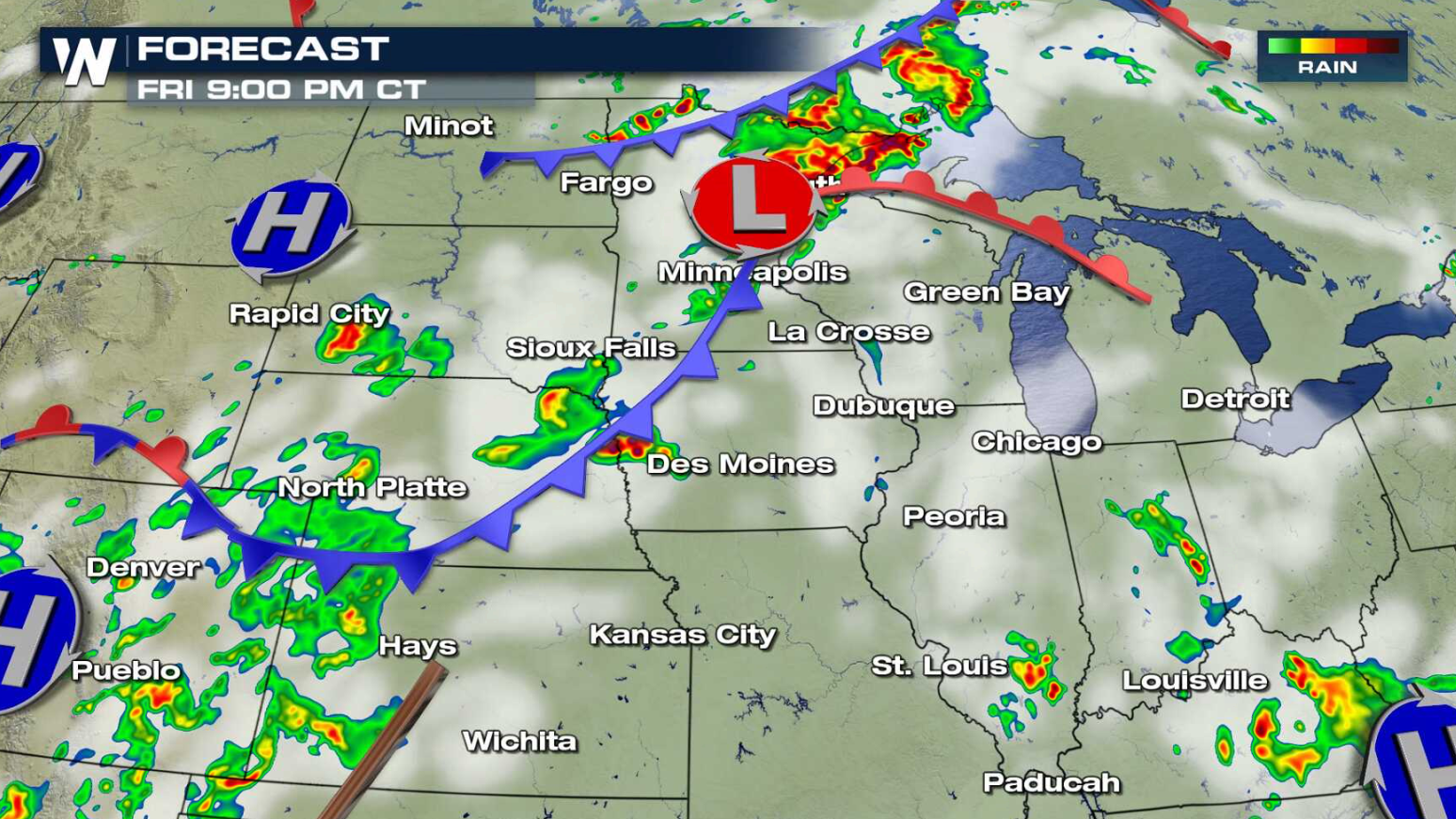 There is a marginal severe weather risk from Wisconsin to the Front Range this weekend.
 For WeatherNation: Meteorologist Mace Michaels
Heat and humidity will be streaming into the system from the south. The atmosphere will be unstable ahead of a cold front and low pressure center, along with ample Jet Stream energy to support severe thunderstorms.
Storms will increase across northern Minnesota throughout the day and become more widespread later tonight.
There is a marginal severe weather risk from Wisconsin to the Front Range this weekend.
For WeatherNation: Meteorologist Mace MichaelsAll Weather News
More
More Storms for the East Through Monday
A low-pressure system that moved through the
2 Aug 2026 10:40 PM

Wildfire Outbreak in the Pacific Northwest
SPOKANE, WA - On Saturday, August 1st, the Ol
2 Aug 2026 10:35 PM


After Reaching Category 5, Genevieve Weakens in the Pacific
PacificGenevieve formed on last Friday south
2 Aug 2026 6:25 PM

Flooding, Severe Storms Target the Midwest Again
After an active week of storms across the nor
1 Aug 2026 1:40 AM

Flooding Risk Increases as Heavy Rain Targets the Tri-State Area
Tuesday, heavy rainfall moved across the Nort
30 Jul 2026 12:25 AM

Severe Weather: Energy From the Midwest Now in the Southeast
UPPER MIDWEST - Through Monday, dangerous tor
29 Jul 2026 10:30 PM