Thursday Severe Update
Top Stories
14 Jun 2018 5:46 AM
Severe storms are in the forecast the High Plains on Thursday. All modes of severe weather will be possible with damaging winds, large hail and a few tornadoes all being possible. Here is the very latest.
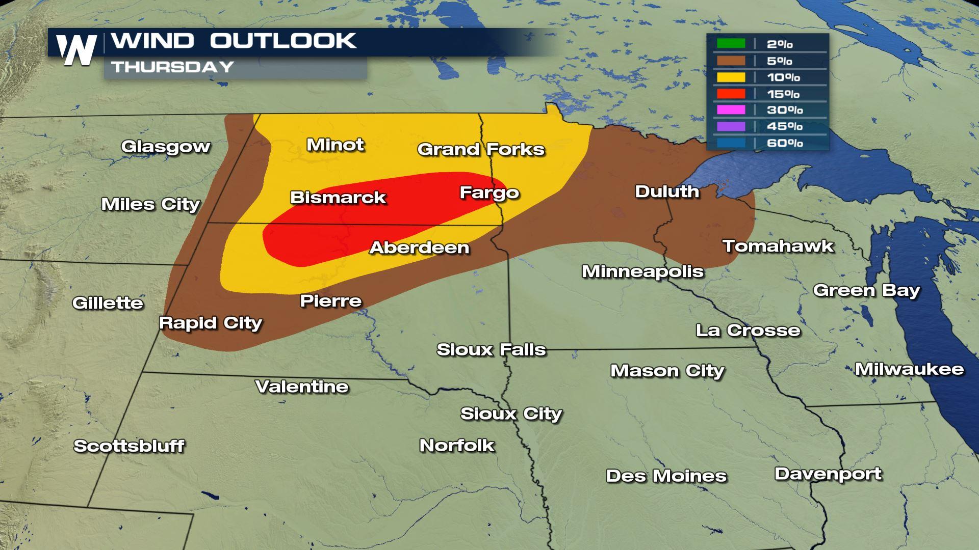
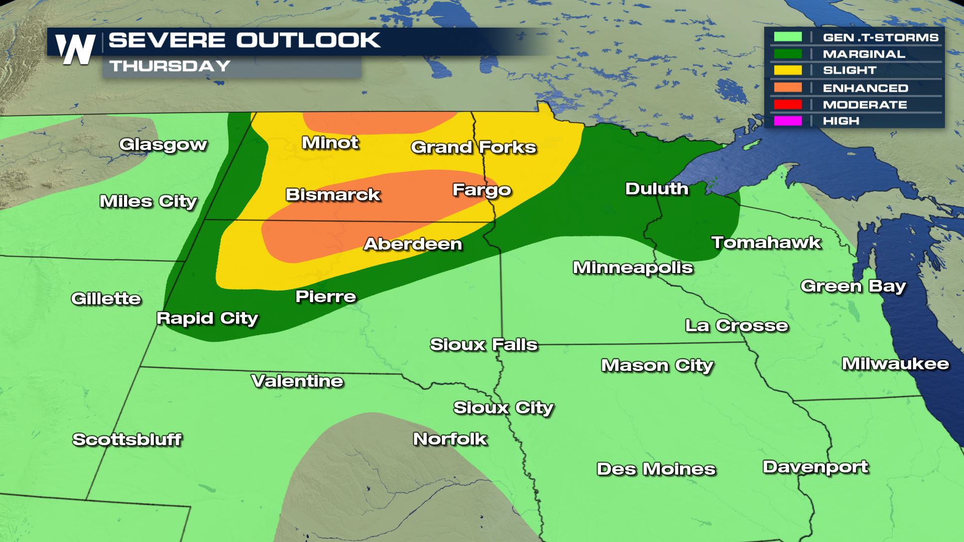 The highest risk for severe weather will be over the Dakotas and NW Minnesota.
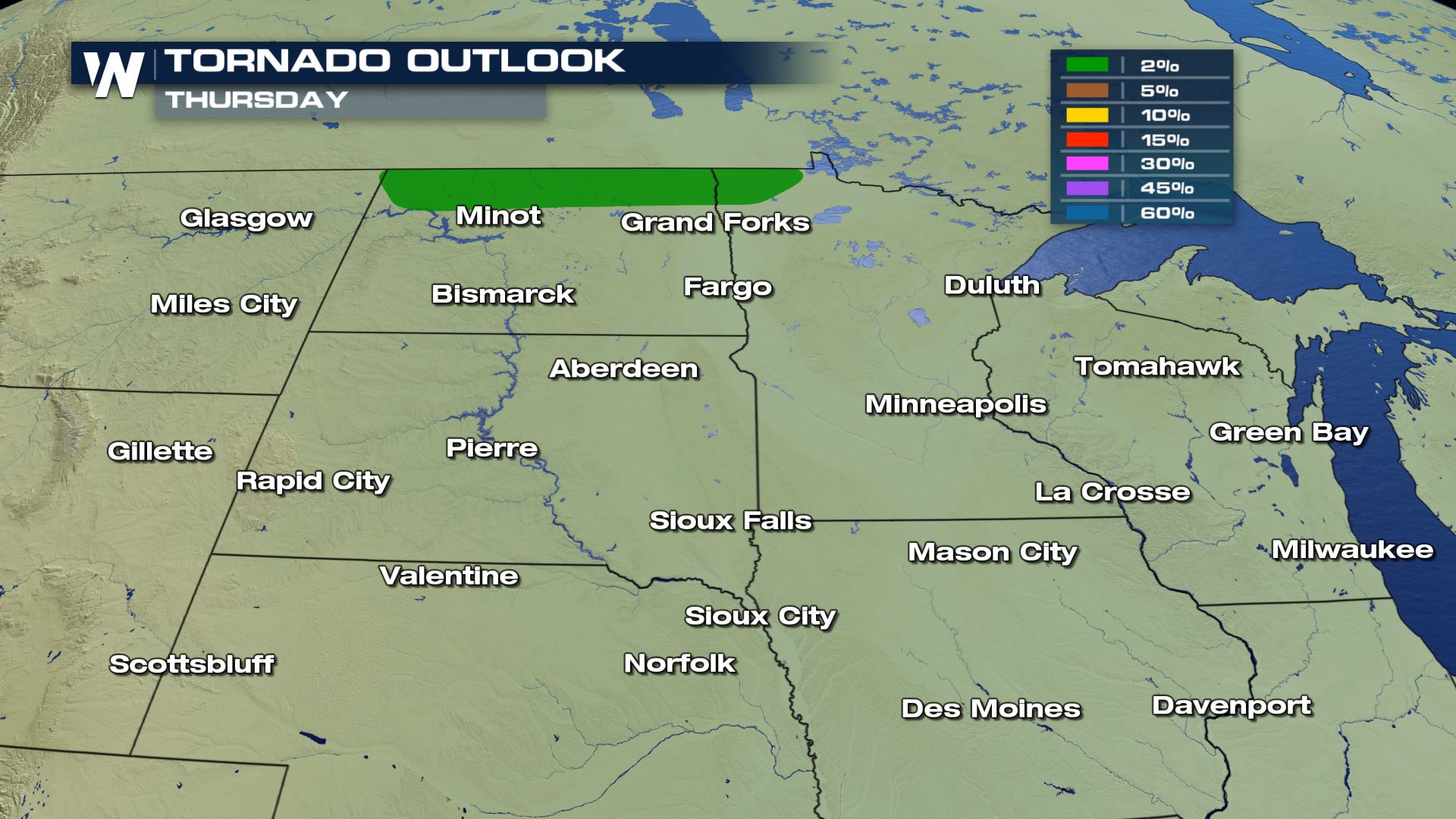

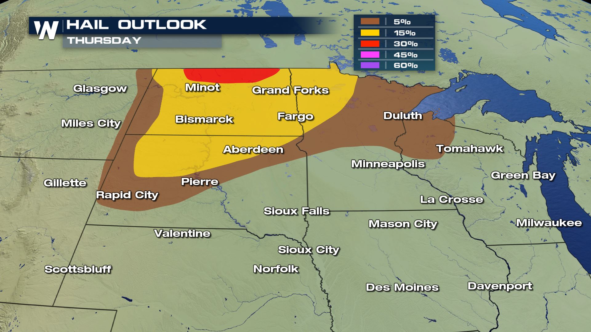 Damaging winds and large hail will be the main severe weather risks with an isolated tornado risk for northern North Dakota as well. The timing for these storms will be for the afternoon and evening. Keep checking back with WeatherNation for the very latest.
Meteorologist Patrick Crawford
Damaging winds and large hail will be the main severe weather risks with an isolated tornado risk for northern North Dakota as well. The timing for these storms will be for the afternoon and evening. Keep checking back with WeatherNation for the very latest.
Meteorologist Patrick Crawford
Severe Outlook
The highest risk for severe weather will be over the Dakotas and NW Minnesota.
Severe Risks
All the severe weather risks will be in these locations.
Damaging winds and large hail will be the main severe weather risks with an isolated tornado risk for northern North Dakota as well. The timing for these storms will be for the afternoon and evening. Keep checking back with WeatherNation for the very latest.
Meteorologist Patrick Crawford
All Weather News
More
Fronts Continue To Spark Severe Weather Across the Plains
A cold front that brought record lows to the
18 Jul 2025 10:40 PM

Extreme Heat Impacts for the East Coast & South
Extreme heat continues to impact several area
18 Jul 2025 10:05 PM

Flooding Threat Remains Elevated in the East
A cold front pushing through the Eastern Seab
18 Jul 2025 9:10 PM

EF-2 Firenado from the Deer Creek Fire in Utah
A fire tornado was spotted near La Sal, Utah
18 Jul 2025 7:30 AM

Tropical System Brings Flood Risk to the Central Gulf
Time has run out for notable tropical develop
18 Jul 2025 3:05 AM

Heavy Rain, Flooding Threat Returns to Florida
Keep the rain boots handy in Florida - heavy
13 Jul 2025 12:50 PM

Severe Storm Risk Pushes into the Great Lakes, Ohio Valley
Friday was another busy day with severe weath
12 Jul 2025 8:00 PM