Thursday Severe Weather from the Upper Midwest to Southern Plains
Special Stories
18 Jun 2020 8:30 AM
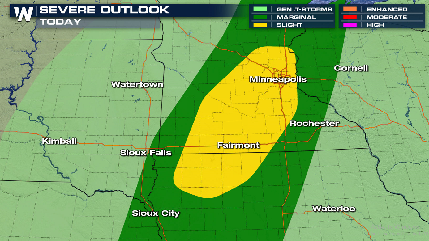
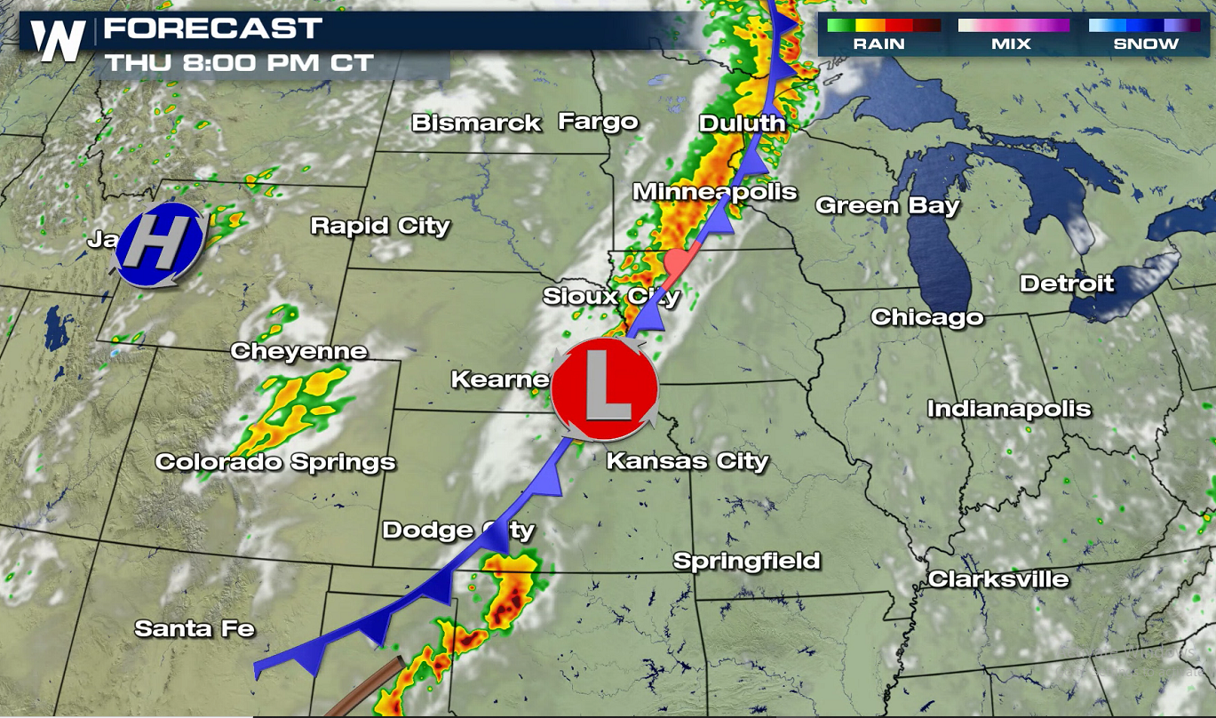
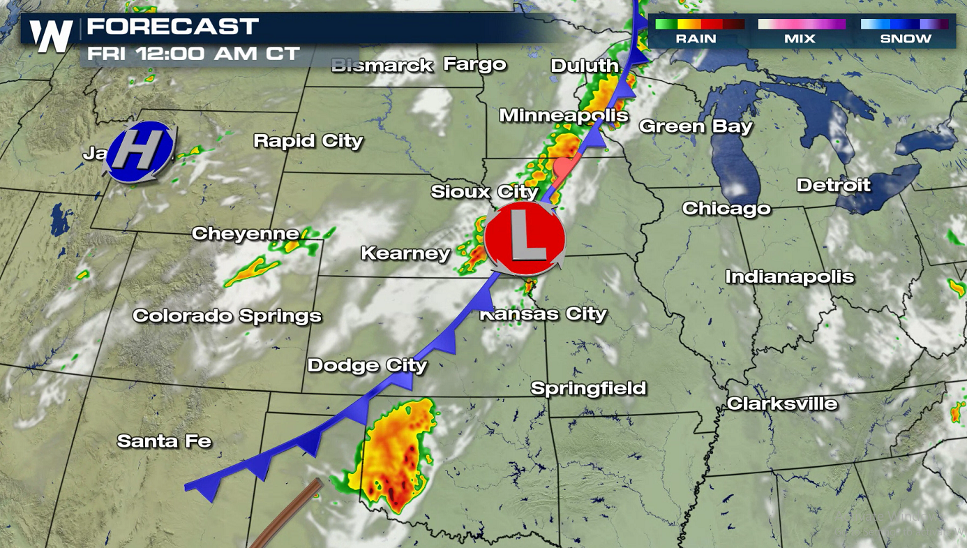
A slow moving storm system will push across the Upper Midwest to the southern Plains into the western Great Lakes today (Thursday), bringing a round of intense thunderstorms to the region. There is a marginal risk, level one on a scale to 5, from the Canadian Border in Minnesota to the Rio Grande in Texas. A slight risk (level 2) includes the Twin Cities in Minnesota to northwestern Iowa.
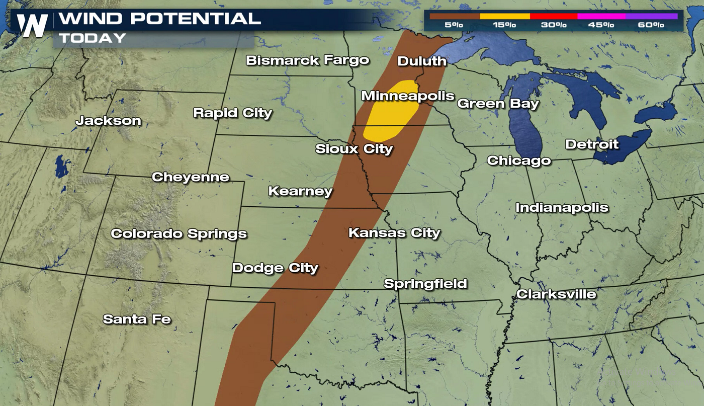 Strong wind gusts, greater than 58 mph, are the main threat today (Thursday). Heat and humidity will build over the region this afternoon. Jet stream energy from the Northwest will slide into the area along with the cold front, igniting thunderstorm development.
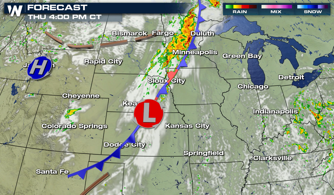
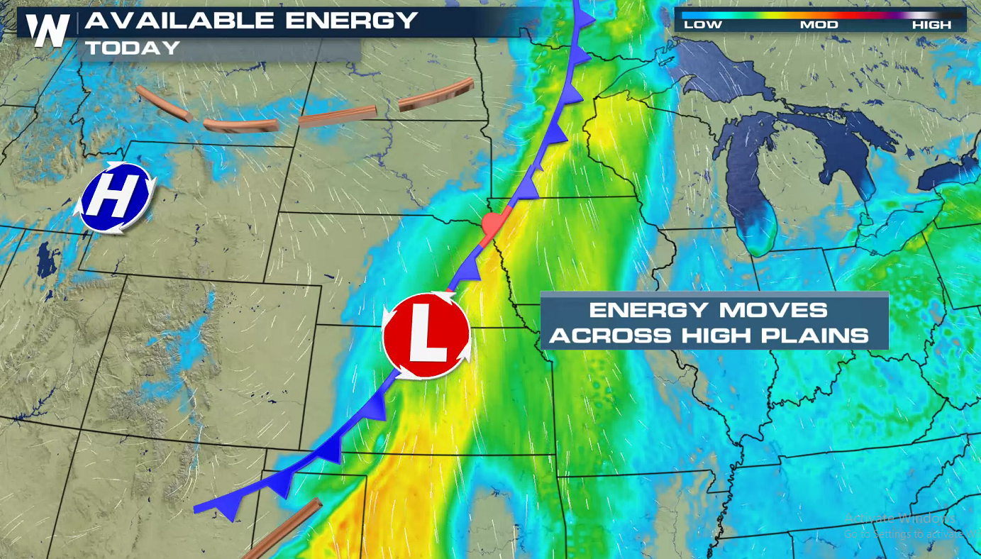 As instability climbs, a squall line will likely form in the late afternoon along the cold front southward to a low pressure center in Nebraska. A few storms may contain damaging wind gusts. Additional storms will fire in the southern Plains. A weakening trend will likely occur in the overnight.
 Keep it tuned to WeatherNation on-air and online for the latest severe weather forecasts.

 Strong wind gusts, greater than 58 mph, are the main threat today (Thursday). Heat and humidity will build over the region this afternoon. Jet stream energy from the Northwest will slide into the area along with the cold front, igniting thunderstorm development.
 As instability climbs, a squall line will likely form in the late afternoon along the cold front southward to a low pressure center in Nebraska. A few storms may contain damaging wind gusts. Additional storms will fire in the southern Plains. A weakening trend will likely occur in the overnight.


 Keep it tuned to WeatherNation on-air and online for the latest severe weather forecasts.
All Weather News
More