Thursday Severe Weather in the East and South Texas
Special Stories
9 Apr 2020 8:00 AM
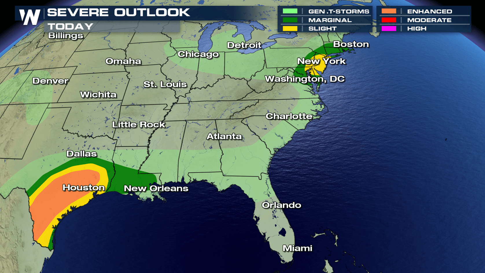
A sharp cold front that moved through the Mississippi and Tennessee Valleys producing severe storms Wednesday will stretch out along the Gulf of Mexico coast to the Eastern Seaboard today (Thursday). The threat for severe storms in the Northeast exists in the first half of the day. Another round of severe weather is expected to ramp up across Texas in the afternoon.
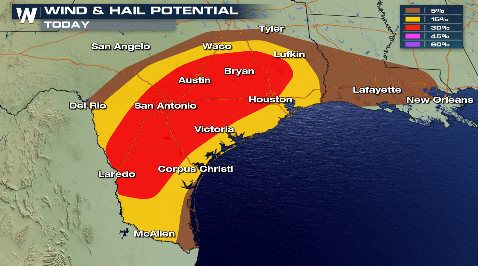
 Hail and damaging winds are expected to be the primary risks with Thursday's storms. This is due to the same area of low pressure and trailing cold front responsible for Tuesday and Wednesday's severe weather.
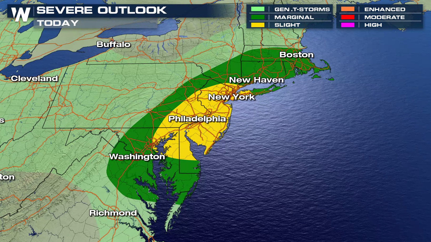
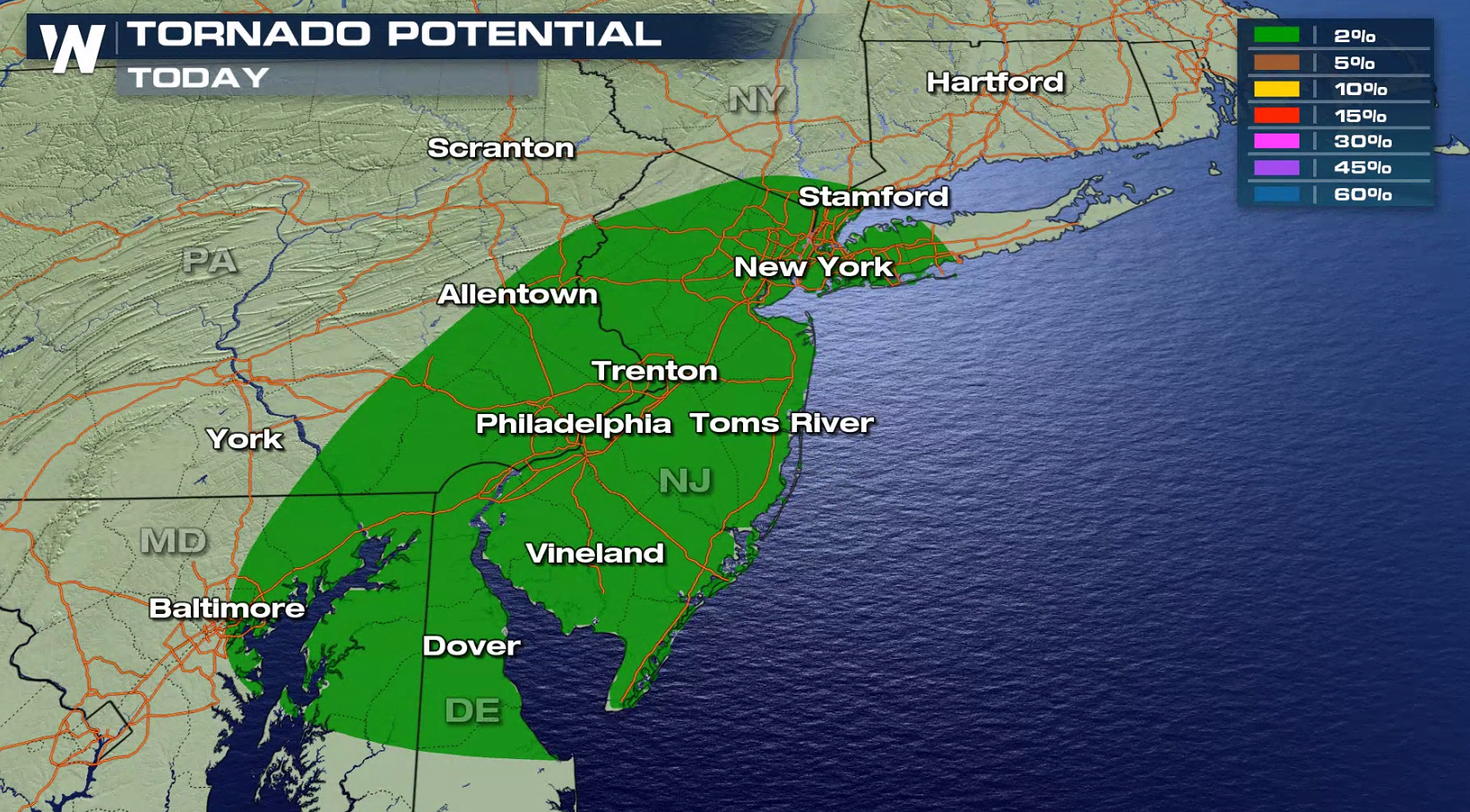
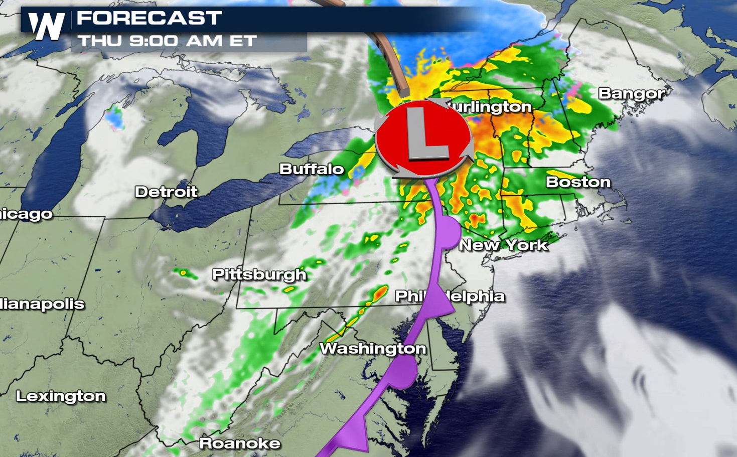
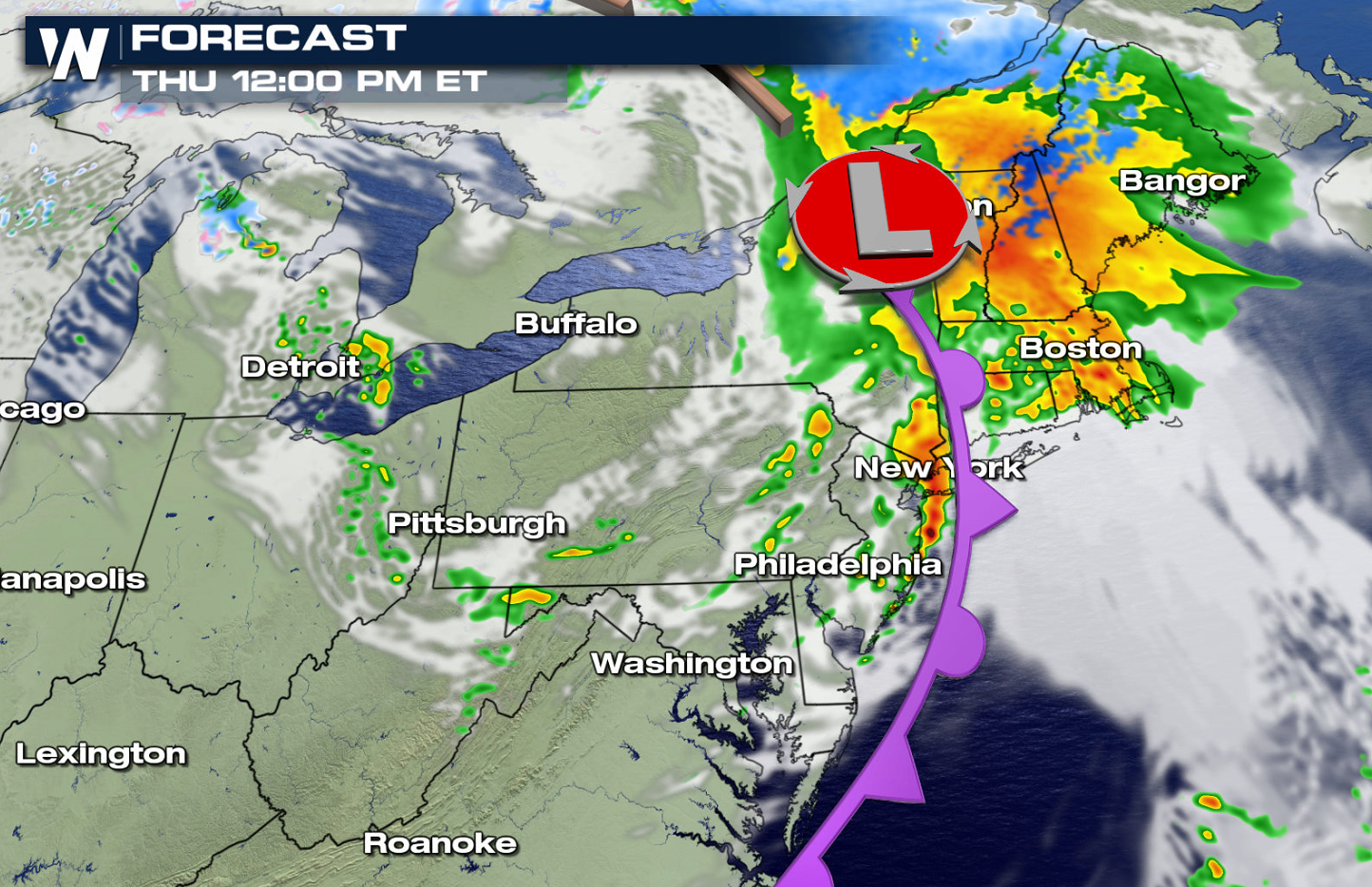
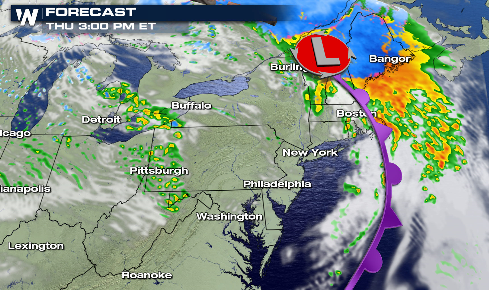
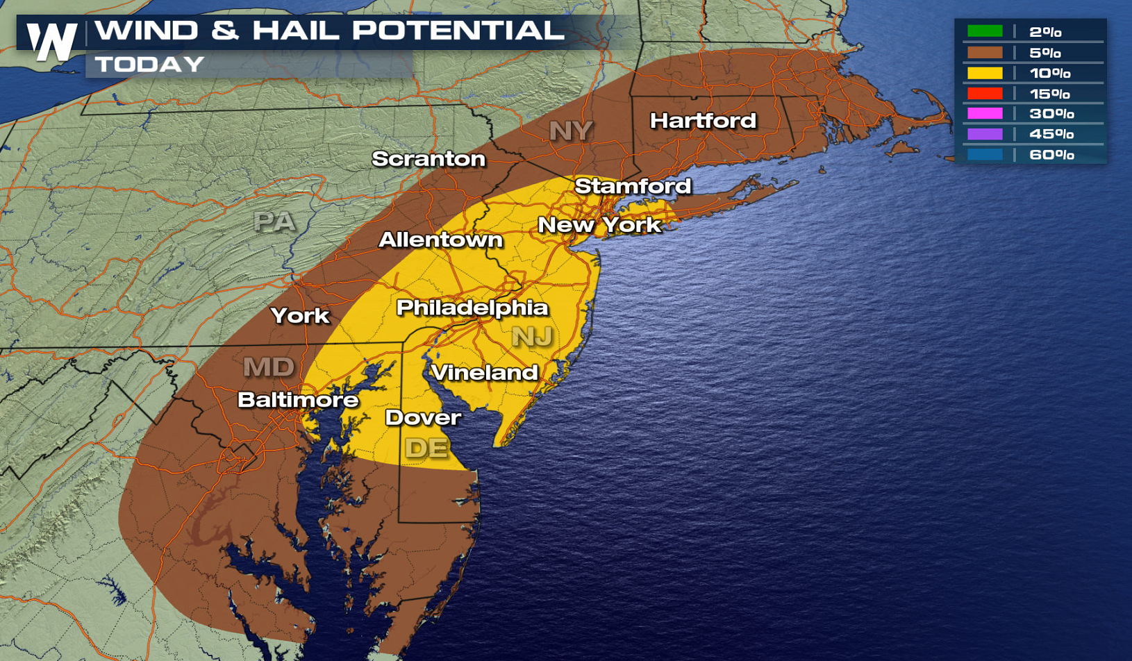 The cold front pushed across the Appalachians earlier this morning (Thursday). Thunderstorms will be numerous along the front, with isolated severe cells possible in the Northeast. As the front approaches the Atlantic Ocean, the severe threat will come to an end in the afternoon as storms move out to sea.
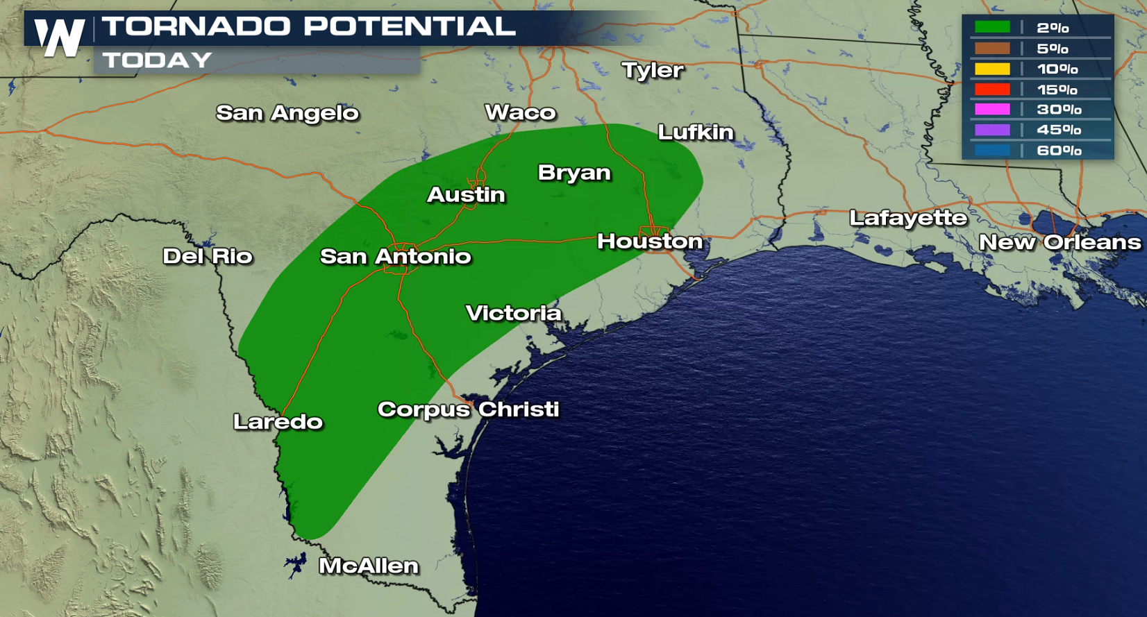
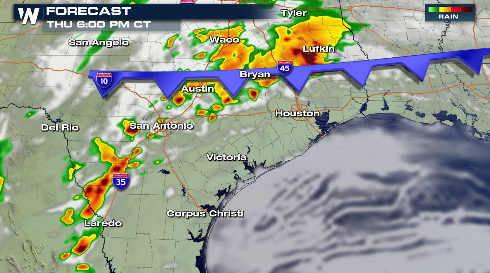
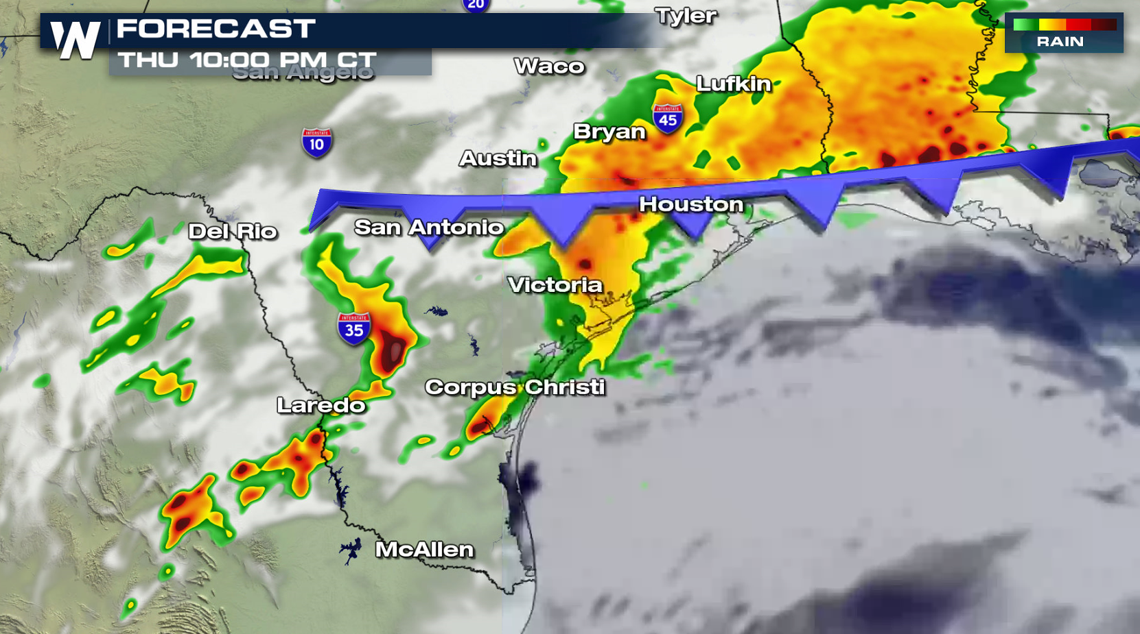
 In Texas, severe thunderstorm development is possible in the late afternoon and evening. Large hail is the biggest concern, although there is the potential for an isolated tornado or two. Strong wind gusts may also occur.
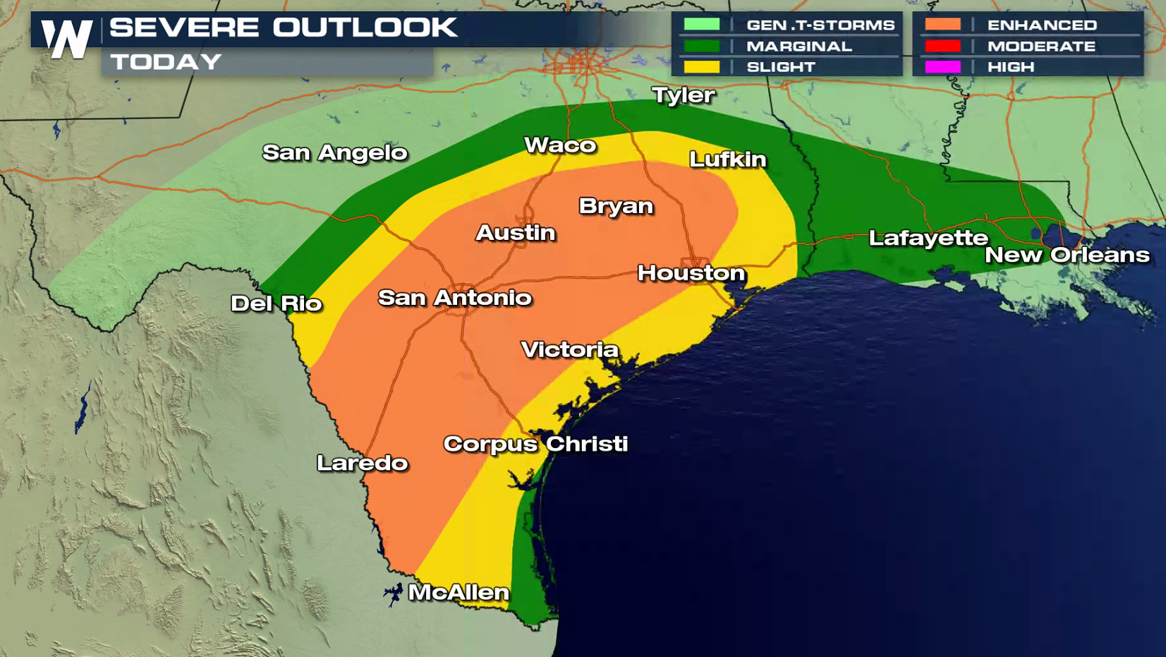
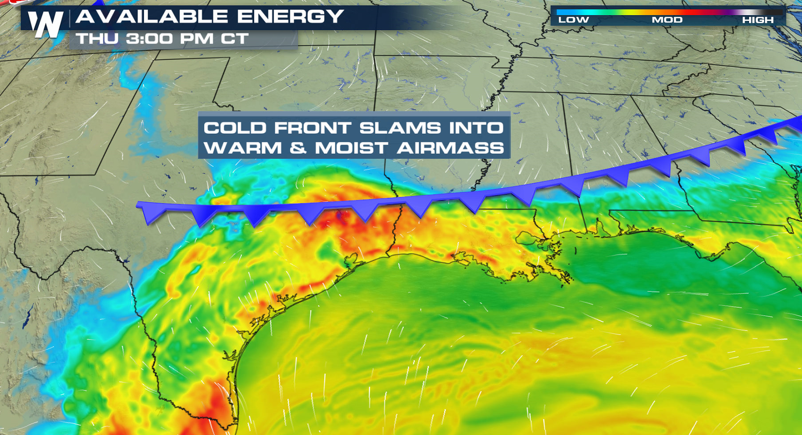
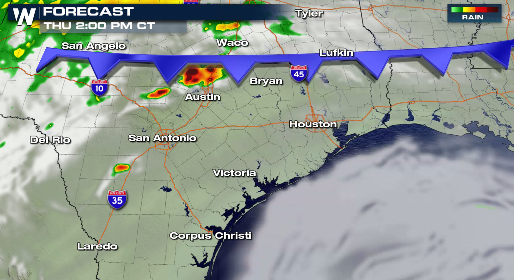
 The cold front will lag back into Texas for the afternoon as it approaches the Gulf of Mexico coast. With heat and humidity building throughout the day, instability will climb.
 Additional severe thunderstorms are possible for Friday into this weekend. Be sure to stay with WeatherNation for the latest severe weather update throughout severe weather season.
Hail and damaging winds are expected to be the primary risks with Thursday's storms. This is due to the same area of low pressure and trailing cold front responsible for Tuesday and Wednesday's severe weather.
The cold front pushed across the Appalachians earlier this morning (Thursday). Thunderstorms will be numerous along the front, with isolated severe cells possible in the Northeast. As the front approaches the Atlantic Ocean, the severe threat will come to an end in the afternoon as storms move out to sea.
In Texas, severe thunderstorm development is possible in the late afternoon and evening. Large hail is the biggest concern, although there is the potential for an isolated tornado or two. Strong wind gusts may also occur.
The cold front will lag back into Texas for the afternoon as it approaches the Gulf of Mexico coast. With heat and humidity building throughout the day, instability will climb.
Additional severe thunderstorms are possible for Friday into this weekend. Be sure to stay with WeatherNation for the latest severe weather update throughout severe weather season.All Weather News
More


Tropics: Fausto Heads towards Hawaii; Genevieve a Major Hurricane
PacificTropical Depression Fausto continues t
29 Jul 2026 10:15 AM

Flooding Risk Increases as Heavy Rain Targets the Tri-State Area
New England - Along with the threat of severe
29 Jul 2026 10:10 AM


Southeast Flood Risk Lingers Near Stalled Front
A stalled boundary over the Southeast will ke
25 Jul 2026 10:55 AM

Another Round of Storms Targets the Northeast
Tuesday brought severe weather again across p
23 Jul 2026 1:15 AM