Thursday Severe Weather Update
Top Stories
12 Jul 2018 5:16 AM
We are looking at a strong chance for large hail, damaging winds over parts of the Upper Midwest today and tonight. Heavy rain will also lead to an increased risk of flash flooding.
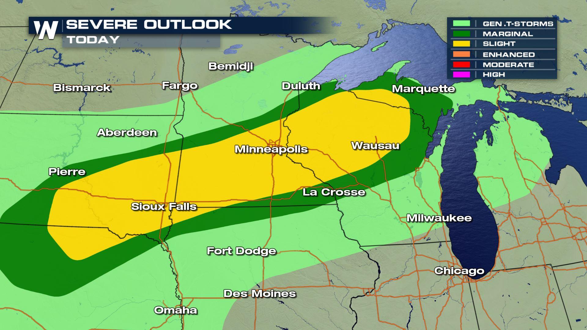
 You can see a slight risk of severe storms today from Northern Nebraska to the Western UP of Michigan. So cities like Wausau, Minneapolis and Sioux Falls will need to be weather aware today.
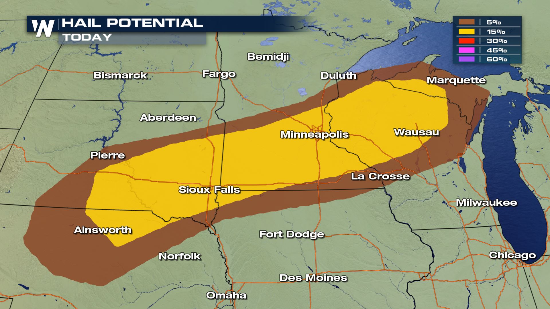
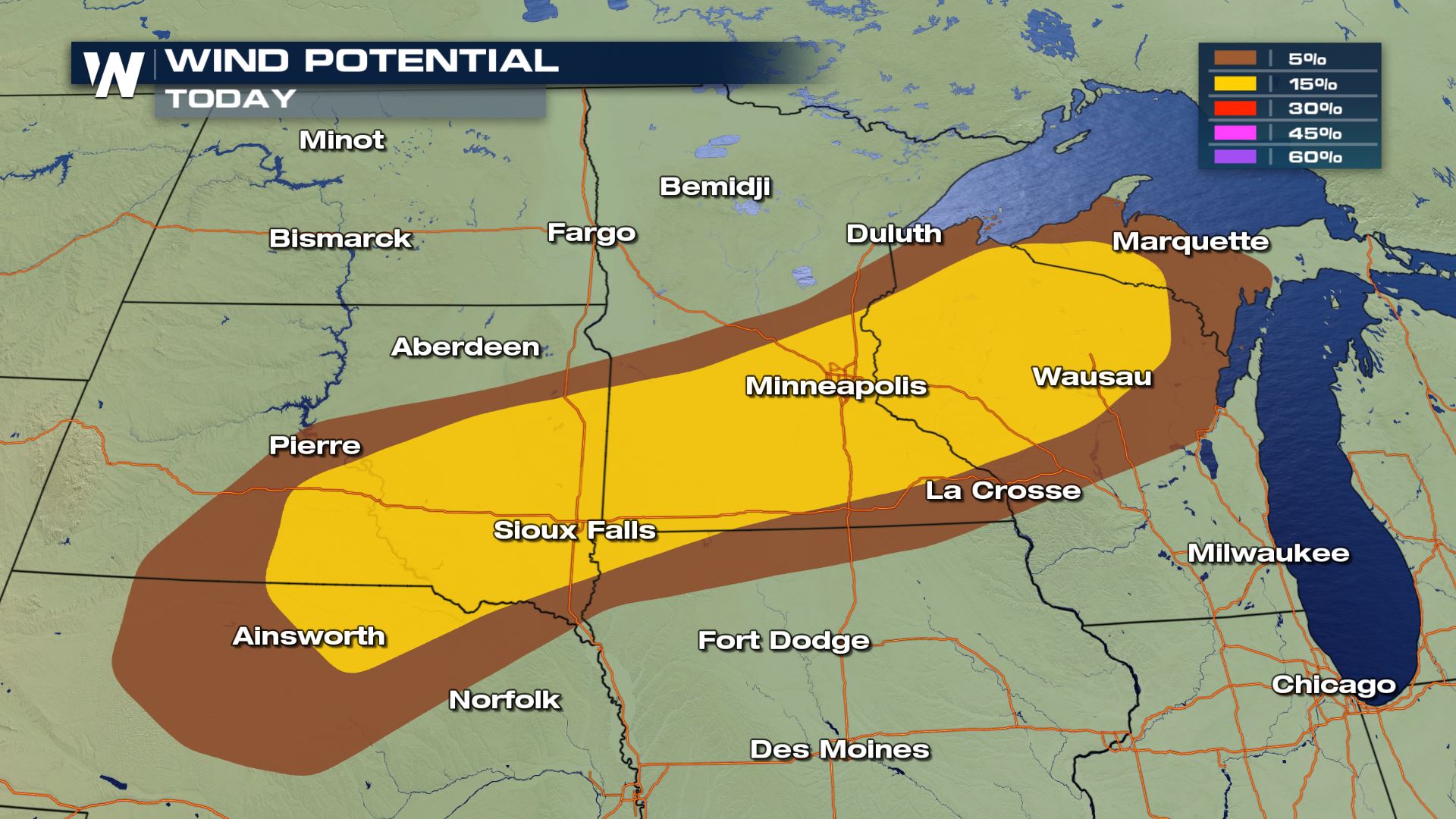 Large hail and damaging winds will be the primary weather risks for these areas today.
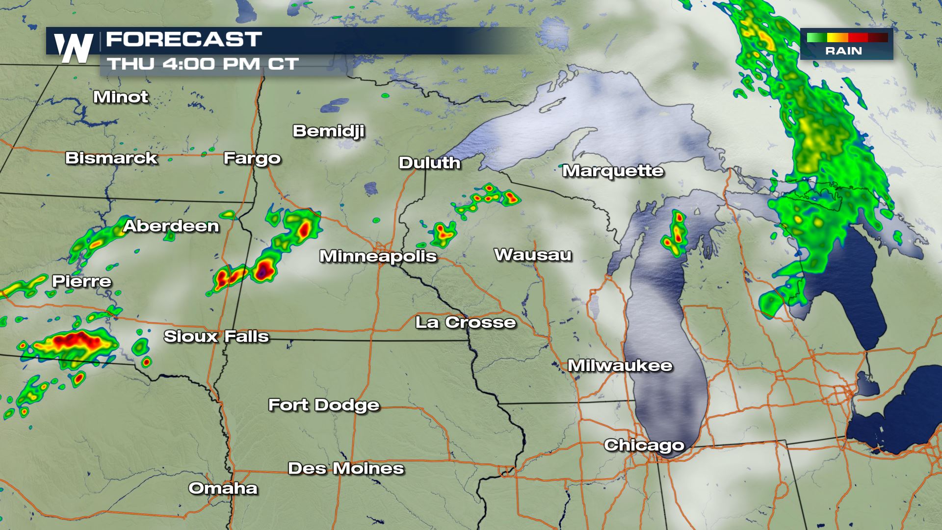
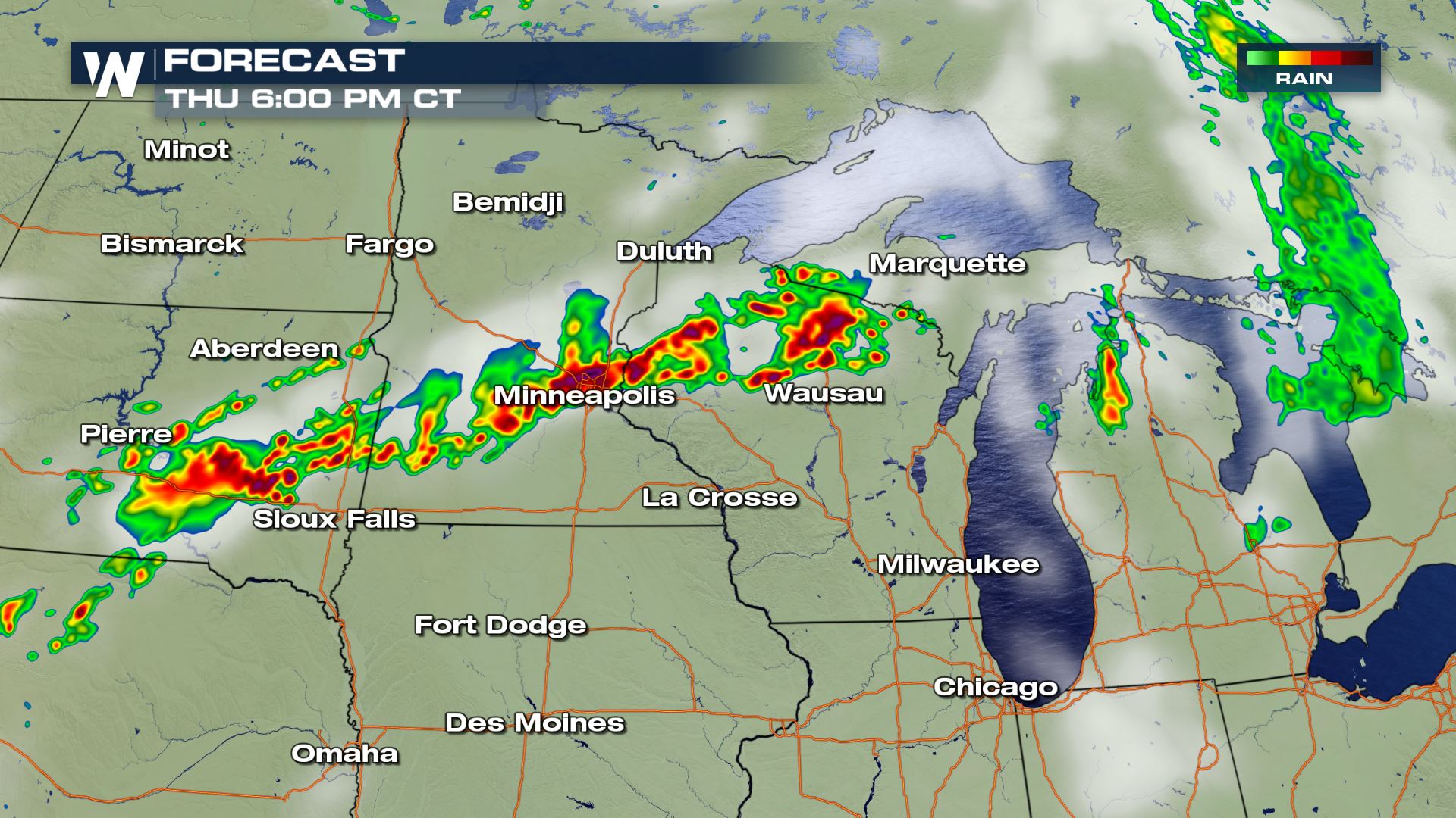
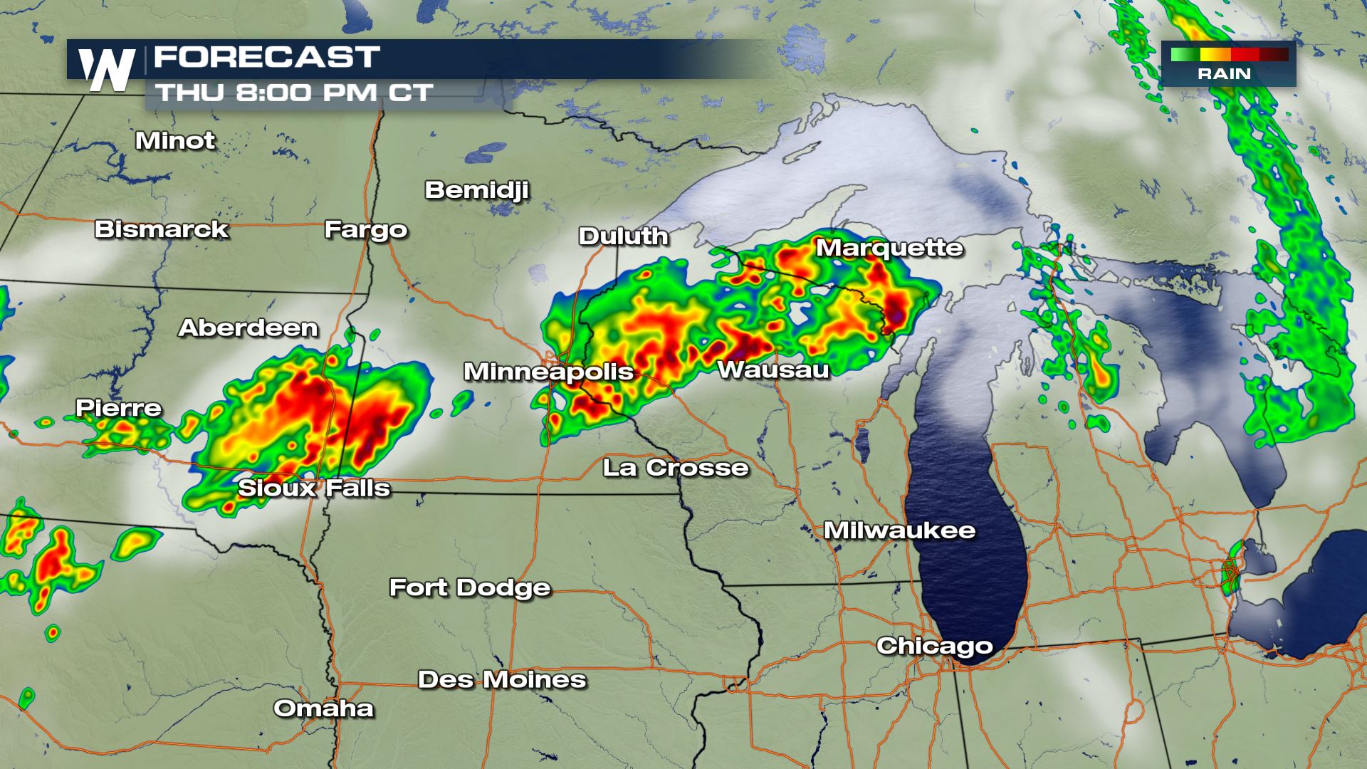 Showers and storms will start up in the afternoon and should last through the evening.
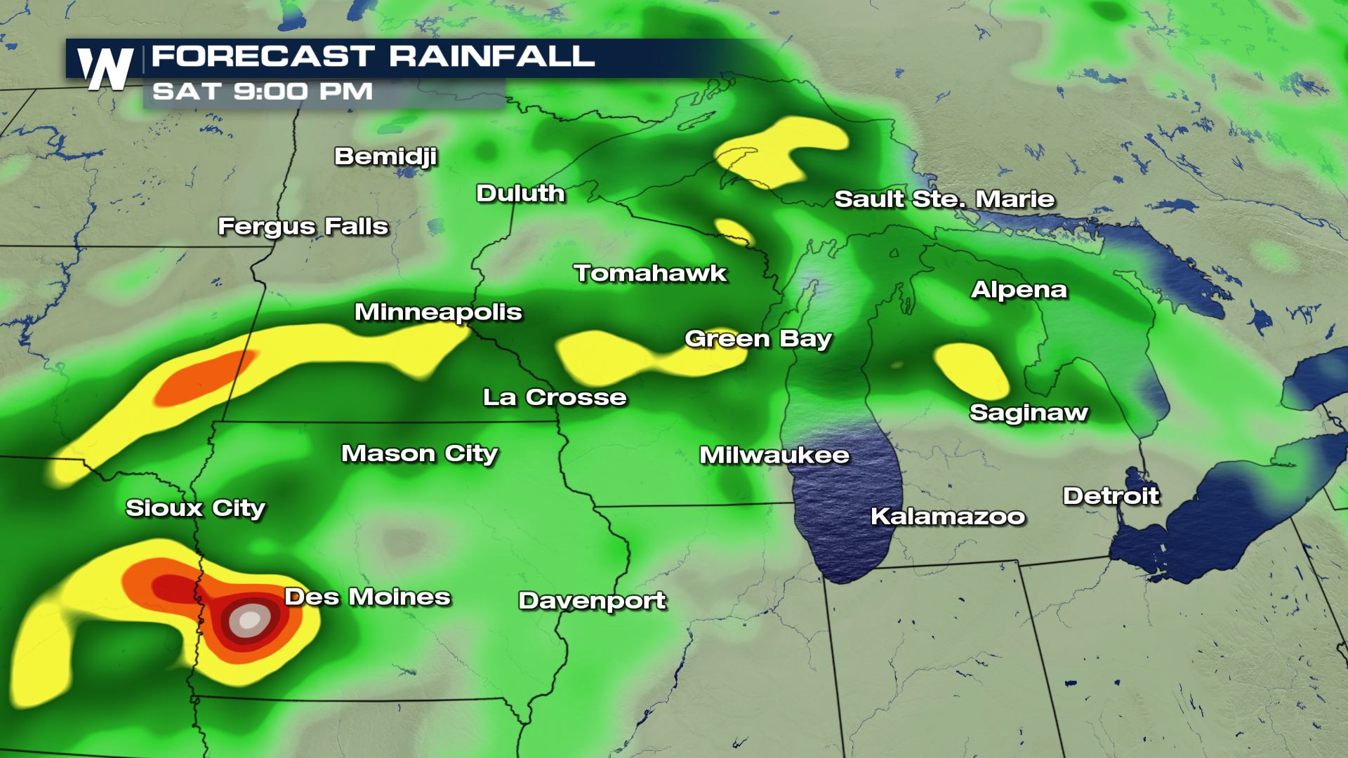 Heavy rain will lead to the potential for flash flooding...especially over areas of Iowa, Minnesota and Wisconsin.
Keep checking WeatherNation for the very latest updates.
Meteorologist Patrick Crawford
Heavy rain will lead to the potential for flash flooding...especially over areas of Iowa, Minnesota and Wisconsin.
Keep checking WeatherNation for the very latest updates.
Meteorologist Patrick Crawford
Severe Outlook
You can see a slight risk of severe storms today from Northern Nebraska to the Western UP of Michigan. So cities like Wausau, Minneapolis and Sioux Falls will need to be weather aware today.
Severe Risks
Large hail and damaging winds will be the primary weather risks for these areas today.
Forecast
Showers and storms will start up in the afternoon and should last through the evening.
Rainfall Forecast
Heavy rain will lead to the potential for flash flooding...especially over areas of Iowa, Minnesota and Wisconsin.
Keep checking WeatherNation for the very latest updates.
Meteorologist Patrick CrawfordAll Weather News
More
Severe Chances Return for the Midwest The Next Few Days
The upcoming stretch of hot temperatures will
25 Jul 2026 2:00 AM

Tropics: Fausto Heads to Hawaii; Genevieve Has Formed and Could Become a Major Hurricane
Atlantic BasinBertha has dissipated after mov
25 Jul 2026 1:50 AM

Southeast Flood Risk Lingers Near Stalled Front
A stalled boundary over the Southeast will ke
25 Jul 2026 1:50 AM

Weekend Heat For the Western and Central United States
Are you over the summer heat yet? Well, more
25 Jul 2026 1:40 AM

Hot & Smoky w/ a Chance of Lightning
Conditions have been really dry out west. We'
24 Jul 2026 11:15 AM

Another Round of Storms Targets the Northeast
Tuesday brought severe weather again across p
23 Jul 2026 1:15 AM

Another Round of Severe Weather for the Upper Midwest and Great Lakes
The upper-level low train continues to keep t
21 Jul 2026 1:45 AM