Tiny IceCube Satellite's First Global Map of Ice Clouds
Special Stories
31 May 2018 9:33 AM
From NASA
Looking at Earth from the International Space Station, astronauts see big, white clouds spreading across the planet. They cannot distinguish a gray rain cloud from a puffy white cloud. While satellites can see through many clouds and estimate the liquid precipitation they hold, they can’t see the smaller ice particles that create enormous rain clouds.
An experimental small satellite has filled this void and captured the first global picture of the small frozen particles inside clouds, normally called ice clouds.
Deployed from the space station in May 2017, IceCube is testing instruments for their ability to make space-based measurements of the small, frozen crystals that make up ice clouds. “Heavy downpours originate from ice clouds,” said Dong Wu, IceCube principal investigator at NASA’s Goddard Space Flight Center in Greenbelt, Maryland.
https://www.youtube.com/watch?v=gjhQLOptd3Q
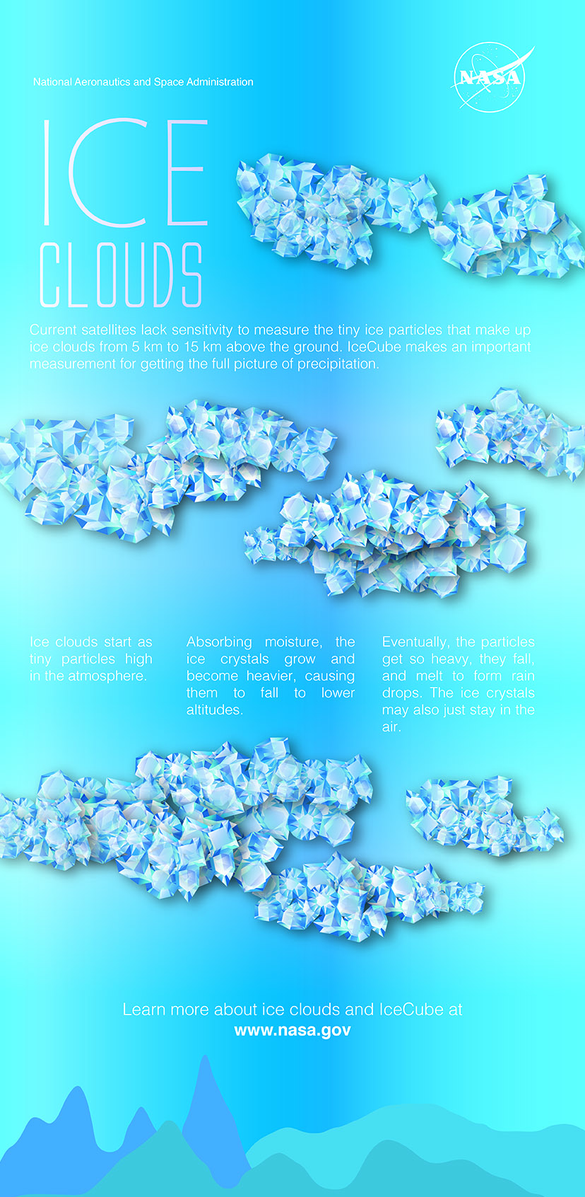
Ice clouds start as tiny particles high in the atmosphere. Absorbing moisture, the ice crystals grow and become heavier, causing them to fall to lower altitudes. Eventually, the particles get so heavy, they fall and melt to form rain drops. The ice crystals may also just stay in the air.
Like other clouds, ice clouds affect Earth’s energy budget by either reflecting or absorbing the Sun’s energy and by affecting the emission of heat from Earth into space. Thus, ice clouds are key variables in weather and climate models.
This is a three-month average of ice clouds. The brightest peak areas represent the largest concentration of ice clouds. They are also the spots with heavy precipitation beneath. They reach up to the top of the troposphere from deep convection, which is normally strongest in the tropics.
 [IceCube has created a global map of these ice clouds around the planet, which could someday help improve models and forecasts. Credits: NASA Goddard/ Jennifer Brill]
Measuring atmospheric ice on a global scale remains highly uncertain because satellites have been unable to detect the amount of small ice particles inside the clouds, as these particles are too opaque for infrared and visible sensors to penetrate. To overcome that limitation, IceCube was outfitted with a submillimeter radiometer that bridges the missing sensitivity between infrared and microwave wavelengths.
Despite weighing only 10 pounds and being about size of a loaf of bread, IceCube is a bona fide spacecraft, complete with three-axis attitude control, deployable solar arrays and a deployable UHF communications antenna. The CubeSat spins around its axis, like a plate spinning on a pole. It points at Earth to take a measurement then looks at the cold space to calibrate.
Originally a 30-day technology-demonstration mission, IceCube is still fully operational in low-Earth orbit almost a year later, measuring ice clouds and providing data that's "good enough to do some real science," Wu said.
[IceCube has created a global map of these ice clouds around the planet, which could someday help improve models and forecasts. Credits: NASA Goddard/ Jennifer Brill]
Measuring atmospheric ice on a global scale remains highly uncertain because satellites have been unable to detect the amount of small ice particles inside the clouds, as these particles are too opaque for infrared and visible sensors to penetrate. To overcome that limitation, IceCube was outfitted with a submillimeter radiometer that bridges the missing sensitivity between infrared and microwave wavelengths.
Despite weighing only 10 pounds and being about size of a loaf of bread, IceCube is a bona fide spacecraft, complete with three-axis attitude control, deployable solar arrays and a deployable UHF communications antenna. The CubeSat spins around its axis, like a plate spinning on a pole. It points at Earth to take a measurement then looks at the cold space to calibrate.
Originally a 30-day technology-demonstration mission, IceCube is still fully operational in low-Earth orbit almost a year later, measuring ice clouds and providing data that's "good enough to do some real science," Wu said.
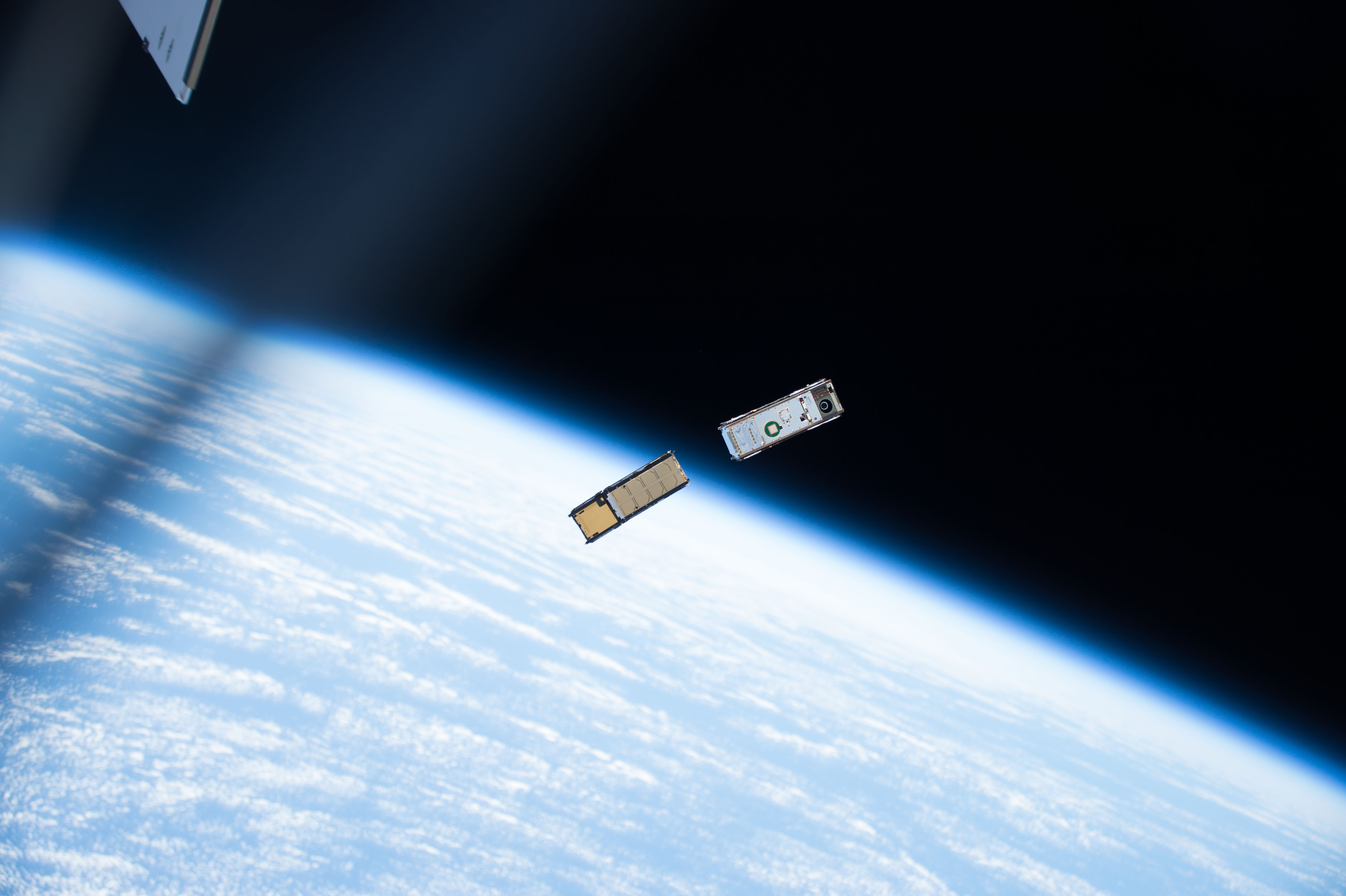 [The bread loaf-sized IceCube was deployed from the International Space Station in May 2017. One month later, it began science operations gathering global data about atmospheric ice clouds in the submillimeter wavelengths. Credits: NASA]
"The hard part about developing the CubeSat is making the commercial parts durable in space," said Tom Johnson, Goddard’s Small Satellite manager stationed at NASA’s Wallops Flight Facility in Virginia. ”We bought commercial components for IceCube and spent a lot of time testing the components making sure each part worked."
Over the past year, engineers tested the satellite’s limits while on orbit. They wanted to see if the instrument's batteries stored enough power to run 24 hours. IceCube charges its batteries when the Sun shines on its solar arrays. During the test, safeguards prevented the satellite from losing all its power and ending the mission; however, the test was successful. The batteries operated the IceCube all night and recharged during the day. This change made the CubeSat more valuable for science data collection.
While the IceCube team planned for the mission to operate for 30 days in space, “It does not cost very much to keep it going,” Johnson said, “so we extended the mission due to the outstanding science that IceCube is performing. We download data eight to 10 times a week. Even if we miss a week, the CubeSat can hold a couple of weeks of data.”
[The bread loaf-sized IceCube was deployed from the International Space Station in May 2017. One month later, it began science operations gathering global data about atmospheric ice clouds in the submillimeter wavelengths. Credits: NASA]
"The hard part about developing the CubeSat is making the commercial parts durable in space," said Tom Johnson, Goddard’s Small Satellite manager stationed at NASA’s Wallops Flight Facility in Virginia. ”We bought commercial components for IceCube and spent a lot of time testing the components making sure each part worked."
Over the past year, engineers tested the satellite’s limits while on orbit. They wanted to see if the instrument's batteries stored enough power to run 24 hours. IceCube charges its batteries when the Sun shines on its solar arrays. During the test, safeguards prevented the satellite from losing all its power and ending the mission; however, the test was successful. The batteries operated the IceCube all night and recharged during the day. This change made the CubeSat more valuable for science data collection.
While the IceCube team planned for the mission to operate for 30 days in space, “It does not cost very much to keep it going,” Johnson said, “so we extended the mission due to the outstanding science that IceCube is performing. We download data eight to 10 times a week. Even if we miss a week, the CubeSat can hold a couple of weeks of data.”
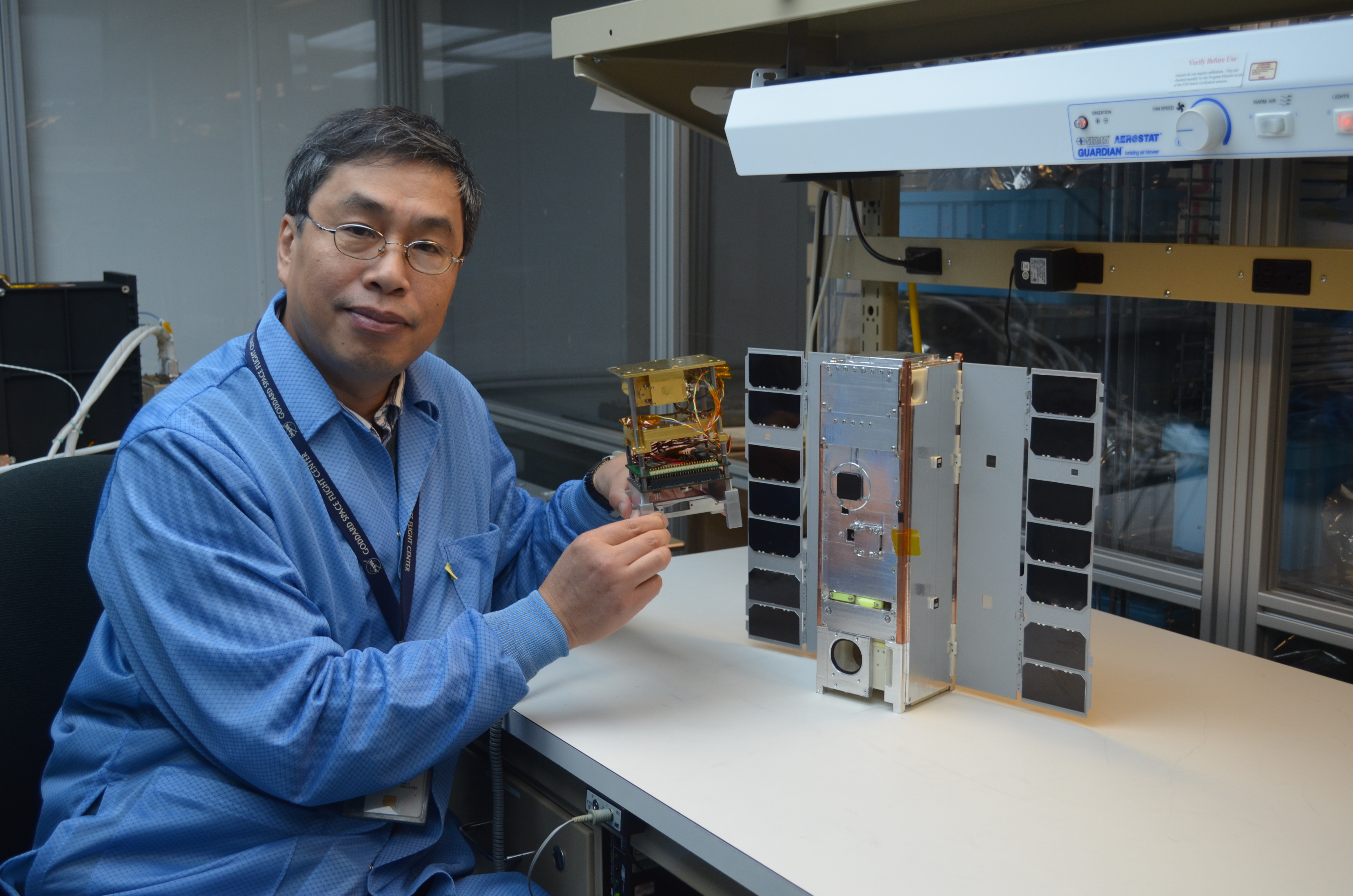 [IceCube Principal Investigator Dong Wu set out to demonstrate a commercial 883-Gigahertz radiometer in space, but ended up getting much more: the world’s first ice-cloud map in that frequency. Here he is pictured holding the instrument. Credits: NASA]
Johnson says he is not surprised by how long IceCube has lasted. “It will last about a year, when it will reenter Earth’s atmosphere and burn up in.”
The IceCube team built the spacecraft using funding from NASA’s Earth Science Technology Office’s (ESTO) In-Space Validation of Earth Science Technologies (InVEST) program and NASA’s Science Mission Directorate CubeSat Initiative.
Small satellites, including CubeSats, are playing an increasingly larger role in exploration, technology demonstration, scientific research and educational investigations at NASA. They have been used in planetary space exploration, fundamental Earth and space science, and developing precursor science instruments like cutting-edge laser communications, satellite-to-satellite communications and autonomous movement capabilities.
Edited for WeatherNation by Meteorologist Mace Michaels
[IceCube Principal Investigator Dong Wu set out to demonstrate a commercial 883-Gigahertz radiometer in space, but ended up getting much more: the world’s first ice-cloud map in that frequency. Here he is pictured holding the instrument. Credits: NASA]
Johnson says he is not surprised by how long IceCube has lasted. “It will last about a year, when it will reenter Earth’s atmosphere and burn up in.”
The IceCube team built the spacecraft using funding from NASA’s Earth Science Technology Office’s (ESTO) In-Space Validation of Earth Science Technologies (InVEST) program and NASA’s Science Mission Directorate CubeSat Initiative.
Small satellites, including CubeSats, are playing an increasingly larger role in exploration, technology demonstration, scientific research and educational investigations at NASA. They have been used in planetary space exploration, fundamental Earth and space science, and developing precursor science instruments like cutting-edge laser communications, satellite-to-satellite communications and autonomous movement capabilities.
Edited for WeatherNation by Meteorologist Mace Michaels
[IceCube has created a global map of these ice clouds around the planet, which could someday help improve models and forecasts. Credits: NASA Goddard/ Jennifer Brill]
Measuring atmospheric ice on a global scale remains highly uncertain because satellites have been unable to detect the amount of small ice particles inside the clouds, as these particles are too opaque for infrared and visible sensors to penetrate. To overcome that limitation, IceCube was outfitted with a submillimeter radiometer that bridges the missing sensitivity between infrared and microwave wavelengths.
Despite weighing only 10 pounds and being about size of a loaf of bread, IceCube is a bona fide spacecraft, complete with three-axis attitude control, deployable solar arrays and a deployable UHF communications antenna. The CubeSat spins around its axis, like a plate spinning on a pole. It points at Earth to take a measurement then looks at the cold space to calibrate.
Originally a 30-day technology-demonstration mission, IceCube is still fully operational in low-Earth orbit almost a year later, measuring ice clouds and providing data that's "good enough to do some real science," Wu said.
[The bread loaf-sized IceCube was deployed from the International Space Station in May 2017. One month later, it began science operations gathering global data about atmospheric ice clouds in the submillimeter wavelengths. Credits: NASA]
"The hard part about developing the CubeSat is making the commercial parts durable in space," said Tom Johnson, Goddard’s Small Satellite manager stationed at NASA’s Wallops Flight Facility in Virginia. ”We bought commercial components for IceCube and spent a lot of time testing the components making sure each part worked."
Over the past year, engineers tested the satellite’s limits while on orbit. They wanted to see if the instrument's batteries stored enough power to run 24 hours. IceCube charges its batteries when the Sun shines on its solar arrays. During the test, safeguards prevented the satellite from losing all its power and ending the mission; however, the test was successful. The batteries operated the IceCube all night and recharged during the day. This change made the CubeSat more valuable for science data collection.
While the IceCube team planned for the mission to operate for 30 days in space, “It does not cost very much to keep it going,” Johnson said, “so we extended the mission due to the outstanding science that IceCube is performing. We download data eight to 10 times a week. Even if we miss a week, the CubeSat can hold a couple of weeks of data.”
[IceCube Principal Investigator Dong Wu set out to demonstrate a commercial 883-Gigahertz radiometer in space, but ended up getting much more: the world’s first ice-cloud map in that frequency. Here he is pictured holding the instrument. Credits: NASA]
Johnson says he is not surprised by how long IceCube has lasted. “It will last about a year, when it will reenter Earth’s atmosphere and burn up in.”
The IceCube team built the spacecraft using funding from NASA’s Earth Science Technology Office’s (ESTO) In-Space Validation of Earth Science Technologies (InVEST) program and NASA’s Science Mission Directorate CubeSat Initiative.
Small satellites, including CubeSats, are playing an increasingly larger role in exploration, technology demonstration, scientific research and educational investigations at NASA. They have been used in planetary space exploration, fundamental Earth and space science, and developing precursor science instruments like cutting-edge laser communications, satellite-to-satellite communications and autonomous movement capabilities.
Edited for WeatherNation by Meteorologist Mace MichaelsAll Weather News
More
Fronts Continue To Spark Severe Weather Across the Plains
A cold front that brought record lows to the
18 Jul 2025 10:40 PM

Extreme Heat Impacts for the East Coast & South
Extreme heat continues to impact several area
18 Jul 2025 10:05 PM

Flooding Threat Remains Elevated in the East
A cold front pushing through the Eastern Seab
18 Jul 2025 9:10 PM

EF-2 Firenado from the Deer Creek Fire in Utah
A fire tornado was spotted near La Sal, Utah
18 Jul 2025 7:30 AM

Tropical System Brings Flood Risk to the Central Gulf
Time has run out for notable tropical develop
18 Jul 2025 3:05 AM

Heavy Rain, Flooding Threat Returns to Florida
Keep the rain boots handy in Florida - heavy
13 Jul 2025 12:50 PM

Severe Storm Risk Pushes into the Great Lakes, Ohio Valley
Friday was another busy day with severe weath
12 Jul 2025 8:00 PM