Top Weather Stories for April 20, 2018
Special Stories
20 Apr 2018 9:47 AM
Here are some of the top weather stories for Friday, April 20th, 2018:
Severe Weather from the South to Southeast
Severe weather is expected across the part of the South today and threat will shift east through the weekend. Storms that turn severe could produce heavy rain, damaging wind, large hail an isolated. Rain totals could measure up to 4 inches across some areas of the South and Southeast.
Lingering Fire Threat Red Flag Warnings are active across parts of New Mexico and Texas as there areas expect to deal with strong wind, warmth and relatively dry weather today. Wind could gust past 60 mph.🚨#BREAKING There is now a slight risk of severe weather over a small part of the Llano Estacado area of eastern New Mexico and Texas today. Large hail, damaging winds and a few tornadoes will be possible. #Weather #NMwx #txwx pic.twitter.com/vyFLYaJmQq
— WeatherNation (@WeatherNation) April 20, 2018
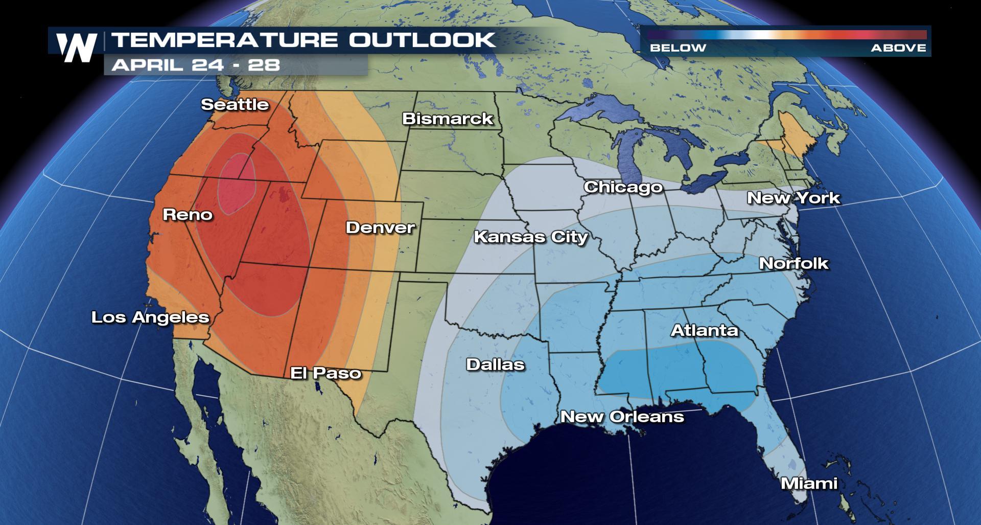
Eastern Chill, Western Warmth The longer term weather pattern for the end of April will likely below normal conditions to the eastern United States and warmer conditions to the western United States.Yikes! The #SkipperIslandFire in Colorado has forced local authorities to close down I-70 because flames have jumped the highway! It's one of several fires that are burning in the state. #Cowx pic.twitter.com/YF1w06UD1L
— WeatherNation (@WeatherNation) April 19, 2018
Tune into WeatherNation for the latest forecast. For WeatherNation, I am Meteorologist Marcus Walter.Temperature Outlook for April 24th - 28th, 2018 pic.twitter.com/WZqTElM4cp
— WeatherNation (@WeatherNation) April 20, 2018
All Weather News
More
Fronts Continue To Spark Severe Weather Across the Plains
A cold front that brought record lows to the
18 Jul 2025 10:40 PM

Extreme Heat Impacts for the East Coast & South
Extreme heat continues to impact several area
18 Jul 2025 10:05 PM

Flooding Threat Remains Elevated in the East
A cold front pushing through the Eastern Seab
18 Jul 2025 9:10 PM

EF-2 Firenado from the Deer Creek Fire in Utah
A fire tornado was spotted near La Sal, Utah
18 Jul 2025 7:30 AM

Tropical System Brings Flood Risk to the Central Gulf
Time has run out for notable tropical develop
18 Jul 2025 3:05 AM

Heavy Rain, Flooding Threat Returns to Florida
Keep the rain boots handy in Florida - heavy
13 Jul 2025 12:50 PM

Severe Storm Risk Pushes into the Great Lakes, Ohio Valley
Friday was another busy day with severe weath
12 Jul 2025 8:00 PM