Strong Storms Overnight Move Into Northeast Friday

Top Stories
20 Sep 2018 3:53 PM
*Updated 11:30 p.m. Central Time Thursday*
The severe weather threat is steadily decreasing, but not completely done for the rest of Thursday night into Friday. A few stronger thunderstorms capable of wind gusts up to 50 mph and heavy rain will continue to move toward the Great Lakes. We have added a couple of new hour-by-hour graphics below, skip ahead to see those and the severe weather threat for Friday.
Roughly 7 million people were under either a tornado watch or severe thunderstorm watch as of 6:30 p.m. Central Time Thursday.
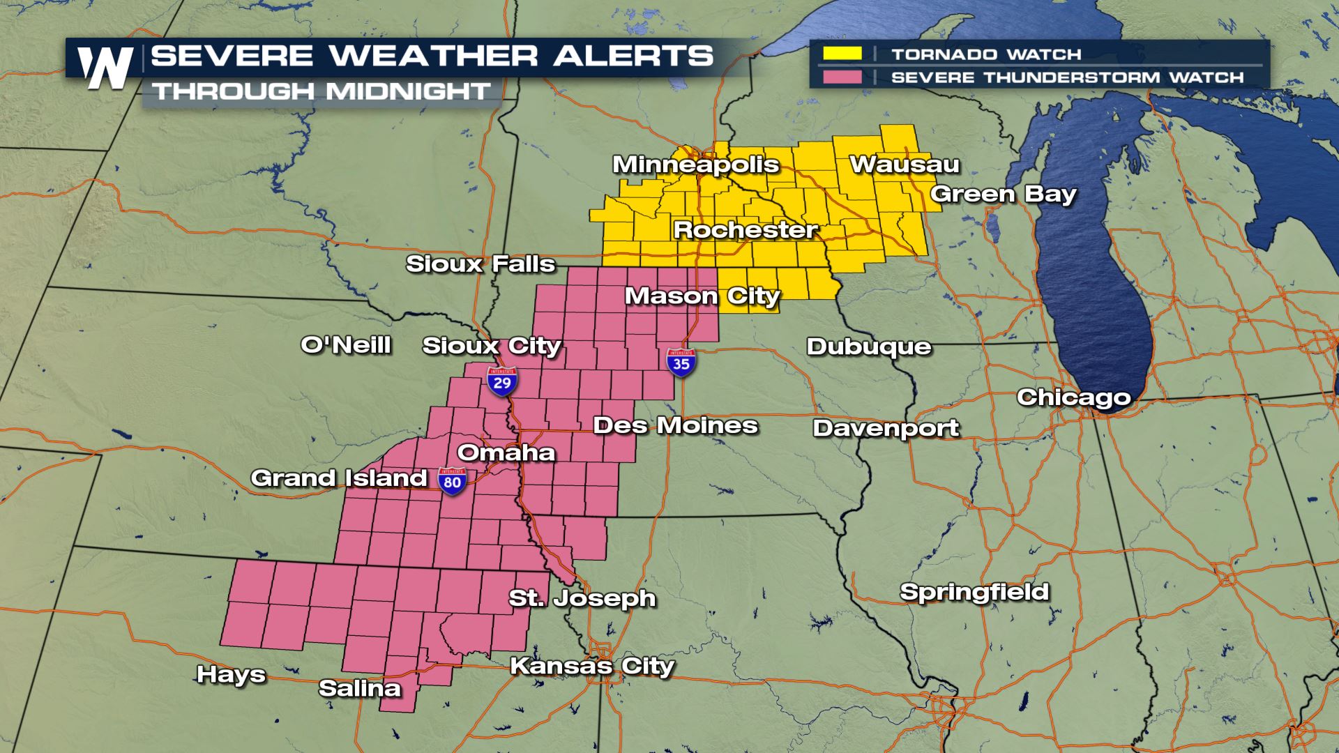 A snapshot of the severe weather alerts as of roughly 6:30 p.m. Central Time Thursday. September 20.
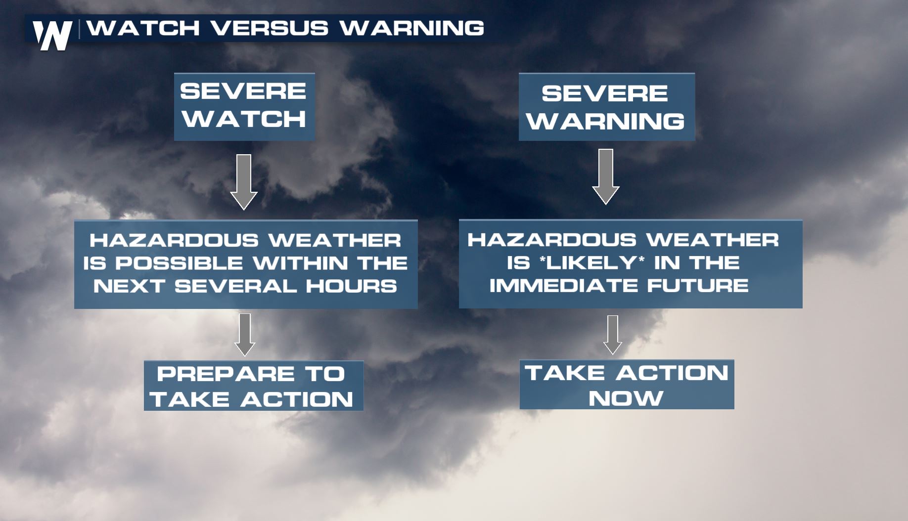
Remember, when a weather 'watch' is issued it means that you should prepare to take action, if needed. However if a weather 'warning' is issued, action needs to be taken now!
A snapshot of the severe weather alerts as of roughly 6:30 p.m. Central Time Thursday. September 20.
Remember, when a weather 'watch' is issued it means that you should prepare to take action, if needed. However if a weather 'warning' is issued, action needs to be taken now!
 There have already been tornado warnings issued Thursday, including near Cleveland, Ohio.
https://twitter.com/WeatherNation/status/1042892797139836928
The biggest weather hazards from this system were isolated tornadoes, wind gusts up to 70 miles per hour, and lime-sized hailstones.
There have already been tornado warnings issued Thursday, including near Cleveland, Ohio.
https://twitter.com/WeatherNation/status/1042892797139836928
The biggest weather hazards from this system were isolated tornadoes, wind gusts up to 70 miles per hour, and lime-sized hailstones.
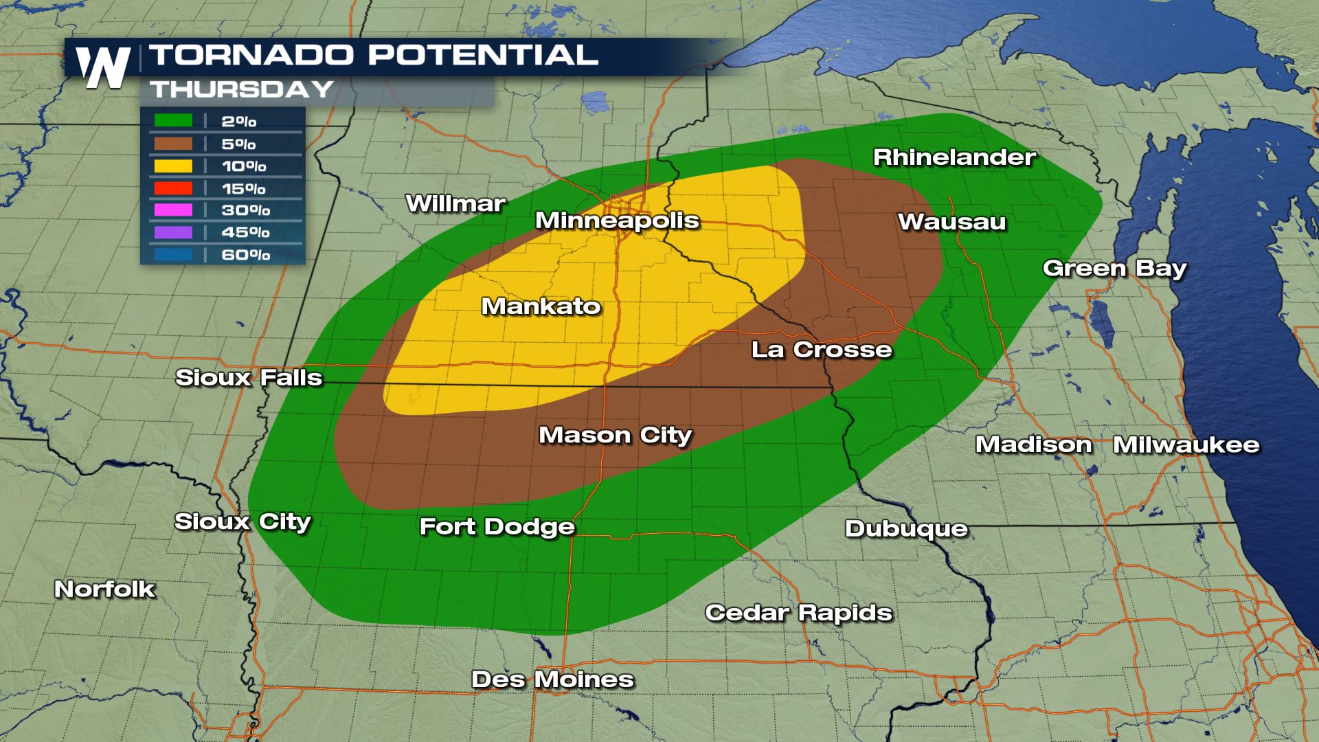 The potential for getting a tornado within 25 miles of any point Thursday, September 20.
The timing for the storms will be between now and roughly midnight local time (into Friday morning) as the thunderstorms evolve along a cold front.
The potential for getting a tornado within 25 miles of any point Thursday, September 20.
The timing for the storms will be between now and roughly midnight local time (into Friday morning) as the thunderstorms evolve along a cold front.
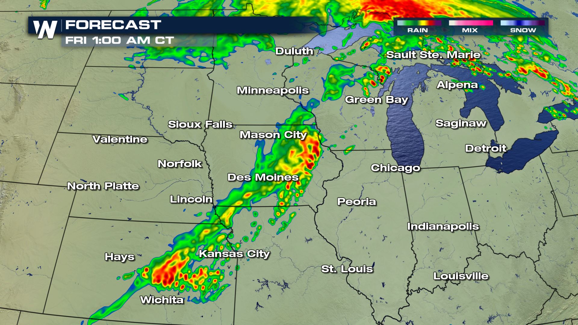 The forecast early Friday morning where yellows and reds show moderate and heavy rainfall.
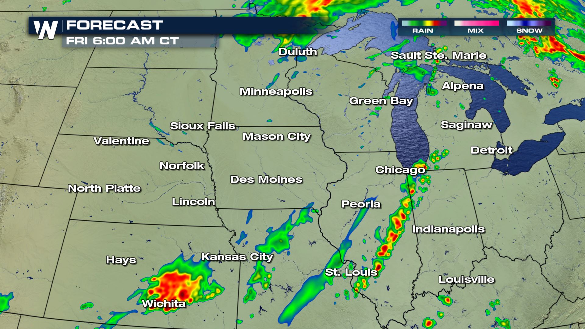 The forecast daybreak Friday morning where yellows and reds show moderate and heavy rainfall.
Keep an eye on the western and southwestern horizon, as storms will be coming from that direction. Have a backup plan in case you will be outside for a prolonged amount of time. Stay weather aware and ready as these storms roll in.
The forecast daybreak Friday morning where yellows and reds show moderate and heavy rainfall.
Keep an eye on the western and southwestern horizon, as storms will be coming from that direction. Have a backup plan in case you will be outside for a prolonged amount of time. Stay weather aware and ready as these storms roll in.
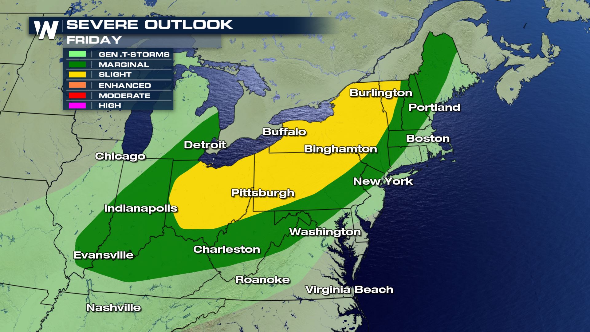 The severe weather outlook shifts into much of the Northeast Friday, September 21.
Stay with WeatherNation for the latest on this severe weather situation.
For WeatherNation, Meteorologist Steve Glazier
The severe weather outlook shifts into much of the Northeast Friday, September 21.
Stay with WeatherNation for the latest on this severe weather situation.
For WeatherNation, Meteorologist Steve Glazier
A snapshot of the severe weather alerts as of roughly 6:30 p.m. Central Time Thursday. September 20.
Remember, when a weather 'watch' is issued it means that you should prepare to take action, if needed. However if a weather 'warning' is issued, action needs to be taken now!
There have already been tornado warnings issued Thursday, including near Cleveland, Ohio.
https://twitter.com/WeatherNation/status/1042892797139836928
The biggest weather hazards from this system were isolated tornadoes, wind gusts up to 70 miles per hour, and lime-sized hailstones.
The potential for getting a tornado within 25 miles of any point Thursday, September 20.
The timing for the storms will be between now and roughly midnight local time (into Friday morning) as the thunderstorms evolve along a cold front.
The forecast early Friday morning where yellows and reds show moderate and heavy rainfall.
The forecast daybreak Friday morning where yellows and reds show moderate and heavy rainfall.
Keep an eye on the western and southwestern horizon, as storms will be coming from that direction. Have a backup plan in case you will be outside for a prolonged amount of time. Stay weather aware and ready as these storms roll in.
The severe weather outlook shifts into much of the Northeast Friday, September 21.
Stay with WeatherNation for the latest on this severe weather situation.
For WeatherNation, Meteorologist Steve GlazierAll Weather News
More
Fronts Continue To Spark Severe Weather Across the Plains
A cold front that brought record lows to the
18 Jul 2025 10:40 PM

Extreme Heat Impacts for the East Coast & South
Extreme heat continues to impact several area
18 Jul 2025 10:05 PM

Flooding Threat Remains Elevated in the East
A cold front pushing through the Eastern Seab
18 Jul 2025 9:10 PM

EF-2 Firenado from the Deer Creek Fire in Utah
A fire tornado was spotted near La Sal, Utah
18 Jul 2025 7:30 AM

Tropical System Brings Flood Risk to the Central Gulf
Time has run out for notable tropical develop
18 Jul 2025 3:05 AM

Heavy Rain, Flooding Threat Returns to Florida
Keep the rain boots handy in Florida - heavy
13 Jul 2025 12:50 PM

Severe Storm Risk Pushes into the Great Lakes, Ohio Valley
Friday was another busy day with severe weath
12 Jul 2025 8:00 PM