Tornado Touches Down in Jacksonville FL

Special Stories
7 Jul 2021 4:11 PM
There has been a tremendous amount of damage reported in the Jacksonville area after a tornado touched down Wednesday evening.
https://twitter.com/NWSJacksonville/status/1412883365045444618?s=20
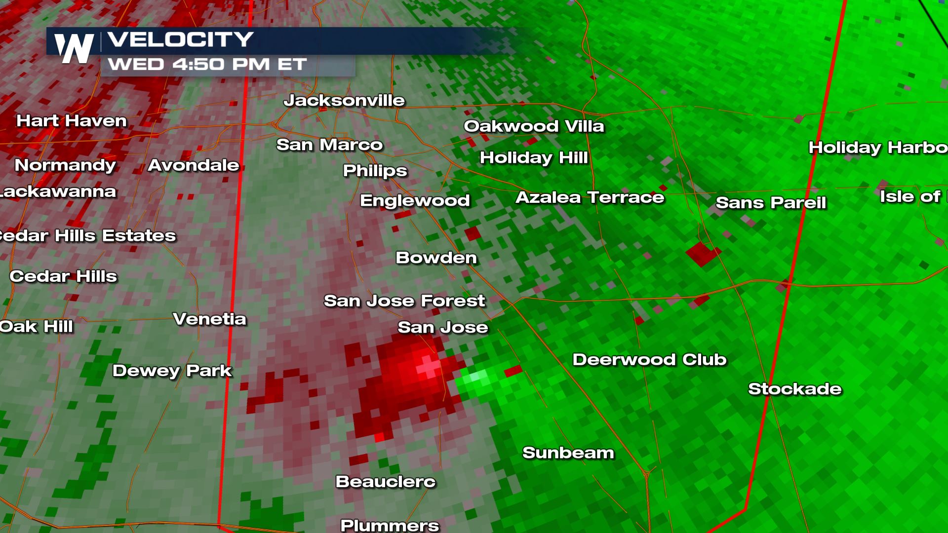
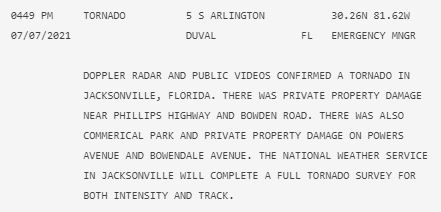
The National Weather Service in Jacksonville confirmed a tornado at 4:54PM ET in Arlington, FL.
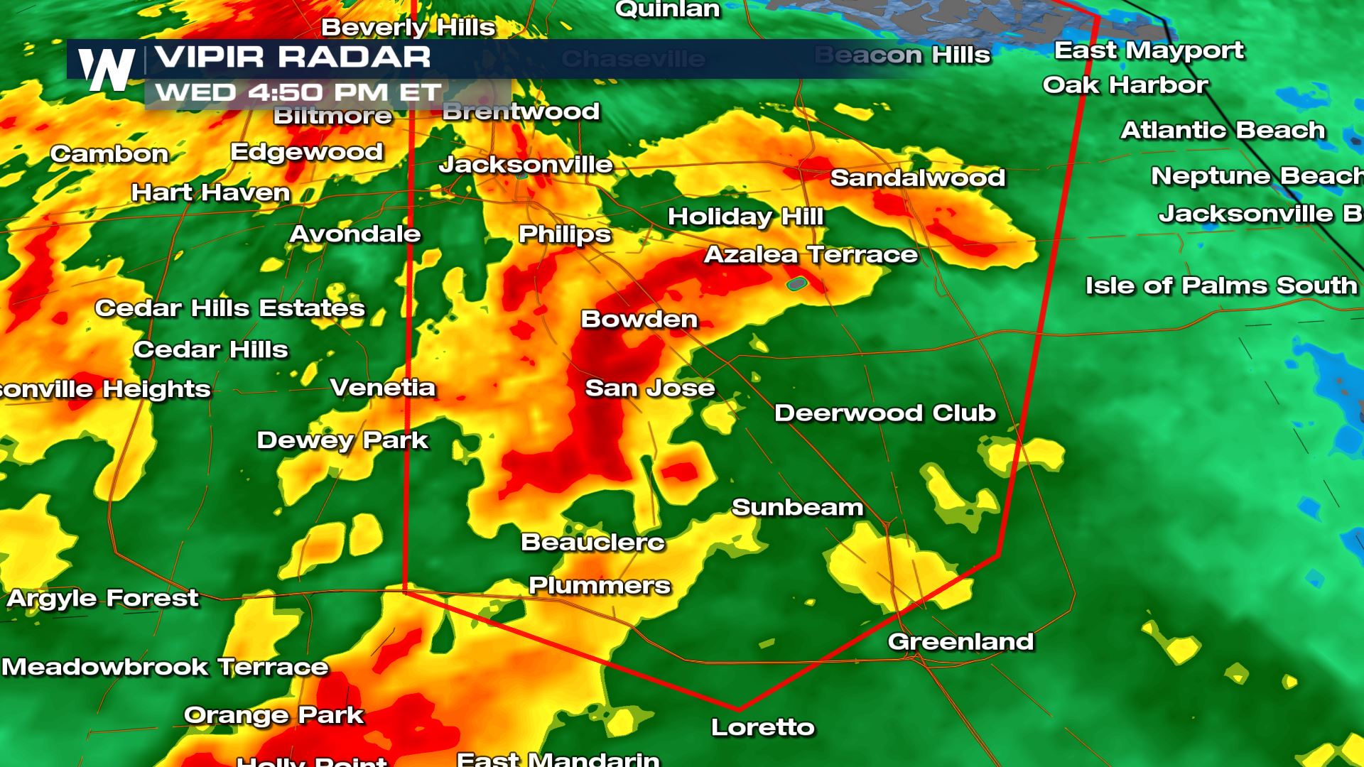 At the time there was significant rotation (the red and green close together below near San Jose) showing up on the velocity scans from the radar in Jacksonville. This indicated a possible tornado.
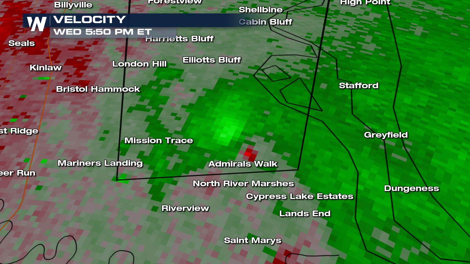
 As this storm pushed to the north it entered Southern Georgia and another tornado warning was issued near Admirals Walk around 5:50PM ET. The tornado was confirmed later again by radar at Kings Bay Base at 5:57PM ET.
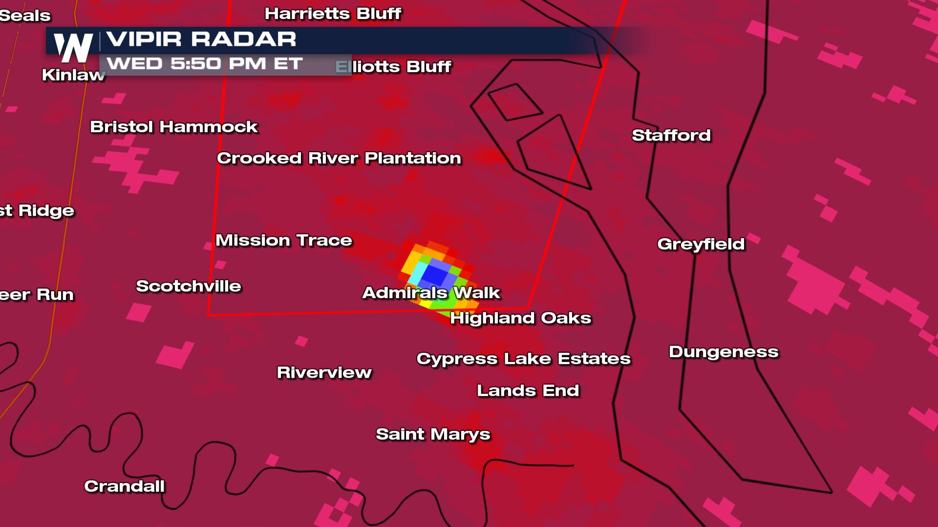
 At the time there was a very strong signature showing up for the correlation coefficient from the Radar in Jacksonville. This indicates that the tornado may have been lofting debris into the atmosphere in which the radar could not identify what exactly it was. The lower the correlation coefficient (blues and blacks) the more likely that what the radar is seeing is not spherical and very jagged.
 The National Weather Service out of Jacksonville has confirmed the tornado touching down earlier Wednesday. The rating of the tornado has still yet to be determined until a survey can be performed.
For the latest on breaking severe weather, tune into Weathernation.
The National Weather Service out of Jacksonville has confirmed the tornado touching down earlier Wednesday. The rating of the tornado has still yet to be determined until a survey can be performed.
For the latest on breaking severe weather, tune into Weathernation.
At the time there was significant rotation (the red and green close together below near San Jose) showing up on the velocity scans from the radar in Jacksonville. This indicated a possible tornado.
As this storm pushed to the north it entered Southern Georgia and another tornado warning was issued near Admirals Walk around 5:50PM ET. The tornado was confirmed later again by radar at Kings Bay Base at 5:57PM ET.
At the time there was a very strong signature showing up for the correlation coefficient from the Radar in Jacksonville. This indicates that the tornado may have been lofting debris into the atmosphere in which the radar could not identify what exactly it was. The lower the correlation coefficient (blues and blacks) the more likely that what the radar is seeing is not spherical and very jagged.
The National Weather Service out of Jacksonville has confirmed the tornado touching down earlier Wednesday. The rating of the tornado has still yet to be determined until a survey can be performed.
All Weather News
More
Fronts Continue To Spark Severe Weather Across the Plains
A cold front that brought record lows to the
18 Jul 2025 10:40 PM

Extreme Heat Impacts for the East Coast & South
Extreme heat continues to impact several area
18 Jul 2025 10:05 PM

Flooding Threat Remains Elevated in the East
A cold front pushing through the Eastern Seab
18 Jul 2025 9:10 PM

EF-2 Firenado from the Deer Creek Fire in Utah
A fire tornado was spotted near La Sal, Utah
18 Jul 2025 7:30 AM

Tropical System Brings Flood Risk to the Central Gulf
Time has run out for notable tropical develop
18 Jul 2025 3:05 AM

Heavy Rain, Flooding Threat Returns to Florida
Keep the rain boots handy in Florida - heavy
13 Jul 2025 12:50 PM

Severe Storm Risk Pushes into the Great Lakes, Ohio Valley
Friday was another busy day with severe weath
12 Jul 2025 8:00 PM