Overnight Storms to Continue Into Monday Morning
Top Stories
29 Jul 2018 1:43 PM
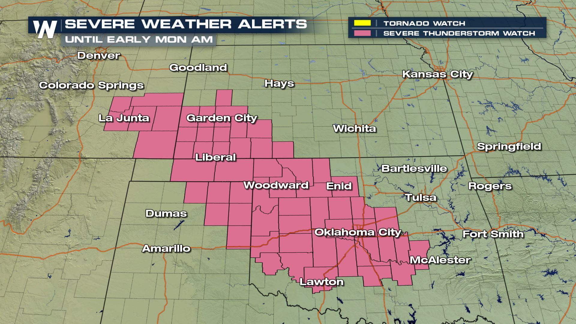
UPDATED 11 P.M. SUNDAY
The chance for severe thunderstorms continues into Monday morning for parts of the Plains. A severe thunderstorm watch was issued for Oklahoma nearly until daybreak Monday!
https://twitter.com/WeatherNation/status/1023767466676109312
PREVIOUS STORY AS FOLLOWS:
For the third consecutive day, the Western Plains are at a heightened risk for tornadoes. A tornado watch remains in effect for parts of Wyoming, Nebraska, Colorado and Kansas.
https://twitter.com/WeatherNation/status/1023647288382509057
Shortly after the tornado watch was issued, an additional severe thunderstorm watch was released:
https://twitter.com/WeatherNation/status/1023653764937396224
A watch of any sort (here, tornadoes and severe storms) means that weather conditions are favorable for that specific weather event. It means you should monitor weather forecasts and prepare to take action.
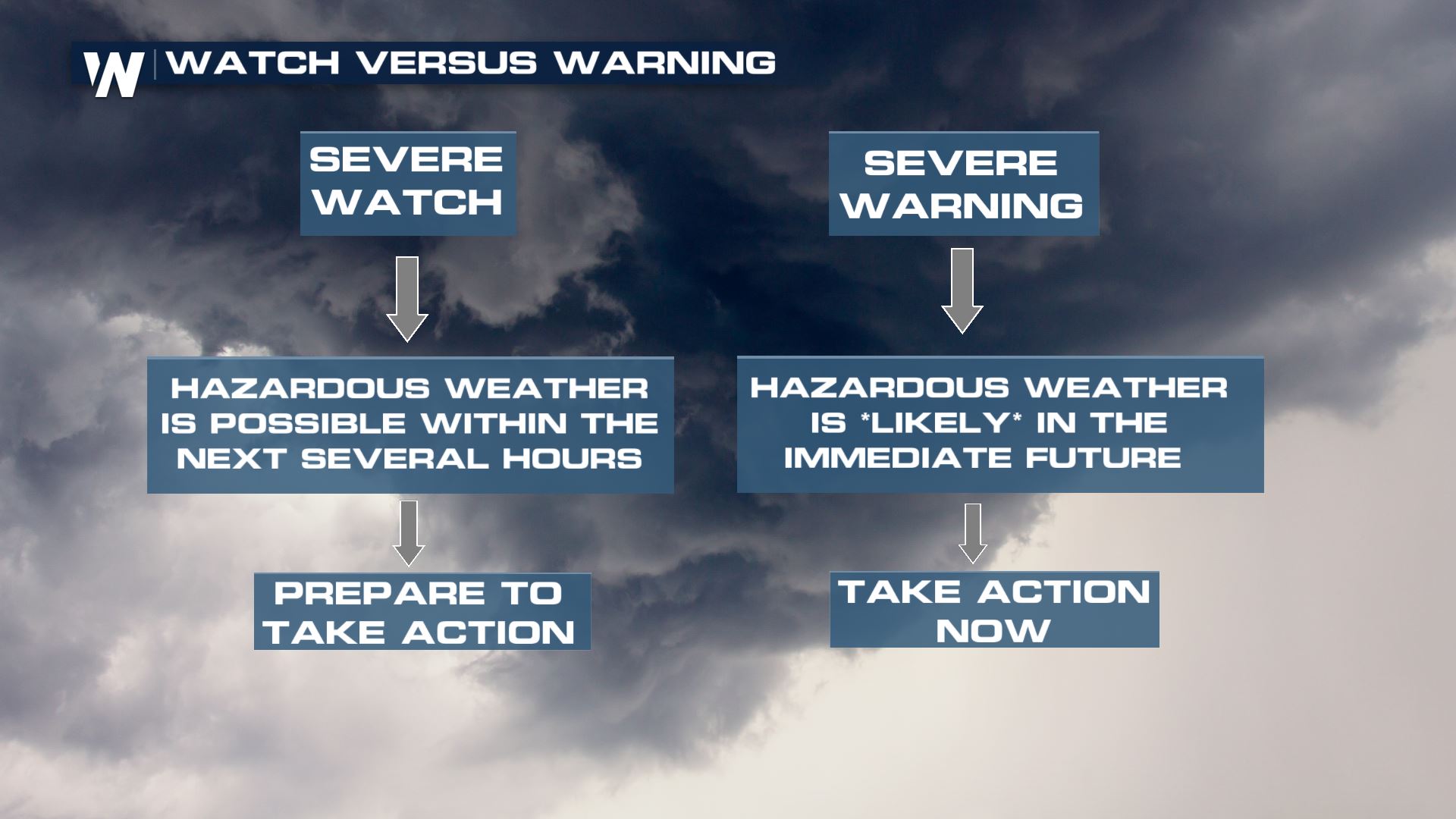 What's important about this tornado watch is that there is a HIGH LIKELIHOOD of tornadoes.
The Storm Prediction Center (which helps issue these watches) says a few tornadoes are likely with a couple of intense tornadoes possible. Scattered large hail up to 3.5 inches thick and wind gusts up to 80 mph will be possible.
The thunderstorms will be most numerous between 2 p.m. and 9 p.m. local time Sunday.
What's important about this tornado watch is that there is a HIGH LIKELIHOOD of tornadoes.
The Storm Prediction Center (which helps issue these watches) says a few tornadoes are likely with a couple of intense tornadoes possible. Scattered large hail up to 3.5 inches thick and wind gusts up to 80 mph will be possible.
The thunderstorms will be most numerous between 2 p.m. and 9 p.m. local time Sunday.
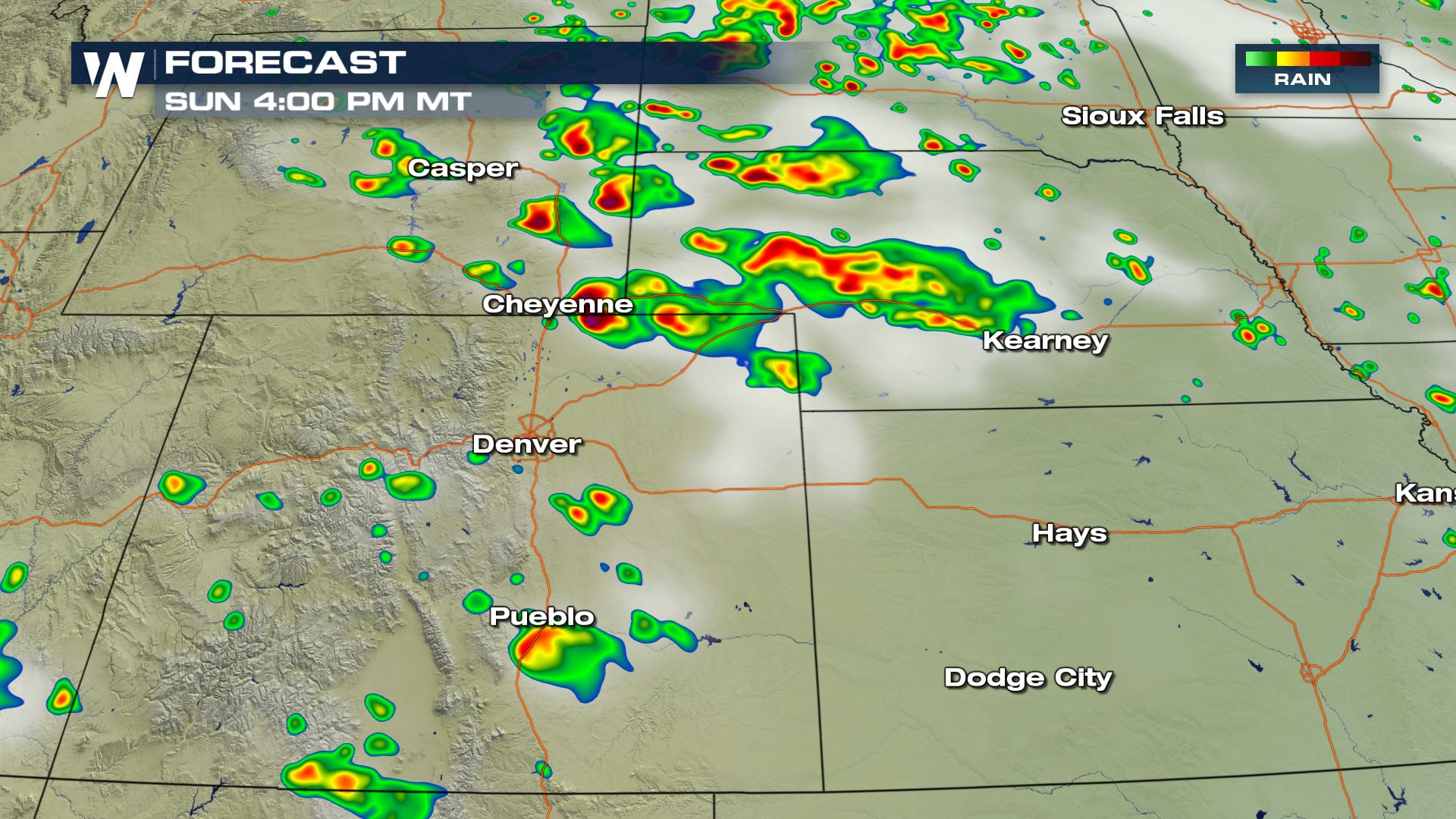 The forecast (simulated radar) mid-afternoon Sunday, July 29
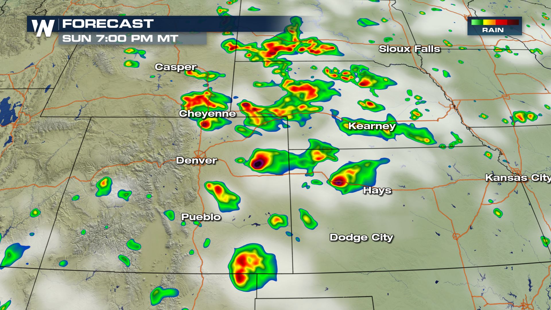 The forecast (simulated radar) during the evening Sunday, July 29
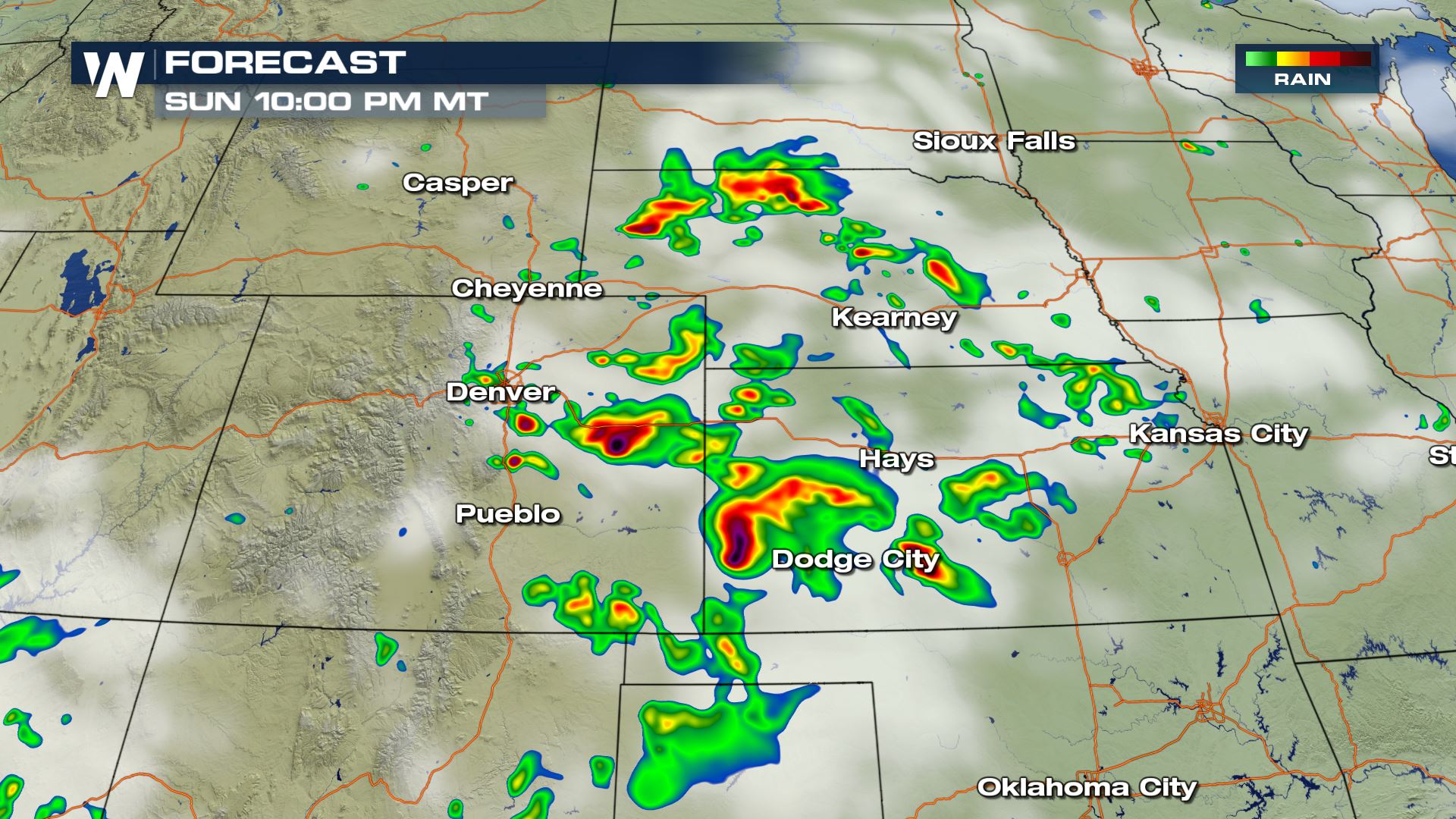 The forecast (simulated radar) after sunset Sunday, July 29
The thunderstorms will move to the southeast around 35 miles per hour. Keep an eye on the western and northwestern sky for incoming, hazardous weather. Have a way of receiving weather warnings. Have a backup plan in case you are outside. Always be weather ready!
We have written more extensively about the severe risks via Meteorologist Patrick Crawford's earlier article here.
For WeatherNation, Meteorologist Steve Glazier
The forecast (simulated radar) after sunset Sunday, July 29
The thunderstorms will move to the southeast around 35 miles per hour. Keep an eye on the western and northwestern sky for incoming, hazardous weather. Have a way of receiving weather warnings. Have a backup plan in case you are outside. Always be weather ready!
We have written more extensively about the severe risks via Meteorologist Patrick Crawford's earlier article here.
For WeatherNation, Meteorologist Steve Glazier
What's important about this tornado watch is that there is a HIGH LIKELIHOOD of tornadoes.
The Storm Prediction Center (which helps issue these watches) says a few tornadoes are likely with a couple of intense tornadoes possible. Scattered large hail up to 3.5 inches thick and wind gusts up to 80 mph will be possible.
The thunderstorms will be most numerous between 2 p.m. and 9 p.m. local time Sunday.
The forecast (simulated radar) mid-afternoon Sunday, July 29
The forecast (simulated radar) during the evening Sunday, July 29
The forecast (simulated radar) after sunset Sunday, July 29
The thunderstorms will move to the southeast around 35 miles per hour. Keep an eye on the western and northwestern sky for incoming, hazardous weather. Have a way of receiving weather warnings. Have a backup plan in case you are outside. Always be weather ready!
We have written more extensively about the severe risks via Meteorologist Patrick Crawford's earlier article here.
For WeatherNation, Meteorologist Steve GlazierAll Weather News
More
Fronts Continue To Spark Severe Weather Across the Plains
A cold front that brought record lows to the
18 Jul 2025 10:40 PM

Extreme Heat Impacts for the East Coast & South
Extreme heat continues to impact several area
18 Jul 2025 10:05 PM

Flooding Threat Remains Elevated in the East
A cold front pushing through the Eastern Seab
18 Jul 2025 9:10 PM

EF-2 Firenado from the Deer Creek Fire in Utah
A fire tornado was spotted near La Sal, Utah
18 Jul 2025 7:30 AM

Tropical System Brings Flood Risk to the Central Gulf
Time has run out for notable tropical develop
18 Jul 2025 3:05 AM

Heavy Rain, Flooding Threat Returns to Florida
Keep the rain boots handy in Florida - heavy
13 Jul 2025 12:50 PM

Severe Storm Risk Pushes into the Great Lakes, Ohio Valley
Friday was another busy day with severe weath
12 Jul 2025 8:00 PM