Tracking the Tropics

Special Stories
4 Jun 2019 5:21 AM
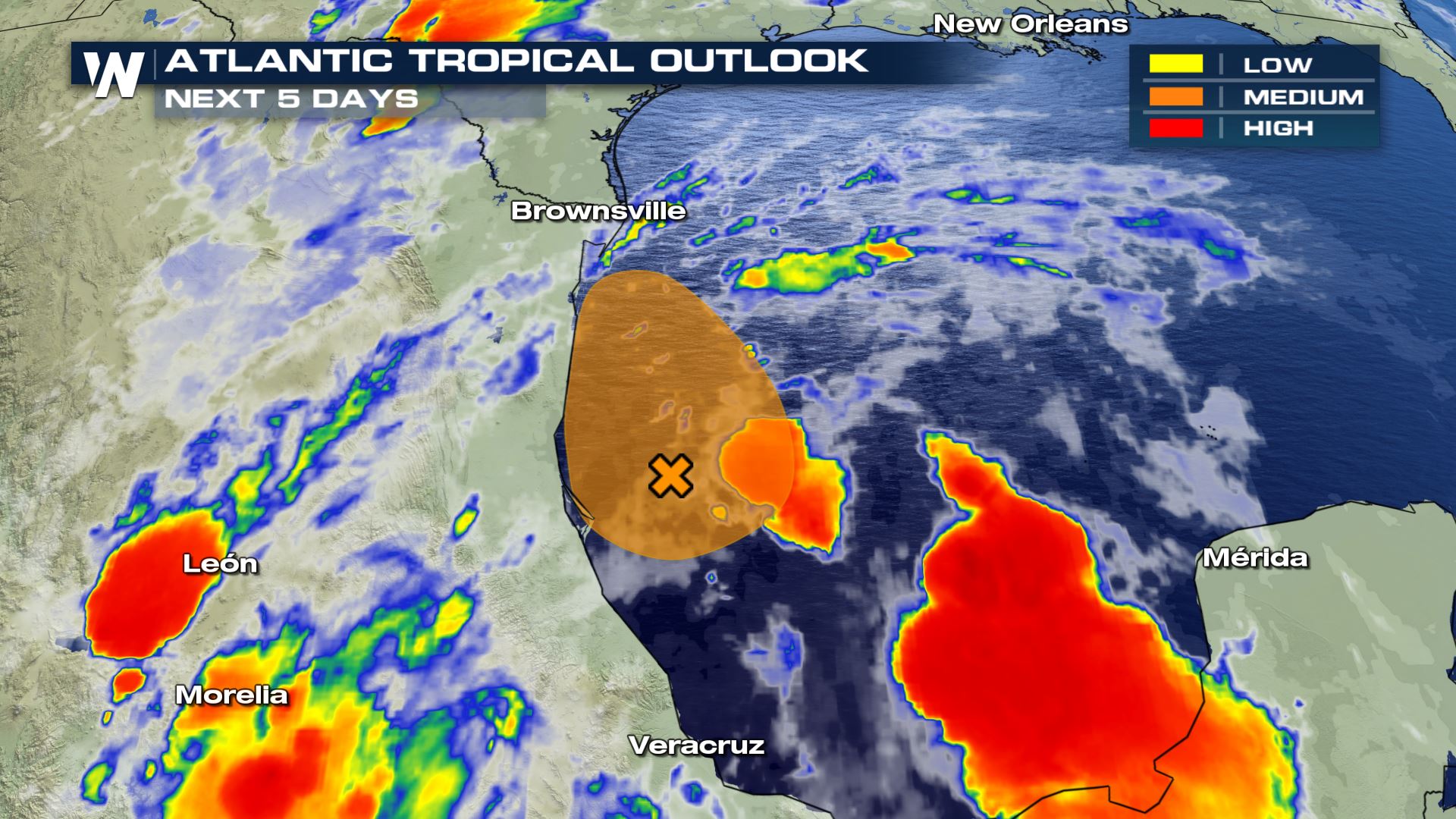
There is a broad region of low pressure currently centered in the Bay of Campeche. As of this morning (Tuesday), the chance of development into a tropical system is near 40 percent, according the National Hurricane Center. The center of the system is expected to move northwest along the east coast of Mexico over the next few days.
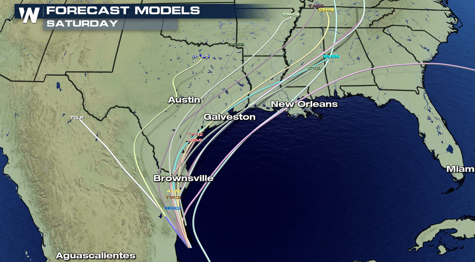
 The forecast models show a likely westward drift, eventually turning north as the system gets caught up in upper level steering winds.
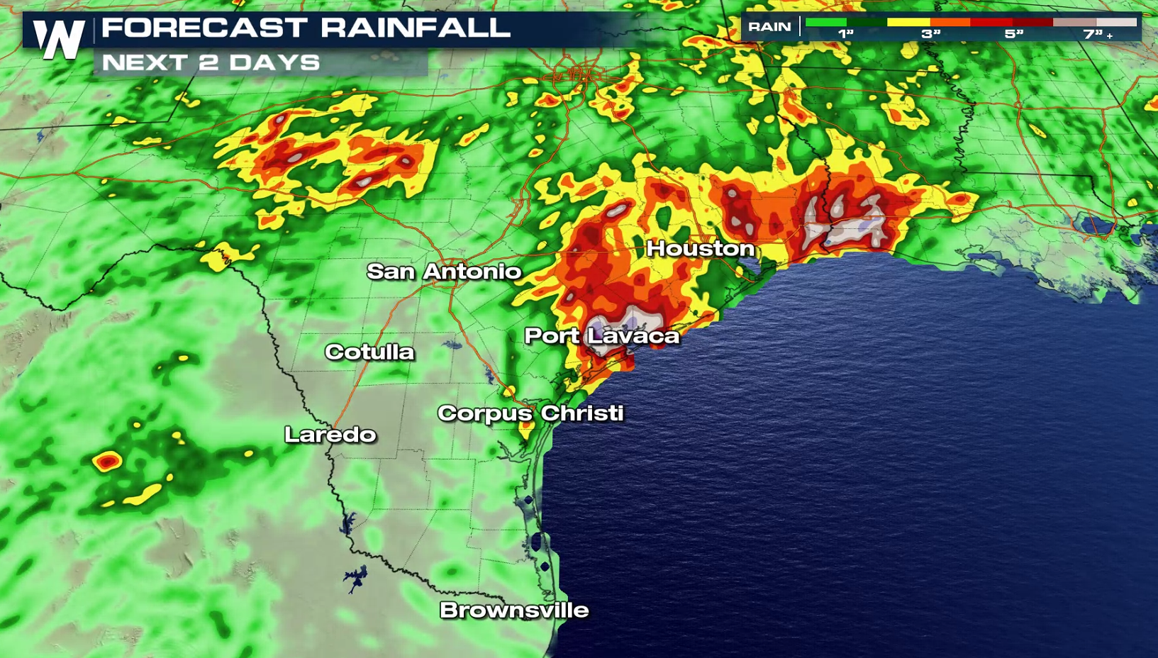
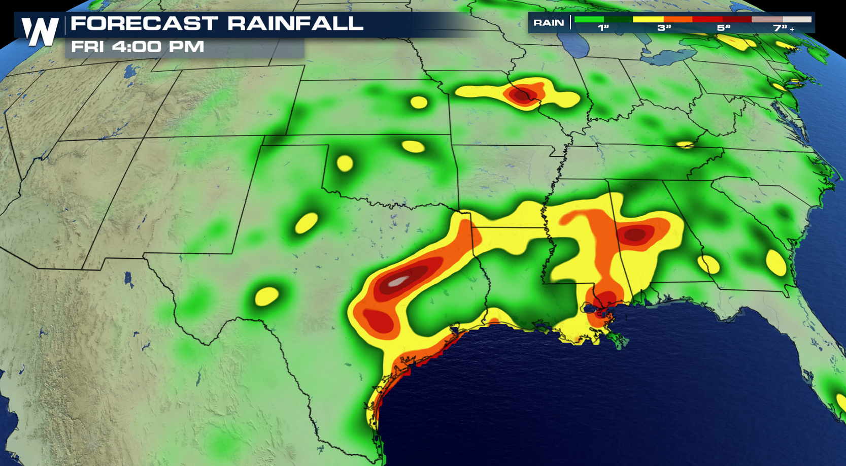
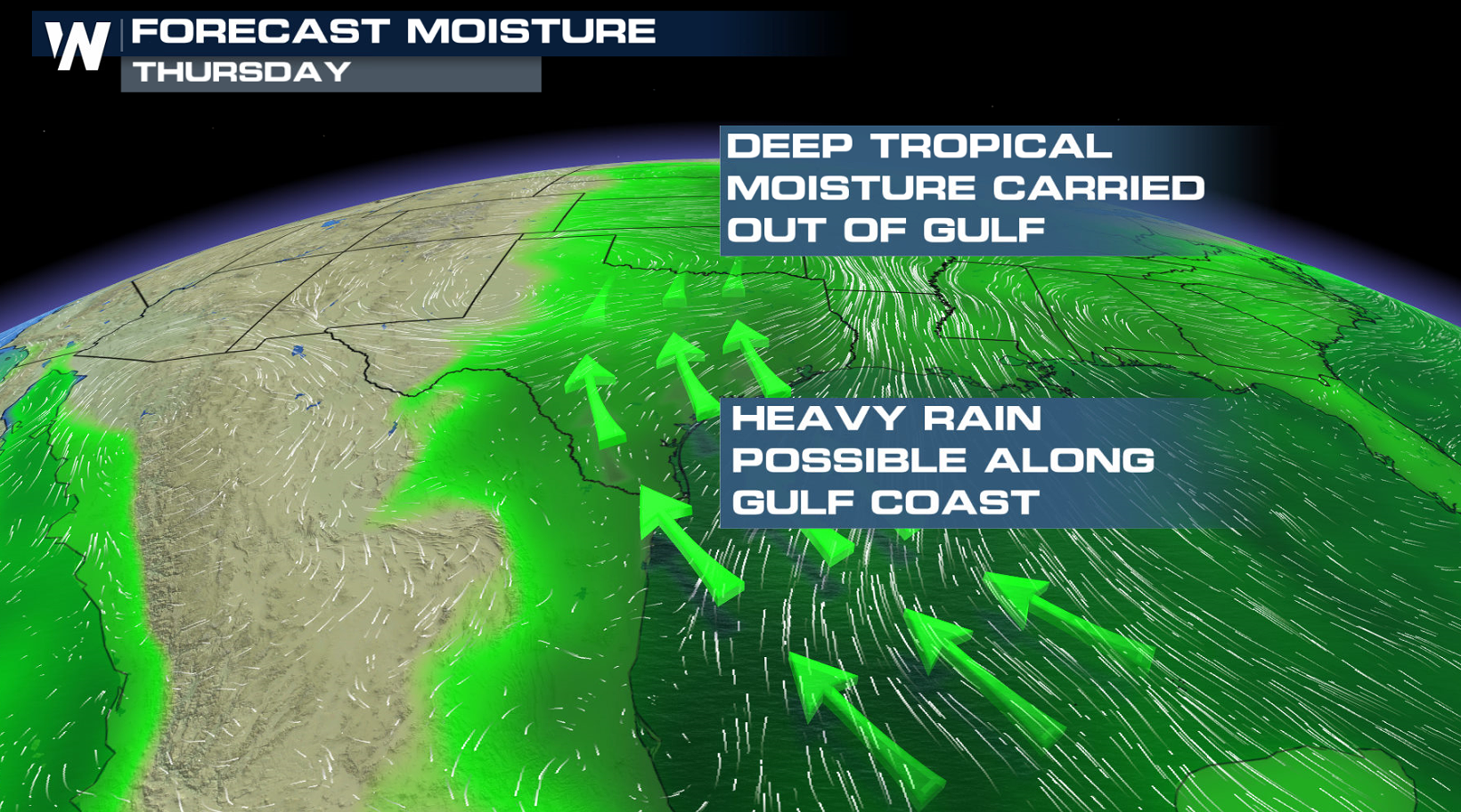 Even if the system doesn't intensify, heavy rainfall will impact southern Mexico for the next several days. Leftover moisture from the system may even drift into the south-central U.S. into the work week. 4+ inches of rain will be possible throughout Mexico which could lead to flooding for some areas. The southern U.S. might even see up to 6 inches of rain from all the moisture pooling in from the Gulf of Mexico.
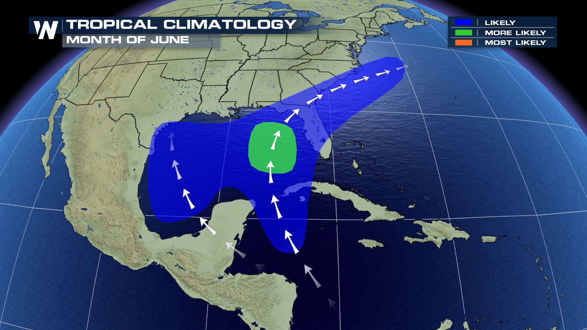
 Climatologically, the majority of June's tropical activity is within the Gulf of Mexico. However, it is still possible that development could occur elsewhere in the Atlantic basin, something we saw with our first named storm of the 2019 year with Andrea.
 Click here to see how you can prepare for the season, become more educated about tropical systems, and much more.
The forecast models show a likely westward drift, eventually turning north as the system gets caught up in upper level steering winds.
Even if the system doesn't intensify, heavy rainfall will impact southern Mexico for the next several days. Leftover moisture from the system may even drift into the south-central U.S. into the work week. 4+ inches of rain will be possible throughout Mexico which could lead to flooding for some areas. The southern U.S. might even see up to 6 inches of rain from all the moisture pooling in from the Gulf of Mexico.
Climatologically, the majority of June's tropical activity is within the Gulf of Mexico. However, it is still possible that development could occur elsewhere in the Atlantic basin, something we saw with our first named storm of the 2019 year with Andrea.
Click here to see how you can prepare for the season, become more educated about tropical systems, and much more.All Weather News
More
Dangerous Stretch of Heat Shaping Up This Week
The hottest temperatures of the year are loom
28 Jun 2026 2:30 AM

Weekend System To Shake up Pattern Across the Country
A significant early-summer trough is digging
28 Jun 2026 2:25 AM

Massive Fires Burn in Utah, Extreme Fire Danger Continues This Weekend
Photo: Iron Fire getting doused with a retard
28 Jun 2026 2:20 AM

'MCS' Season Brings Severe and Flooding Threats Across the Southeast
As Summer settles in across the Central U.S.,
28 Jun 2026 2:10 AM


Severe Threat Tracks into the Northeast Friday
Another day, another Illinois tornado. That's
26 Jun 2026 2:25 AM
