Tropical Activity Settling Down in the Atlantic

Special Stories
4 Aug 2019 4:15 PM
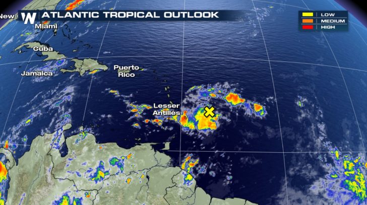
After an active week with several areas of potential development, the outlook for the Atlantic basin has quieted down. A tropical wave associated with some showers and thunderstorms remains east of the Lesser Antilles. The conditions around this disturbance, however, are not suitable for intensification. No further organization of this system is expected. It will still bring some thunderstorms and cloudiness to the northeastern Caribbean islands.
 Aside from this area of disturbed weather, no new tropical development is expected across the Atlantic basin for the next 5 days.
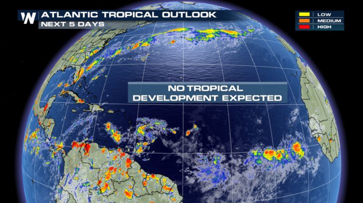 A large plume of Saharan dust will be moving across the Central Atlantic and into the Eastern Caribbean this week. The more dust the merrier because this will help hinder any potential tropical development.
https://gph.is/g/ZWmQBeo
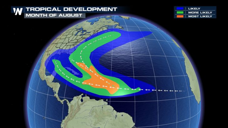
Any quiet time in the Atlantic is certainly a good thing, especially because August is when we typically see activity ramp up across the basin. The region of typical development expands this month, now including the Central Atlantic and East Coast of the US.
A large plume of Saharan dust will be moving across the Central Atlantic and into the Eastern Caribbean this week. The more dust the merrier because this will help hinder any potential tropical development.
https://gph.is/g/ZWmQBeo
Any quiet time in the Atlantic is certainly a good thing, especially because August is when we typically see activity ramp up across the basin. The region of typical development expands this month, now including the Central Atlantic and East Coast of the US.
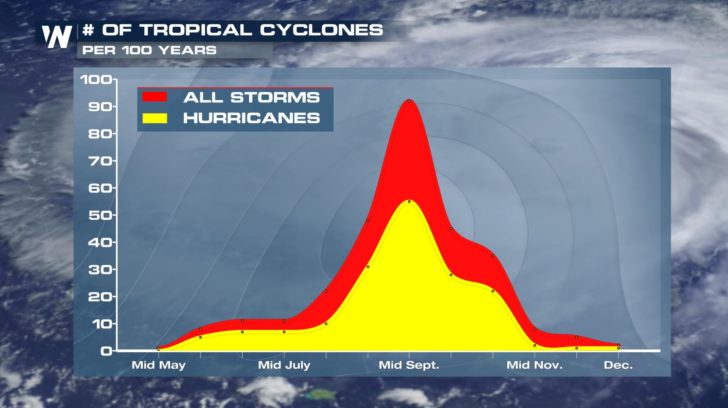
 Tropical activity peaks in mid-September. This is the time of the year when the ingredients necessary for development are readily available across the region.
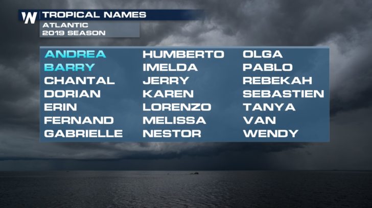
 If and when we see our next named system form, it would be the third of the season and receive the name Chantal.
 If anything starts to brew in the Atlantic, we will update you online and on-air.
-Meteorologist Viki Knapp
If anything starts to brew in the Atlantic, we will update you online and on-air.
-Meteorologist Viki Knapp
Aside from this area of disturbed weather, no new tropical development is expected across the Atlantic basin for the next 5 days.
A large plume of Saharan dust will be moving across the Central Atlantic and into the Eastern Caribbean this week. The more dust the merrier because this will help hinder any potential tropical development.
https://gph.is/g/ZWmQBeo
Any quiet time in the Atlantic is certainly a good thing, especially because August is when we typically see activity ramp up across the basin. The region of typical development expands this month, now including the Central Atlantic and East Coast of the US.
Tropical activity peaks in mid-September. This is the time of the year when the ingredients necessary for development are readily available across the region.
If and when we see our next named system form, it would be the third of the season and receive the name Chantal.
If anything starts to brew in the Atlantic, we will update you online and on-air.
-Meteorologist Viki KnappAll Weather News
More
Watching the Gulf for Tropical Development
In the Atlantic basin, we are keeping a very
18 Jul 2026 2:10 AM

Monsoon Moisture Brings Weekend Flood Threat
The monsoon has returned to the southwestern
18 Jul 2026 2:00 AM

Severe Storms Target the Northeast Saturday
While smoke and heat have made headlines in t
18 Jul 2026 1:55 AM

Thick Wildfire Smoke Continues to Pour Across the Great Lakes, East Coast
Wildfires burning in Northwestern Ontario, Ca
18 Jul 2026 1:45 AM

After Historic Flooding, Flood Risk Moves West Saturday
TEXAS HILL COUNTRY - Life-threatening floodin
18 Jul 2026 1:00 AM

Heat Alerts Across the Nation End Thursday
ALL-TIME RECORD HIGHS were broken across the
16 Jul 2026 1:00 AM

Rare Enhanced Severe Threat For New England
WHAT TO EXPECT The SPC has issued a severe ou
15 Jul 2026 1:35 AM