Tropical Depression Could Form Near South Florida
Special Stories
11 Sep 2019 7:00 PM
UPDATE: POTENTIAL TROPICAL CYCLONE FORMS -CLICK HERE FOR THE LATEST HERE
A tropical depression could form as early as Friday across the northwest Bahamas or near South Florida, according to the National Hurricane Center.
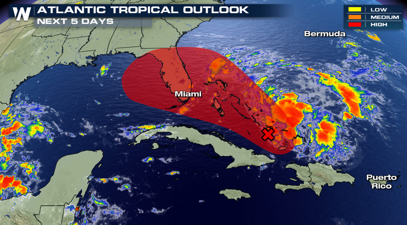
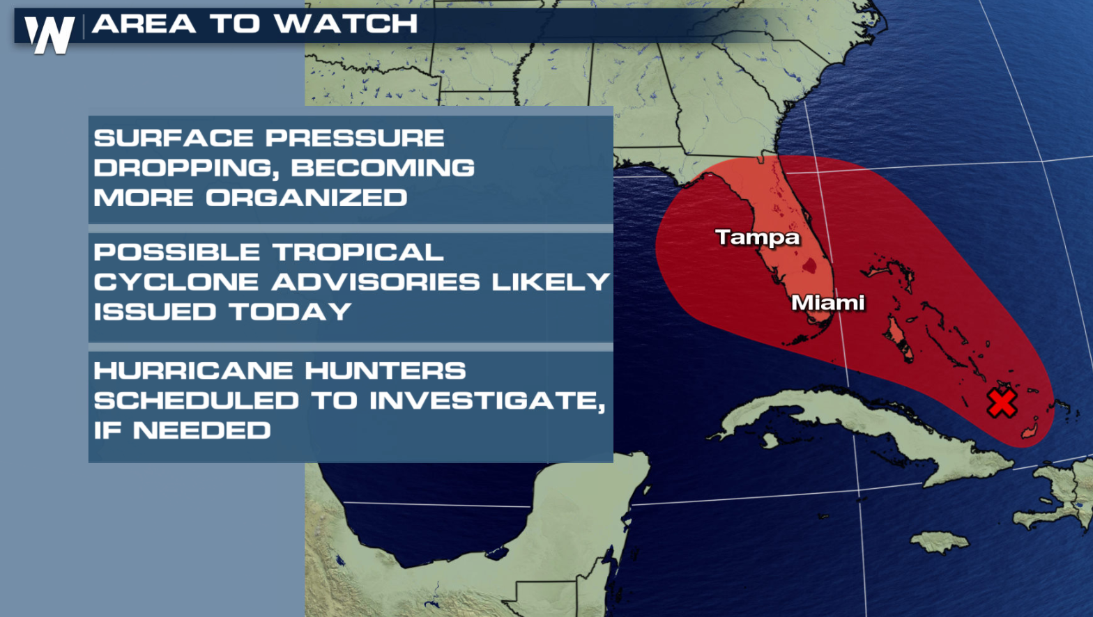
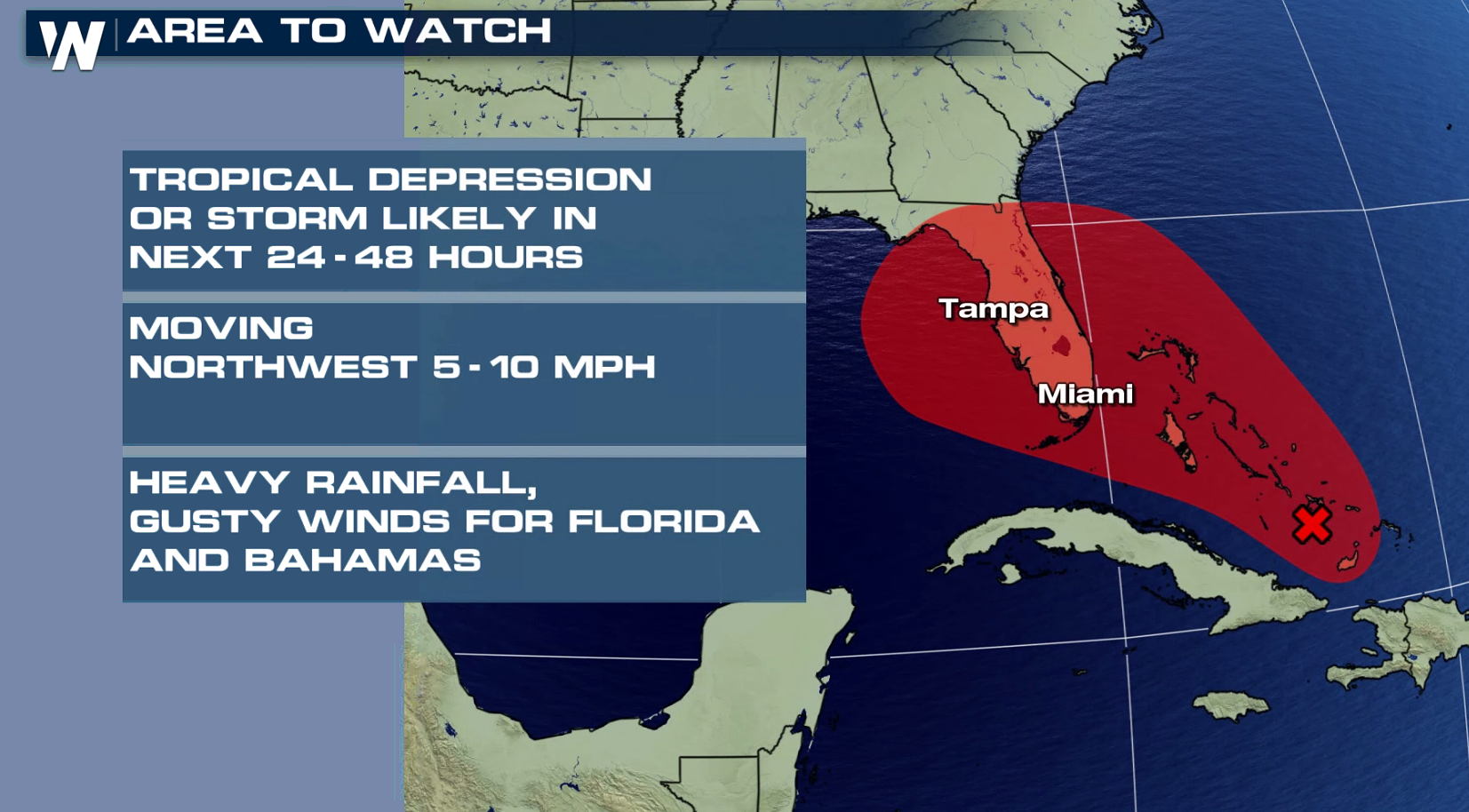
 Currently, the National Hurricane Center says there is a 70% chance of a tropical depression forming near South Florida through Saturday and a 80% chance of a tropical depression (or tropical storm) forming in the eastern Gulf of Mexico into early next week.
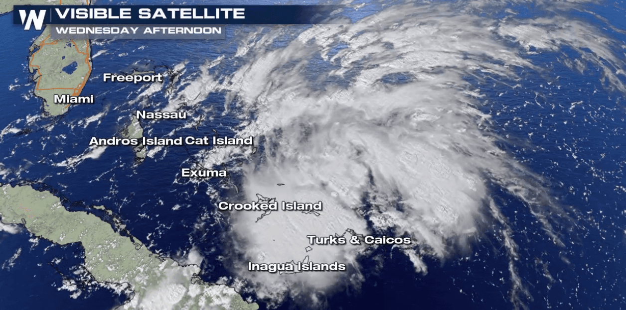
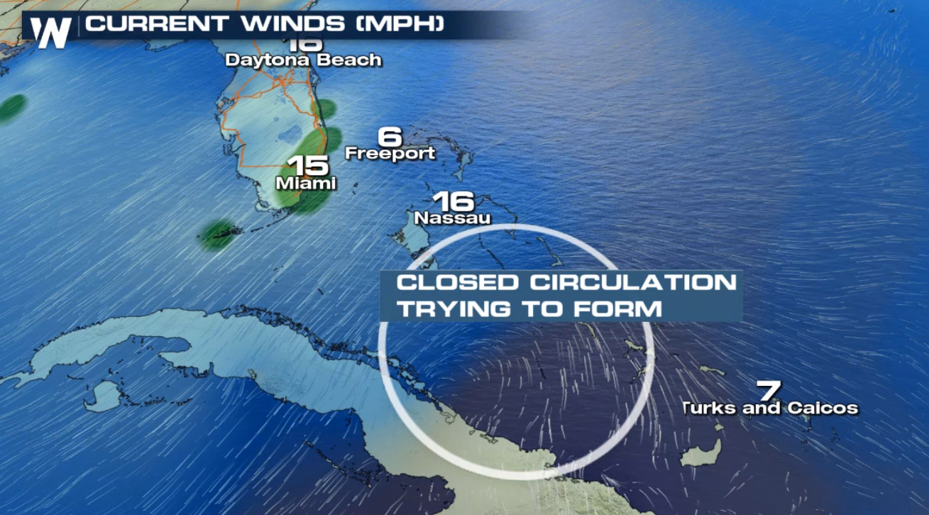
 Here is NHC's latest tropical weather outlook for this system: "Satellite images indicate that the area of disturbed weather over the central and southeastern Bahamas is gradually becoming better organized while surface pressures are falling in the area. Conditions are becoming favorable for a tropical depression or a tropical storm to form within the next day or so as the system moves toward the northwest through the northwestern Bahamas and toward the Florida Peninsula at 5 to 10 mph. If this development trend continues Potential Tropical Cyclone advisories will likely be initiated later today. This disturbance will bring heavy rainfall and gusty winds across portions of the Bahamas through Friday, especially in portions of the northwestern Bahamas affected by Hurricane Dorian. An Air Force Reserve reconnaissance aircraft is scheduled to investigate the system this afternoon, if necessary."
 Regardless of development, heavy thunderstorms and breezy winds can be expected across the Bahamas on into Friday. For Florida, those breezy showers will start to arrive Friday afternoon, becoming heavier and more widespread on Saturday.
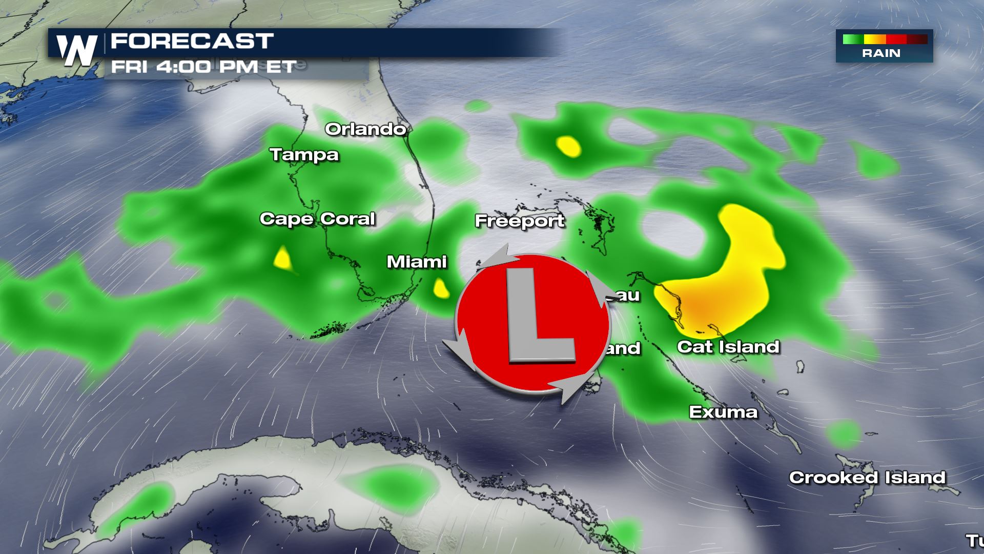
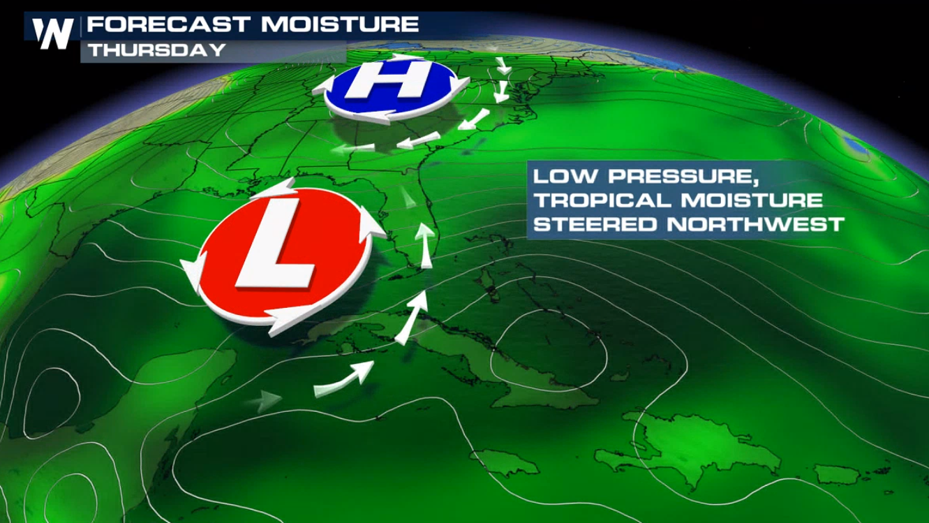
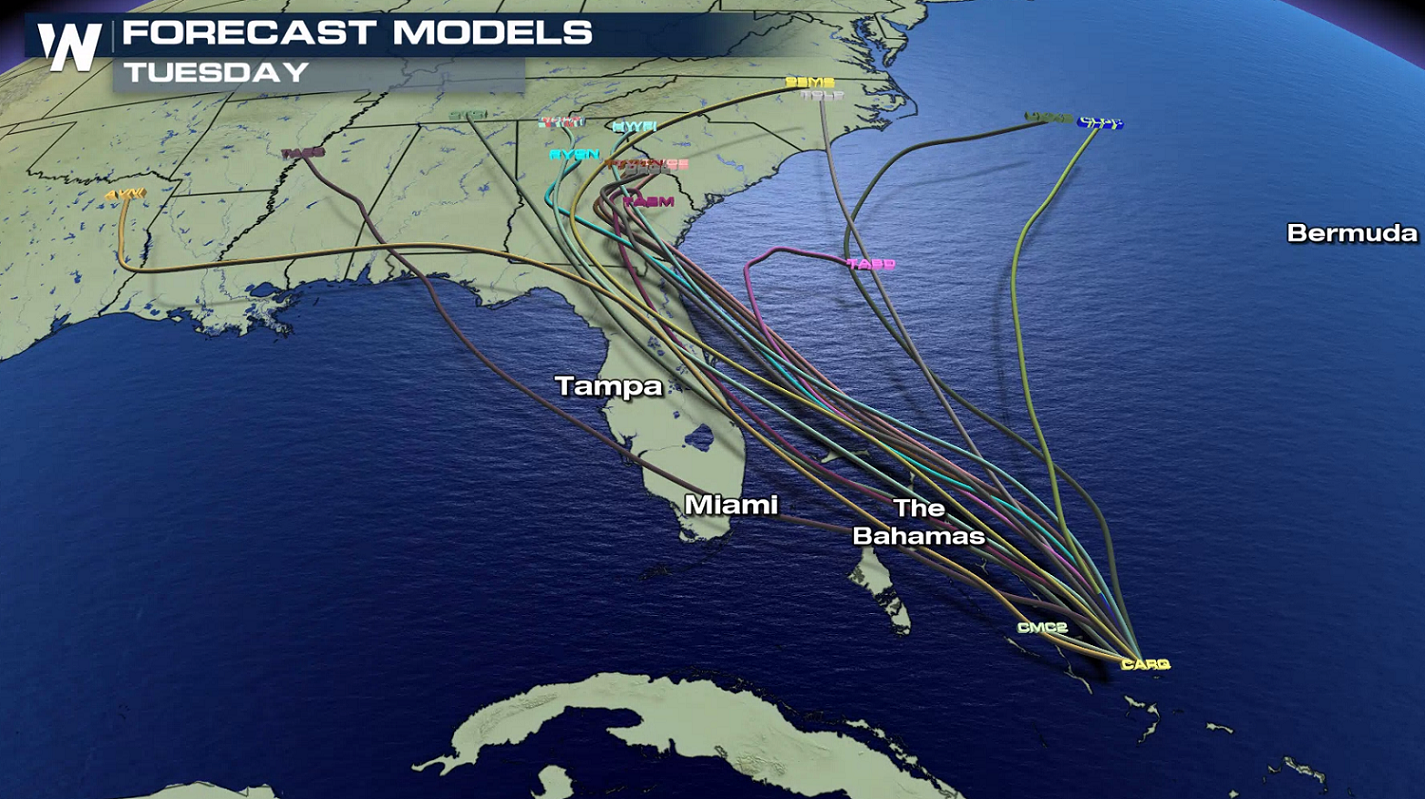
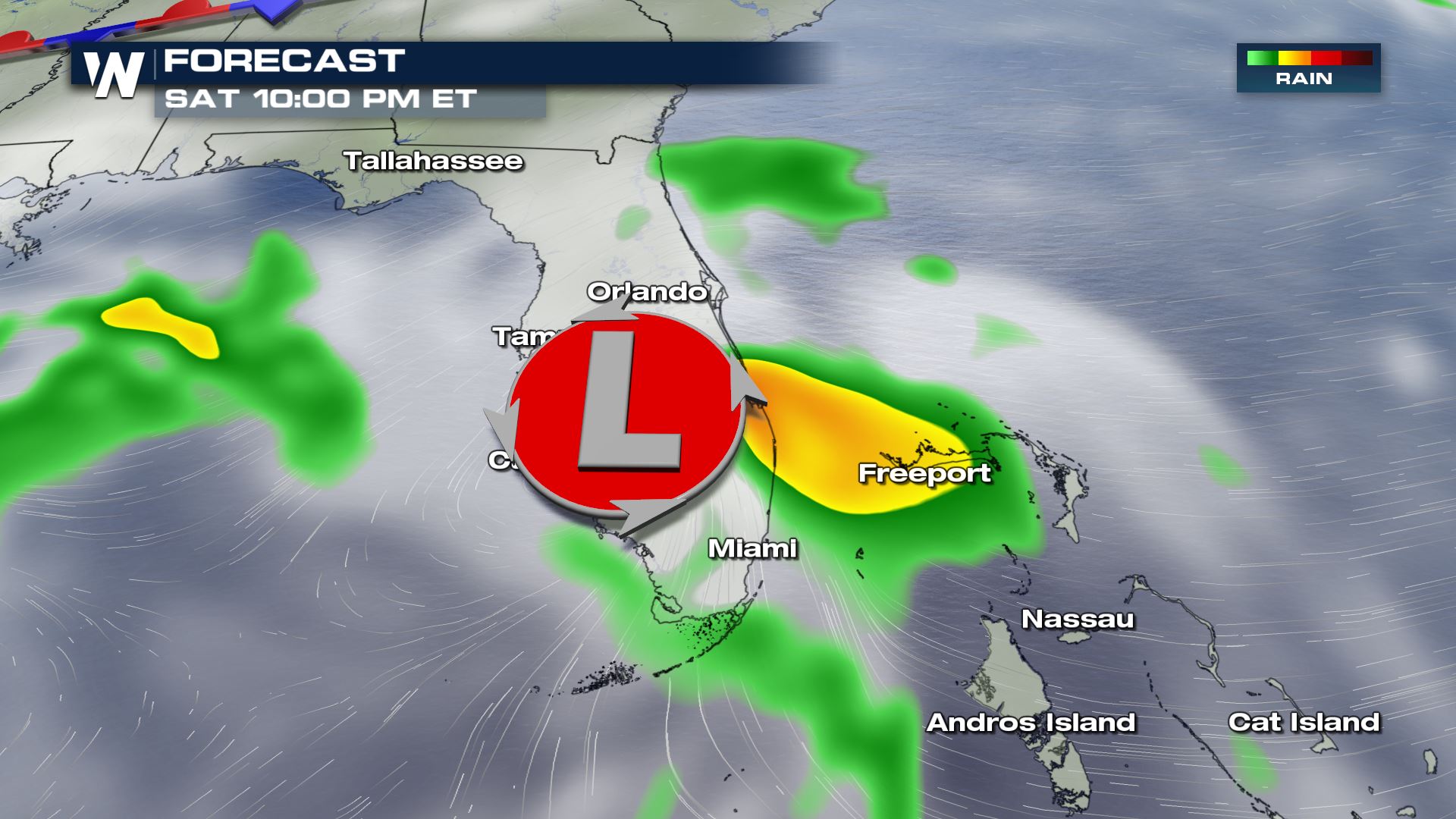 By Sunday, forecast models show the tropical entity (whatever it may be at that time) nearing the west coast of Florida on Sunday and possibly eastern Gulf of Mexico or northeast Gulf Coast states by Monday.
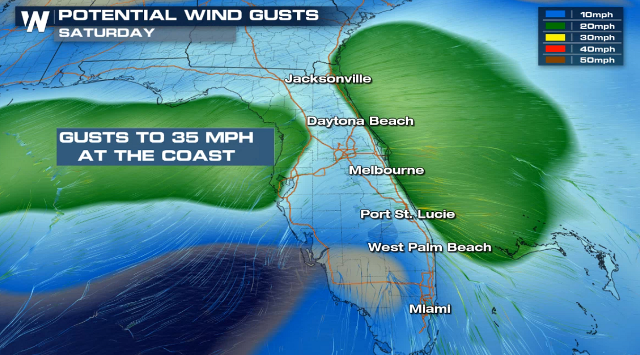 Floridians can expect gusty winds, heavy showers and localized flooding through the weekend. It is too soon to tell any impacts for the northern Gulf Coast. Monitor the progress of this tropical wave with us here at WeatherNation.
For WeatherNation, Meteorologist Steve Glazier
Floridians can expect gusty winds, heavy showers and localized flooding through the weekend. It is too soon to tell any impacts for the northern Gulf Coast. Monitor the progress of this tropical wave with us here at WeatherNation.
For WeatherNation, Meteorologist Steve Glazier
Currently, the National Hurricane Center says there is a 70% chance of a tropical depression forming near South Florida through Saturday and a 80% chance of a tropical depression (or tropical storm) forming in the eastern Gulf of Mexico into early next week.
Here is NHC's latest tropical weather outlook for this system: "Satellite images indicate that the area of disturbed weather over the central and southeastern Bahamas is gradually becoming better organized while surface pressures are falling in the area. Conditions are becoming favorable for a tropical depression or a tropical storm to form within the next day or so as the system moves toward the northwest through the northwestern Bahamas and toward the Florida Peninsula at 5 to 10 mph. If this development trend continues Potential Tropical Cyclone advisories will likely be initiated later today. This disturbance will bring heavy rainfall and gusty winds across portions of the Bahamas through Friday, especially in portions of the northwestern Bahamas affected by Hurricane Dorian. An Air Force Reserve reconnaissance aircraft is scheduled to investigate the system this afternoon, if necessary."
Regardless of development, heavy thunderstorms and breezy winds can be expected across the Bahamas on into Friday. For Florida, those breezy showers will start to arrive Friday afternoon, becoming heavier and more widespread on Saturday.
By Sunday, forecast models show the tropical entity (whatever it may be at that time) nearing the west coast of Florida on Sunday and possibly eastern Gulf of Mexico or northeast Gulf Coast states by Monday.
Floridians can expect gusty winds, heavy showers and localized flooding through the weekend. It is too soon to tell any impacts for the northern Gulf Coast. Monitor the progress of this tropical wave with us here at WeatherNation.
For WeatherNation, Meteorologist Steve GlazierAll Weather News
More
Wildfire Outbreak in the Pacific Northwest
SPOKANE, WA - On Saturday, August 1st, the Ol
3 Aug 2026 1:55 AM

More Storms for the East Through Monday
A low-pressure system that moved through the
3 Aug 2026 1:50 AM


After Reaching Category 5, Genevieve Weakens in the Pacific
PacificGenevieve formed last Friday south of
3 Aug 2026 12:30 AM

Flooding, Severe Storms Target the Midwest Again
After an active week of storms across the nor
1 Aug 2026 1:40 AM

Flooding Risk Increases as Heavy Rain Targets the Tri-State Area
Tuesday, heavy rainfall moved across the Nort
30 Jul 2026 12:25 AM

Severe Weather: Energy From the Midwest Now in the Southeast
UPPER MIDWEST - Through Monday, dangerous tor
29 Jul 2026 10:30 PM