Tropical Depression Three Lurks Off Carolina Coast
Top Stories
6 Jul 2018 3:16 PM
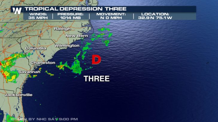
Tropical Depression Three remains stationary well off the coast of the Carolinas as of Saturday evening.
The National Hurricane Center said 'Three' could strengthen and become Tropical Storm Chris overnight or on Sunday.
NOAA's Hurricane Hunters are scheduled to investigate the depression overnight.
Tropical Depression Three is located out over open water with winds at 35 mph and remains stationary.
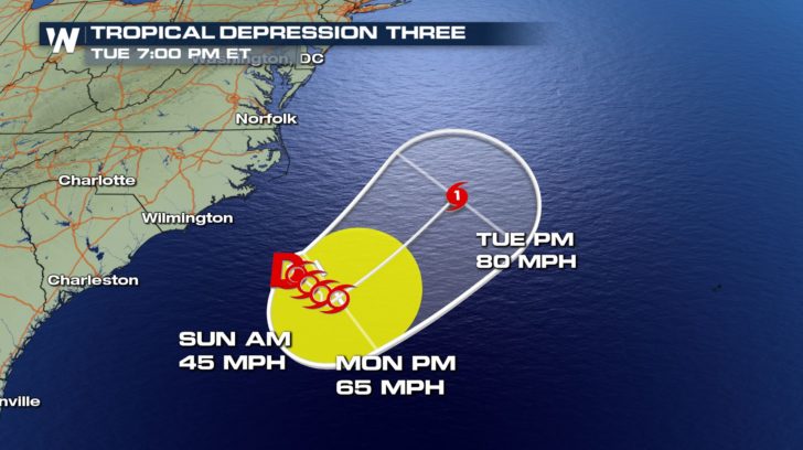
 The current National Hurricane Center forecast shows a strengthening trend into the beginning of the week.
Once winds surpass 39 mph, it would become a tropical storm and would be named Chris.
The storm is also expected to reach hurricane strength at the beginning of next week as it moves northeastward into the Atlantic.
The current National Hurricane Center forecast shows a strengthening trend into the beginning of the week.
Once winds surpass 39 mph, it would become a tropical storm and would be named Chris.
The storm is also expected to reach hurricane strength at the beginning of next week as it moves northeastward into the Atlantic.
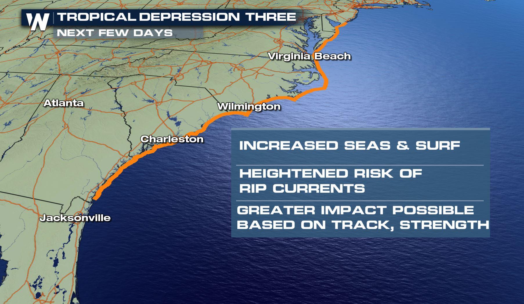
 Tropical Depression Three is forecast to stay well off the coast of North Carolina in the Atlantic Ocean, but will still pose indirect impacts for parts of the East Coast. Dangerous and possibly life threatening rip currents are expected. Be sure to monitor conditions at your local beach if you plan to head into the water.
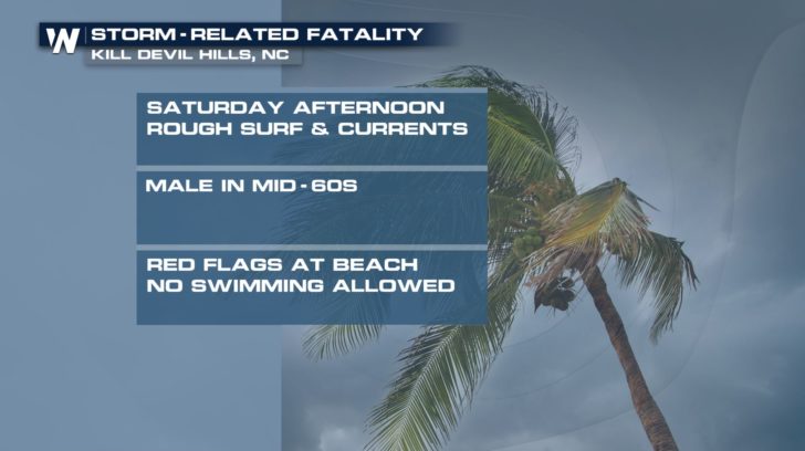
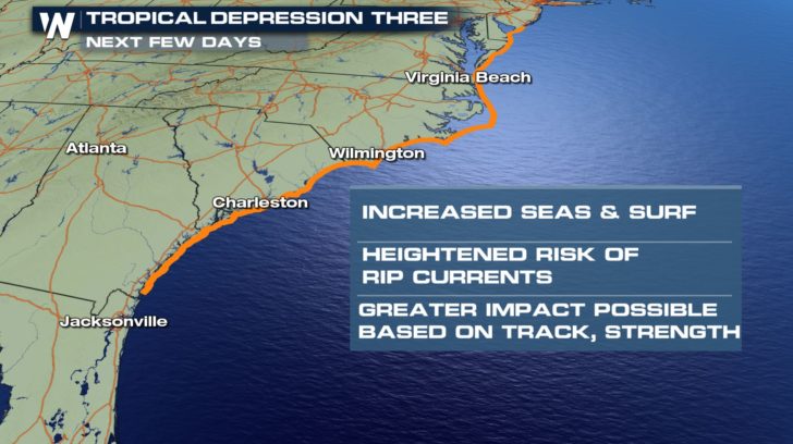 At least one fatality was reported on Saturday of a swimmer that was pulled from rough surf and dangerous currents off the coast of Kill Devil Hills, North Carolina. Remember, when there's a red flag at the beach, that means no swimming and a yellow flag means there are strong currents and to swim with caution.
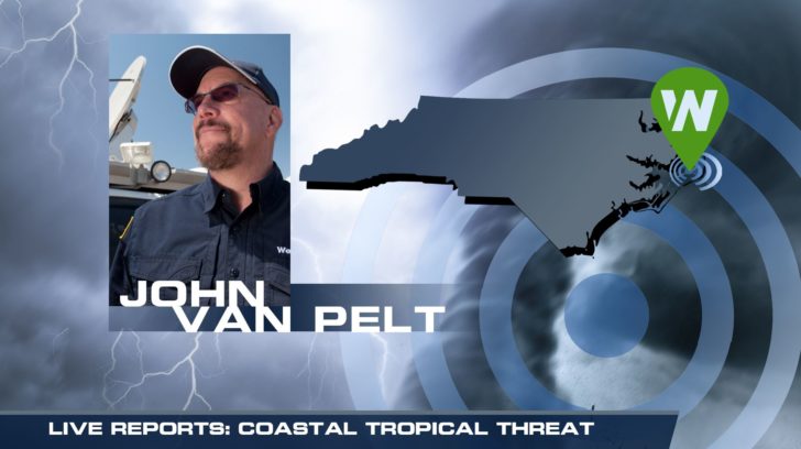
 WeatherNation will continue to have team coverage and follow the progression of this storm, including live reports from WeatherNation's field correspondent John Van Pelt starting on Sunday. John will report on conditions from the Outer Banks of North Carolina.
 For WeatherNation, I'm Meteorologist Meredith Garofalo
The current National Hurricane Center forecast shows a strengthening trend into the beginning of the week.
Once winds surpass 39 mph, it would become a tropical storm and would be named Chris.
The storm is also expected to reach hurricane strength at the beginning of next week as it moves northeastward into the Atlantic.
Tropical Depression Three is forecast to stay well off the coast of North Carolina in the Atlantic Ocean, but will still pose indirect impacts for parts of the East Coast. Dangerous and possibly life threatening rip currents are expected. Be sure to monitor conditions at your local beach if you plan to head into the water.
At least one fatality was reported on Saturday of a swimmer that was pulled from rough surf and dangerous currents off the coast of Kill Devil Hills, North Carolina. Remember, when there's a red flag at the beach, that means no swimming and a yellow flag means there are strong currents and to swim with caution.
WeatherNation will continue to have team coverage and follow the progression of this storm, including live reports from WeatherNation's field correspondent John Van Pelt starting on Sunday. John will report on conditions from the Outer Banks of North Carolina.
For WeatherNation, I'm Meteorologist Meredith Garofalo
All Weather News
More

More Storms for the East Through Monday
A low-pressure system that moved through the
3 Aug 2026 12:20 PM


After Reaching Category 5, Genevieve Weakens in the Pacific
PacificGenevieve formed last Friday south of
3 Aug 2026 12:30 AM

Flooding, Severe Storms Target the Midwest Again
After an active week of storms across the nor
1 Aug 2026 1:40 AM

Flooding Risk Increases as Heavy Rain Targets the Tri-State Area
Tuesday, heavy rainfall moved across the Nort
30 Jul 2026 12:25 AM