Tropical Storm Chris forms in the Atlantic
Top Stories
8 Jul 2018 7:41 AM
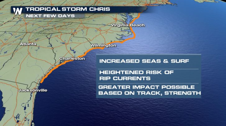
Early on Sunday morning, Tropical Storm Chris formed in the Atlantic. Just off the coast of the Carolinas, Chris is churning with winds at 40 mph.
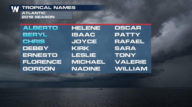
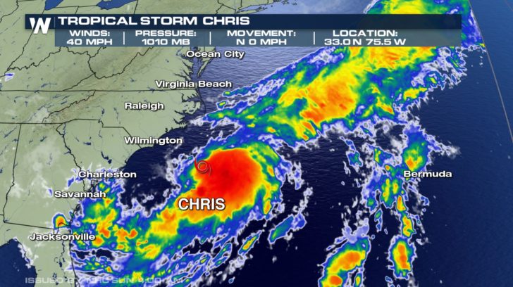 After a quiet start to the Atlantic hurricane season, we are now on our third named storm.
 With no upper level steering mechanism to move Chris, the storm will meander off the coasts of the Eastern Seaboard. However, a cold front will start to steer Chris north and east the mid-week. As Chris moves over the warm Gulf Stream, it will strengthen late Tuesday, into Wednesday into a Category 1 hurricane.
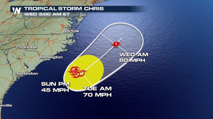 While the Eastern Seaboard will receive indirect impacts, Chris will not make landfall. Those along the coasts of the Carolinas up to the Mid-Atlantic will be most concerned about dangerous rip currents and high surf.
 Be sure to check back with WeatherNation for more updates on Tropical Storm Chris.
For WeatherNation, Meteorologist Kate Mantych.,
Be sure to check back with WeatherNation for more updates on Tropical Storm Chris.
For WeatherNation, Meteorologist Kate Mantych.,
After a quiet start to the Atlantic hurricane season, we are now on our third named storm.
With no upper level steering mechanism to move Chris, the storm will meander off the coasts of the Eastern Seaboard. However, a cold front will start to steer Chris north and east the mid-week. As Chris moves over the warm Gulf Stream, it will strengthen late Tuesday, into Wednesday into a Category 1 hurricane.
While the Eastern Seaboard will receive indirect impacts, Chris will not make landfall. Those along the coasts of the Carolinas up to the Mid-Atlantic will be most concerned about dangerous rip currents and high surf.
Be sure to check back with WeatherNation for more updates on Tropical Storm Chris.
For WeatherNation, Meteorologist Kate Mantych.,All Weather News
More
Wildfire Outbreak in the Pacific Northwest
SPOKANE, WA - On Saturday, August 1st, the Ol
3 Aug 2026 1:55 AM

More Storms for the East Through Monday
A low-pressure system that moved through the
3 Aug 2026 1:50 AM


After Reaching Category 5, Genevieve Weakens in the Pacific
PacificGenevieve formed last Friday south of
3 Aug 2026 12:30 AM

Flooding, Severe Storms Target the Midwest Again
After an active week of storms across the nor
1 Aug 2026 1:40 AM

Flooding Risk Increases as Heavy Rain Targets the Tri-State Area
Tuesday, heavy rainfall moved across the Nort
30 Jul 2026 12:25 AM

Severe Weather: Energy From the Midwest Now in the Southeast
UPPER MIDWEST - Through Monday, dangerous tor
29 Jul 2026 10:30 PM