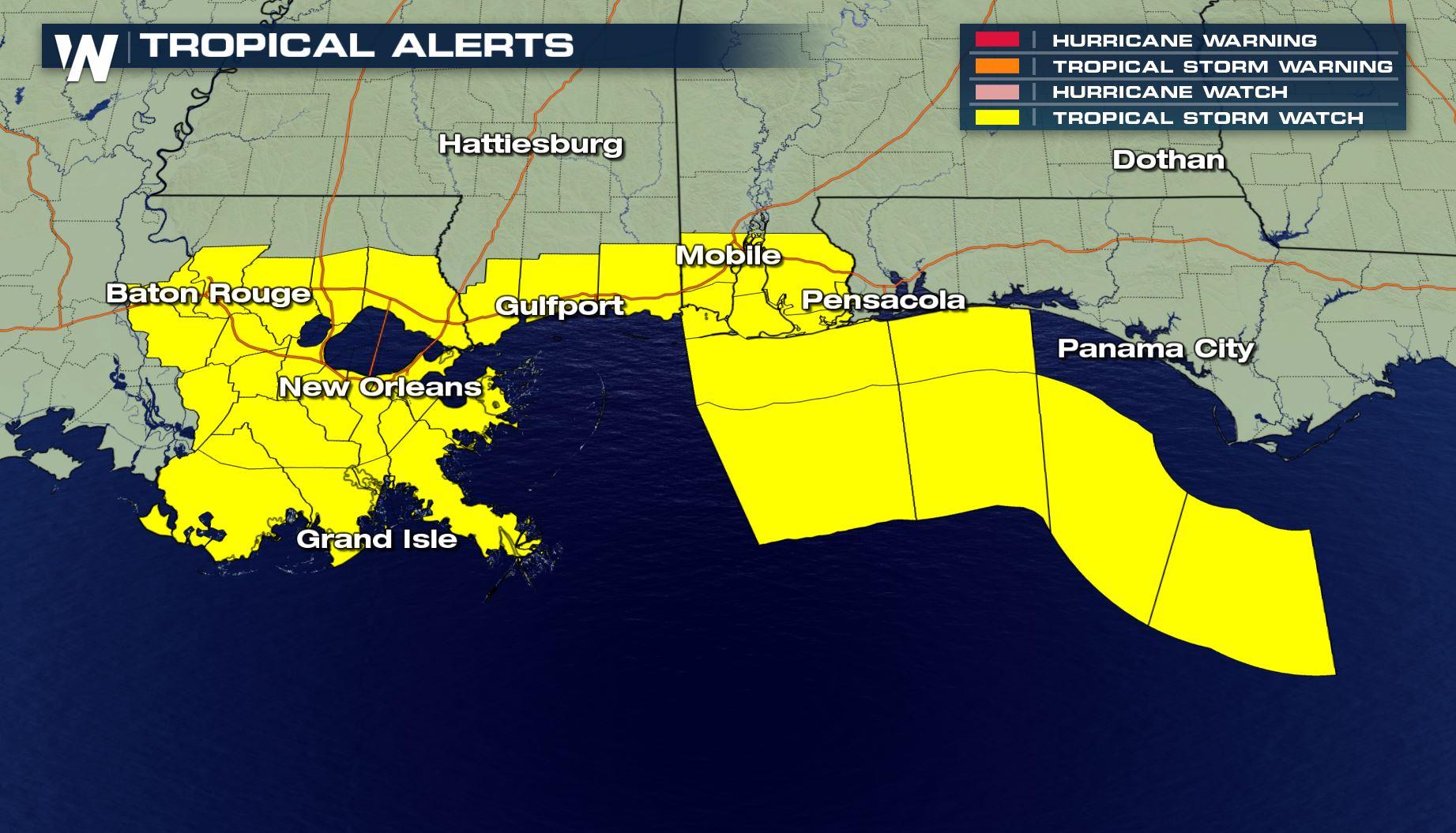
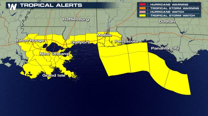
Tropical Storm Watches In Effect Along The Gulf
Special Stories
2 Sep 2018 3:45 PM
Tropical Storm Watches are now in effect for portions of the Gulf from Louisiana east into parts of the western Florida panhandle. A Tropical Storm Watch means that there is a chance of a Tropical Storm, with winds from 39 to 73 miles per hour, hitting a specified area within 48 hours. It goes from roughly New Orleans east to coastal Alabama.
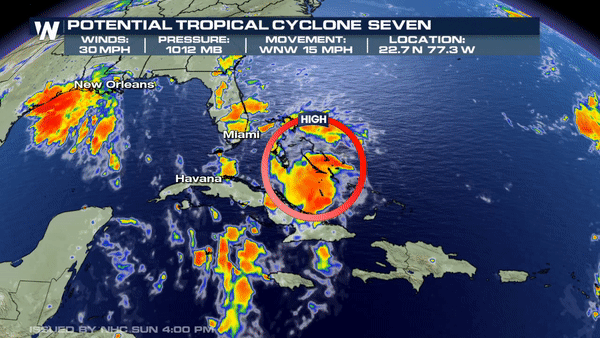
 This disturbance is currently located in the Bahamas and is known as PTC (Potential Tropical Cyclone) 7. As of now, it is a disorganized area of storms that is moving west. The National Hurricane Center is forecasting a high chance of further development over the next 5 days as it moves into the Gulf of Mexico by late Monday.
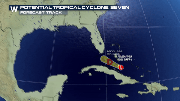
 Based on upper-level steering, this disturbance will track WNW into the Gulf by Monday and continue a track along the Central Gulf Coast by Tuesday and Wednesday.
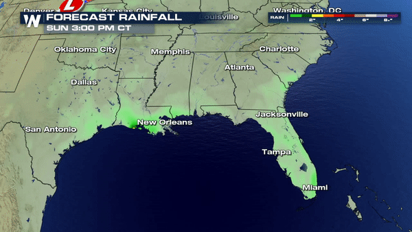
 While further formation is expected, the main concern at this time is still heavy rain and gusty wind. Rain will be the focus as this system brings anywhere from 4"-6" of tropical downpours by early-mid week.
 This is a developing story and forecast changes are still likely so please keep checking back for updates.
Meteorologist Merry Matthews
This is a developing story and forecast changes are still likely so please keep checking back for updates.
Meteorologist Merry Matthews
This disturbance is currently located in the Bahamas and is known as PTC (Potential Tropical Cyclone) 7. As of now, it is a disorganized area of storms that is moving west. The National Hurricane Center is forecasting a high chance of further development over the next 5 days as it moves into the Gulf of Mexico by late Monday.
Based on upper-level steering, this disturbance will track WNW into the Gulf by Monday and continue a track along the Central Gulf Coast by Tuesday and Wednesday.
While further formation is expected, the main concern at this time is still heavy rain and gusty wind. Rain will be the focus as this system brings anywhere from 4"-6" of tropical downpours by early-mid week.
This is a developing story and forecast changes are still likely so please keep checking back for updates.
Meteorologist Merry MatthewsAll Weather News
More
East Gears Up for Stormy, Wet Weekend
A low pressure system crashing through the Mi
1 Aug 2026 11:35 AM


Flooding, Severe Storms Target the Midwest Again
After an active week of storms across the nor
1 Aug 2026 1:40 AM


After Reaching Category 5, Genevieve Weakens in the Pacific
PacificFausto is now a post-tropical cyclone.
31 Jul 2026 1:30 AM

Flooding Risk Increases as Heavy Rain Targets the Tri-State Area
Tuesday, heavy rainfall moved across the Nort
30 Jul 2026 12:25 AM

Severe Weather: Energy From the Midwest Now in the Southeast
UPPER MIDWEST - Through Monday, dangerous tor
29 Jul 2026 10:30 PM