Tropical Update
Special Stories
27 Aug 2018 11:03 AM
The eastern Pacific continues to be quite active!
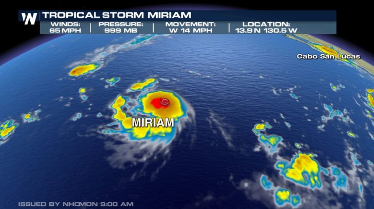
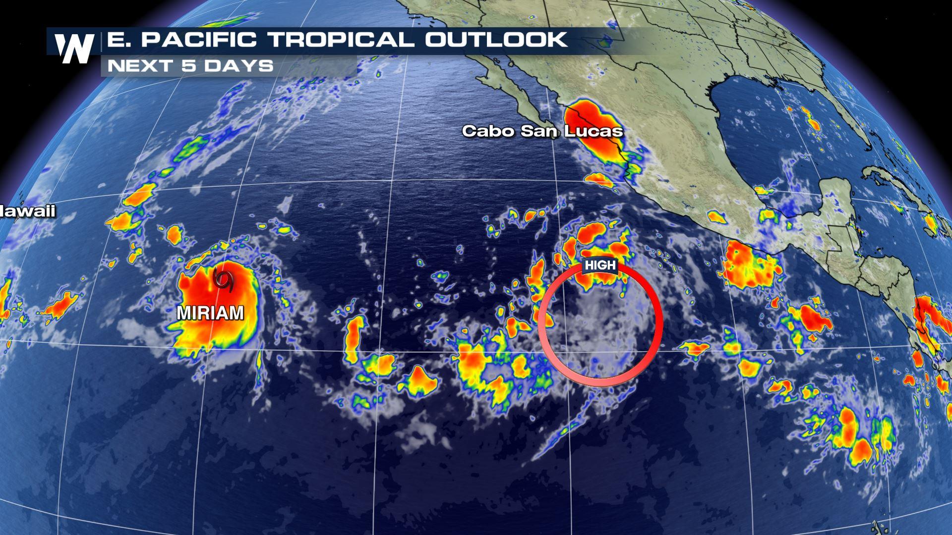
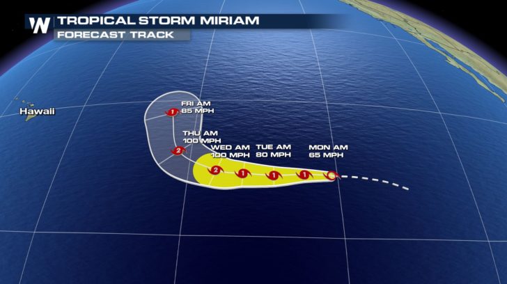 Our newest named storm is Miriam which is currently a tropical storm. It is moving west at 14 mph. Sustained winds are at 65 mph. Currently, Miriam is not looking to make any land impact. The storm will start to curve north by Wednesday night.
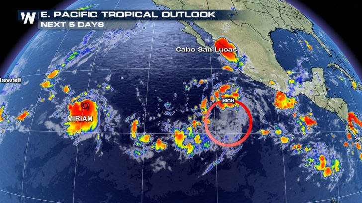 Another storm behind Miriam is starting to show some organization. The storm has about a 90 percent chance of forming into our next named storm.
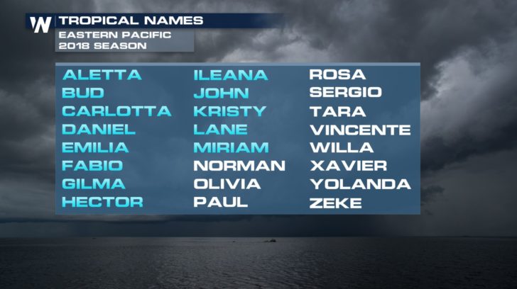 If the low pressure system does strengthen into our next named storm, it will be called Norman.
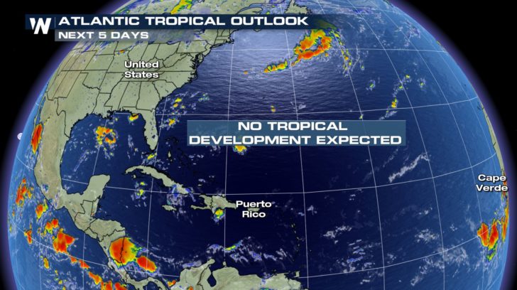 Over in the Atlantic, quiet conditions continue. No tropical development is expected in the next 5 days. We don't want to let our guard down yet, though, because we are heading into the heart of hurricane season. Tropical activity usually ramps up between now and October.
For WeatherNation -Meteorologist Shelly Lindblade
Over in the Atlantic, quiet conditions continue. No tropical development is expected in the next 5 days. We don't want to let our guard down yet, though, because we are heading into the heart of hurricane season. Tropical activity usually ramps up between now and October.
For WeatherNation -Meteorologist Shelly Lindblade
Our newest named storm is Miriam which is currently a tropical storm. It is moving west at 14 mph. Sustained winds are at 65 mph. Currently, Miriam is not looking to make any land impact. The storm will start to curve north by Wednesday night.
Another storm behind Miriam is starting to show some organization. The storm has about a 90 percent chance of forming into our next named storm.
If the low pressure system does strengthen into our next named storm, it will be called Norman.
Over in the Atlantic, quiet conditions continue. No tropical development is expected in the next 5 days. We don't want to let our guard down yet, though, because we are heading into the heart of hurricane season. Tropical activity usually ramps up between now and October.
For WeatherNation -Meteorologist Shelly LindbladeAll Weather News
More

More Storms for the East Through Monday
A low-pressure system that moved through the
3 Aug 2026 12:20 PM


After Reaching Category 5, Genevieve Weakens in the Pacific
PacificGenevieve formed last Friday south of
3 Aug 2026 12:30 AM

Flooding, Severe Storms Target the Midwest Again
After an active week of storms across the nor
1 Aug 2026 1:40 AM

Flooding Risk Increases as Heavy Rain Targets the Tri-State Area
Tuesday, heavy rainfall moved across the Nort
30 Jul 2026 12:25 AM