Trough Brings Record Cold Temps
Special Stories
24 Jul 2019 11:53 AM
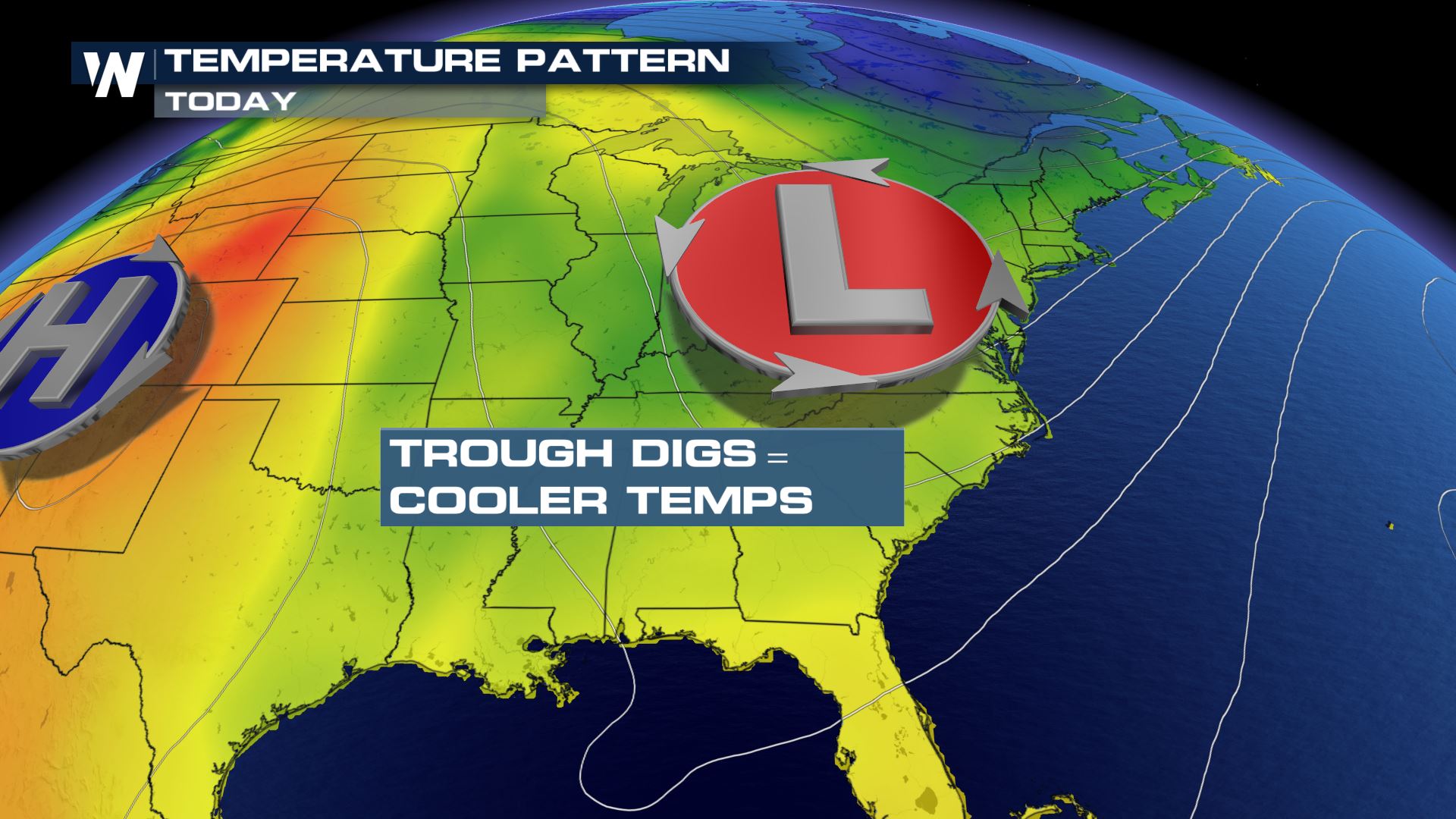
As an upper level trough digs down the East Coast, it will continue to pull in cooler conditions across the region. This pattern will likely continue through the end of the week and then gradually break down into the weekend.
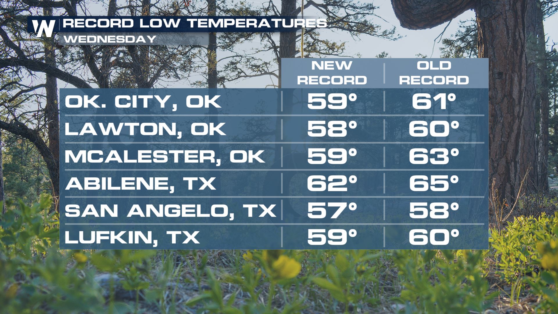
 As drier air works its' way into the region, record low temperatures were felt across much of the central and southern plains. Widespread reports of record low temperatures were observed early Wednesday morning.
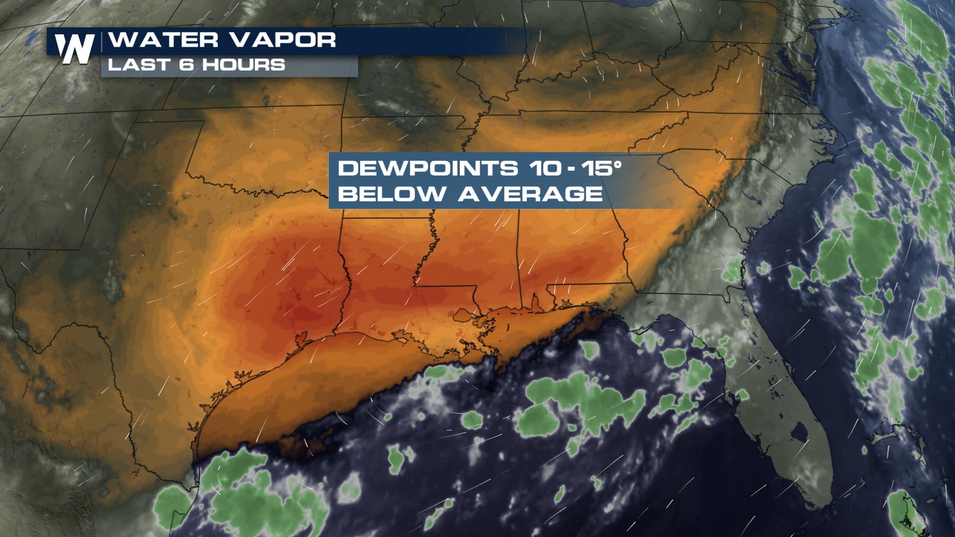
 Dry air cools faster / more easily than does moist air, resulting in the numerous reports of record low temps! This trend likely continues through the week as very dry air is expected to remain in place.
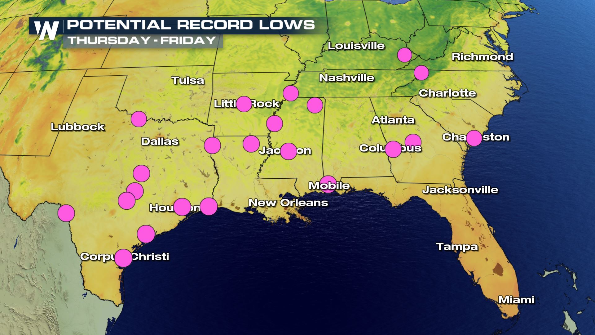
 Here are the areas that will likely feel record low temperatures over the next 48 hours, as dry air and low dew points are in the forecast.
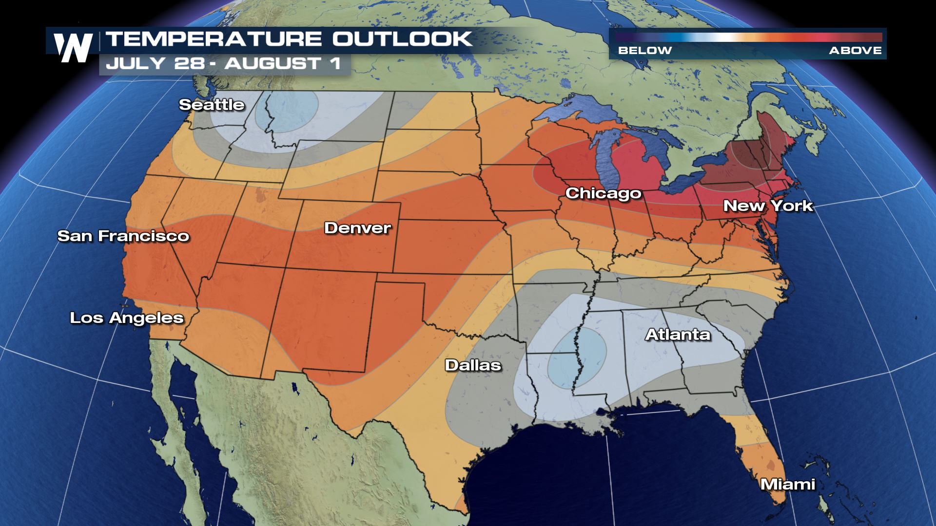
 Per the CPC, or the Climate Prediction Center, temperatures are forecasted to remain slightly below average for areas shaded in blue through the end of July and into early August.
 For WeatherNation, I'm Meteorologist Greg Rule
 As drier air works its' way into the region, record low temperatures were felt across much of the central and southern plains. Widespread reports of record low temperatures were observed early Wednesday morning.
 Dry air cools faster / more easily than does moist air, resulting in the numerous reports of record low temps! This trend likely continues through the week as very dry air is expected to remain in place.
 Here are the areas that will likely feel record low temperatures over the next 48 hours, as dry air and low dew points are in the forecast.
 Per the CPC, or the Climate Prediction Center, temperatures are forecasted to remain slightly below average for areas shaded in blue through the end of July and into early August.
 For WeatherNation, I'm Meteorologist Greg Rule
All Weather News
More