Tuesday Severe Weather Chances in the Southeast

Top Stories
13 Jan 2020 5:00 AM
The South experienced severe storms Friday and Saturday due to a potent storm system. The front that sparked those storms has stalled out across the Southeast, producing heavy rain and some thunderstorms. Isolated severe storms are possible today (Monday) and again on Tuesday in the Mississippi and Tennessee Valleys.
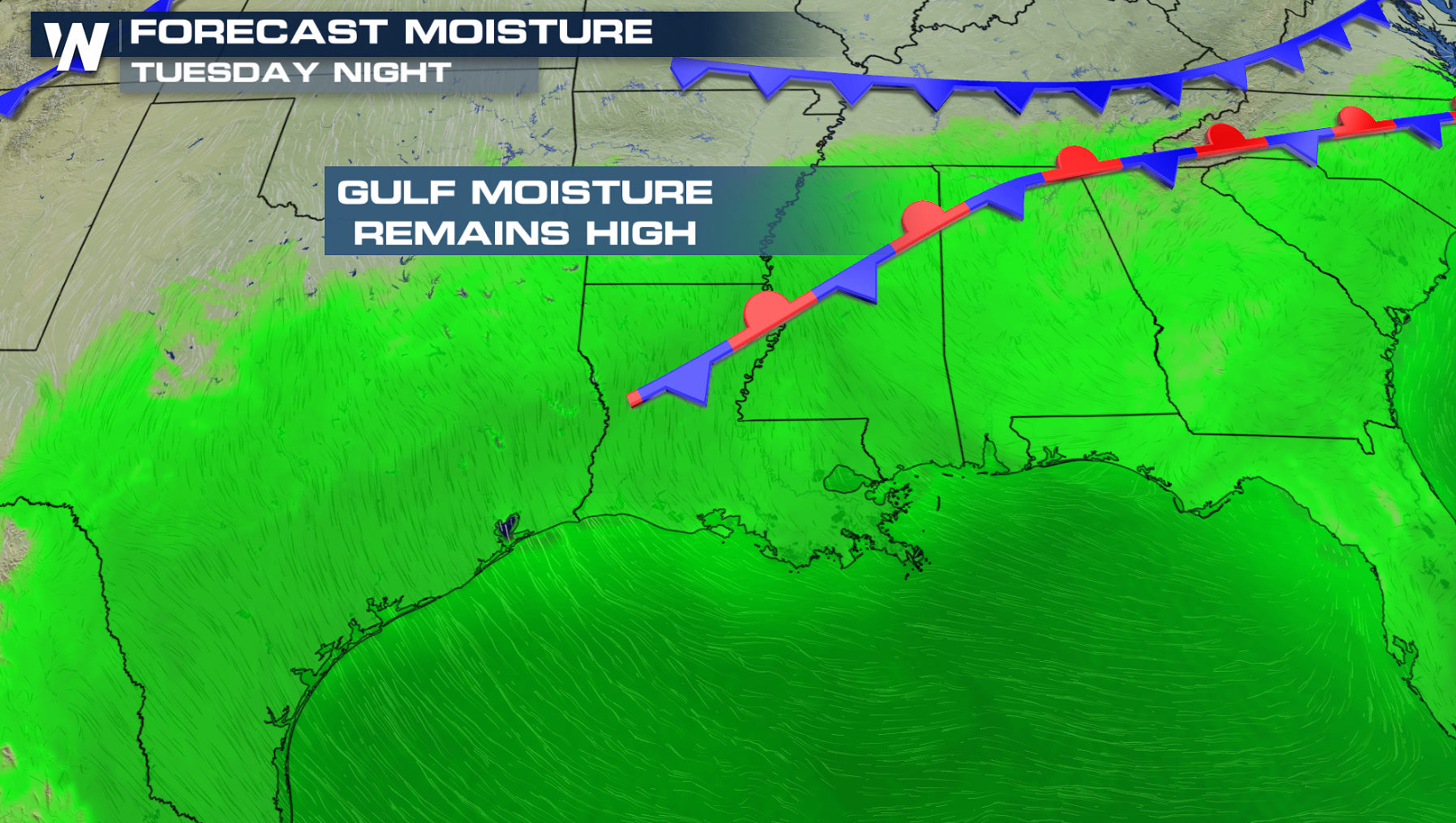
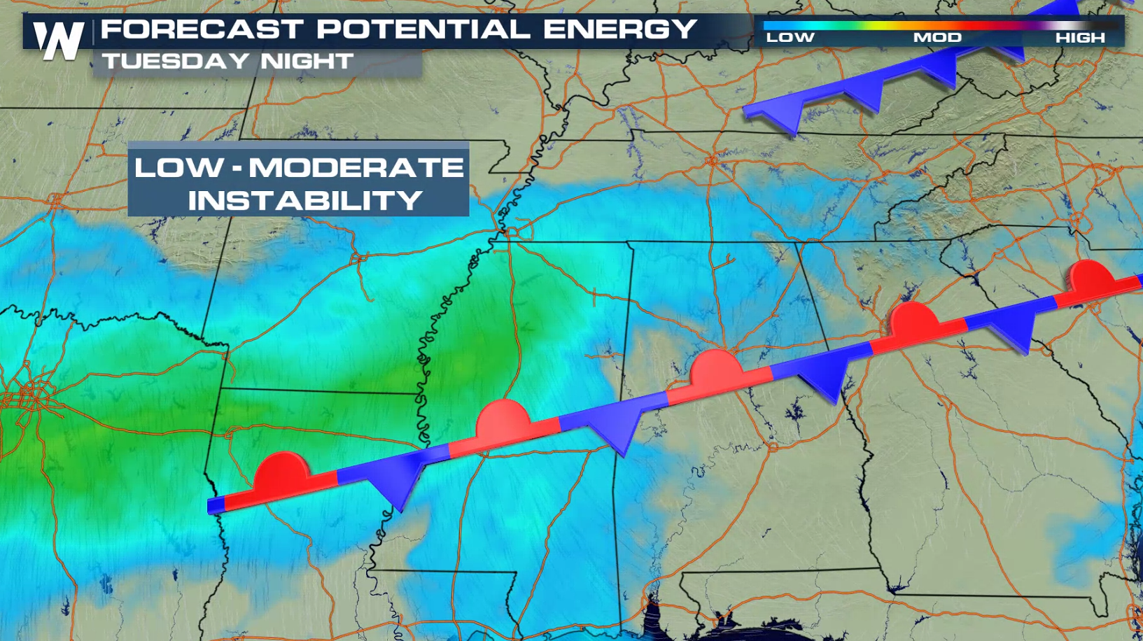
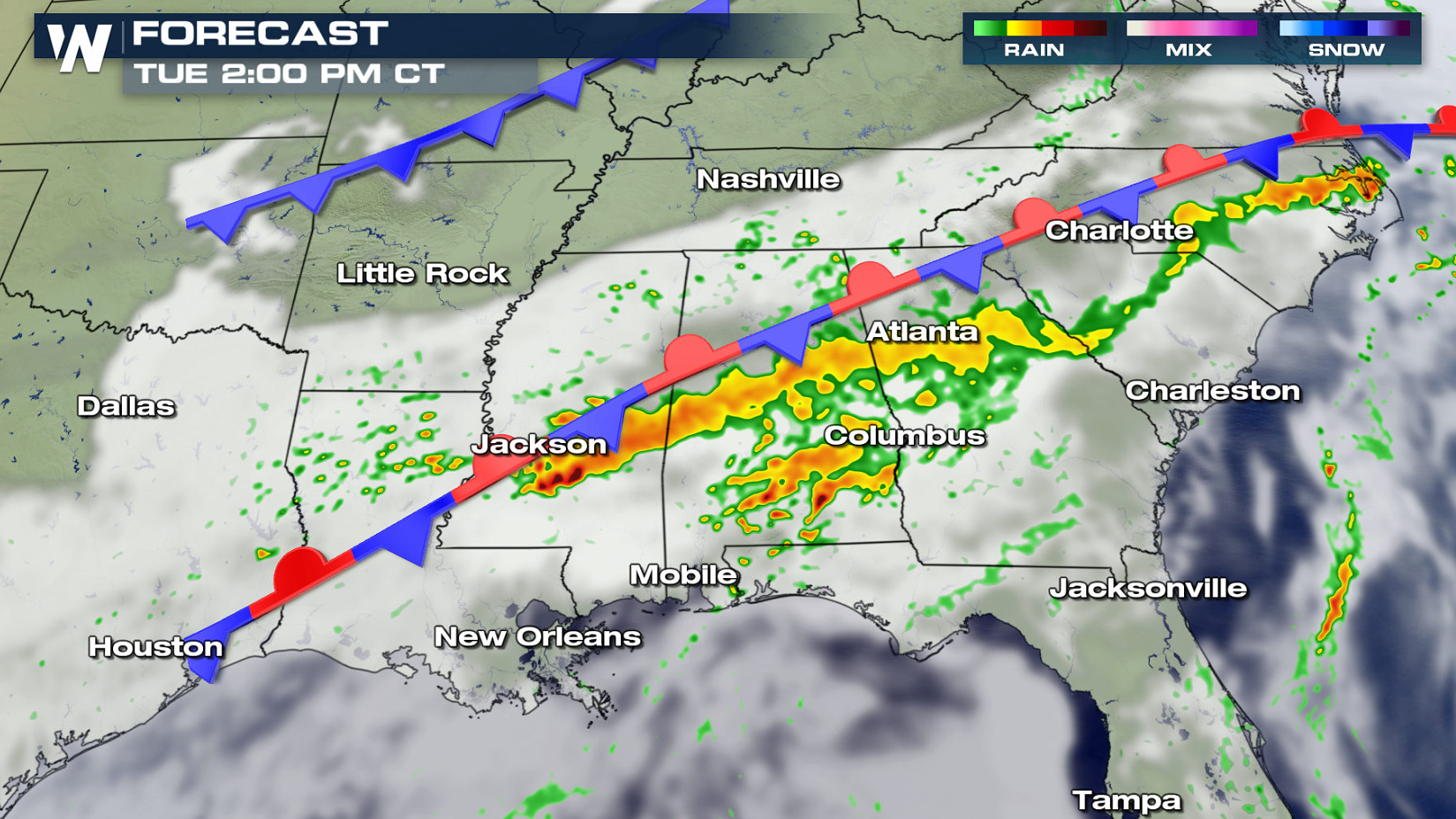
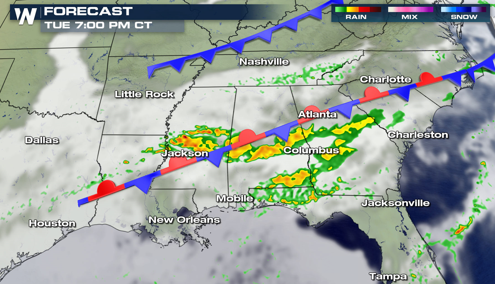
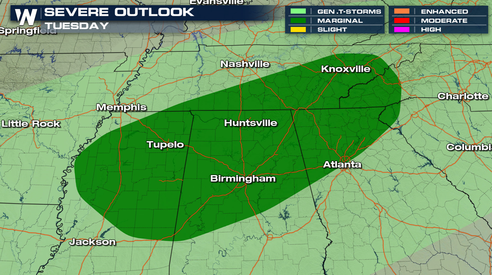 The Storm Prediction Center has issued a Marginal risk for severe storms Tuesday. There will be ample humidity to produce severe storms across the entire Southeast thanks to a steady supply of moisture from the Gulf of Mexico. Instability will remain low to moderate, keeping storm coverage isolated in nature.
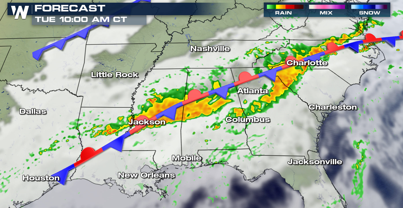
 The front will be the primary focus for thunderstorm development. Heavy rain is possible with the high humidity in the atmosphere. A few storms could produce large hail and damaging wind gusts. The threat for tornadoes is low.
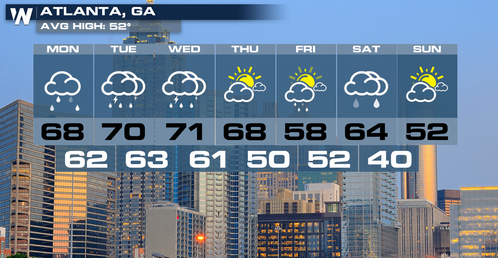
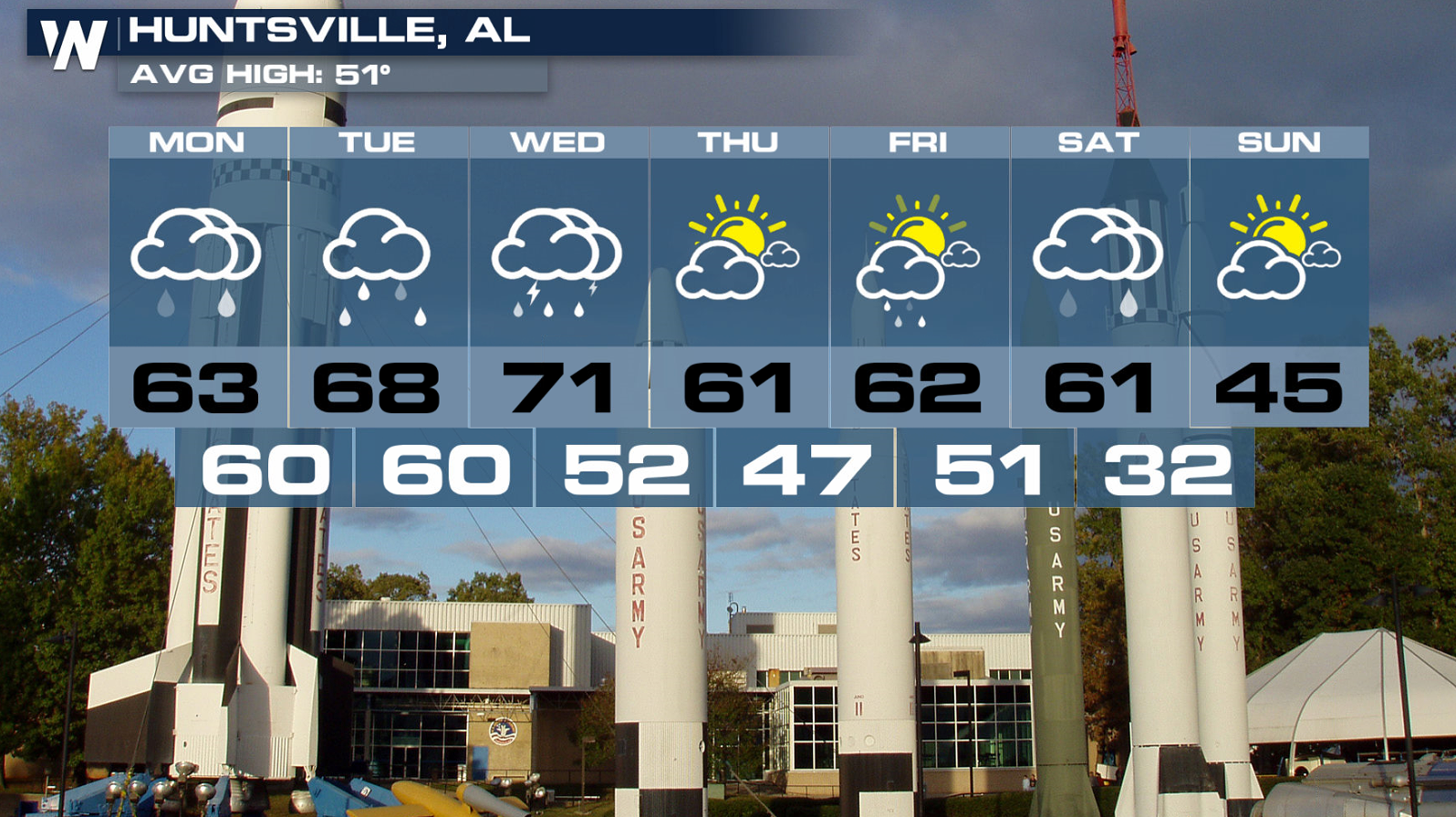
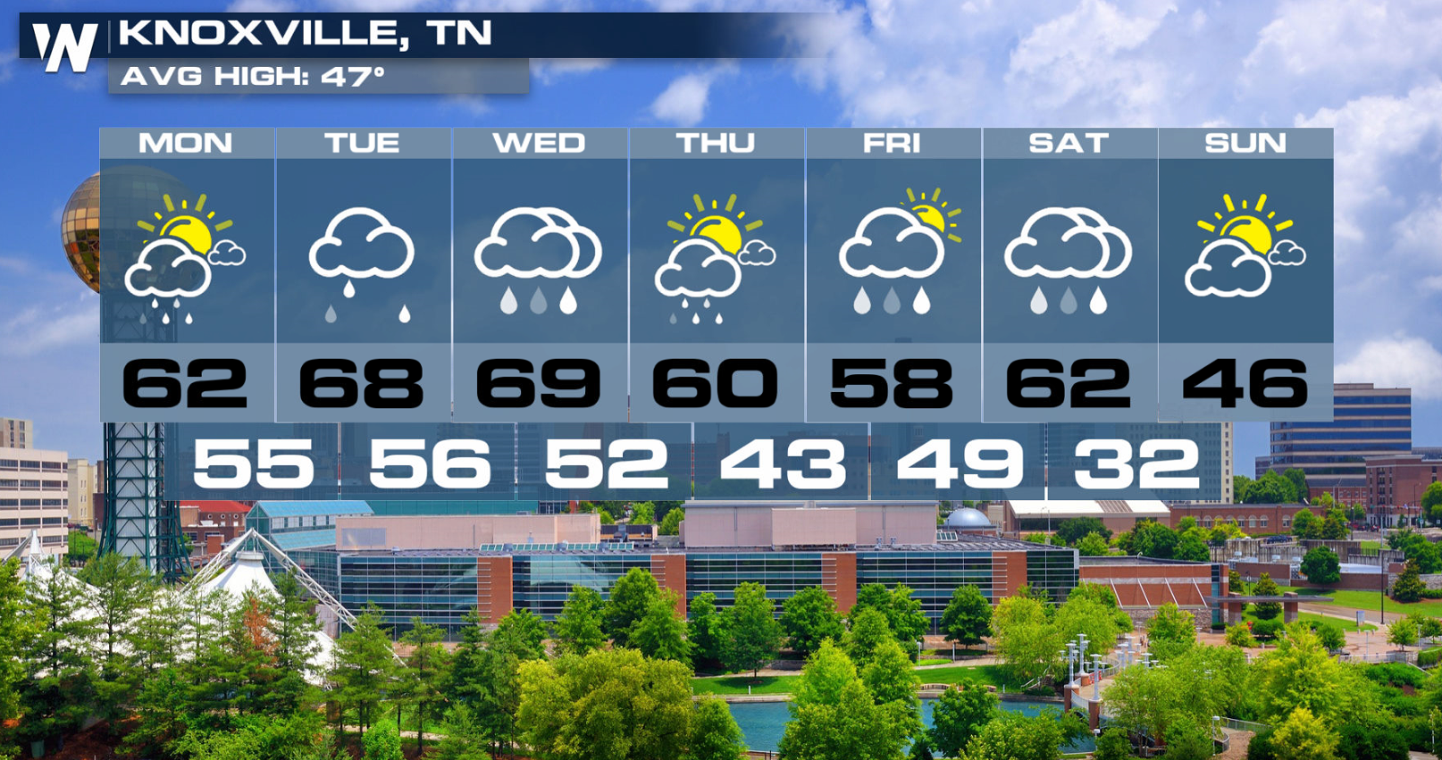
 The wet weather pattern will continue this week for several cities in the Southeast.
 Stay with WeatherNation for updates on the severe weather threat in the Southeast.
The Storm Prediction Center has issued a Marginal risk for severe storms Tuesday. There will be ample humidity to produce severe storms across the entire Southeast thanks to a steady supply of moisture from the Gulf of Mexico. Instability will remain low to moderate, keeping storm coverage isolated in nature.
The front will be the primary focus for thunderstorm development. Heavy rain is possible with the high humidity in the atmosphere. A few storms could produce large hail and damaging wind gusts. The threat for tornadoes is low.
The wet weather pattern will continue this week for several cities in the Southeast.
Stay with WeatherNation for updates on the severe weather threat in the Southeast.
All Weather News
More
Flooding Risk Increases as Heavy Rain Targets the Tri-State Area
TRI-STATE AREA - Along with the threat of sev
28 Jul 2026 8:30 PM

Severe Threat Marches East This Afternoon
UPPER MIDWEST - Through Monday, dangerous tor
28 Jul 2026 8:20 PM

Tropics: Fausto Heads towards Hawaii; Genevieve a Major Hurricane
PacificTropical Storm Fausto continues to tra
28 Jul 2026 8:20 PM


Southeast Flood Risk Lingers Near Stalled Front
A stalled boundary over the Southeast will ke
25 Jul 2026 10:55 AM

Another Round of Storms Targets the Northeast
Tuesday brought severe weather again across p
23 Jul 2026 1:15 AM