Tuesday Severe Weather Update
Special Stories
9 Oct 2018 3:29 AM
A large portion of the Central United States will see the risk of severe weather Tuesday. Large hail, damaging winds and tornadoes will all be possible. Here is the very latest.
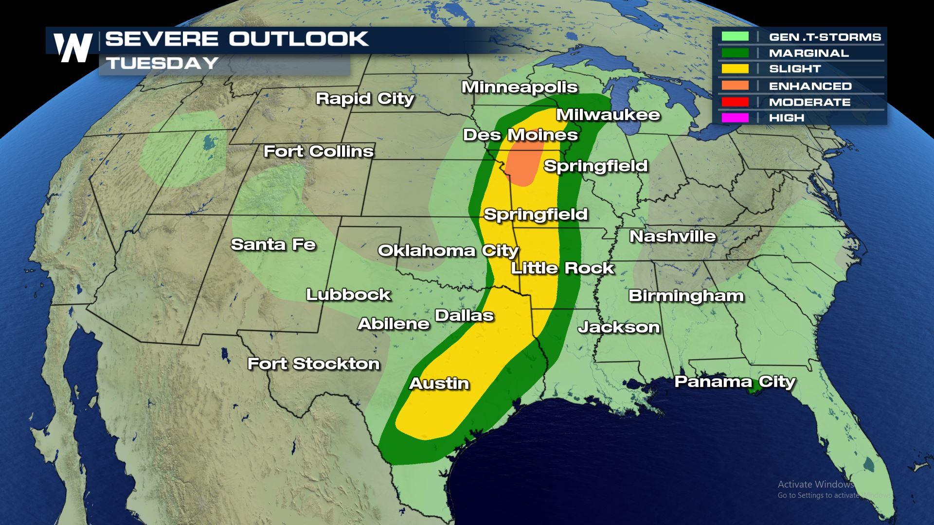
 There is an "Enhanced" risk of severe weather over Missouri and Iowa today, meaning numerous severe storms will be possible. Also..Look at the size of the "Slight" risk of severe weather! It starts in south Texas and goes all the way up to south Wisconsin. So cities like Austin, Dallas, Kansas City, Tulsa and Des Moines could all see severe weather today.
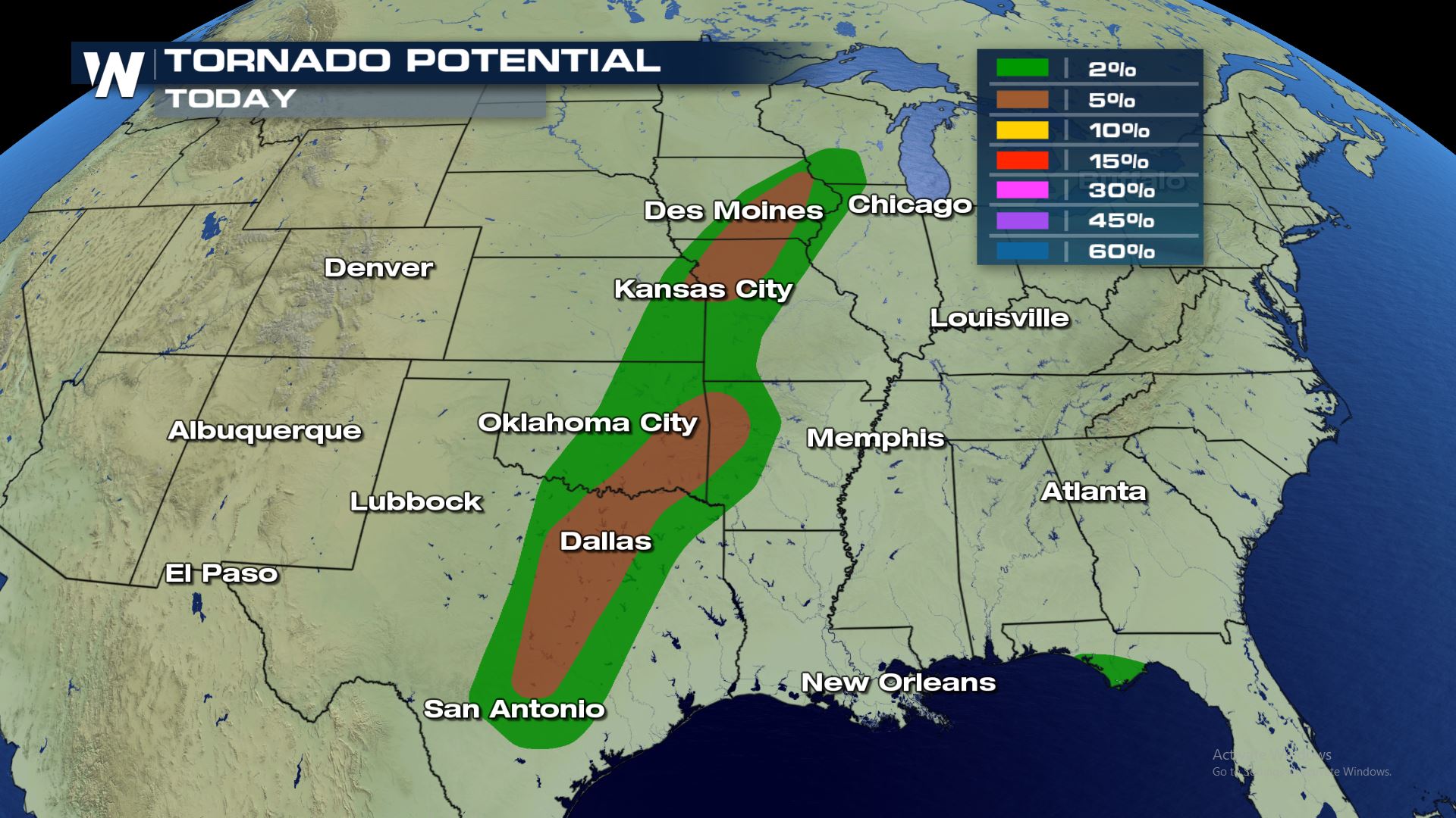
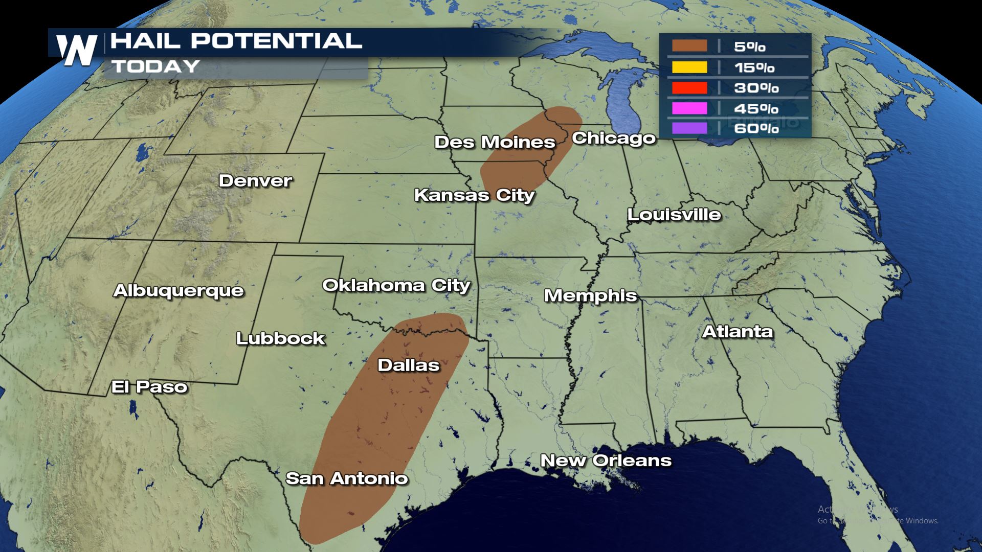
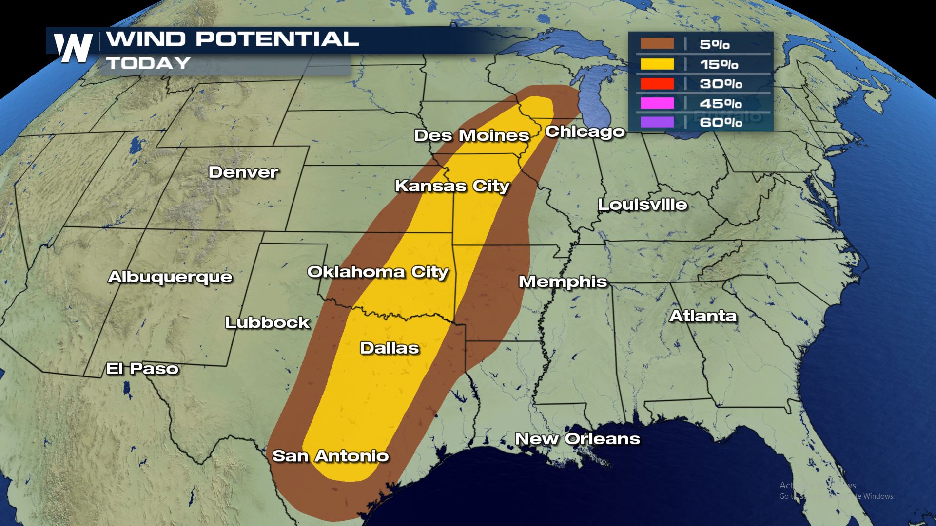 All modes of severe weather will be in the forecast today. The highest risk will be damaging winds and tornadoes with more of an isolated severe hail risk. The high chance for rotating t-storms could lead to some tornado watches later today. Also, these are the same areas that are under flood watches for the risk of flash flooding. Several severe weather risks will come into play today...please be prepared!
 The chance for storms will be in the forecast all of Tuesday with the severe weather risk increasing throughout the afternoon. Keep checking WeatherNation for the very latest updates.
Severe Outlook
There is an "Enhanced" risk of severe weather over Missouri and Iowa today, meaning numerous severe storms will be possible. Also..Look at the size of the "Slight" risk of severe weather! It starts in south Texas and goes all the way up to south Wisconsin. So cities like Austin, Dallas, Kansas City, Tulsa and Des Moines could all see severe weather today.
Severe Risks
All modes of severe weather will be in the forecast today. The highest risk will be damaging winds and tornadoes with more of an isolated severe hail risk. The high chance for rotating t-storms could lead to some tornado watches later today. Also, these are the same areas that are under flood watches for the risk of flash flooding. Several severe weather risks will come into play today...please be prepared!
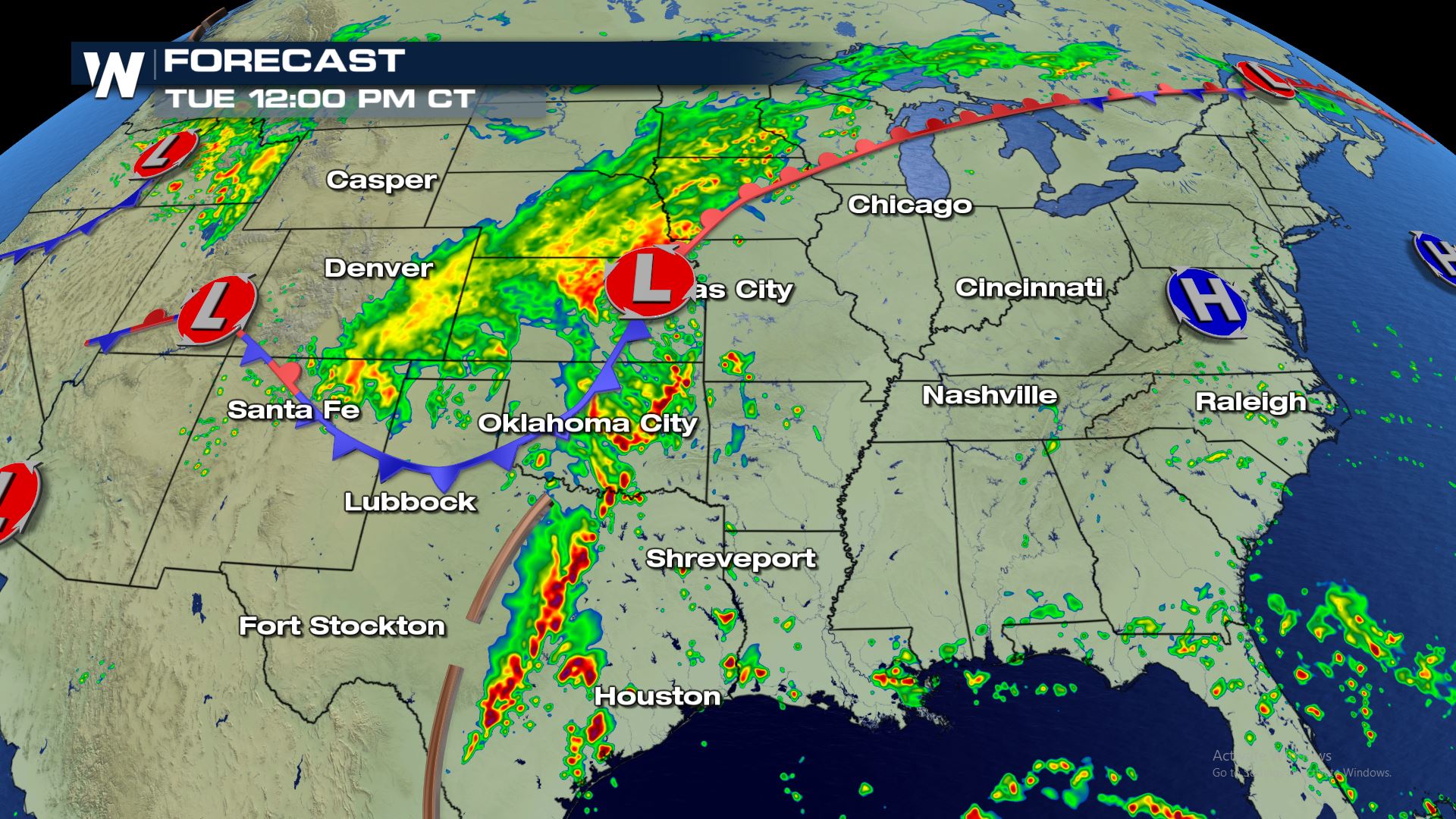
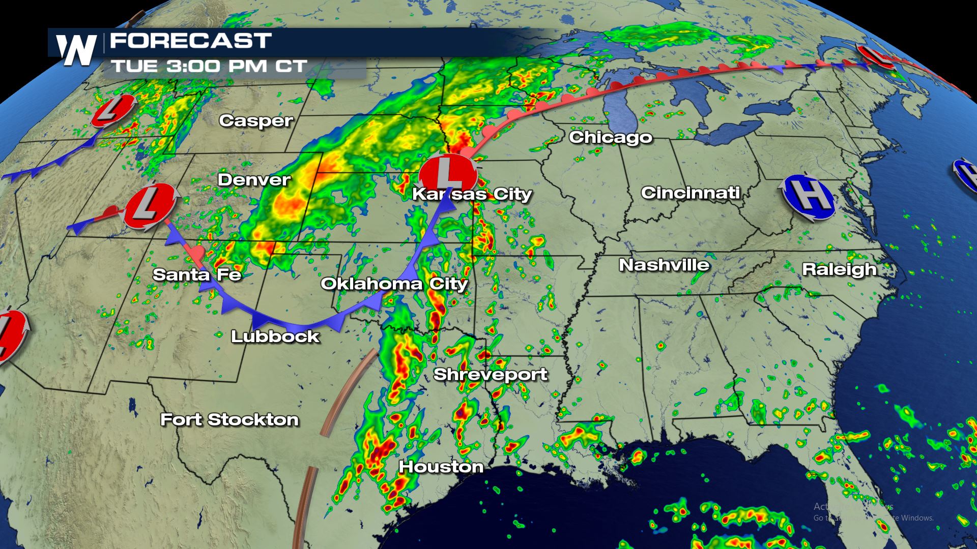
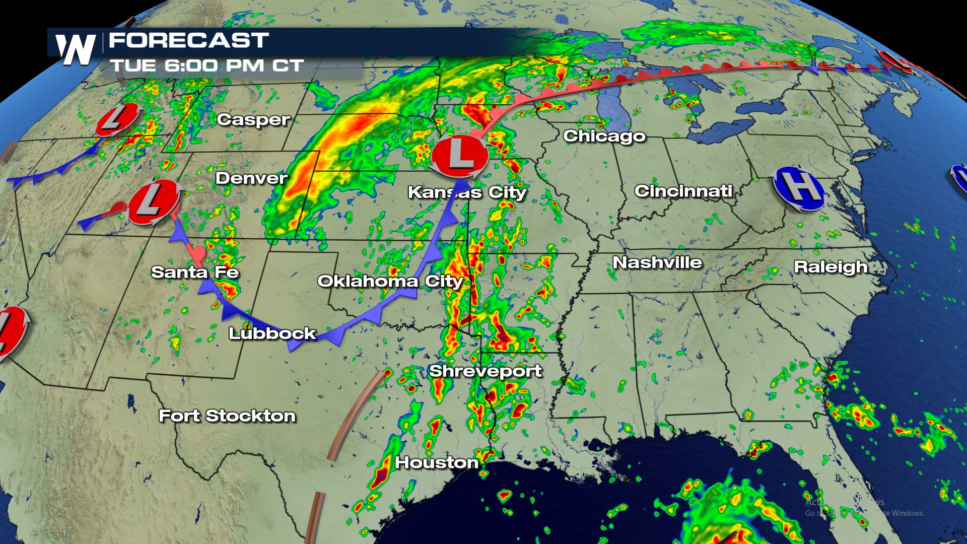
Forecast
The chance for storms will be in the forecast all of Tuesday with the severe weather risk increasing throughout the afternoon. Keep checking WeatherNation for the very latest updates.All Weather News
More
Tropics: Fausto Heads to Hawaii; Genevieve Will Become a Major Hurricane
Atlantic BasinBertha has dissipated after mov
25 Jul 2026 5:33 PM

Severe Storms Target the Midwest This Weekend
Extreme heat will be a big story this week ac
25 Jul 2026 5:25 PM


Heat Wave Grips Central, Western U.S.
Are you over the summer heat yet? SouthwestEx
25 Jul 2026 5:20 PM

Southeast Flood Risk Lingers Near Stalled Front
A stalled boundary over the Southeast will ke
25 Jul 2026 10:55 AM

Another Round of Storms Targets the Northeast
Tuesday brought severe weather again across p
23 Jul 2026 1:15 AM

Another Round of Severe Weather for the Upper Midwest and Great Lakes
The upper-level low train continues to keep t
21 Jul 2026 1:45 AM