Tuesday Severe Weather Update
Top Stories
31 Mar 2020 11:12 AM
https://twitter.com/WeatherNation/status/1245010568416641025
https://twitter.com/WeatherNation/status/1245002918899539968
The system that brought the severe storms to the Lower Mississippi Valley this morning will continue to impact the southeast through the afternoon . All modes of severe weather will be possible, including the risk of tornadoes. We will continue to track this weather event throughout the day. Here is the latest forecast.
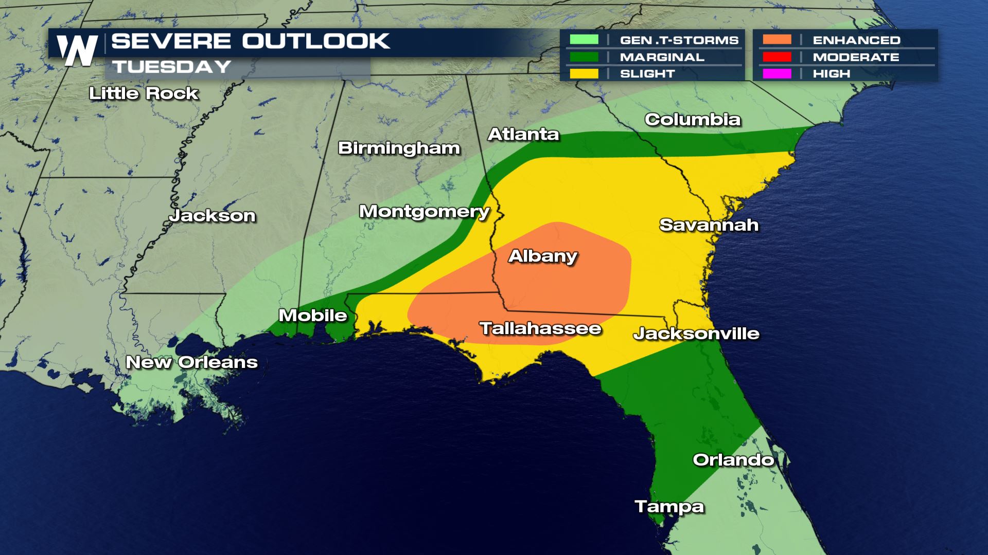 An Enhanced Risk (numerous) of severe storms was added to the severe outlook for the rest of Monday. This is to follow along with the intense storms have have moved through Mississippi and Alabama today.

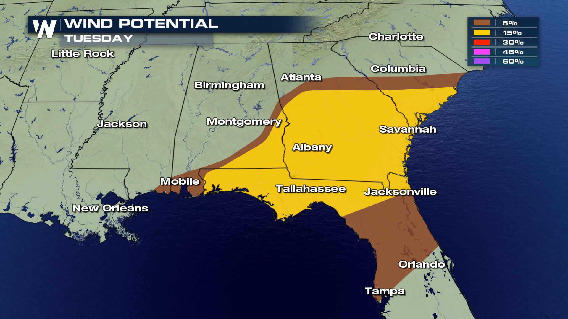
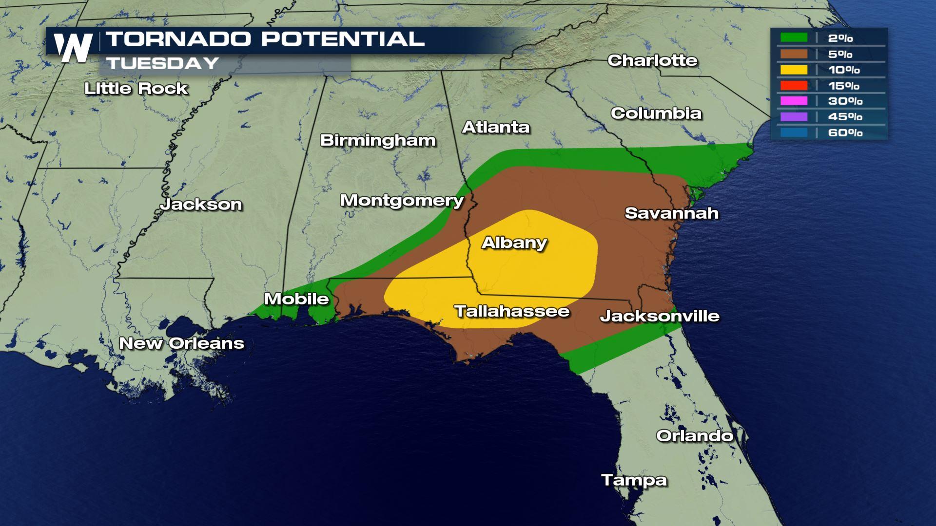
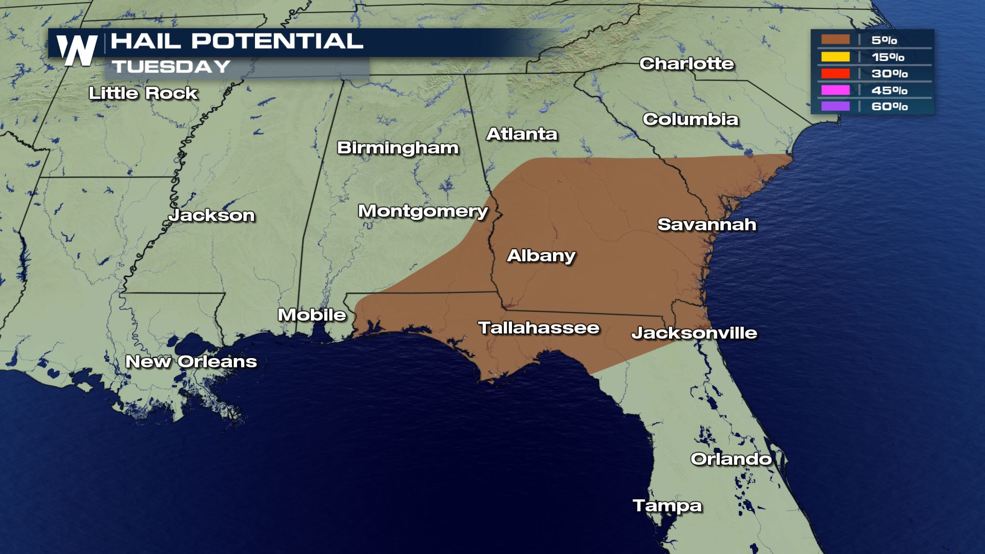 All modes of severe weather are in the forecast today. This means storms will be capable of producing damaging winds, large hail and tornadoes. The tornado risk was upgraded to a 10% risk with the history of these storms dropping tornadoes.
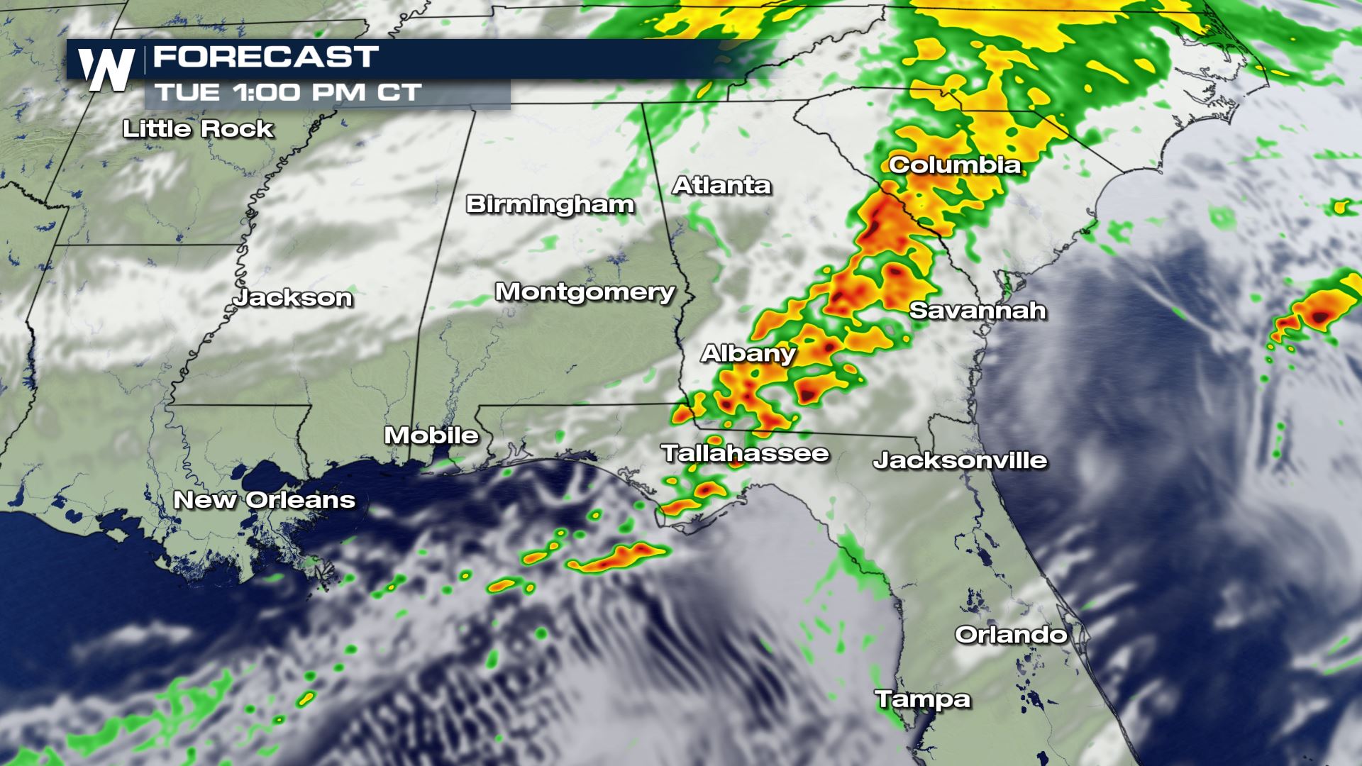
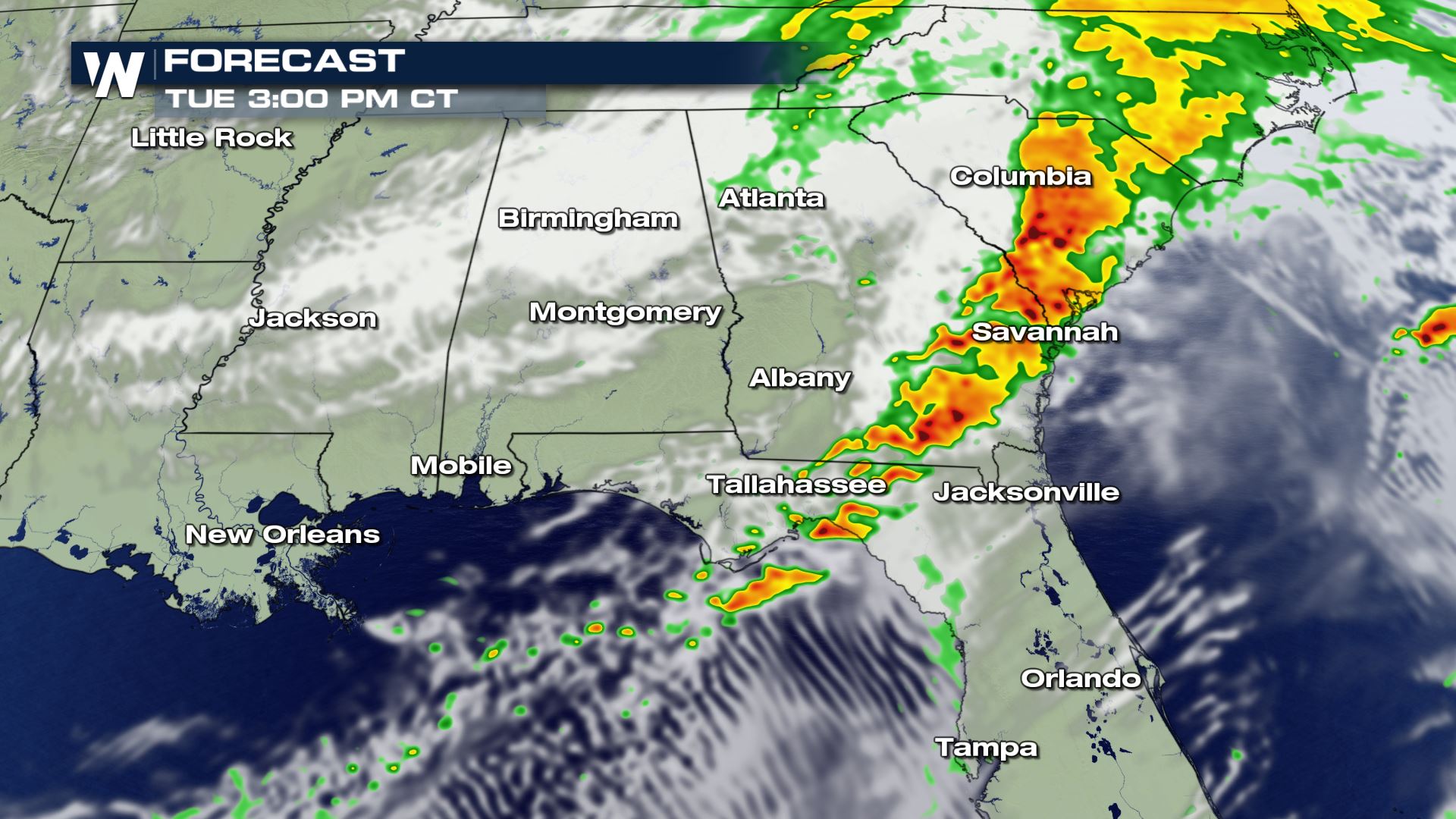
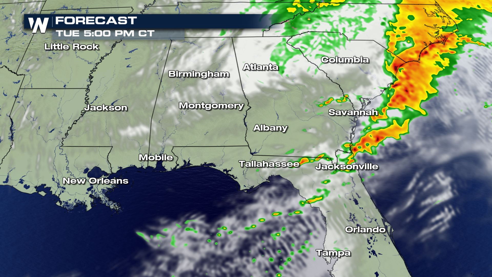 These intense storms will keep moving to the Atlantic coast during the afternoon and early evening. Once these storms move over the Atlantic waters, the severe risk will fall apart. Keep checking with WeatherNation for more on today's severe risk.
Severe Outlook
An Enhanced Risk (numerous) of severe storms was added to the severe outlook for the rest of Monday. This is to follow along with the intense storms have have moved through Mississippi and Alabama today.
Severe Risks
All modes of severe weather are in the forecast today. This means storms will be capable of producing damaging winds, large hail and tornadoes. The tornado risk was upgraded to a 10% risk with the history of these storms dropping tornadoes.
Forecast
These intense storms will keep moving to the Atlantic coast during the afternoon and early evening. Once these storms move over the Atlantic waters, the severe risk will fall apart. Keep checking with WeatherNation for more on today's severe risk.
All Weather News
More
Fronts Continue To Spark Severe Weather Across the Plains
A cold front that brought record lows to the
18 Jul 2025 10:40 PM

Extreme Heat Impacts for the East Coast & South
Extreme heat continues to impact several area
18 Jul 2025 10:05 PM

Flooding Threat Remains Elevated in the East
A cold front pushing through the Eastern Seab
18 Jul 2025 9:10 PM

EF-2 Firenado from the Deer Creek Fire in Utah
A fire tornado was spotted near La Sal, Utah
18 Jul 2025 7:30 AM

Tropical System Brings Flood Risk to the Central Gulf
Time has run out for notable tropical develop
18 Jul 2025 3:05 AM

Heavy Rain, Flooding Threat Returns to Florida
Keep the rain boots handy in Florida - heavy
13 Jul 2025 12:50 PM

Severe Storm Risk Pushes into the Great Lakes, Ohio Valley
Friday was another busy day with severe weath
12 Jul 2025 8:00 PM