Tuesday Severe Storms in the Northern Plains
Special Stories
16 Jun 2020 7:00 AM
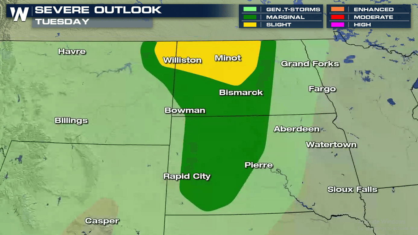
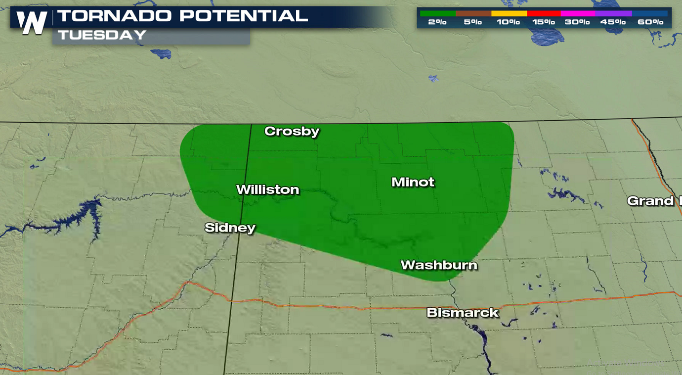
An active weather pattern across the northern tier of the nation will continue through the middle of the week. This will lead to additional severe thunderstorm development this afternoon and evening (Tuesday). The risk area extends from the Canadian Border in North Dakota through the Badlands and into the Black Hills of South Dakota.
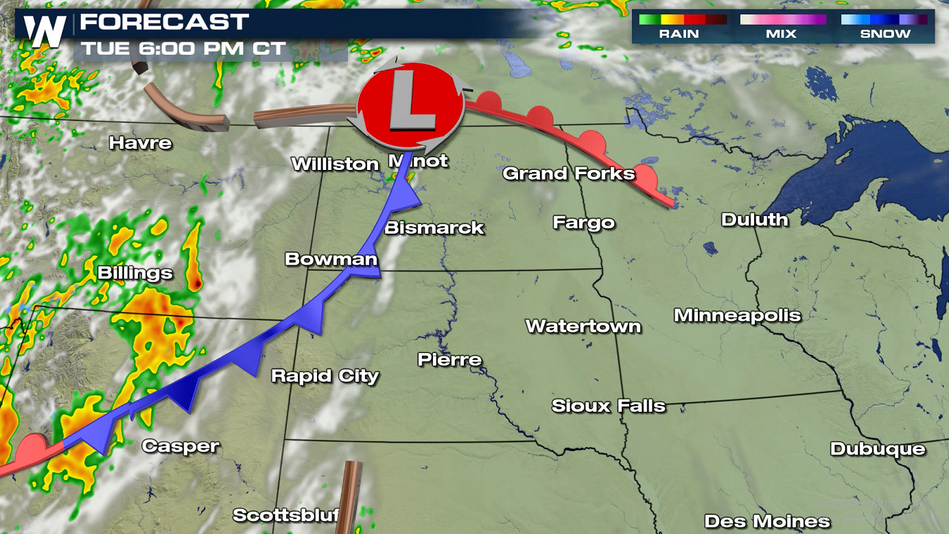
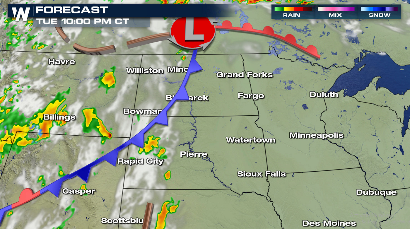
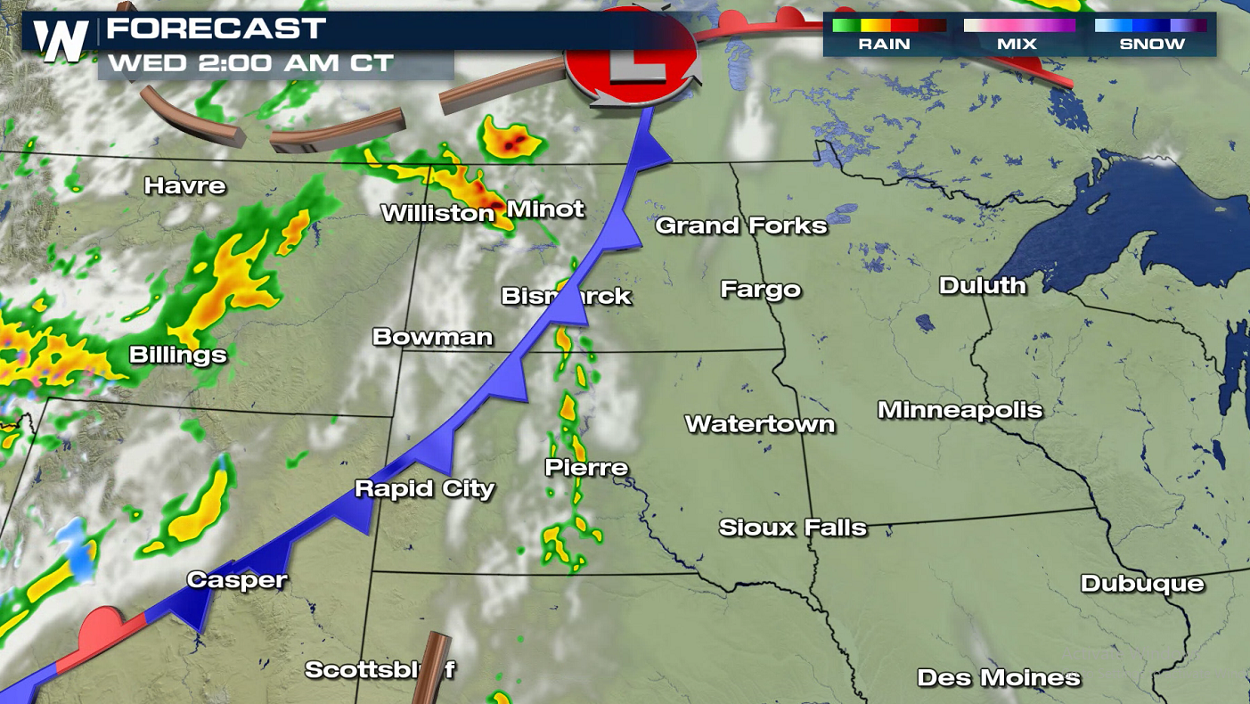
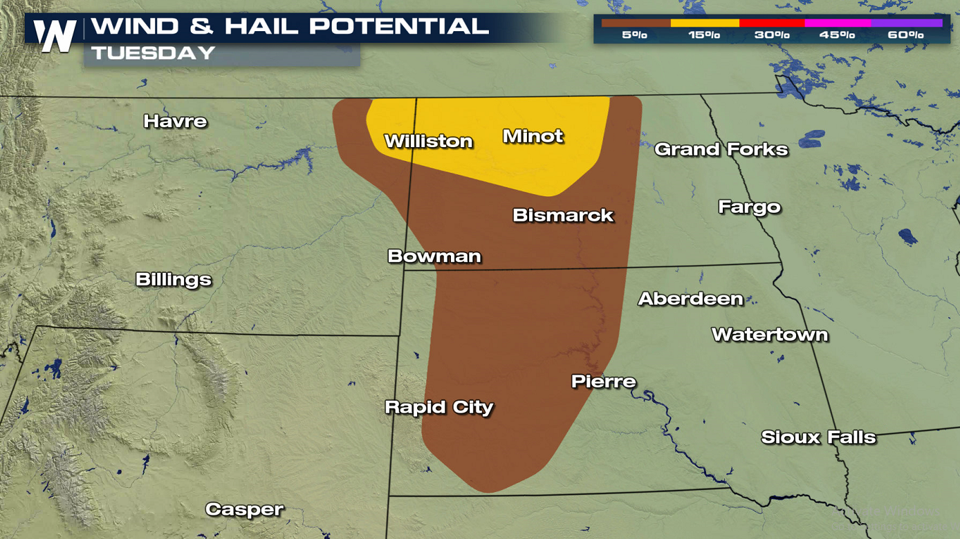 Strong wind gusts, greater than 58 mph, and large hail, greater than the size of quarters, are possible this evening (Tuesday) into early Wednesday morning. As a warm front moves northward, heat and humidity will build over the region. Strong jet stream energy from the Northwest will slide into the area, igniting thunderstorm development.
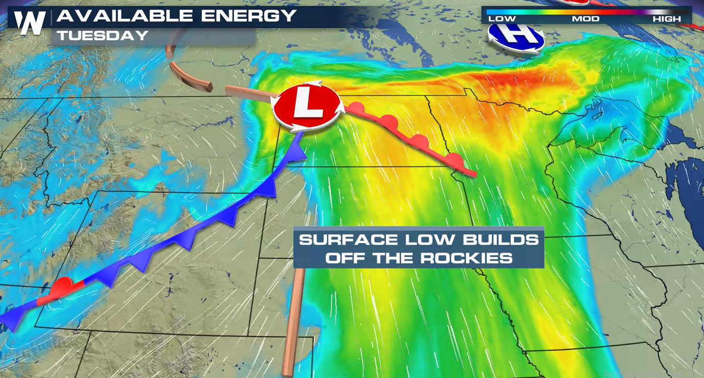
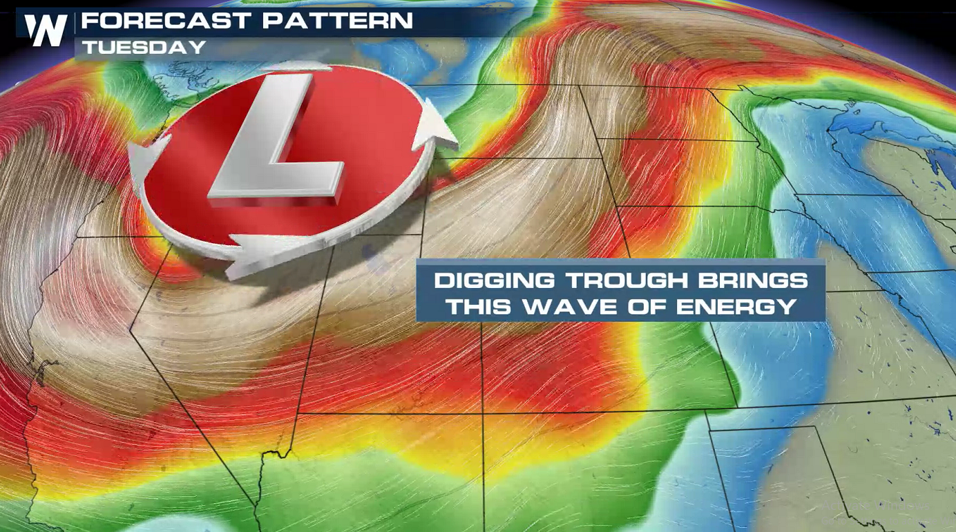 Storms will be focused along a cold front and near a low pressure center. A cap in the atmosphere, associated with warm temperatures aloft, will put a lid on storms developing until the evening. Storms will continue into the overnight, aided by the jet stream energy mentioned above.
 WeatherNation will keep you up-to-date on the potential for severe storms. Check back with us on-air and online for the latest updates.
Strong wind gusts, greater than 58 mph, and large hail, greater than the size of quarters, are possible this evening (Tuesday) into early Wednesday morning. As a warm front moves northward, heat and humidity will build over the region. Strong jet stream energy from the Northwest will slide into the area, igniting thunderstorm development.
Storms will be focused along a cold front and near a low pressure center. A cap in the atmosphere, associated with warm temperatures aloft, will put a lid on storms developing until the evening. Storms will continue into the overnight, aided by the jet stream energy mentioned above.
WeatherNation will keep you up-to-date on the potential for severe storms. Check back with us on-air and online for the latest updates.All Weather News
More
East Gears Up for Stormy, Wet Weekend
A low pressure system crashing through the Mi
1 Aug 2026 11:35 AM


Flooding, Severe Storms Target the Midwest Again
After an active week of storms across the nor
1 Aug 2026 1:40 AM


After Reaching Category 5, Genevieve Weakens in the Pacific
PacificFausto is now a post-tropical cyclone.
31 Jul 2026 1:30 AM

Flooding Risk Increases as Heavy Rain Targets the Tri-State Area
Tuesday, heavy rainfall moved across the Nort
30 Jul 2026 12:25 AM

Severe Weather: Energy From the Midwest Now in the Southeast
UPPER MIDWEST - Through Monday, dangerous tor
29 Jul 2026 10:30 PM