Two Tropical Depressions Form in the Pacific
Special Stories
26 Jul 2018 4:55 PM
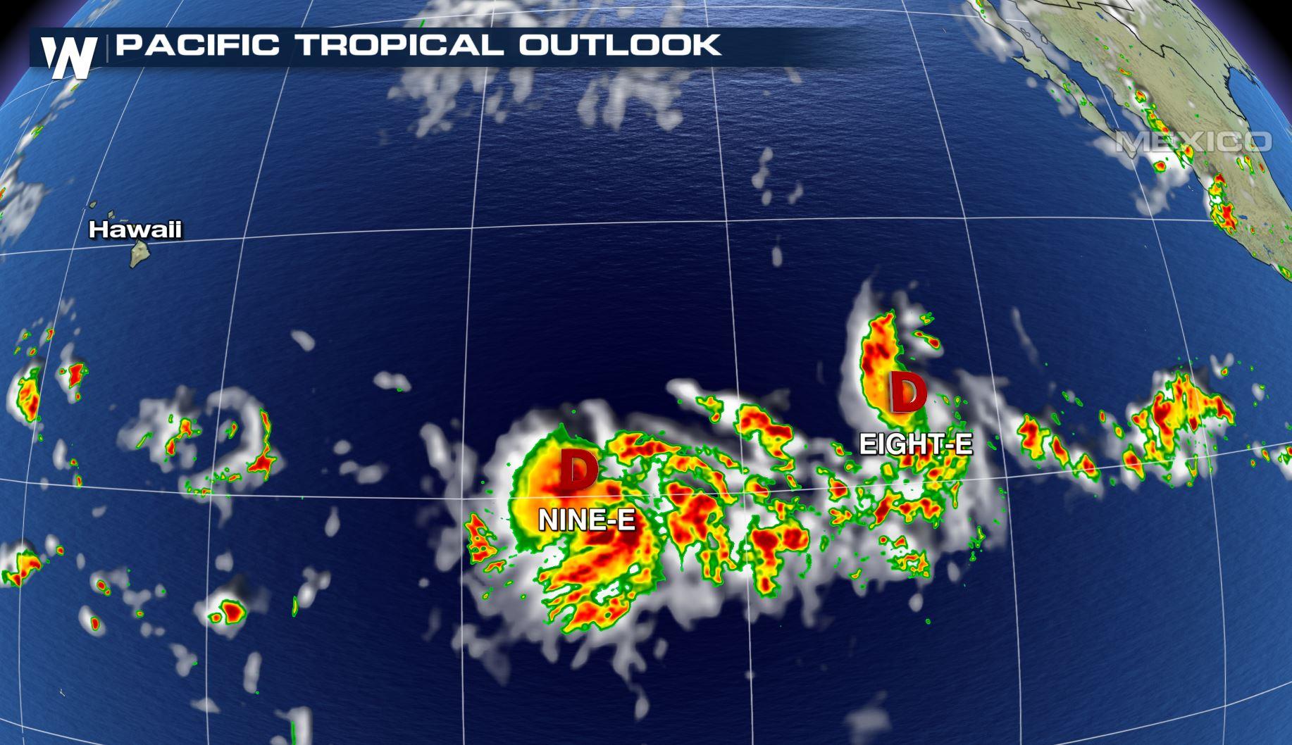
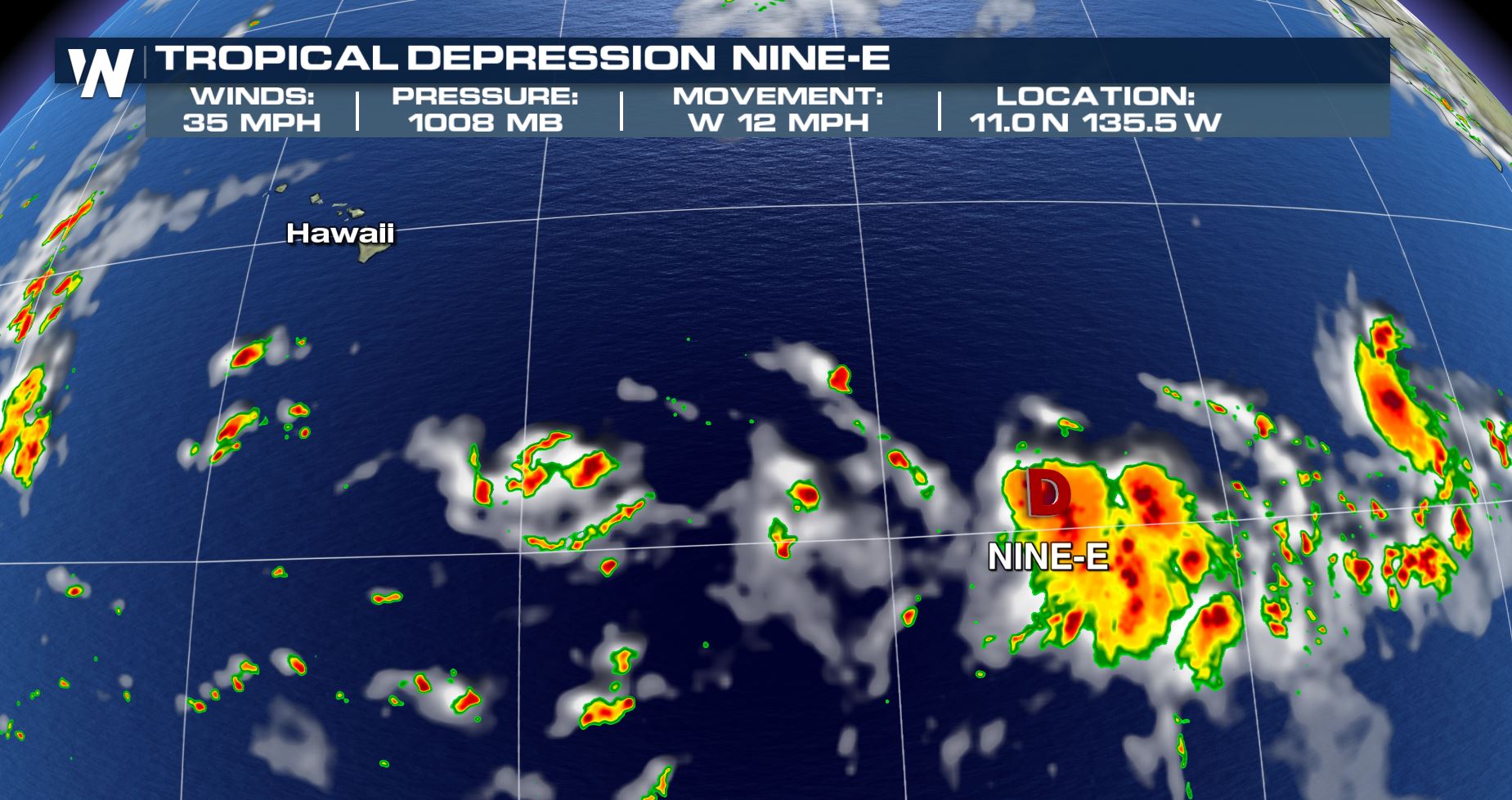
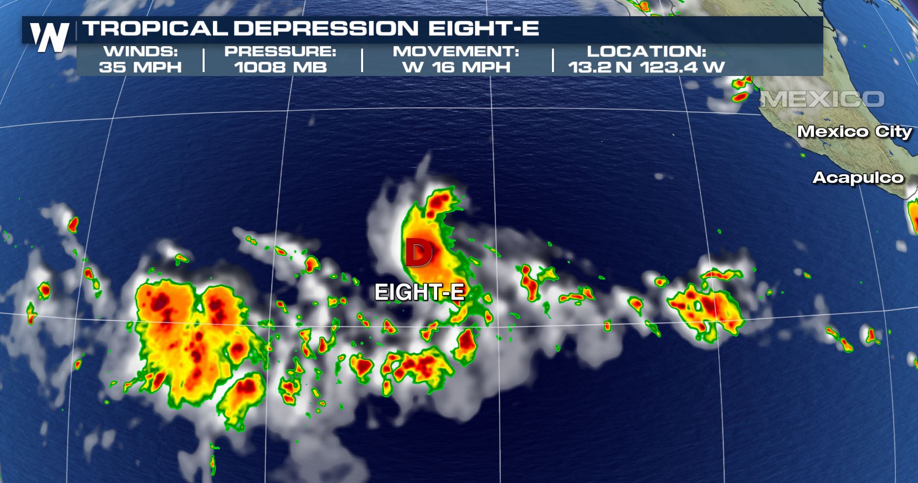
Tropical Depression Eight-E and Nine-E have formed in the eastern Pacific Ocean. Both are along an active line of tropical thunderstorms southeast of Hawaii.
 The National Hurricane Center released advisories on both systems Thursday afternoon. Both storms are forecast to move to the west, with some slight movements to the north and south at times. Tropical Depression Nine-E is forecast to move to the south of Hawaii for now.
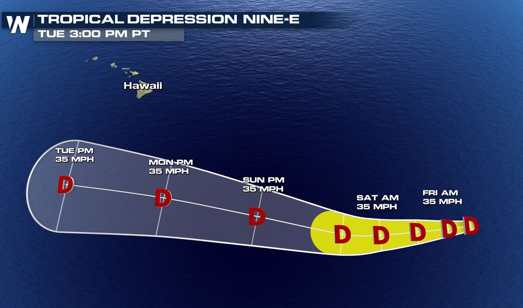 Forecast for Tropical Depression Nine-E between Thursday, July 26 and Tuesday, July 31
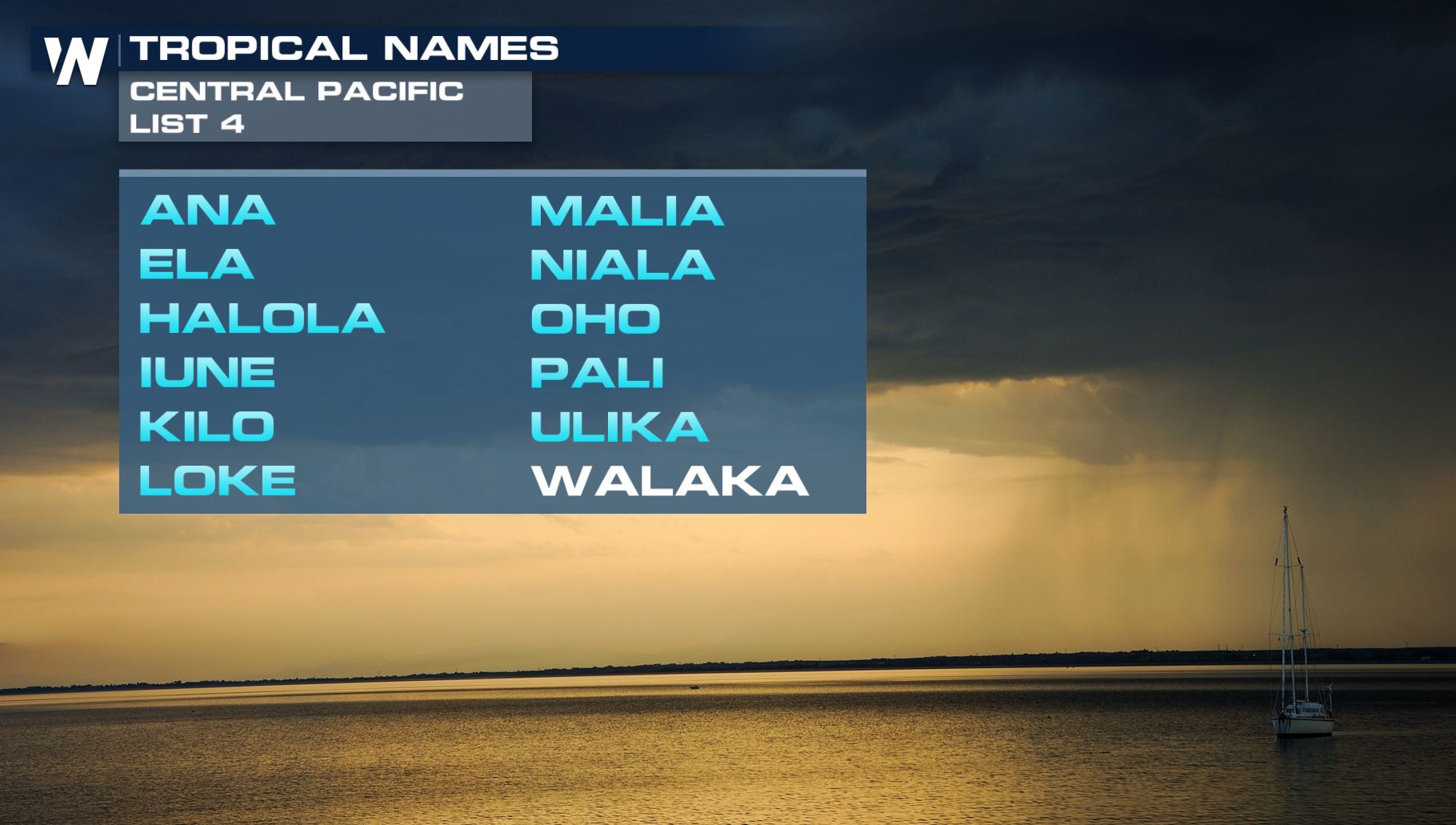
Interestingly if this depression strengthens into a tropical storm, it will either be called "Gilma" or "Walaka." That's because this tropical disturbance is straddling the line between the Eastern Pacific Ocean territory and the Central Pacific Ocean territory.
Forecast for Tropical Depression Nine-E between Thursday, July 26 and Tuesday, July 31
Interestingly if this depression strengthens into a tropical storm, it will either be called "Gilma" or "Walaka." That's because this tropical disturbance is straddling the line between the Eastern Pacific Ocean territory and the Central Pacific Ocean territory.
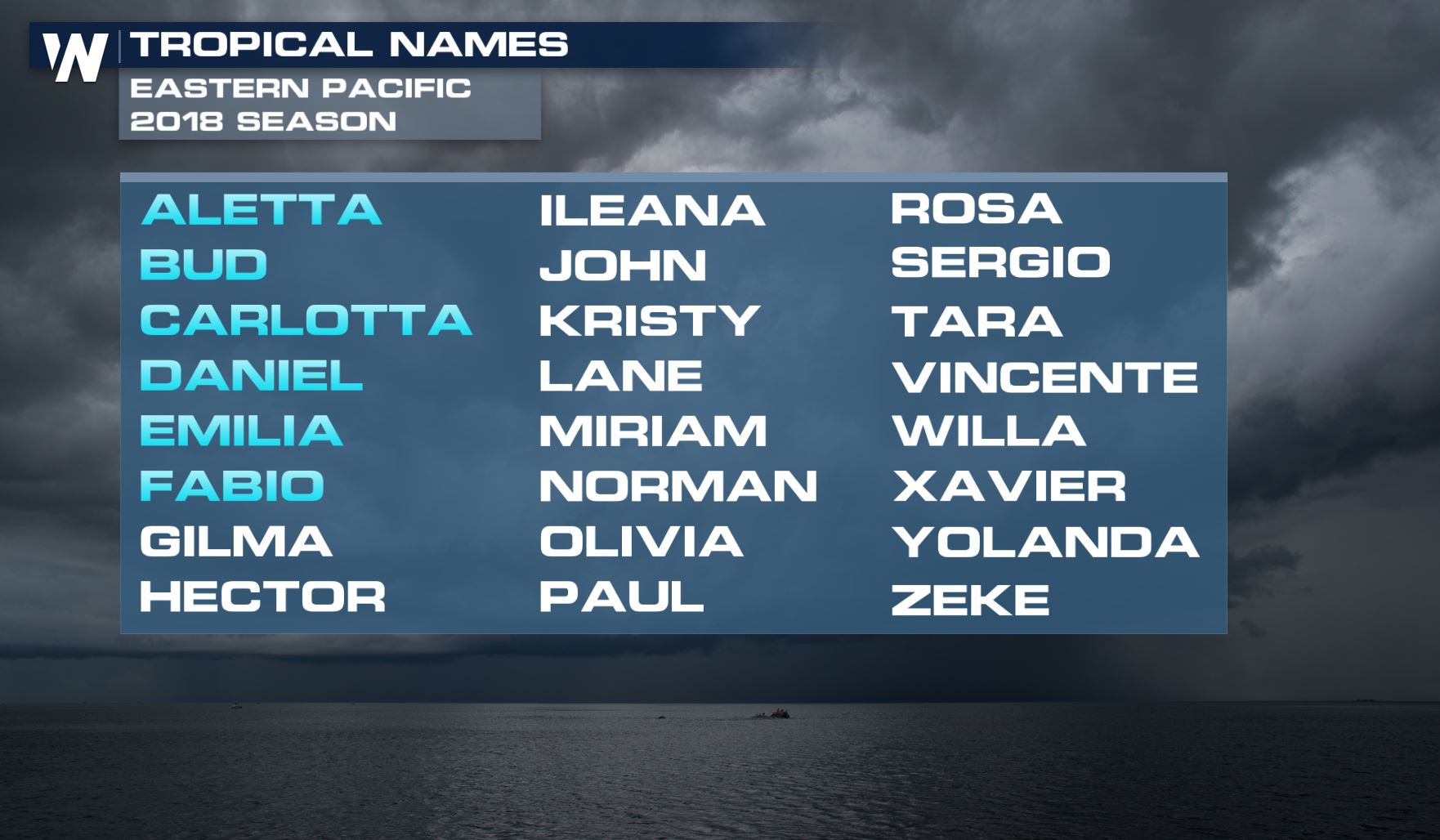 Tropical Depression Nine-E formed near 135.5 West. The cutoff between the eastern and central zones is 140 West. The storm is moving toward that 140W longitude. If this strengthens into Tropical Storm Gilma before 140 West then it will keep that name. However if it forms west of 140W then it will keep the name Walaka.
 Meanwhile Tropical Depression Eight-E is forecast to strengthen into a tropical storm, either Gilma or Hector depending on what 8-E does.
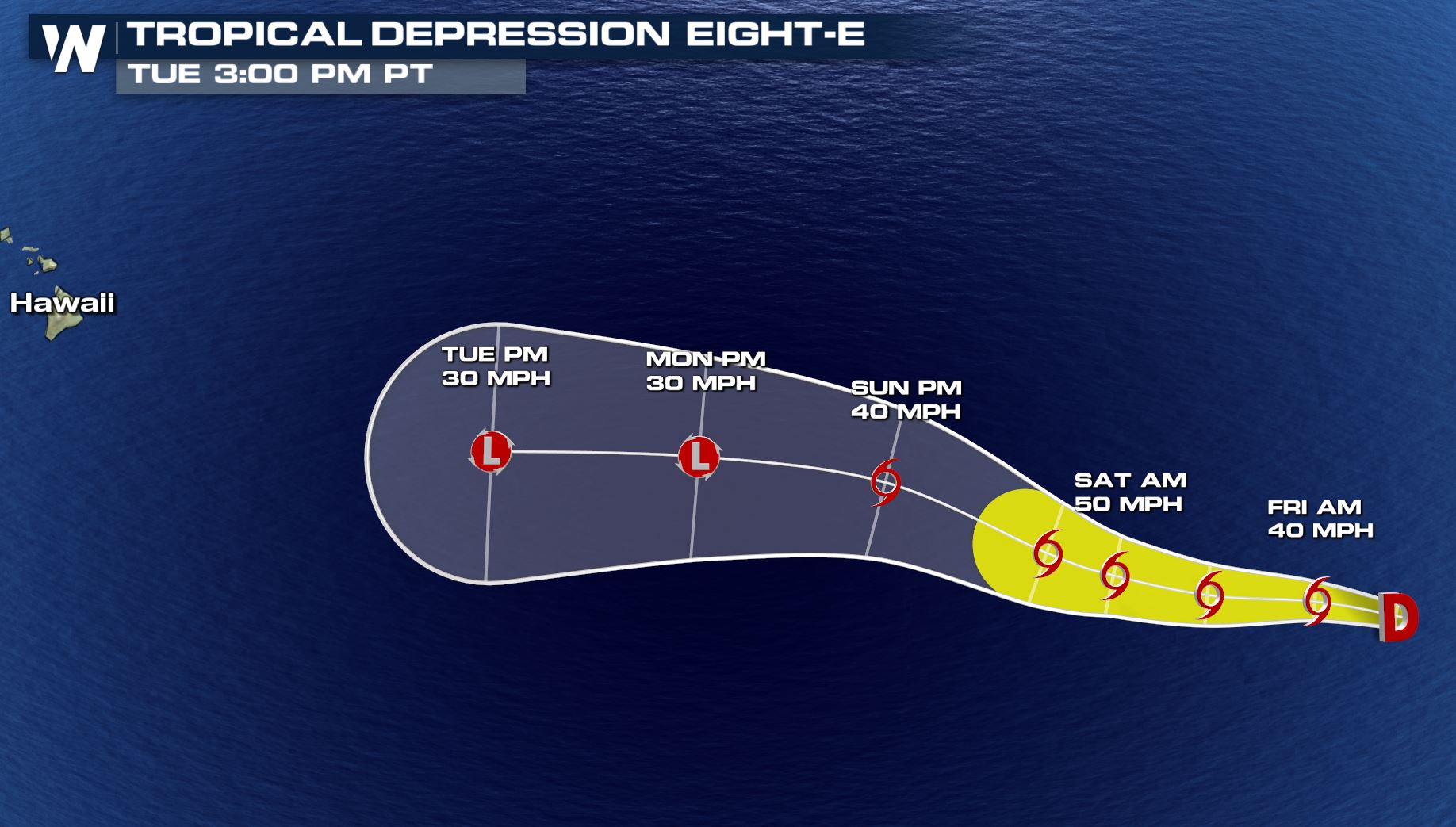 Tropical Depression Eight-E forecast track between Thursday, July 26 and Tuesday, July 31.
While the Pacific is hopping with activity, the Atlantic is quiet for now. No development is expected through the end of July.
Tropical Depression Eight-E forecast track between Thursday, July 26 and Tuesday, July 31.
While the Pacific is hopping with activity, the Atlantic is quiet for now. No development is expected through the end of July.
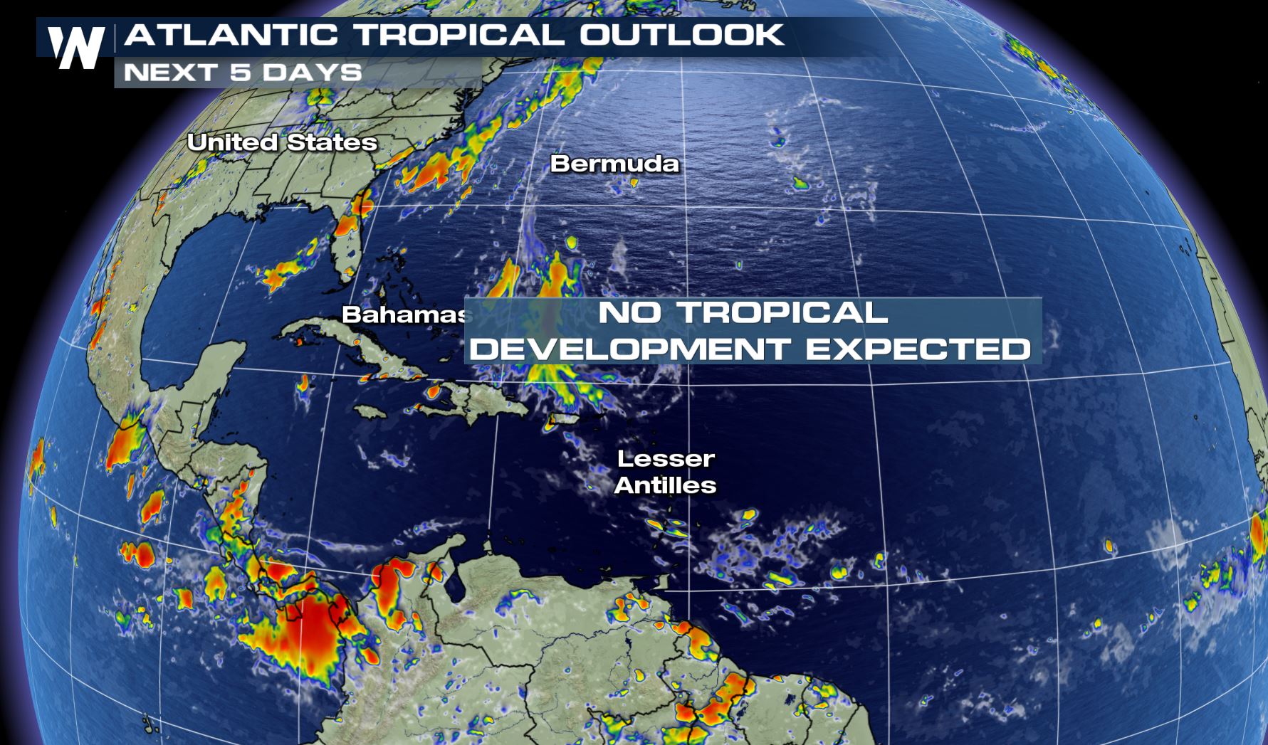 The Atlantic Tropical Outlook through July 31.
For WeatherNation, Meteorologist Steve Glazier
The Atlantic Tropical Outlook through July 31.
For WeatherNation, Meteorologist Steve Glazier
The National Hurricane Center released advisories on both systems Thursday afternoon. Both storms are forecast to move to the west, with some slight movements to the north and south at times. Tropical Depression Nine-E is forecast to move to the south of Hawaii for now.
Forecast for Tropical Depression Nine-E between Thursday, July 26 and Tuesday, July 31
Interestingly if this depression strengthens into a tropical storm, it will either be called "Gilma" or "Walaka." That's because this tropical disturbance is straddling the line between the Eastern Pacific Ocean territory and the Central Pacific Ocean territory.
Tropical Depression Nine-E formed near 135.5 West. The cutoff between the eastern and central zones is 140 West. The storm is moving toward that 140W longitude. If this strengthens into Tropical Storm Gilma before 140 West then it will keep that name. However if it forms west of 140W then it will keep the name Walaka.
Meanwhile Tropical Depression Eight-E is forecast to strengthen into a tropical storm, either Gilma or Hector depending on what 8-E does.
Tropical Depression Eight-E forecast track between Thursday, July 26 and Tuesday, July 31.
While the Pacific is hopping with activity, the Atlantic is quiet for now. No development is expected through the end of July.
The Atlantic Tropical Outlook through July 31.
For WeatherNation, Meteorologist Steve GlazierAll Weather News
More

Flooding, Severe Storms Target the Midwest Again
After an active week of storms across the nor
1 Aug 2026 1:40 AM


After Reaching Category 5, Genevieve Weakens in the Pacific
PacificFausto is now a post-tropical cyclone.
31 Jul 2026 1:30 AM

Flooding Risk Increases as Heavy Rain Targets the Tri-State Area
Tuesday, heavy rainfall moved across the Nort
30 Jul 2026 12:25 AM

Severe Weather: Energy From the Midwest Now in the Southeast
UPPER MIDWEST - Through Monday, dangerous tor
29 Jul 2026 10:30 PM