Updated February Outlook - Cold & Wet North, Warm & Dry South and West
Special Stories
1 Feb 2018 3:26 PM
The updated February forecast was issued Wednesday from NOAA's Climate Prediction Center (CPC). There are only a few minor changed from the forecast issued earlier on January 18th. Cooler and wetter than average weather is still expected over most of the northern tier of the nation. Drier and warmer than normal weather remains in the forecast for the south, but has been expanded westward to include the Southwest.
https://twitter.com/NWSCPC/status/958798687131656192
https://twitter.com/NWSCPC/status/958799116951343104
La Nina conditions are still being observed in the Pacific Ocean and the CPC expects the atmosphere to continue in a La Nina pattern. The forecast update was based heavily on weather trends normally seen during a La Nina, along with model projections.
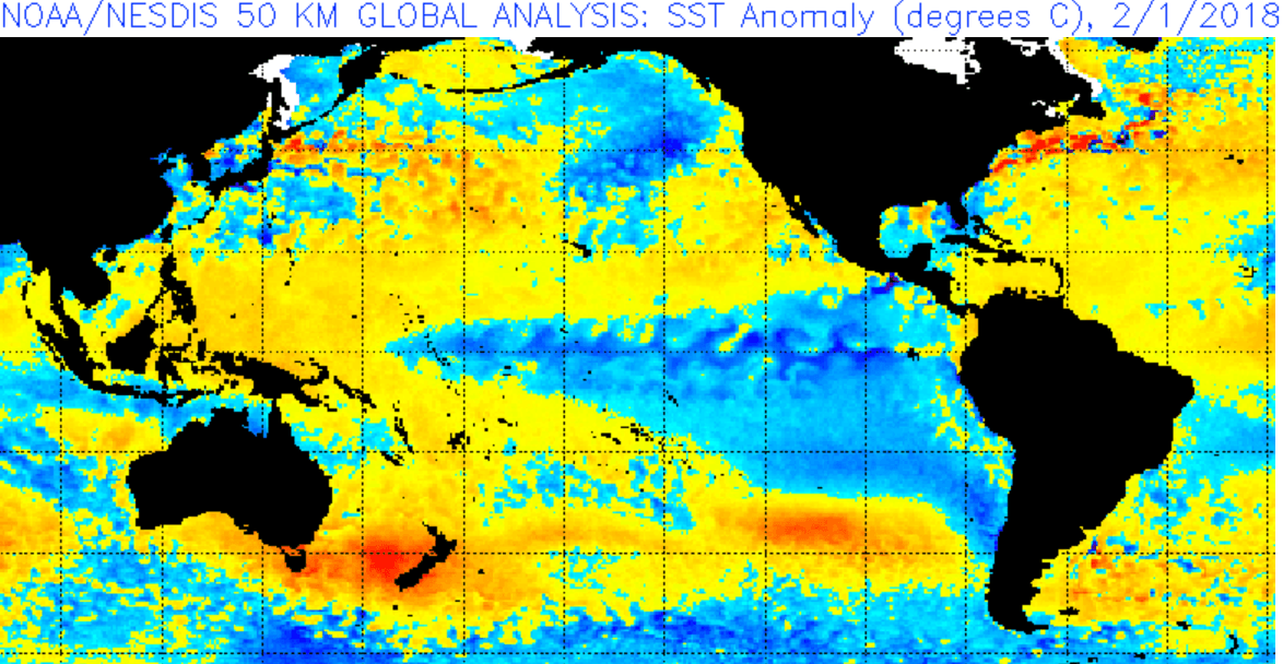
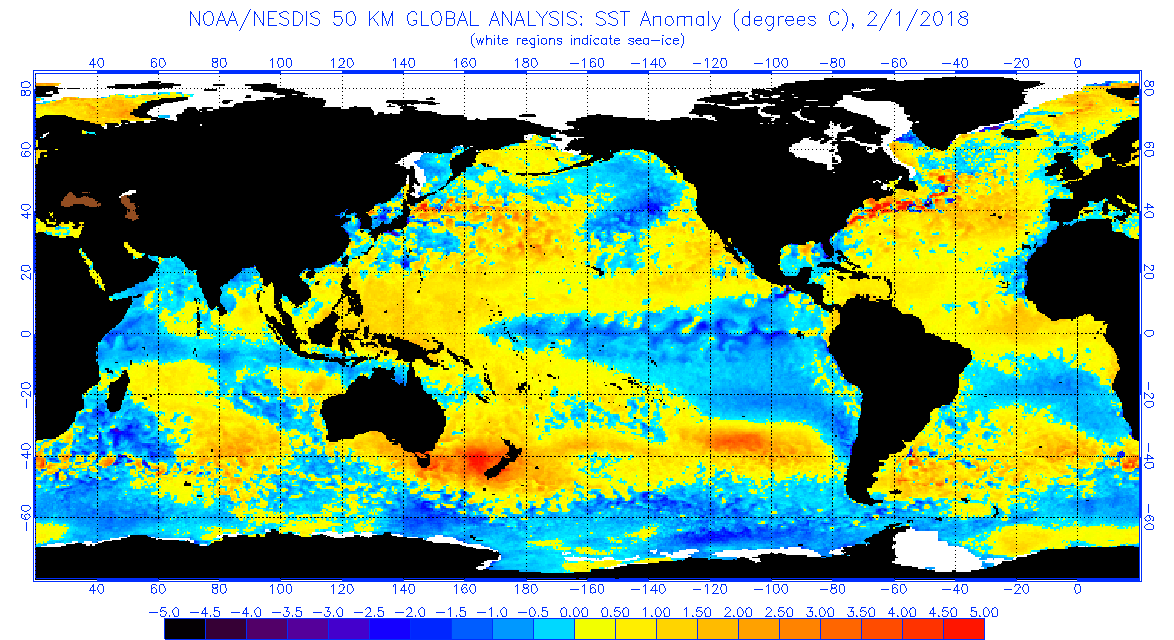 [Latest sea surface temperatures. Colder than average temperatures continue to be observed in the Pacific Ocean near the Equator, indicating a La Nina is still in progress.]
La Nina (translated from Spanish as “little girl”) is a natural ocean-atmospheric phenomenon marked by cooler-than-average sea surface temperatures in the central Pacific Ocean near the equator. It's the opposite of El Nino (“little boy”), which is when warmer than normal water temperatures are observed.
https://www.youtube.com/watch?v=fAvk4RXrW_E
For WeatherNation: Meteorologist Mace Michaels
[Latest sea surface temperatures. Colder than average temperatures continue to be observed in the Pacific Ocean near the Equator, indicating a La Nina is still in progress.]
La Nina (translated from Spanish as “little girl”) is a natural ocean-atmospheric phenomenon marked by cooler-than-average sea surface temperatures in the central Pacific Ocean near the equator. It's the opposite of El Nino (“little boy”), which is when warmer than normal water temperatures are observed.
https://www.youtube.com/watch?v=fAvk4RXrW_E
For WeatherNation: Meteorologist Mace MichaelsAll Weather News
More
Fronts Continue To Spark Severe Weather Across the Plains
A cold front that brought record lows to the
18 Jul 2025 10:40 PM

Extreme Heat Impacts for the East Coast & South
Extreme heat continues to impact several area
18 Jul 2025 10:05 PM

Flooding Threat Remains Elevated in the East
A cold front pushing through the Eastern Seab
18 Jul 2025 9:10 PM

EF-2 Firenado from the Deer Creek Fire in Utah
A fire tornado was spotted near La Sal, Utah
18 Jul 2025 7:30 AM

Tropical System Brings Flood Risk to the Central Gulf
Time has run out for notable tropical develop
18 Jul 2025 3:05 AM

Heavy Rain, Flooding Threat Returns to Florida
Keep the rain boots handy in Florida - heavy
13 Jul 2025 12:50 PM

Severe Storm Risk Pushes into the Great Lakes, Ohio Valley
Friday was another busy day with severe weath
12 Jul 2025 8:00 PM