Updated January Forecast from the NOAA's Climate Prediction Center
Special Stories
2 Jan 2018 5:26 PM
On Sunday, NOAA's Climate Prediction Center updated their 30 day forecast for January. Colder than average temperatures are still expected across the Great Lakes, but have been expanded to include most of the eastern half of the nation. Warmer than normal temperatures have been shoved slightly westward, from the Four Corners to the Pacific Ocean.
https://twitter.com/NWSCPC/status/947565992397467648
In the precipitation forecast, a few adjustments have also been made. Areas along the Pacific Coast are likely to see below average precipitation, replacing the wetter than normal forecast from a couple of weeks ago. Those looking for snow in the Upper Midwest may be disappointed as an area of drier than normal weather is now in the January outlook. Below normal precipitation is still expected in the south, along with wetter than average conditions in the Ohio Valley. The previous January forecast was issued on December 21st.
https://twitter.com/NWSCPC/status/943839827828584448
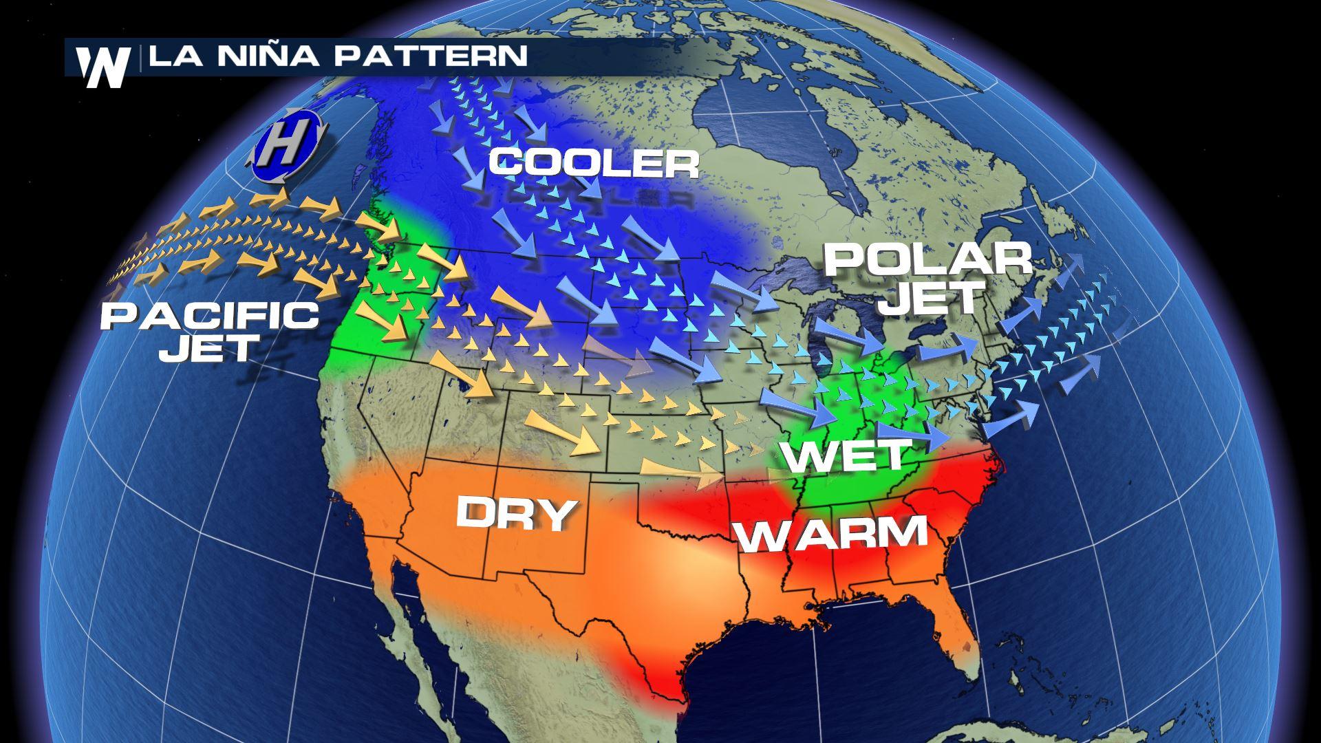
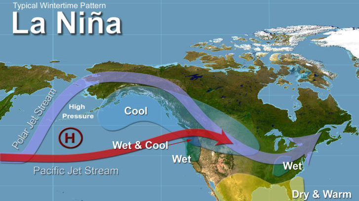
The Climate Prediction Center noted that the forecast was based on model guidance , current ongoing trends in the atmosphere globally, and typical influences of La Nina. The discussion said, "the current state of La Nina and seasonal trends provide backdrop for the monthly outlook.
La Nina conditions are being observed in the Pacific Ocean and are expected to continue through the beginning of the year. La Nina (translated from Spanish as “little girl”) is a natural ocean-atmospheric phenomenon marked by cooler-than-average sea surface temperatures in the central Pacific Ocean near the equator. It's the opposite of El Nino (“little boy”), which is when warmer than normal water temperatures are observed.
Typical La Nina patterns during winter include above-average precipitation and colder-than-average temperatures along the northern tier of the U.S. and below-normal precipitation and drier conditions across the South.
For WeatherNation: Meteorologist Mace Michaels
All Weather News
More
Fronts Continue To Spark Severe Weather Across the Plains
A cold front that brought record lows to the
18 Jul 2025 10:40 PM

Extreme Heat Impacts for the East Coast & South
Extreme heat continues to impact several area
18 Jul 2025 10:05 PM

Flooding Threat Remains Elevated in the East
A cold front pushing through the Eastern Seab
18 Jul 2025 9:10 PM

EF-2 Firenado from the Deer Creek Fire in Utah
A fire tornado was spotted near La Sal, Utah
18 Jul 2025 7:30 AM

Tropical System Brings Flood Risk to the Central Gulf
Time has run out for notable tropical develop
18 Jul 2025 3:05 AM

Heavy Rain, Flooding Threat Returns to Florida
Keep the rain boots handy in Florida - heavy
13 Jul 2025 12:50 PM

Severe Storm Risk Pushes into the Great Lakes, Ohio Valley
Friday was another busy day with severe weath
12 Jul 2025 8:00 PM