Great Lakes Severe Weather Threat Thursday

Special Stories
27 Jun 2019 11:54 AM
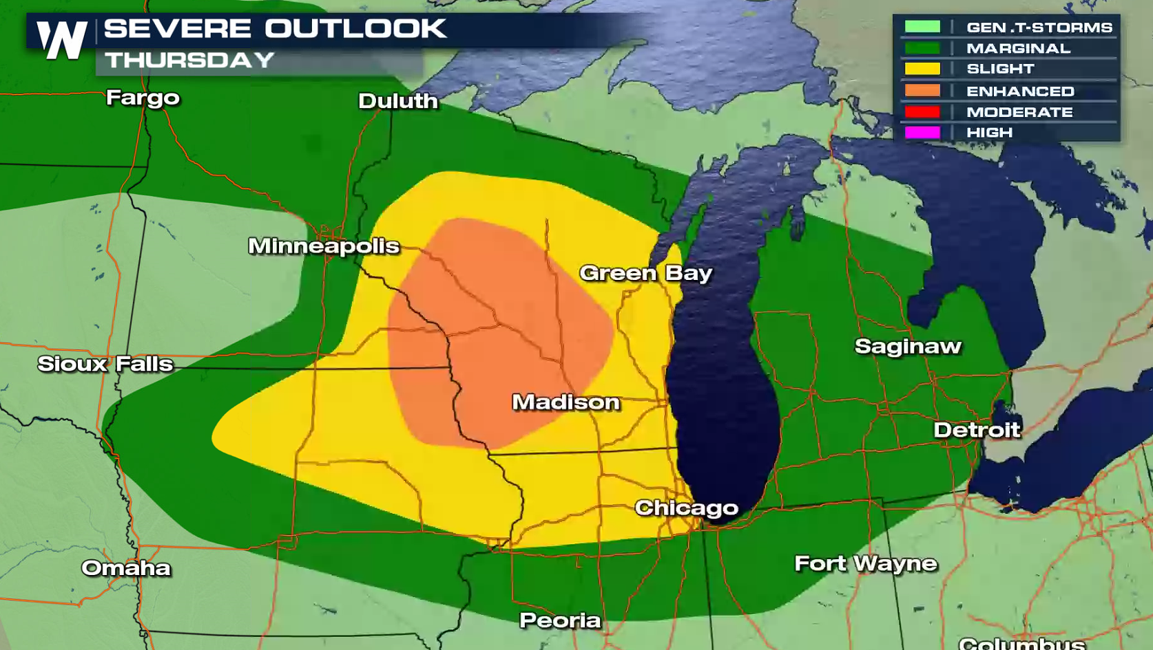
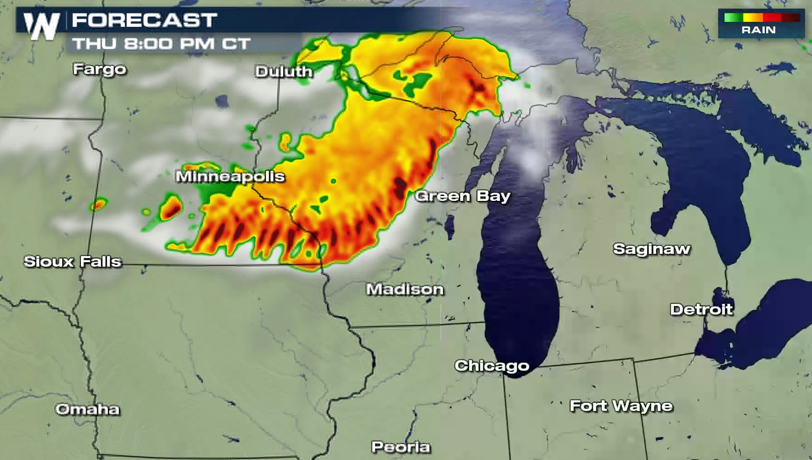
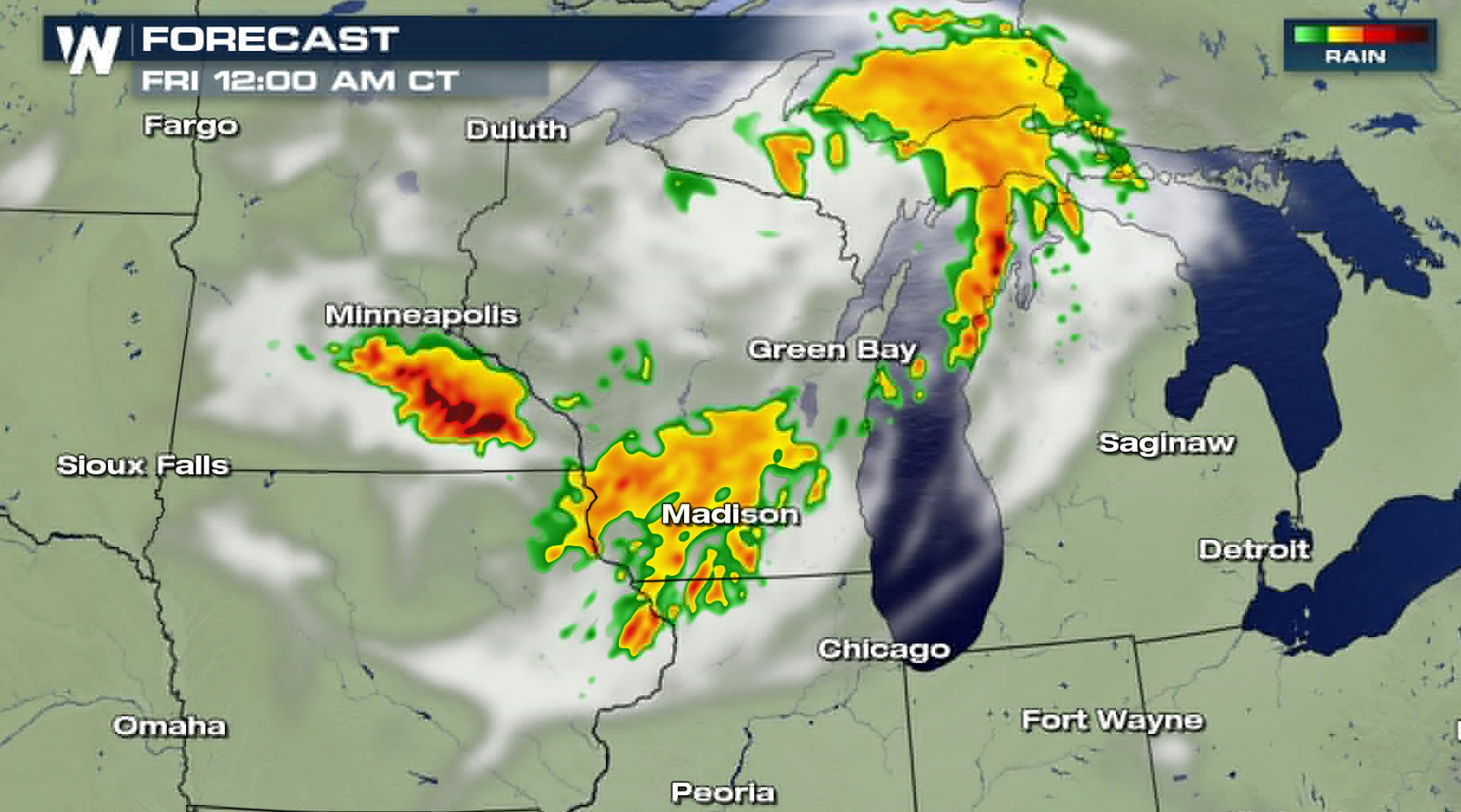
Strong thunderstorms have been moving through the Upper Midwest and western Great Lakes this morning, and another round of severe storms is likely this afternoon and evening (Thursday). The Storm Prediction Center has a slight risk for severe storms in parts of Wisconsin, Iowa, Minnesota and Illinois, with an enhanced risk in southern Wisconsin.
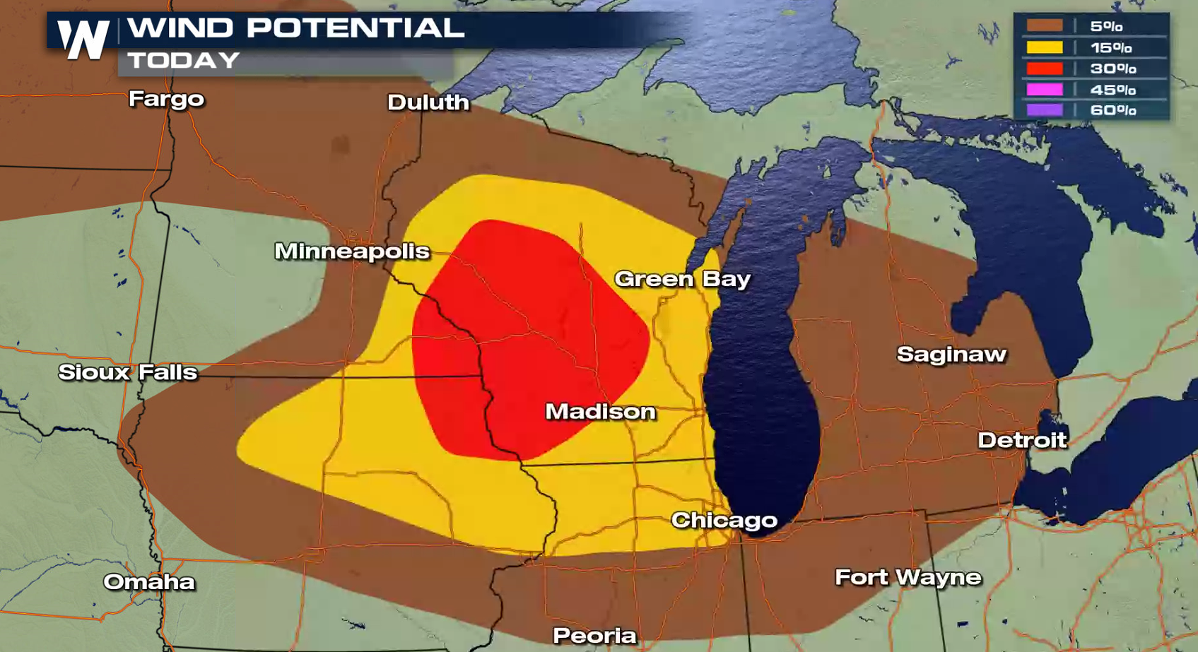
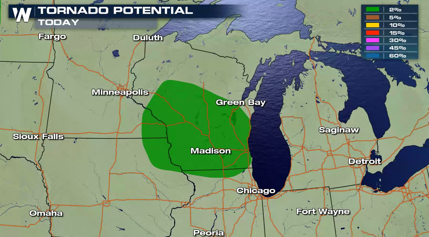
 Damaging wind gusts greater than 60 mph are the biggest concern throughout the day. There is a low chance for large hail and tornadoes.
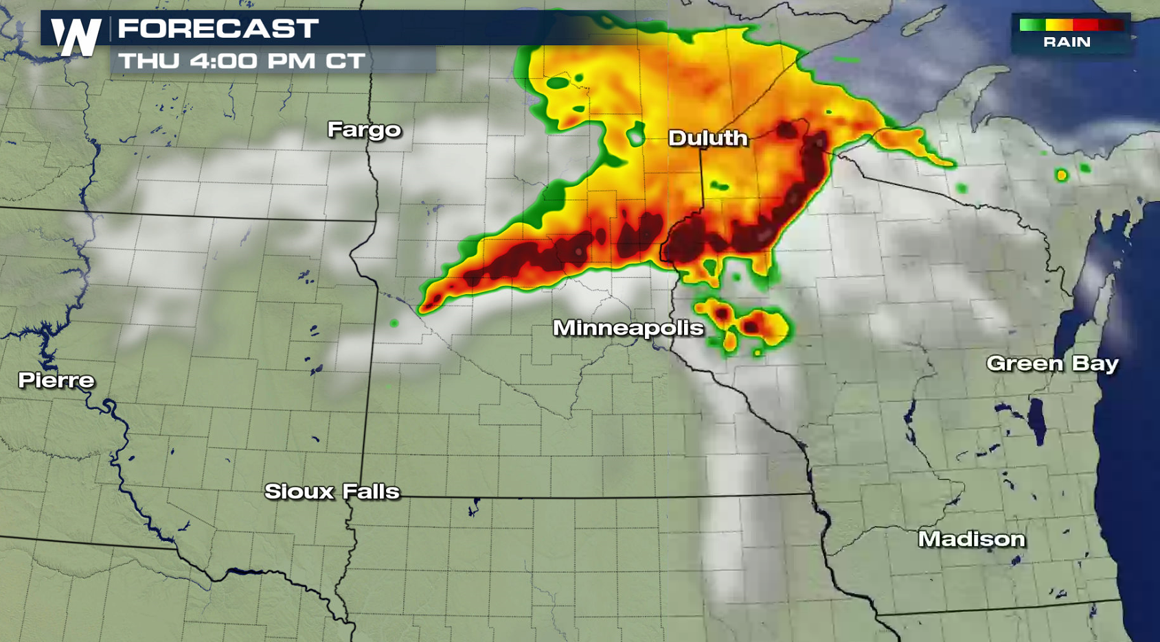
 The morning thunderstorm complex of thunderstorms will diminish, but lead the way to another round of severe storms this afternoon and evening. Warm temperatures and increasing humidity will help to feed storm strength. An upper level disturbance at the Jet Stream level will keep storms firing well into the evening.
 Stay tuned to WeatherNation for updates on-air and online.
Damaging wind gusts greater than 60 mph are the biggest concern throughout the day. There is a low chance for large hail and tornadoes.
The morning thunderstorm complex of thunderstorms will diminish, but lead the way to another round of severe storms this afternoon and evening. Warm temperatures and increasing humidity will help to feed storm strength. An upper level disturbance at the Jet Stream level will keep storms firing well into the evening.
Stay tuned to WeatherNation for updates on-air and online.All Weather News
More
East Gears Up for Stormy, Wet Weekend
A low pressure system crashing through the Mi
1 Aug 2026 11:35 AM


Flooding, Severe Storms Target the Midwest Again
After an active week of storms across the nor
1 Aug 2026 1:40 AM


After Reaching Category 5, Genevieve Weakens in the Pacific
PacificFausto is now a post-tropical cyclone.
31 Jul 2026 1:30 AM

Flooding Risk Increases as Heavy Rain Targets the Tri-State Area
Tuesday, heavy rainfall moved across the Nort
30 Jul 2026 12:25 AM

Severe Weather: Energy From the Midwest Now in the Southeast
UPPER MIDWEST - Through Monday, dangerous tor
29 Jul 2026 10:30 PM