Watching the Tropics
Special Stories
18 Aug 2019 11:36 AM
ATLANTIC OUTLOOK
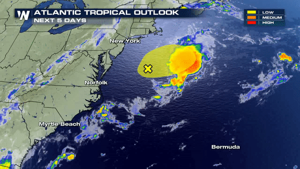
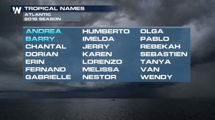 We're watching an area off the coast of New Jersey and Delaware that has a low chance of becoming one of our next named storms. A cluster of thunderstorms is trying to become more organized and we could possibly see "Chantal." If this does become a tropical system, it is likely that this storm will stay off into the Atlantic waters and not have an impact on the United States.
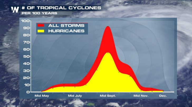 Although the Atlantic hurricane season has been very quiet so far, we shouldn't let our guard down just yet. We are inching closer and closer to the peak of hurricane season in the middle of September.
EASTERN PACIFIC OUTLOOK
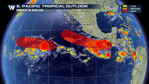
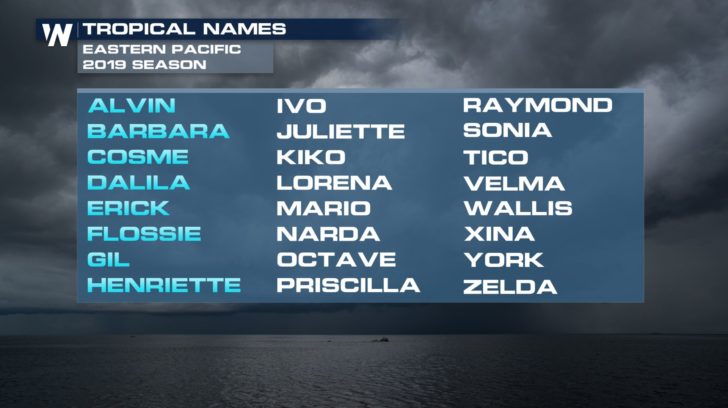 The eastern Pacific has been much more active this hurricane season with 8 storms already checked off on the list. We're watching two other areas of disturbance in the eastern Pacific that both have a high possibility of becoming our next named storms. We might be seeing "Ivo" and "Juliette" by the end of the work week.
All Weather News
More


More Storms for the East Sunday and Monday
A low-pressure system crashing through the Mi
2 Aug 2026 2:20 AM

After Reaching Category 5, Genevieve Weakens in the Pacific
PacificGenevieve formed on last Friday south
2 Aug 2026 1:30 AM

Flooding, Severe Storms Target the Midwest Again
After an active week of storms across the nor
1 Aug 2026 1:40 AM

Flooding Risk Increases as Heavy Rain Targets the Tri-State Area
Tuesday, heavy rainfall moved across the Nort
30 Jul 2026 12:25 AM

Severe Weather: Energy From the Midwest Now in the Southeast
UPPER MIDWEST - Through Monday, dangerous tor
29 Jul 2026 10:30 PM