Weather Buoys Ensure More Accurate Forecasts of Extreme Weather Events
Special Stories
2 May 2022 2:00 AM
[Written by NOAA] NOAA collects marine observations to help monitor, forecast and research changes in weather, climate, the ocean and the coasts. Measurements are gathered using 1,300 weather observing stations — the world’s largest real-time marine observation network — located throughout the Pacific and Atlantic ocean basins and along the coasts. The network includes moored ocean buoys, fixed coastal stations and mobile observing platforms.
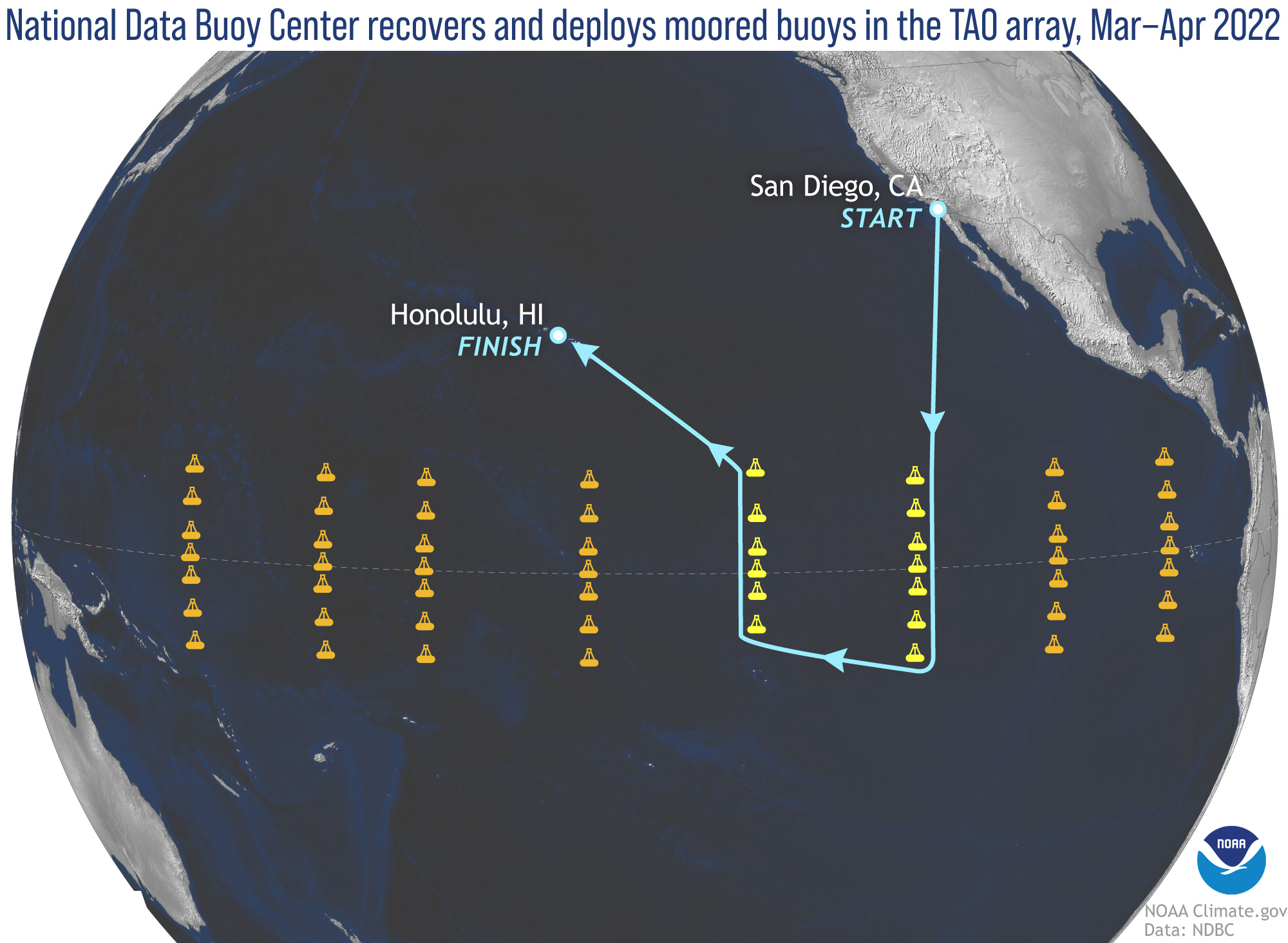 [The first leg of the National Data Buoy Center 2022 mission began March 4, 2022. Buoy technicians sailed from San Diego, California, to the Tropical Atmosphere Ocean (TAO) moored buoy array in the equatorial Pacific Ocean basin. While there, technicians serviced 13 buoys (two of the eight TAO lines). This one-of-a-kind buoy array helps scientists detect, better understand and predict climate variations related to El Niño and the Southern Oscillation (ENSO), which can influence weather patterns around the world. NOAA scientists update the ENSO forecast once a month using observations gathered by the TAO array. Buoy technicians will visit the TAO array two more times this year to service other buoys. (NOAA)]
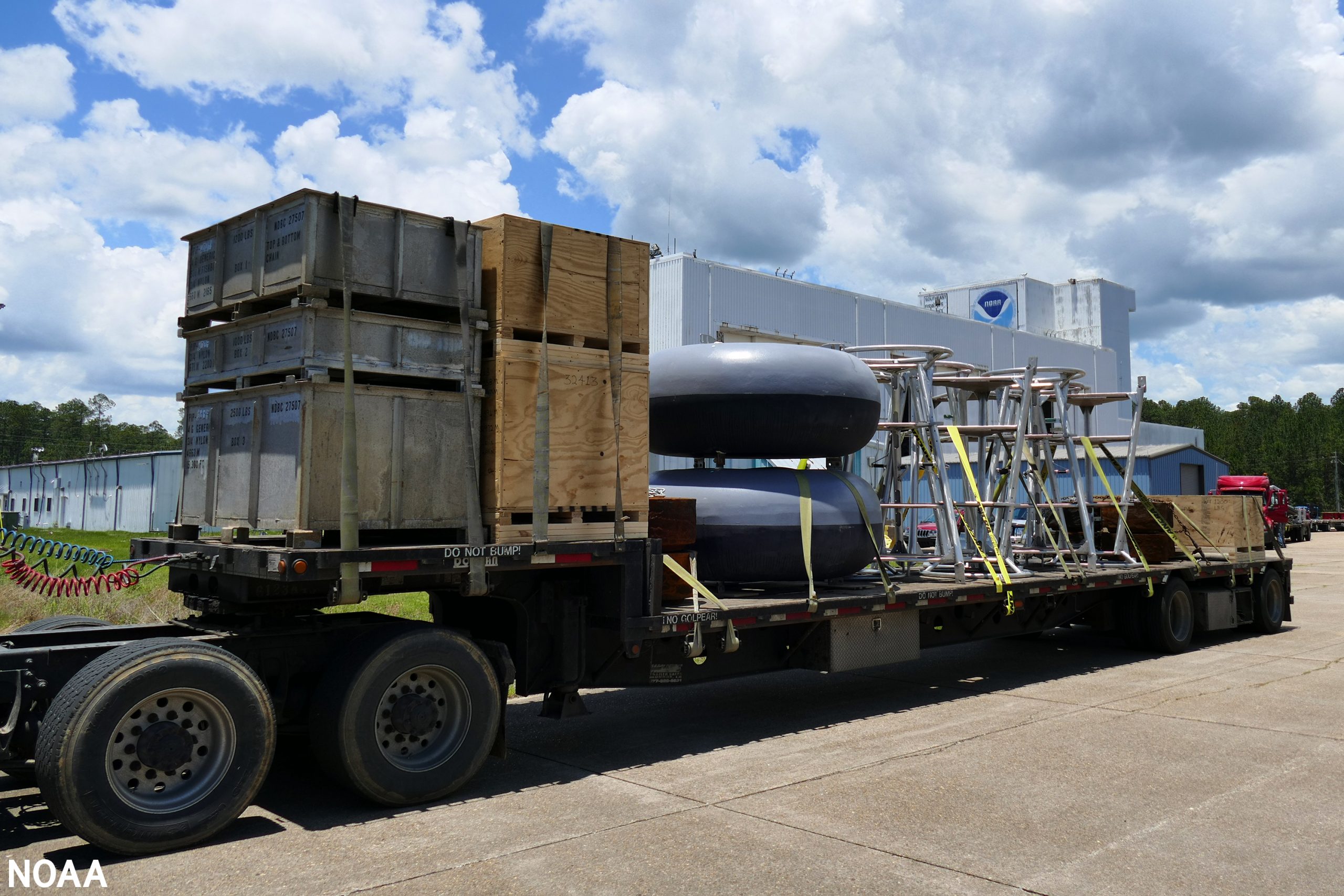 [In late February 2022, workers at the National Data Buoy Center located at the Stennis Space Center along the Mississippi Gulf Coast loaded a half dozen flatbed trucks with parts to repair and to deploy new buoys for the mission. You can get a real sense of the size of these buoys when seen on the truck, which are 7 feet in diameter and 16 feet tall. The annual buoy maintenance mission runs eight months and has 10 port stops this year. (NOAA)]
NOAA’s 200 moored buoys operate in a harsh environment, subjected to powerful ocean currents, fluctuating strong winds, surging waves, sea salt, the sun’s ultraviolet rays, cold temperatures and even vandalism.
Retrace the steps of the crew from NOAA’s National Data Buoy Center as they embark on their annual journey to repair and deploy new moored buoys.
[In late February 2022, workers at the National Data Buoy Center located at the Stennis Space Center along the Mississippi Gulf Coast loaded a half dozen flatbed trucks with parts to repair and to deploy new buoys for the mission. You can get a real sense of the size of these buoys when seen on the truck, which are 7 feet in diameter and 16 feet tall. The annual buoy maintenance mission runs eight months and has 10 port stops this year. (NOAA)]
NOAA’s 200 moored buoys operate in a harsh environment, subjected to powerful ocean currents, fluctuating strong winds, surging waves, sea salt, the sun’s ultraviolet rays, cold temperatures and even vandalism.
Retrace the steps of the crew from NOAA’s National Data Buoy Center as they embark on their annual journey to repair and deploy new moored buoys.
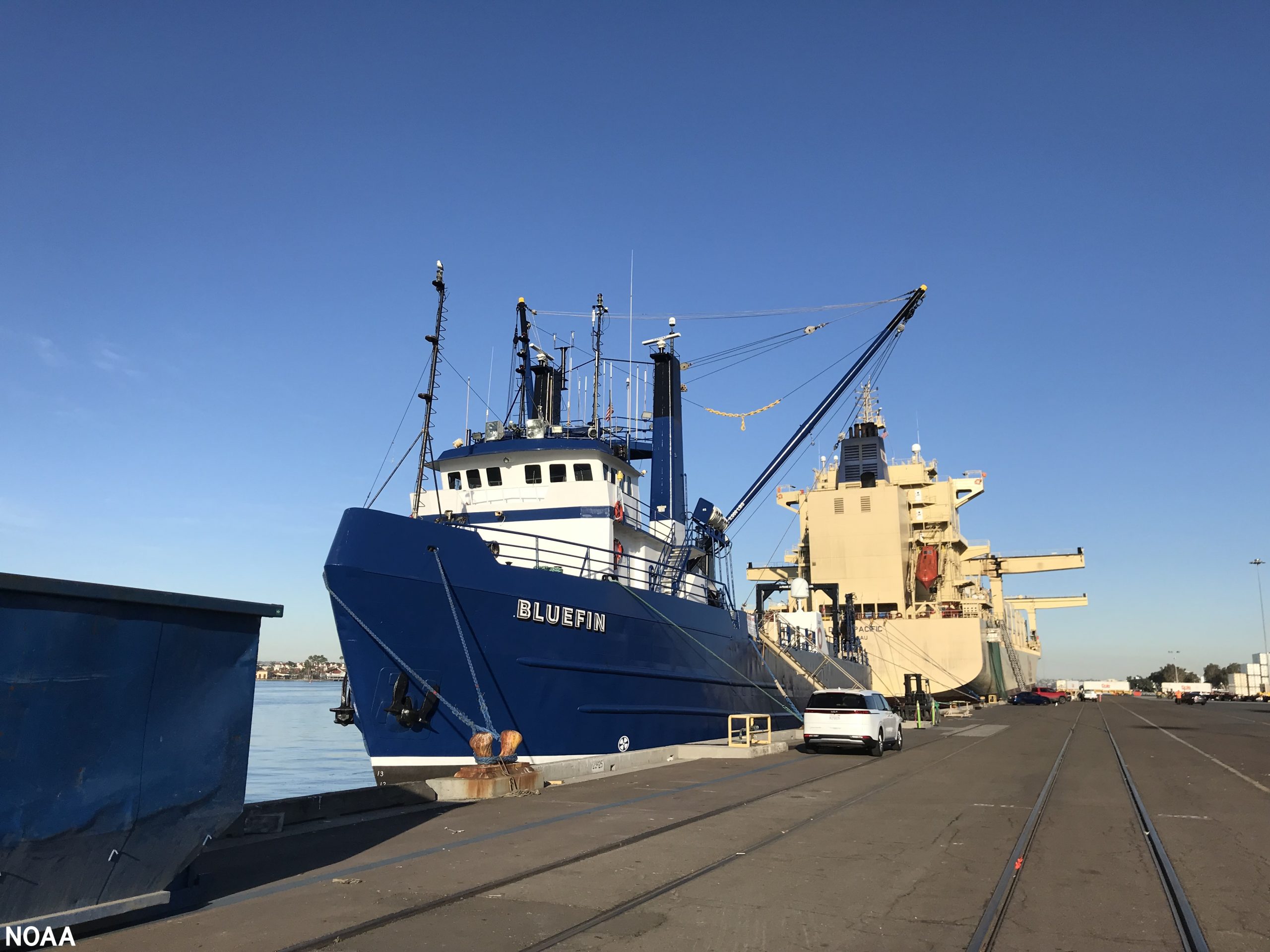 [Loading buoy equipment and personnel on the M/V Bluefin while at the San Diego, California, port. This is where the eight month voyage around the Pacific Ocean basin began. (NOAA)]
The National Data Buoy Center is a division of the National Weather Service and its mission is to ensure the nation’s maritime safety. Buoy observations improve the safety and efficiency of marine transportation. Many industries rely on NOAA’s marine forecasts and real-time buoy observations to monitor current conditions when planning travel or performing work. NOAA’s continuous flow of ocean, weather and wave information is vital to fishermen, cargo ship captains, the U.S. Coast Guard, underwater operations, offshore drilling platform managers, surfers and coastal communities. In addition, scientists use buoy observations to conduct climate change research to understand how our weather patterns are changing.
[Loading buoy equipment and personnel on the M/V Bluefin while at the San Diego, California, port. This is where the eight month voyage around the Pacific Ocean basin began. (NOAA)]
The National Data Buoy Center is a division of the National Weather Service and its mission is to ensure the nation’s maritime safety. Buoy observations improve the safety and efficiency of marine transportation. Many industries rely on NOAA’s marine forecasts and real-time buoy observations to monitor current conditions when planning travel or performing work. NOAA’s continuous flow of ocean, weather and wave information is vital to fishermen, cargo ship captains, the U.S. Coast Guard, underwater operations, offshore drilling platform managers, surfers and coastal communities. In addition, scientists use buoy observations to conduct climate change research to understand how our weather patterns are changing.
 [National Data Buoy Center scientists and engineers developed the next evolution of the TAO buoy and are deploying three prototypes this year (one is pictured here). The new buoys have more sensors to meet climate research needs, including measuring solar radiation. They will also collect more salinity measurements, more barometric pressure measurements and more data on the temperature and currents in the mixed layer of the ocean to help support improved El Niño Southern Oscillation forecast modeling. In addition to having more memory and using less power than the current TAO buoys, these new buoys have a faster processor that will help collect and transmit surface meteorological data every 10 minutes, versus the existing hourly transmissions. NOAA plans to replace the entire array with the next evolution TAO between 2025 and 2027. (NOAA)]
Specially trained technicians from the National Data Buoy Center travel to remote areas in the ocean to service and deploy buoys. Deploying a buoy can take 12-16 hours. When technicians aren’t deploying a buoy, they are assembling new buoys, installing sensors or pressure washing old hulls and getting the next set of buoys ready as the vessel steams to the next buoy. They also retrieve drifting NOAA weather buoys and restore them. This cycle continues for weeks until they reach their port of call, then they restock and start all over again.
[National Data Buoy Center scientists and engineers developed the next evolution of the TAO buoy and are deploying three prototypes this year (one is pictured here). The new buoys have more sensors to meet climate research needs, including measuring solar radiation. They will also collect more salinity measurements, more barometric pressure measurements and more data on the temperature and currents in the mixed layer of the ocean to help support improved El Niño Southern Oscillation forecast modeling. In addition to having more memory and using less power than the current TAO buoys, these new buoys have a faster processor that will help collect and transmit surface meteorological data every 10 minutes, versus the existing hourly transmissions. NOAA plans to replace the entire array with the next evolution TAO between 2025 and 2027. (NOAA)]
Specially trained technicians from the National Data Buoy Center travel to remote areas in the ocean to service and deploy buoys. Deploying a buoy can take 12-16 hours. When technicians aren’t deploying a buoy, they are assembling new buoys, installing sensors or pressure washing old hulls and getting the next set of buoys ready as the vessel steams to the next buoy. They also retrieve drifting NOAA weather buoys and restore them. This cycle continues for weeks until they reach their port of call, then they restock and start all over again.
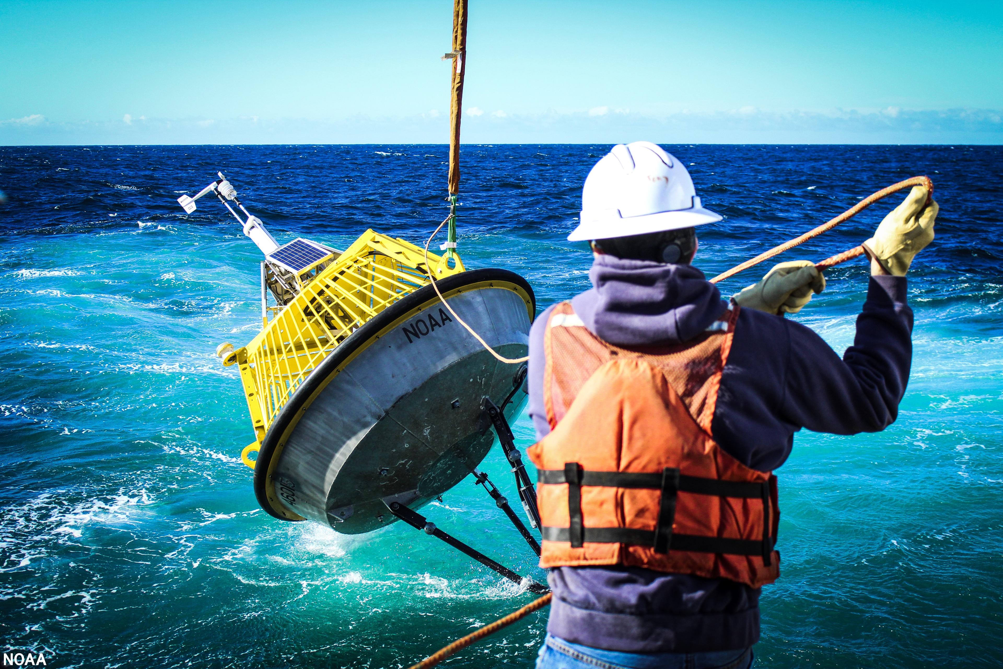
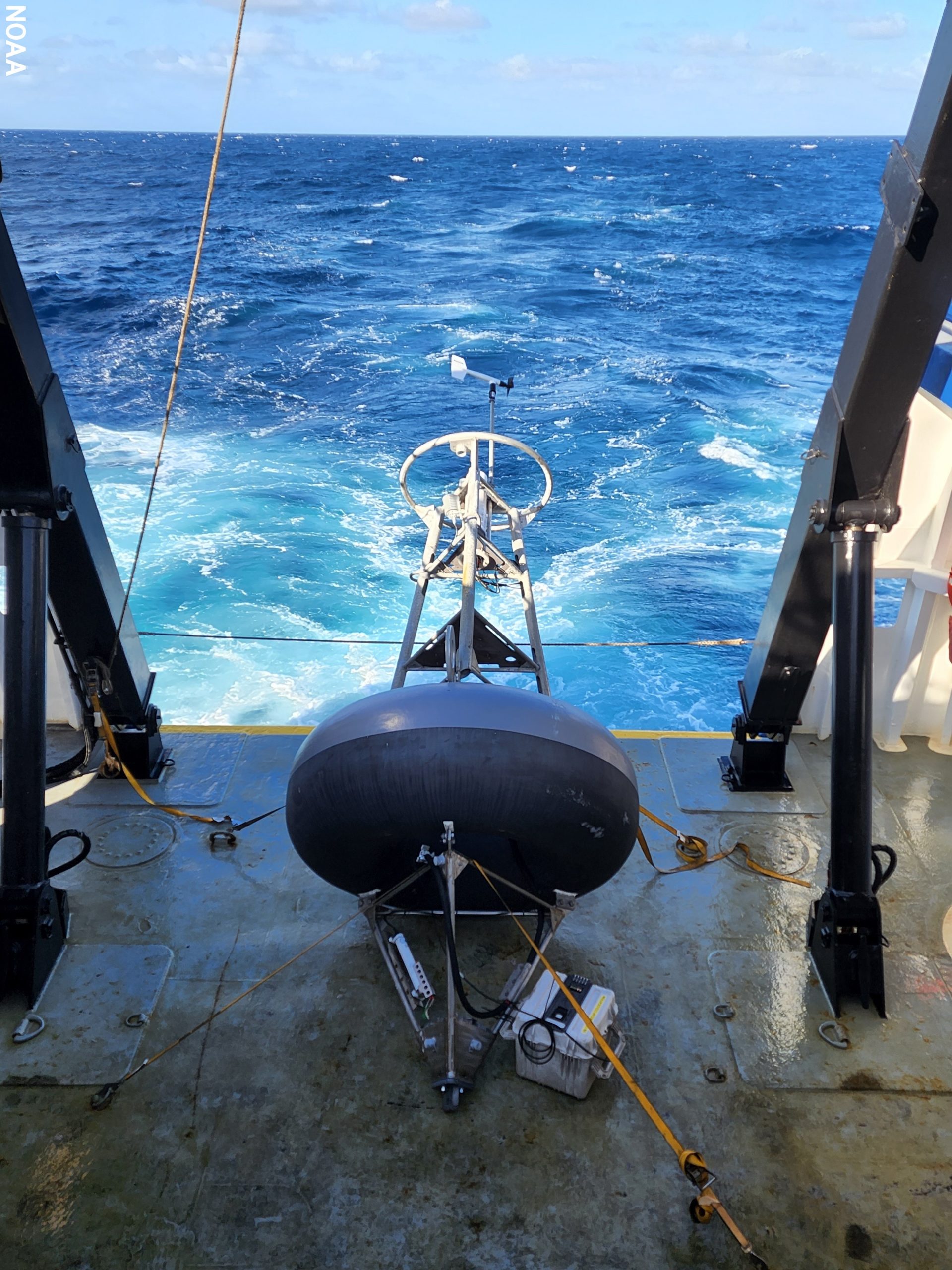
 [A TAO buoy after deployment. TAO buoys are generally placed 120 and 180 nautical miles apart depending on their position in the array. Engineers design the buoys to be robust enough to persevere through significant storms. The placement of the weather sensors is very important. For example, the anemometer, also known as the wind sensor, must be placed high enough to accurately capture wind speed by reducing the effects of air sea interaction. (NOAA)]
The hull was recovered and will be repaired then returned to the array. A new buoy, deployed in the same location, took technicians 10 hours to restore to operational status.
[A TAO buoy after deployment. TAO buoys are generally placed 120 and 180 nautical miles apart depending on their position in the array. Engineers design the buoys to be robust enough to persevere through significant storms. The placement of the weather sensors is very important. For example, the anemometer, also known as the wind sensor, must be placed high enough to accurately capture wind speed by reducing the effects of air sea interaction. (NOAA)]
The hull was recovered and will be repaired then returned to the array. A new buoy, deployed in the same location, took technicians 10 hours to restore to operational status.
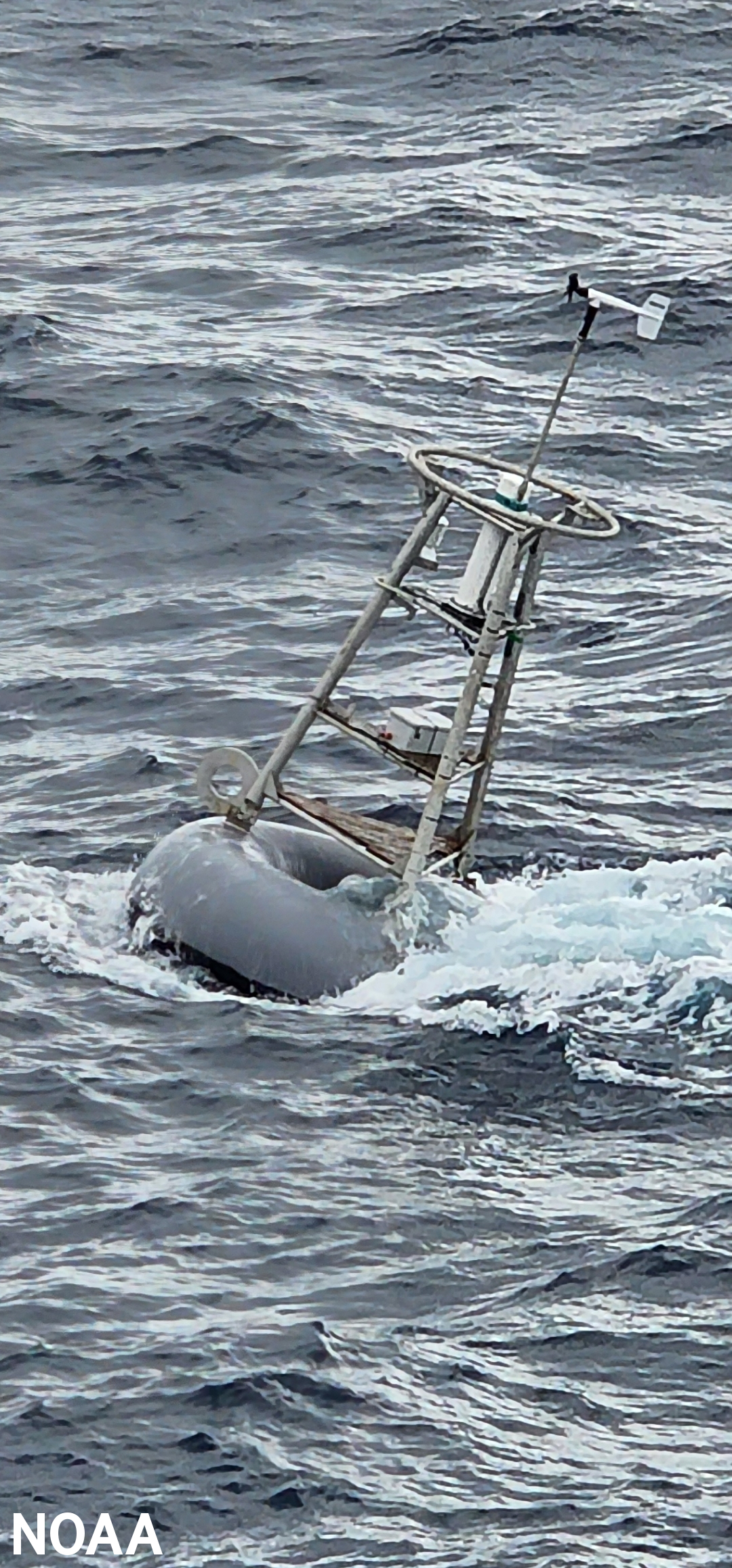
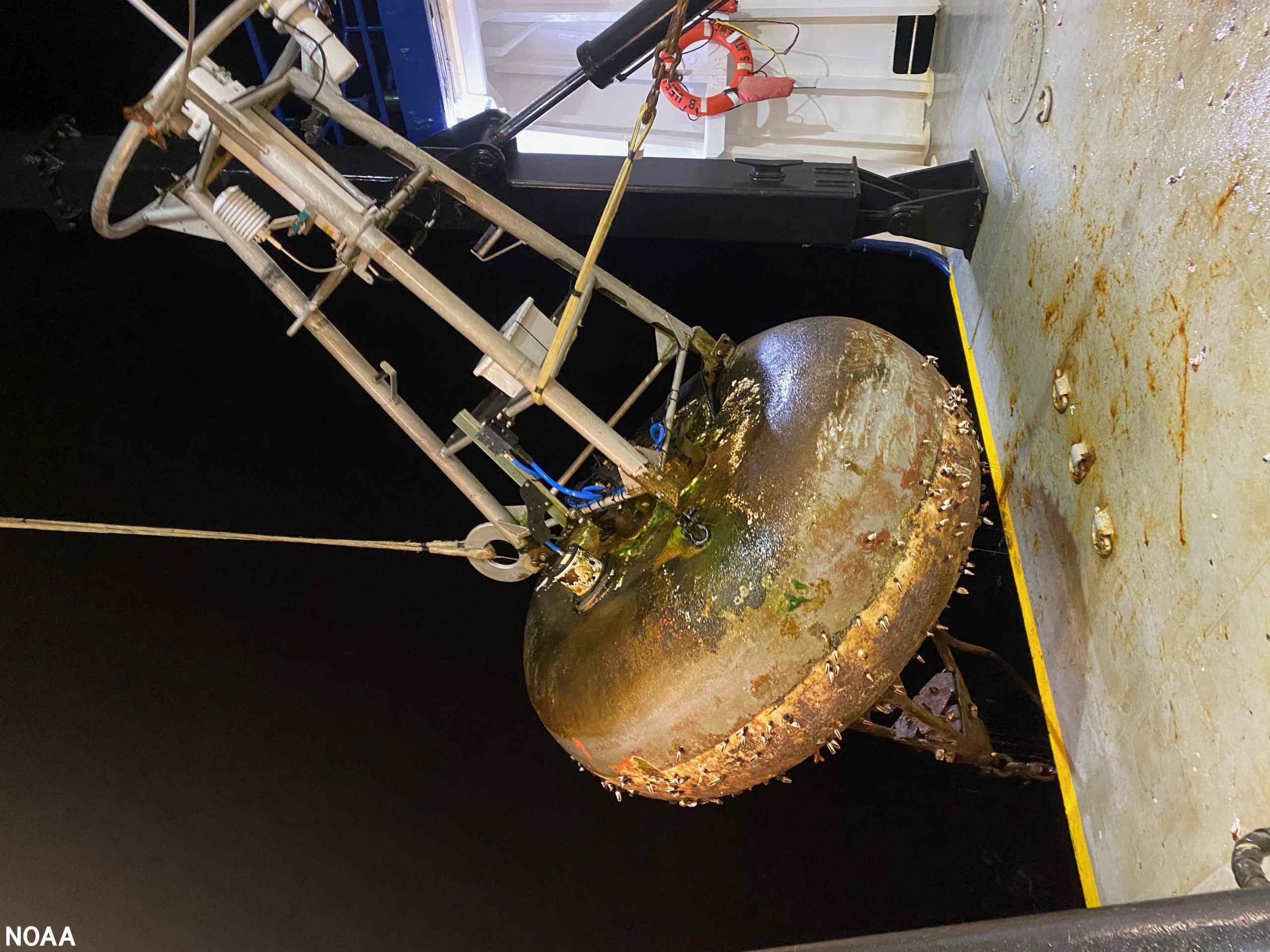 [Nighttime retrieval of a TAO buoy. Technicians pulled this buoy aboard and deployed a new one. When a buoy has been in the water for a long time it may have shell life on the hull (seen here), which could result in injury to the crew. Technicians disassembled the buoy, pressure washed the hull and mounted a new mast and sensors. The refurbished buoy was deployed in a new location. (NOAA)]
NOAA moors its buoys with custom made cast iron anchors and heavy nylon. To reach the seafloor, the nylon length may be 3 miles long. Moored buoys are a cost-effective means for obtaining meteorological and oceanographic data from remote areas in the ocean.
[Nighttime retrieval of a TAO buoy. Technicians pulled this buoy aboard and deployed a new one. When a buoy has been in the water for a long time it may have shell life on the hull (seen here), which could result in injury to the crew. Technicians disassembled the buoy, pressure washed the hull and mounted a new mast and sensors. The refurbished buoy was deployed in a new location. (NOAA)]
NOAA moors its buoys with custom made cast iron anchors and heavy nylon. To reach the seafloor, the nylon length may be 3 miles long. Moored buoys are a cost-effective means for obtaining meteorological and oceanographic data from remote areas in the ocean.
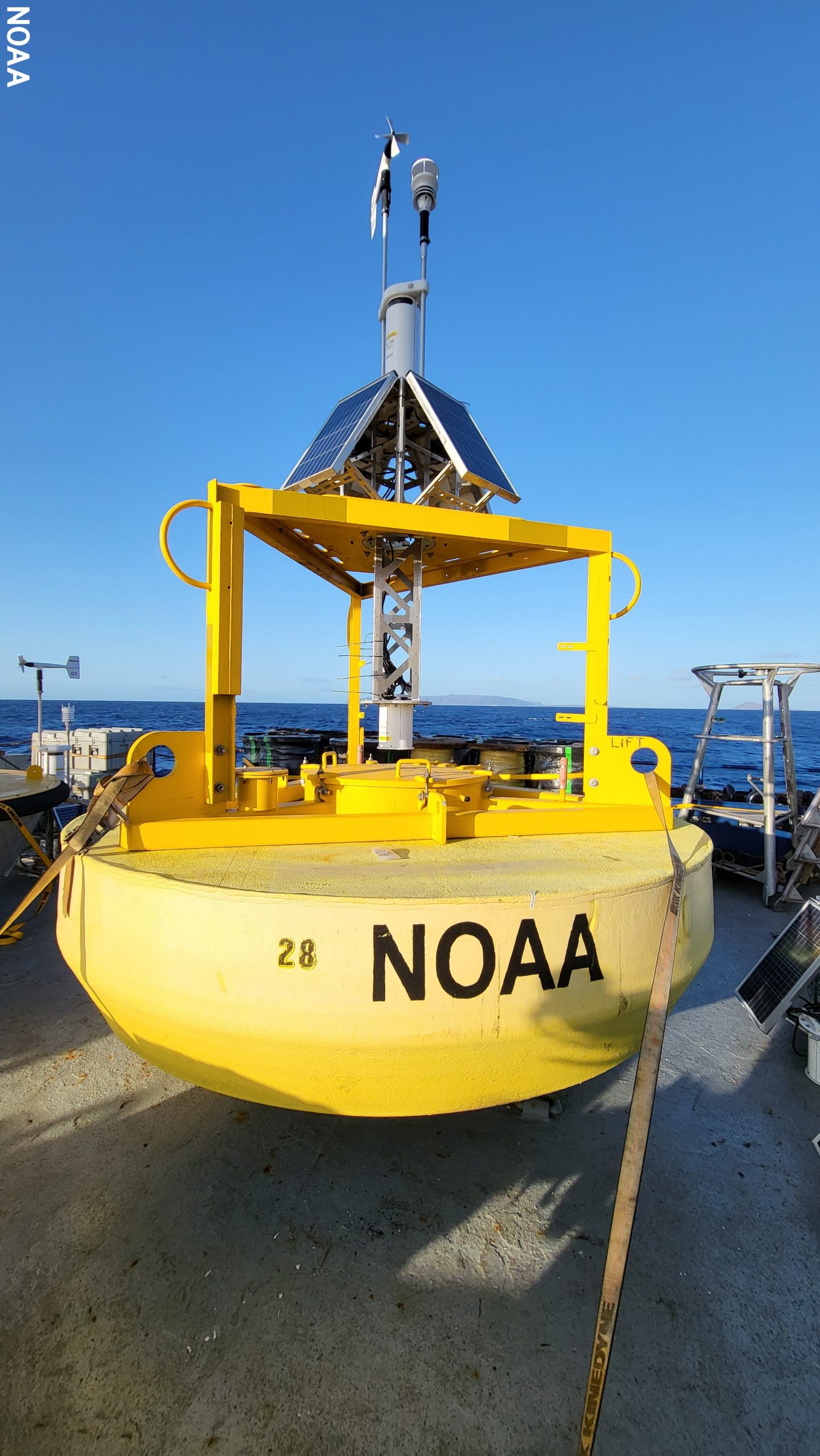
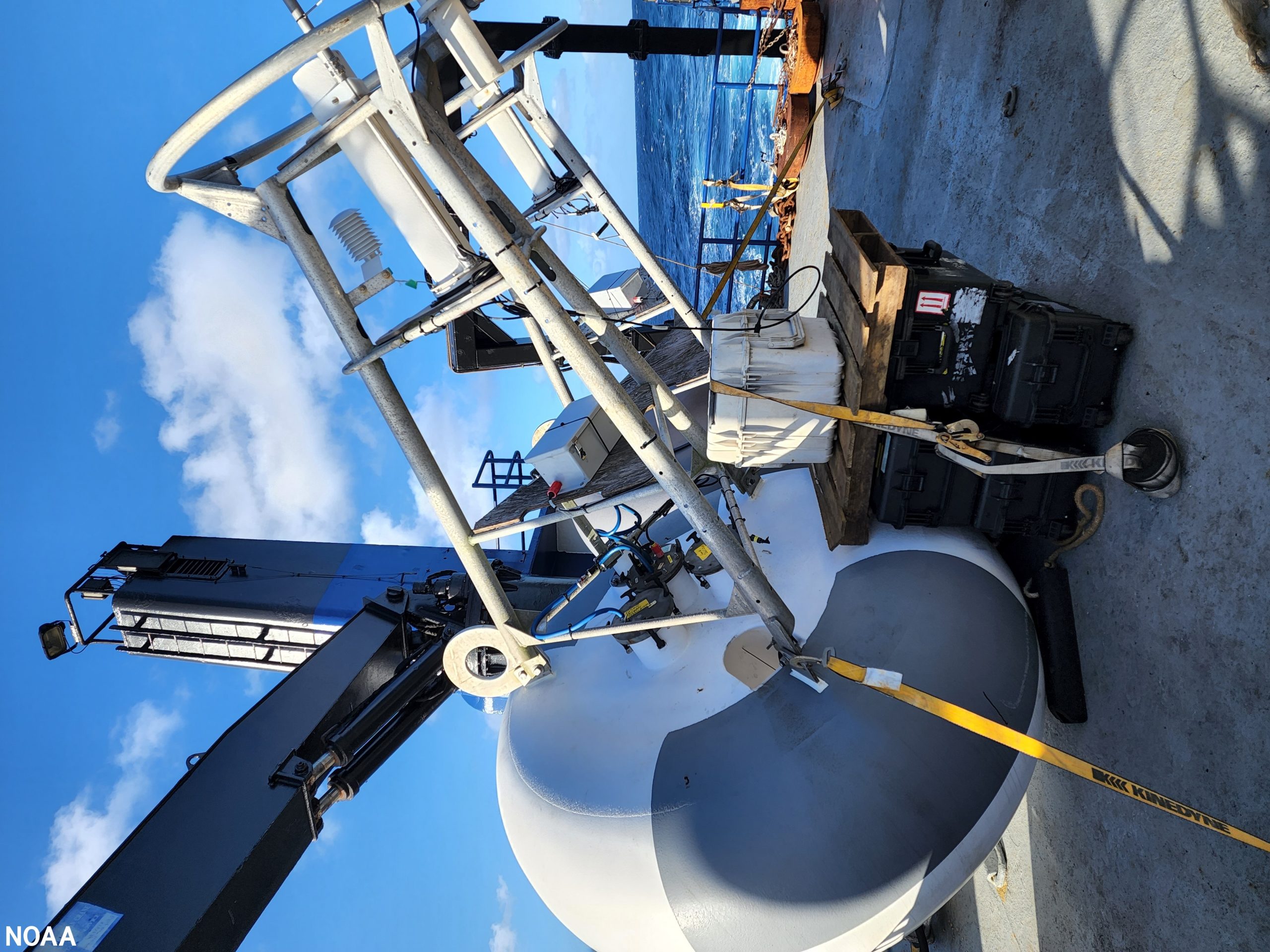 [This is a brand new TAO buoy on deck before deployment. Moored ocean buoys collect wind speed and direction, wave height and movement, air pressure, air and water temperature, dew point and salinity. That data is transmitted in real-time each hour to NOAA’s GOES satellites and is made available on the National Data Buoy Center website. Buoy observations are also fed into computer models that National Weather Service meteorologists use to develop weather and climate forecasts. The observations provide forecasters real-time information that they can use to issue life-saving weather warnings or make critical adjustments to aviation or marine forecasts. (NOAA)]
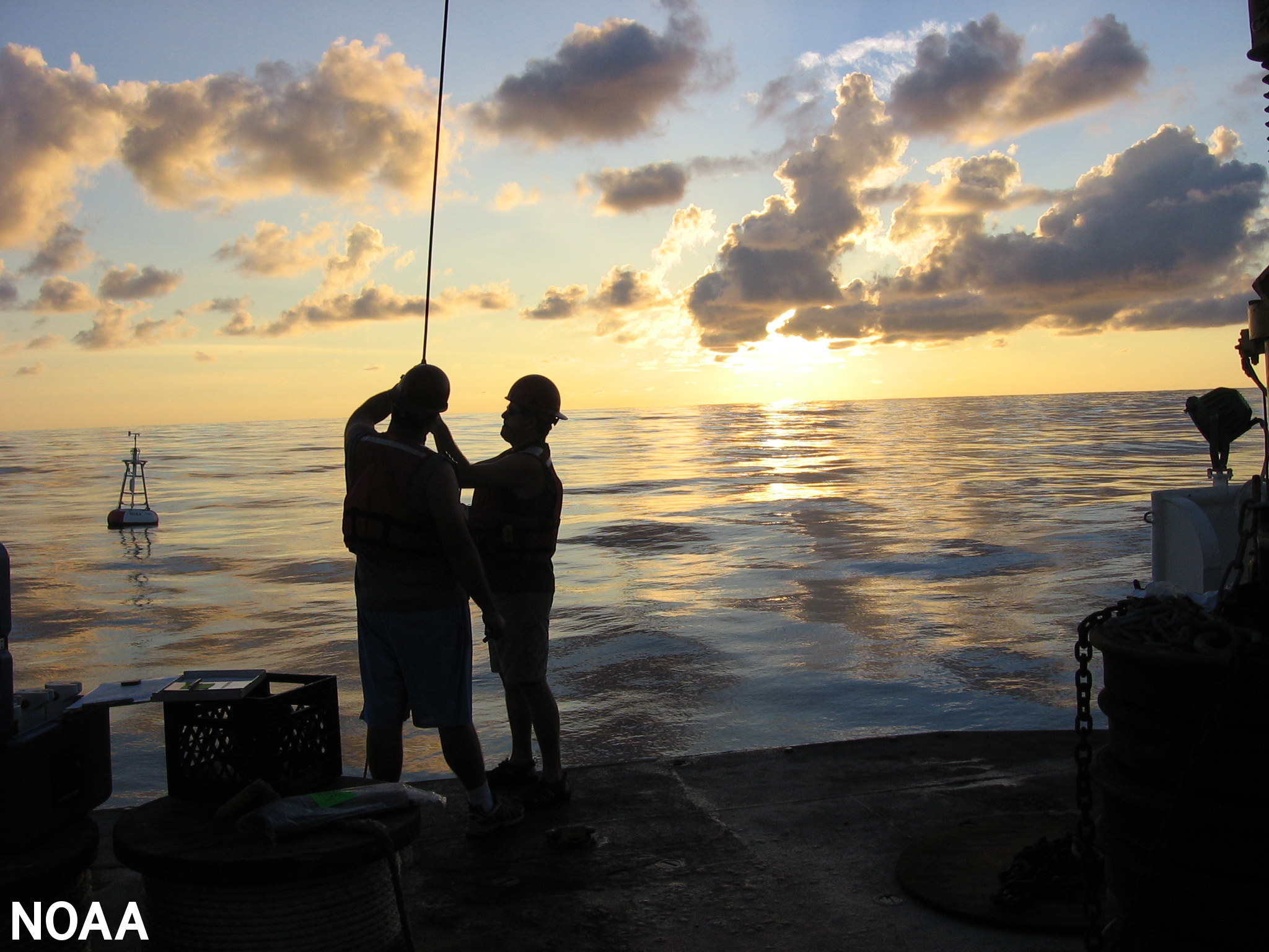 [At sunset, buoy technicians put on the final touches — the underwater sensors. After deploying the buoy, they attach 11 sensors to the wire that will hang 500 meters underwater from the hull to collect data on salinity, currents and subsurface temperatures. The mast has 4-7 weather sensors. Weather buoys ensure more accurate and timely forecasts of extreme weather events. (NOAA)]
 [Servicing the TAO array took 34 days. The ship docked in Honolulu, Hawaii, where staff restocked supplies and rotated in a relief crew. A few days later the new crew began the next leg of the mission, where they inspected and repaired weather buoys surrounding the Hawaiian Islands. Shown here is a NOAA weather buoy ready to be deployed 300 miles off the coast of Honolulu. The buoy is nearly 10 feet in diameter, over 12 feet tall, is powered by solar panels and hosts eight sensors. Observations from weather buoys are vital to mariners and water enthusiasts, and are used to forecast the weather and issue warnings. (NOAA)]
In May, NOAA will service nine weather buoys along the U.S. West Coast beginning in San Diego, California, and ending near Seattle, Washington. During the summer, buoy technicians will sail to the deep ocean along the Aleutian Island chain then south to Guam to service NOAA’s DART buoy network, which plays a critical role in tsunami forecasting. For updates on the mission, visit the NDBC Facebook page.
Edited for WeatherNation by Mace Michaels
[Servicing the TAO array took 34 days. The ship docked in Honolulu, Hawaii, where staff restocked supplies and rotated in a relief crew. A few days later the new crew began the next leg of the mission, where they inspected and repaired weather buoys surrounding the Hawaiian Islands. Shown here is a NOAA weather buoy ready to be deployed 300 miles off the coast of Honolulu. The buoy is nearly 10 feet in diameter, over 12 feet tall, is powered by solar panels and hosts eight sensors. Observations from weather buoys are vital to mariners and water enthusiasts, and are used to forecast the weather and issue warnings. (NOAA)]
In May, NOAA will service nine weather buoys along the U.S. West Coast beginning in San Diego, California, and ending near Seattle, Washington. During the summer, buoy technicians will sail to the deep ocean along the Aleutian Island chain then south to Guam to service NOAA’s DART buoy network, which plays a critical role in tsunami forecasting. For updates on the mission, visit the NDBC Facebook page.
Edited for WeatherNation by Mace Michaels
[The first leg of the National Data Buoy Center 2022 mission began March 4, 2022. Buoy technicians sailed from San Diego, California, to the Tropical Atmosphere Ocean (TAO) moored buoy array in the equatorial Pacific Ocean basin. While there, technicians serviced 13 buoys (two of the eight TAO lines). This one-of-a-kind buoy array helps scientists detect, better understand and predict climate variations related to El Niño and the Southern Oscillation (ENSO), which can influence weather patterns around the world. NOAA scientists update the ENSO forecast once a month using observations gathered by the TAO array. Buoy technicians will visit the TAO array two more times this year to service other buoys. (NOAA)]
[In late February 2022, workers at the National Data Buoy Center located at the Stennis Space Center along the Mississippi Gulf Coast loaded a half dozen flatbed trucks with parts to repair and to deploy new buoys for the mission. You can get a real sense of the size of these buoys when seen on the truck, which are 7 feet in diameter and 16 feet tall. The annual buoy maintenance mission runs eight months and has 10 port stops this year. (NOAA)]
NOAA’s 200 moored buoys operate in a harsh environment, subjected to powerful ocean currents, fluctuating strong winds, surging waves, sea salt, the sun’s ultraviolet rays, cold temperatures and even vandalism.
Retrace the steps of the crew from NOAA’s National Data Buoy Center as they embark on their annual journey to repair and deploy new moored buoys.
[Loading buoy equipment and personnel on the M/V Bluefin while at the San Diego, California, port. This is where the eight month voyage around the Pacific Ocean basin began. (NOAA)]
The National Data Buoy Center is a division of the National Weather Service and its mission is to ensure the nation’s maritime safety. Buoy observations improve the safety and efficiency of marine transportation. Many industries rely on NOAA’s marine forecasts and real-time buoy observations to monitor current conditions when planning travel or performing work. NOAA’s continuous flow of ocean, weather and wave information is vital to fishermen, cargo ship captains, the U.S. Coast Guard, underwater operations, offshore drilling platform managers, surfers and coastal communities. In addition, scientists use buoy observations to conduct climate change research to understand how our weather patterns are changing.
[National Data Buoy Center scientists and engineers developed the next evolution of the TAO buoy and are deploying three prototypes this year (one is pictured here). The new buoys have more sensors to meet climate research needs, including measuring solar radiation. They will also collect more salinity measurements, more barometric pressure measurements and more data on the temperature and currents in the mixed layer of the ocean to help support improved El Niño Southern Oscillation forecast modeling. In addition to having more memory and using less power than the current TAO buoys, these new buoys have a faster processor that will help collect and transmit surface meteorological data every 10 minutes, versus the existing hourly transmissions. NOAA plans to replace the entire array with the next evolution TAO between 2025 and 2027. (NOAA)]
Specially trained technicians from the National Data Buoy Center travel to remote areas in the ocean to service and deploy buoys. Deploying a buoy can take 12-16 hours. When technicians aren’t deploying a buoy, they are assembling new buoys, installing sensors or pressure washing old hulls and getting the next set of buoys ready as the vessel steams to the next buoy. They also retrieve drifting NOAA weather buoys and restore them. This cycle continues for weeks until they reach their port of call, then they restock and start all over again.
[A TAO buoy after deployment. TAO buoys are generally placed 120 and 180 nautical miles apart depending on their position in the array. Engineers design the buoys to be robust enough to persevere through significant storms. The placement of the weather sensors is very important. For example, the anemometer, also known as the wind sensor, must be placed high enough to accurately capture wind speed by reducing the effects of air sea interaction. (NOAA)]
The hull was recovered and will be repaired then returned to the array. A new buoy, deployed in the same location, took technicians 10 hours to restore to operational status.
[Nighttime retrieval of a TAO buoy. Technicians pulled this buoy aboard and deployed a new one. When a buoy has been in the water for a long time it may have shell life on the hull (seen here), which could result in injury to the crew. Technicians disassembled the buoy, pressure washed the hull and mounted a new mast and sensors. The refurbished buoy was deployed in a new location. (NOAA)]
NOAA moors its buoys with custom made cast iron anchors and heavy nylon. To reach the seafloor, the nylon length may be 3 miles long. Moored buoys are a cost-effective means for obtaining meteorological and oceanographic data from remote areas in the ocean.
[This is a brand new TAO buoy on deck before deployment. Moored ocean buoys collect wind speed and direction, wave height and movement, air pressure, air and water temperature, dew point and salinity. That data is transmitted in real-time each hour to NOAA’s GOES satellites and is made available on the National Data Buoy Center website. Buoy observations are also fed into computer models that National Weather Service meteorologists use to develop weather and climate forecasts. The observations provide forecasters real-time information that they can use to issue life-saving weather warnings or make critical adjustments to aviation or marine forecasts. (NOAA)]
[At sunset, buoy technicians put on the final touches — the underwater sensors. After deploying the buoy, they attach 11 sensors to the wire that will hang 500 meters underwater from the hull to collect data on salinity, currents and subsurface temperatures. The mast has 4-7 weather sensors. Weather buoys ensure more accurate and timely forecasts of extreme weather events. (NOAA)]
[Servicing the TAO array took 34 days. The ship docked in Honolulu, Hawaii, where staff restocked supplies and rotated in a relief crew. A few days later the new crew began the next leg of the mission, where they inspected and repaired weather buoys surrounding the Hawaiian Islands. Shown here is a NOAA weather buoy ready to be deployed 300 miles off the coast of Honolulu. The buoy is nearly 10 feet in diameter, over 12 feet tall, is powered by solar panels and hosts eight sensors. Observations from weather buoys are vital to mariners and water enthusiasts, and are used to forecast the weather and issue warnings. (NOAA)]
In May, NOAA will service nine weather buoys along the U.S. West Coast beginning in San Diego, California, and ending near Seattle, Washington. During the summer, buoy technicians will sail to the deep ocean along the Aleutian Island chain then south to Guam to service NOAA’s DART buoy network, which plays a critical role in tsunami forecasting. For updates on the mission, visit the NDBC Facebook page.
Edited for WeatherNation by Mace MichaelsAll Weather News
More
Fronts Continue To Spark Severe Weather Across the Plains
A cold front that brought record lows to the
18 Jul 2025 10:40 PM

Extreme Heat Impacts for the East Coast & South
Extreme heat continues to impact several area
18 Jul 2025 10:05 PM

Flooding Threat Remains Elevated in the East
A cold front pushing through the Eastern Seab
18 Jul 2025 9:10 PM

EF-2 Firenado from the Deer Creek Fire in Utah
A fire tornado was spotted near La Sal, Utah
18 Jul 2025 7:30 AM

Tropical System Brings Flood Risk to the Central Gulf
Time has run out for notable tropical develop
18 Jul 2025 3:05 AM

Heavy Rain, Flooding Threat Returns to Florida
Keep the rain boots handy in Florida - heavy
13 Jul 2025 12:50 PM

Severe Storm Risk Pushes into the Great Lakes, Ohio Valley
Friday was another busy day with severe weath
12 Jul 2025 8:00 PM