Wednesday and Thursday Severe Weather Outlooks

Special Stories
2 Jul 2019 9:36 PM
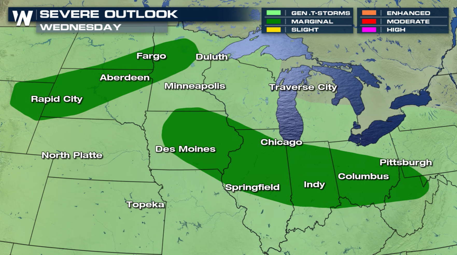
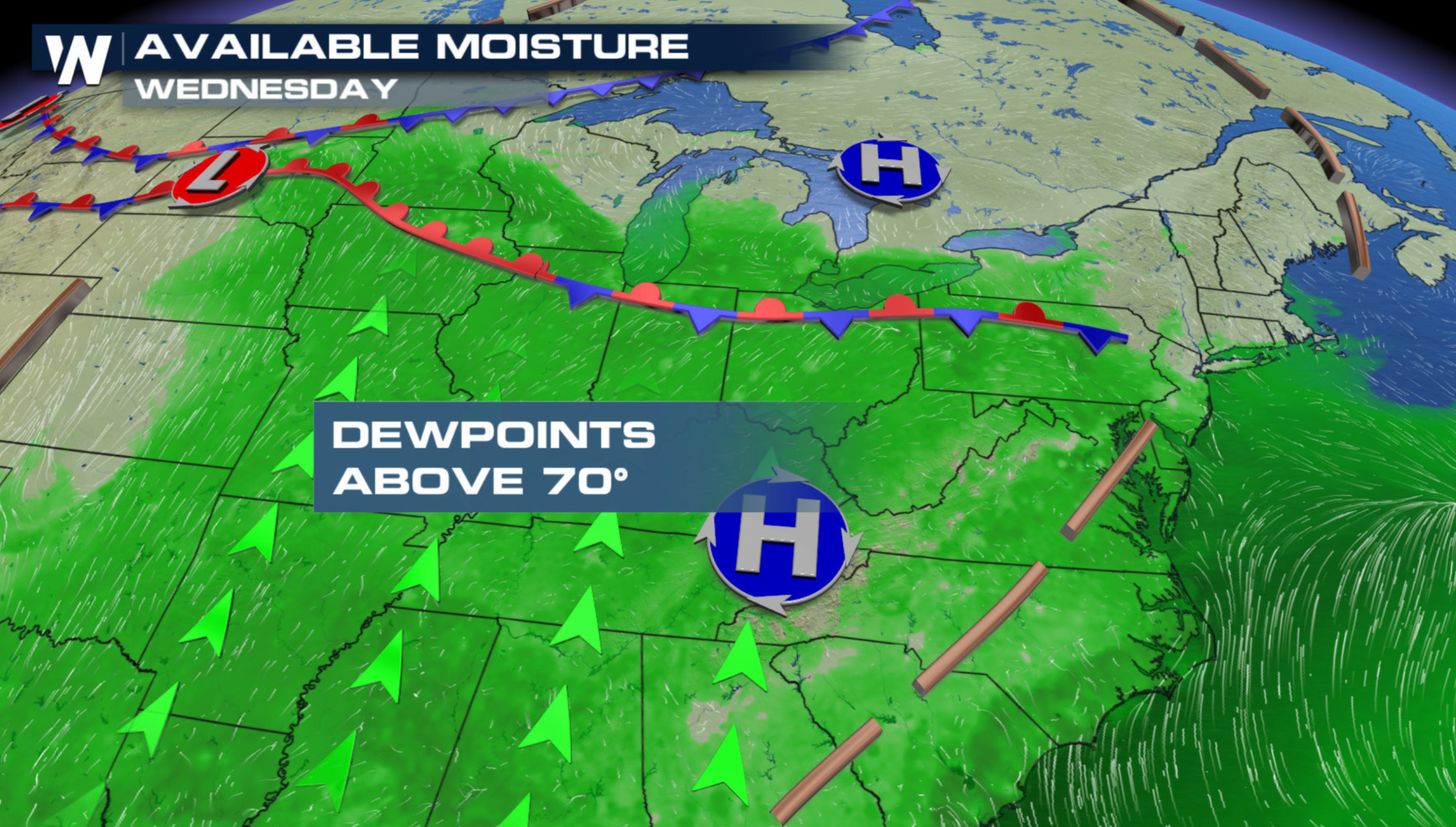
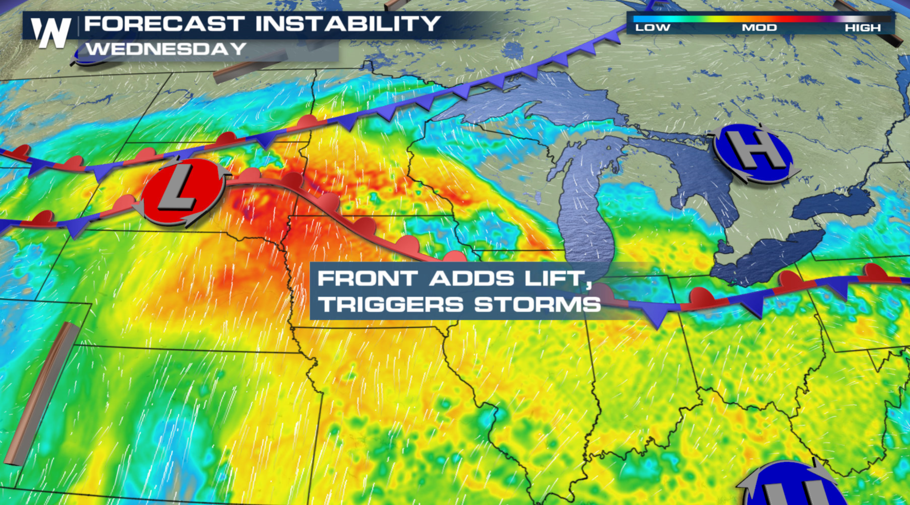
After several active days of severe weather, the forecast looks a little quieter for Wednesday and Thursday. Some severe storms are likely, but overall coverage will be diminished with weaker Jet Stream energy. There is a marginal risk for severe thunderstorms Wednesday in the Upper Midwest and Ohio Valley. A stalled front will interact with high humidity and warm temperatures. The mercury will climb into the 90s in some areas, with dew points in the 70s, creating significant instability for severe storms.
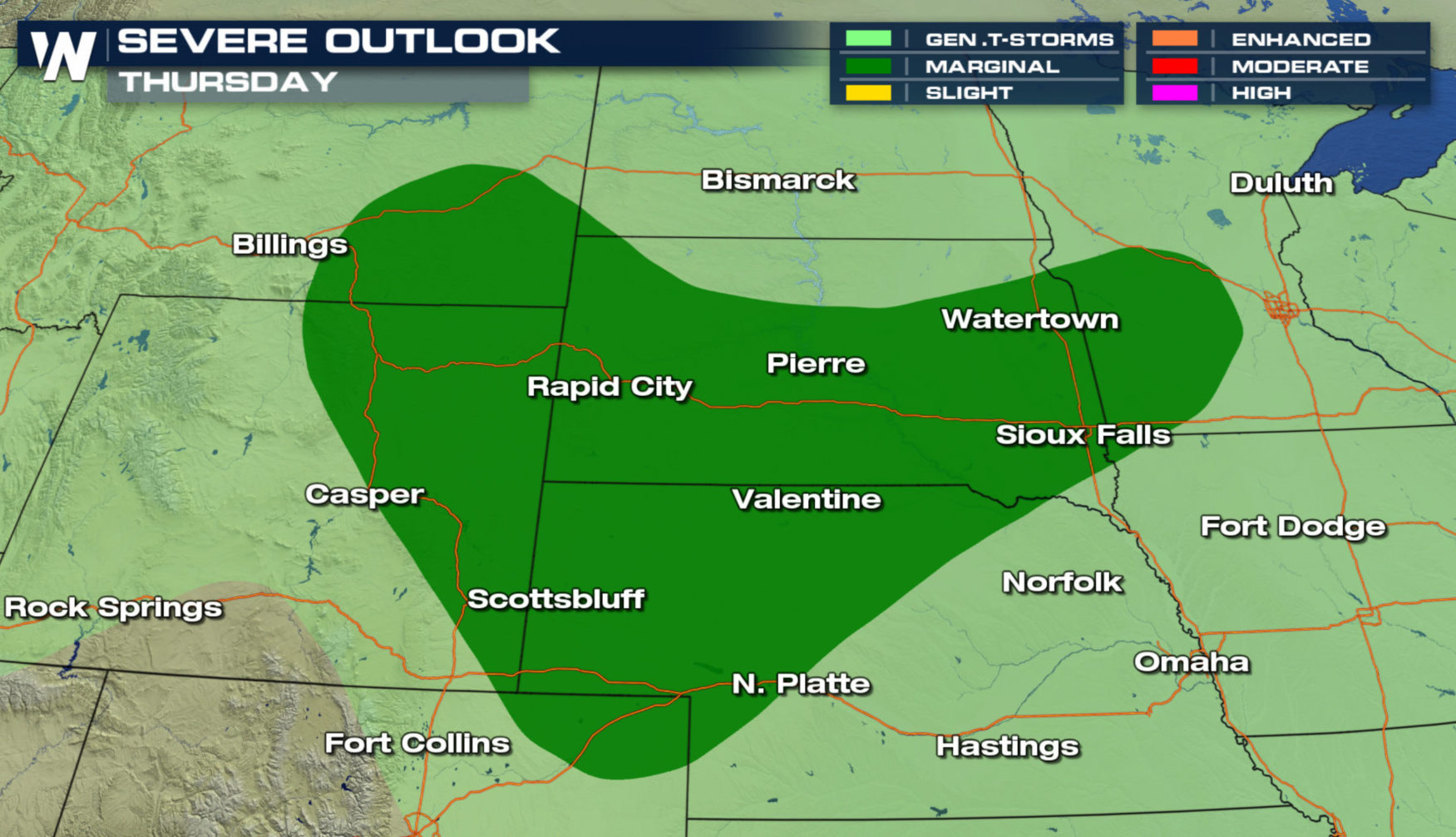
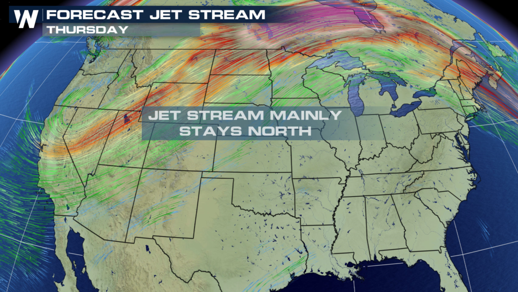
 With the Jet Stream barely moving for Thursday, Independence Day, a marginal severe weather risk continues in the Upper Midwest and High Plains. A stalled front will be the focus for a few severe storms in the late afternoon and evening.
 WeatherNation will have severe weather updates on-air and online, check back with us throughout the day for the latest information.
For WeatherNation: Meteorologist Mace Michaels
WeatherNation will have severe weather updates on-air and online, check back with us throughout the day for the latest information.
For WeatherNation: Meteorologist Mace Michaels
With the Jet Stream barely moving for Thursday, Independence Day, a marginal severe weather risk continues in the Upper Midwest and High Plains. A stalled front will be the focus for a few severe storms in the late afternoon and evening.
WeatherNation will have severe weather updates on-air and online, check back with us throughout the day for the latest information.
For WeatherNation: Meteorologist Mace MichaelsAll Weather News
More

Flooding, Severe Storms Target the Midwest Again
After an active week of storms across the nor
1 Aug 2026 1:40 AM


After Reaching Category 5, Genevieve Weakens in the Pacific
PacificFausto is now a post-tropical cyclone.
31 Jul 2026 1:30 AM

Flooding Risk Increases as Heavy Rain Targets the Tri-State Area
Tuesday, heavy rainfall moved across the Nort
30 Jul 2026 12:25 AM

Severe Weather: Energy From the Midwest Now in the Southeast
UPPER MIDWEST - Through Monday, dangerous tor
29 Jul 2026 10:30 PM