Severe Storms Linger Through Ohio Valley, Mid-Atlantic
Special Stories
4 Jun 2020 7:30 AM
https://www.facebook.com/WeatherNation/videos/176754920441762/
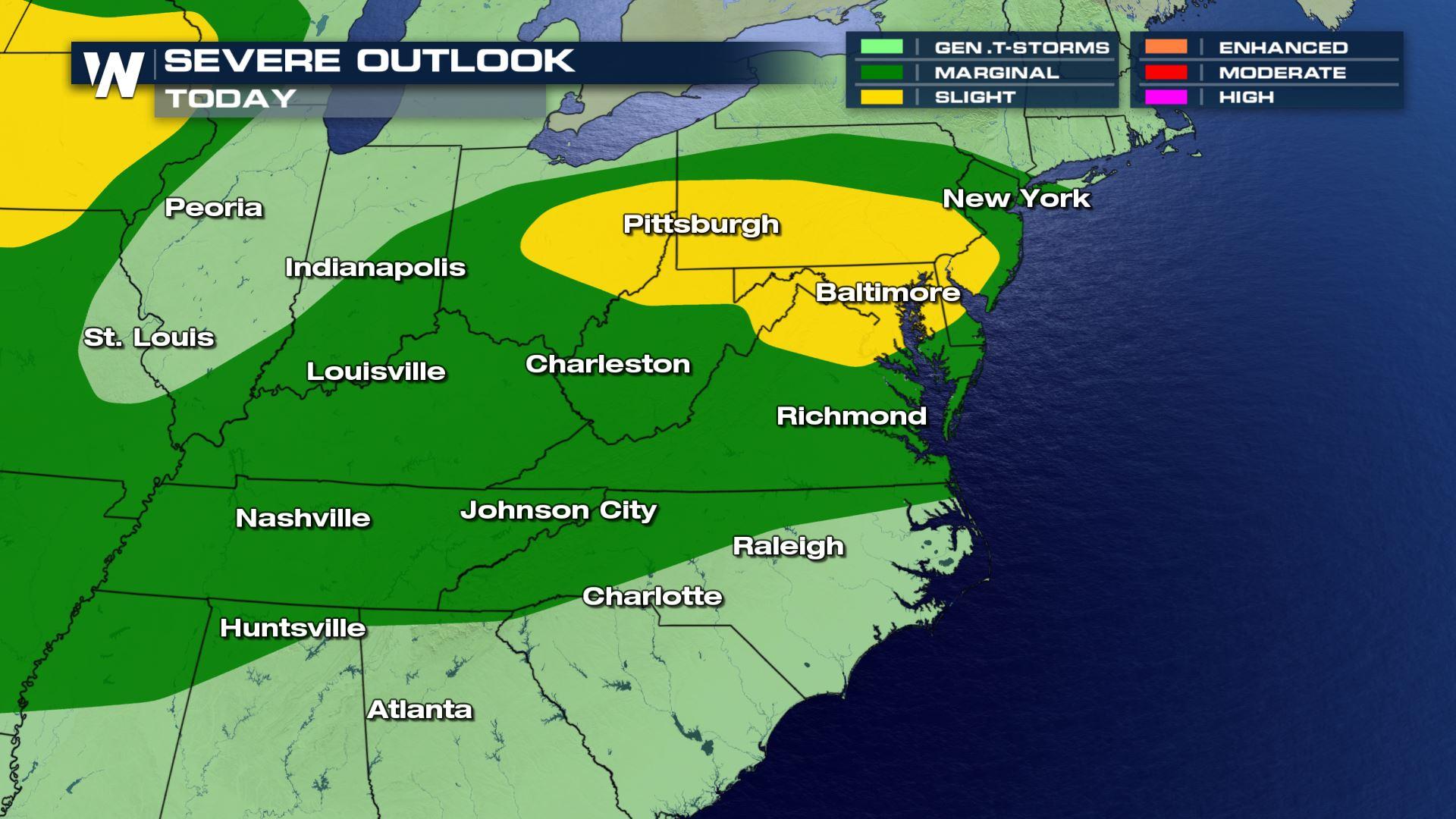
The threat for severe thunderstorms continues from the Ohio Valley to the Mid-Atlantic today (Thursday). The risk area from the Storm Prediction Center extends from the Central Plains through the Ohio Valley to the Jersey Shore. Damaging straight line winds will be the biggest concern but there also is a threat for large hail and even isolated tornadoes.
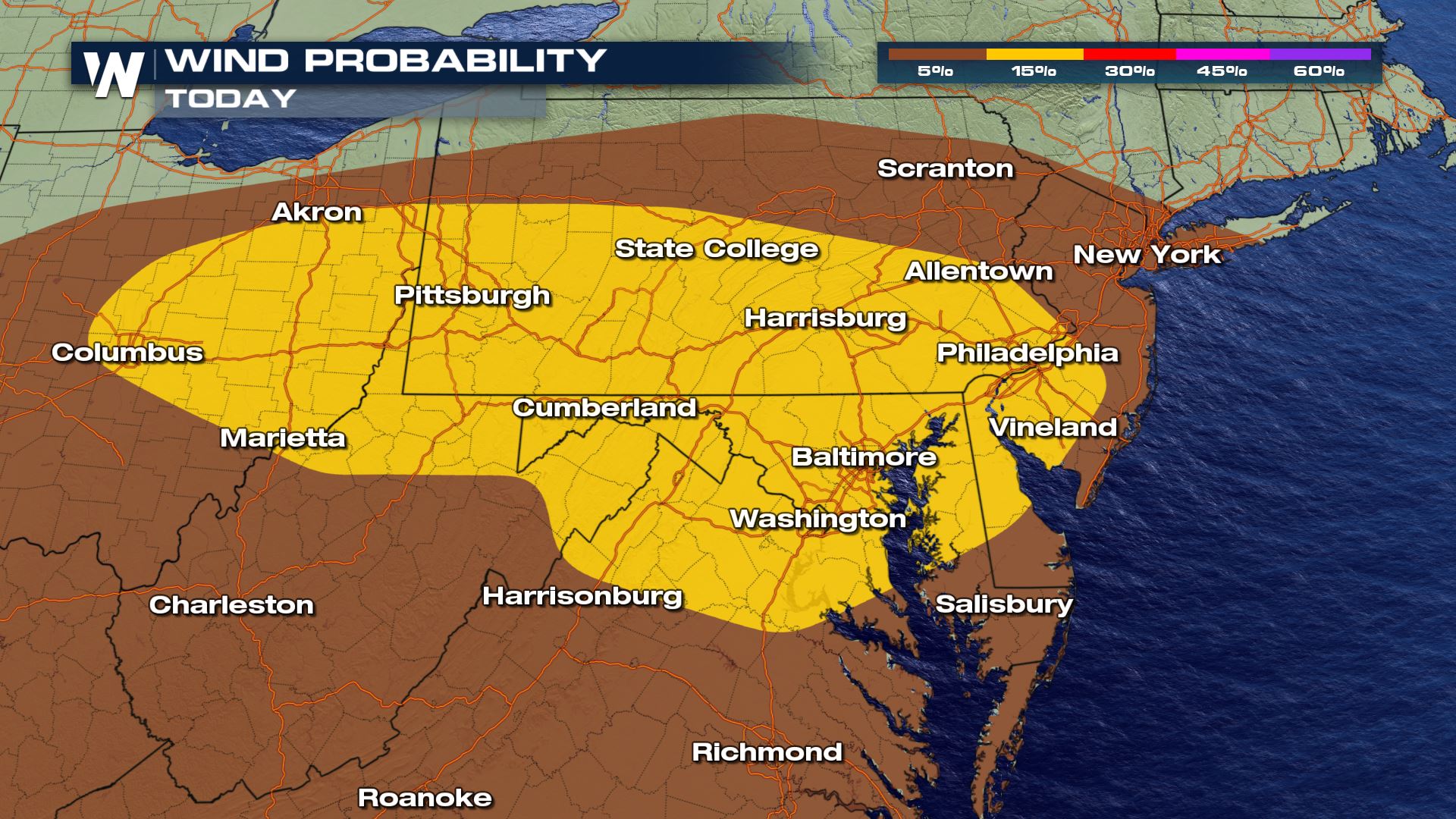 Jet Stream energy is expected to increase throughout the late afternoon and evening hours as instability builds, created by ample heat and humidity. This will help to fuel severe thunderstorm development. Scattered thunderstorms are expected to develop along a trough in the afternoon, continuing through the night.
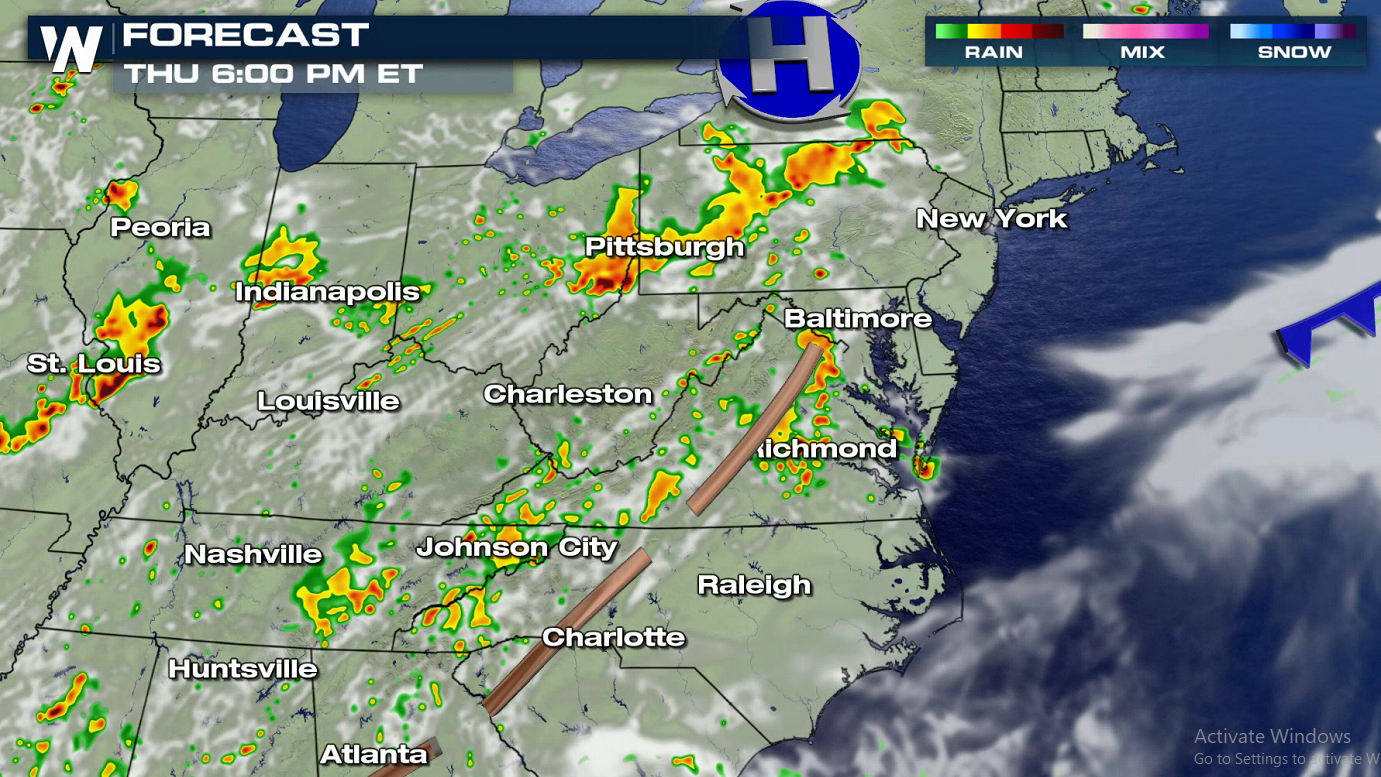
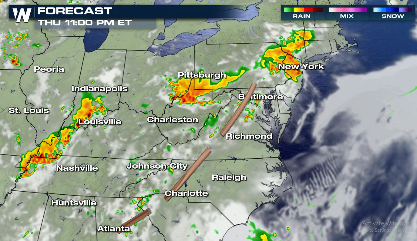 If you are in the risk areas, check back with WeatherNation for the latest severe weather information and forecast updates on-air and online. Not sure what the outlooks mean? Watch below to learn more:
https://www.youtube.com/watch?v=_lunoaofhN0
If you are in the risk areas, check back with WeatherNation for the latest severe weather information and forecast updates on-air and online. Not sure what the outlooks mean? Watch below to learn more:
https://www.youtube.com/watch?v=_lunoaofhN0
Jet Stream energy is expected to increase throughout the late afternoon and evening hours as instability builds, created by ample heat and humidity. This will help to fuel severe thunderstorm development. Scattered thunderstorms are expected to develop along a trough in the afternoon, continuing through the night.
If you are in the risk areas, check back with WeatherNation for the latest severe weather information and forecast updates on-air and online. Not sure what the outlooks mean? Watch below to learn more:
https://www.youtube.com/watch?v=_lunoaofhN0All Weather News
More
Fronts Continue To Spark Severe Weather Across the Plains
A cold front that brought record lows to the
18 Jul 2025 10:40 PM

Extreme Heat Impacts for the East Coast & South
Extreme heat continues to impact several area
18 Jul 2025 10:05 PM

Flooding Threat Remains Elevated in the East
A cold front pushing through the Eastern Seab
18 Jul 2025 9:10 PM

EF-2 Firenado from the Deer Creek Fire in Utah
A fire tornado was spotted near La Sal, Utah
18 Jul 2025 7:30 AM

Tropical System Brings Flood Risk to the Central Gulf
Time has run out for notable tropical develop
18 Jul 2025 3:05 AM

Heavy Rain, Flooding Threat Returns to Florida
Keep the rain boots handy in Florida - heavy
13 Jul 2025 12:50 PM

Severe Storm Risk Pushes into the Great Lakes, Ohio Valley
Friday was another busy day with severe weath
12 Jul 2025 8:00 PM