Snow Moves From Chicago to Smokies

An upper low breaking off from the main flow in the Great Lakes drifted through places like Milwaukee and Chicago on Friday, bringing cold air, brutal wind chills, and snow! Light snow was reported at the Chicago area airports, with anywhere from half an inch to around 2" accumulating. Areas near Duluth picked up 4-6 inches!
The cold air will continue to drop farther south through the Midwest, Ohio Valley, and Appalachia Saturday. There will be enough cold air and moisture to continue to bring snow as the low moves south. Residents in Indiana and Ohio woke up to snow showers, with advisories for Ohio (1-3") continuing through midday.
Winds from the north and northwest will enhance the upslope snow potential for the west slope of the Appalachians Saturday afternoon. As temperatures warm during the peak heating hours of the day though, most of the snow will transition back to rain for Virginia and North Carolina. Lingering snow showers are possible through Saturday evening in the Smokies of East Tennessee and western North Carolina.
Snow will be generally light, but upwards of 3" will be possible in the Midwest, with isolated higher totals in the Blue Ridge Mountains of Tennessee, North Carolina, and Southwest Virginia.
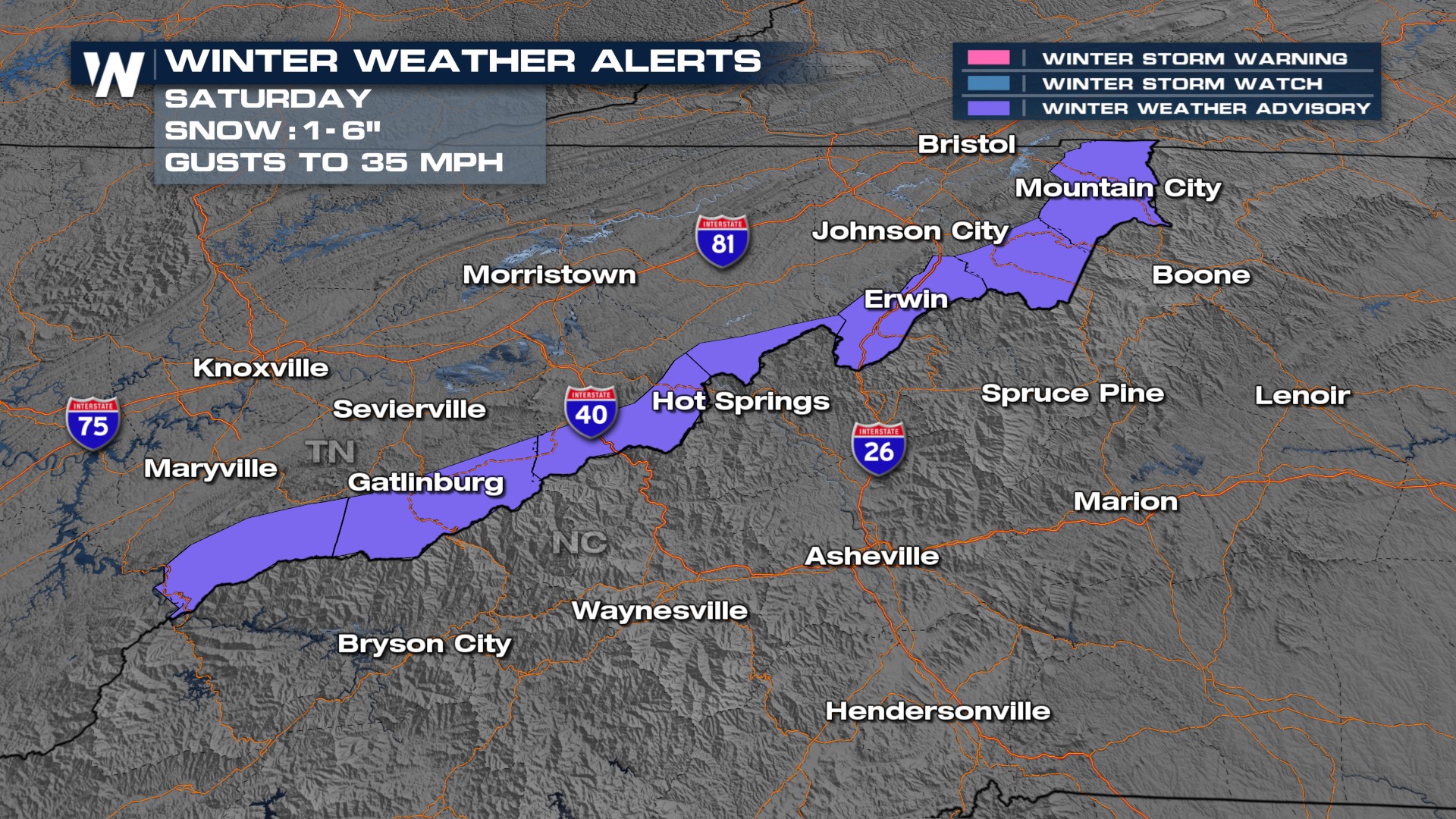
 A winter weather advisory has been issued for the Smoky Mountains, up the spine of the Blue Ridge, in eastern Tennessee for 1-6" of snow, gusty winds and occasional low visibility. The highest snow totals will be above 4,000 feet in elevation, with up to 1" of snow above 2,500 feet in elevation. Watch out for slippery areas on I-40 as well as bridges and overpasses in this area.