Strong Wind, Snow Blast Northwest U.S.
Special Stories
14 Oct 2020 8:00 AM
Hurricane-force wind gusts roared across the Rocky Mountain Range Tuesday night and Wednesday morning as the weather pattern becomes much more active across this part of the country.
https://twitter.com/WeatherNation/status/1316363376059129864
Big Sky, Montana recorded a maximum wind gust of 71 miles per hour early Wednesday. That wasn't even the strongest gust!
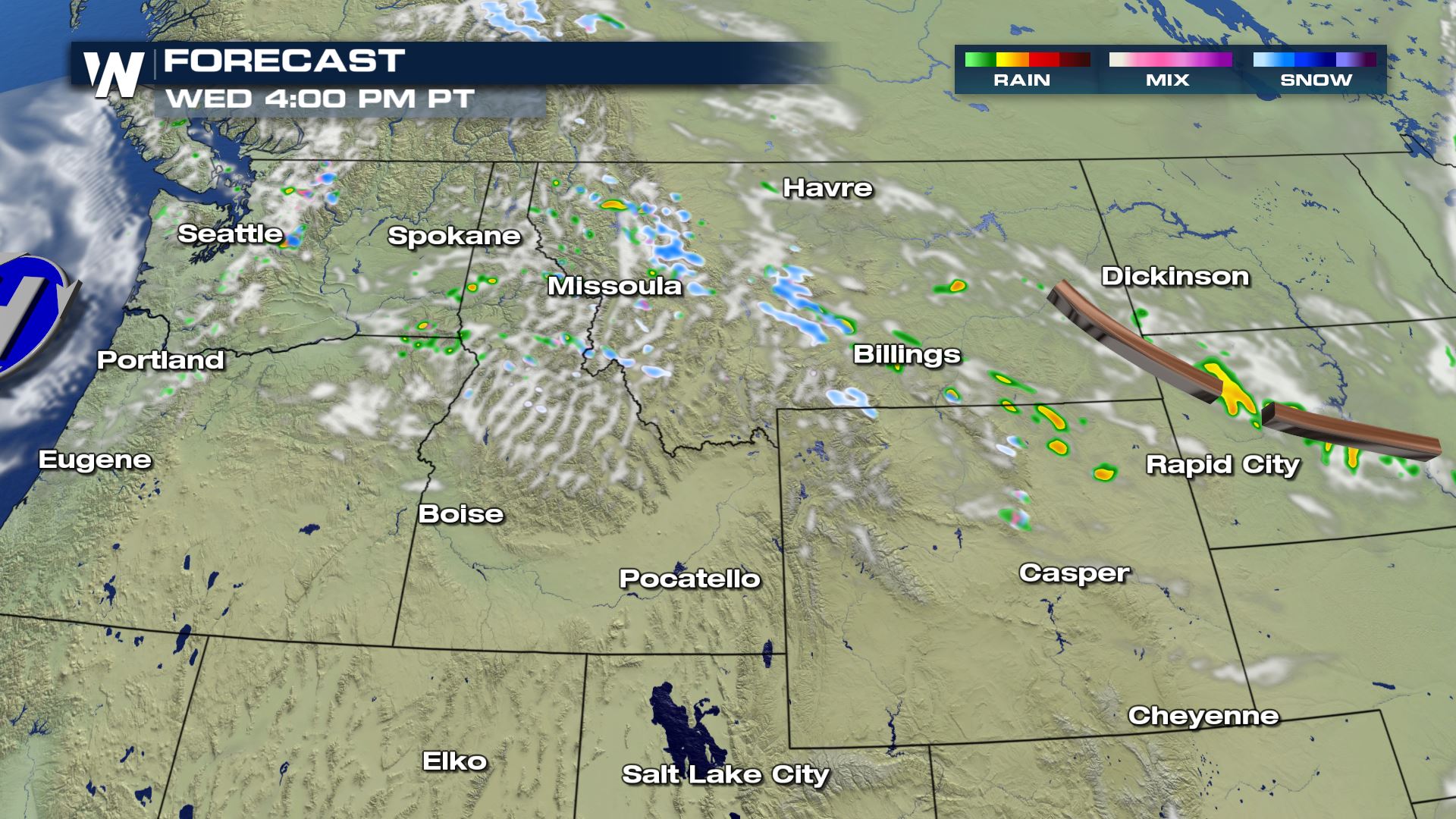
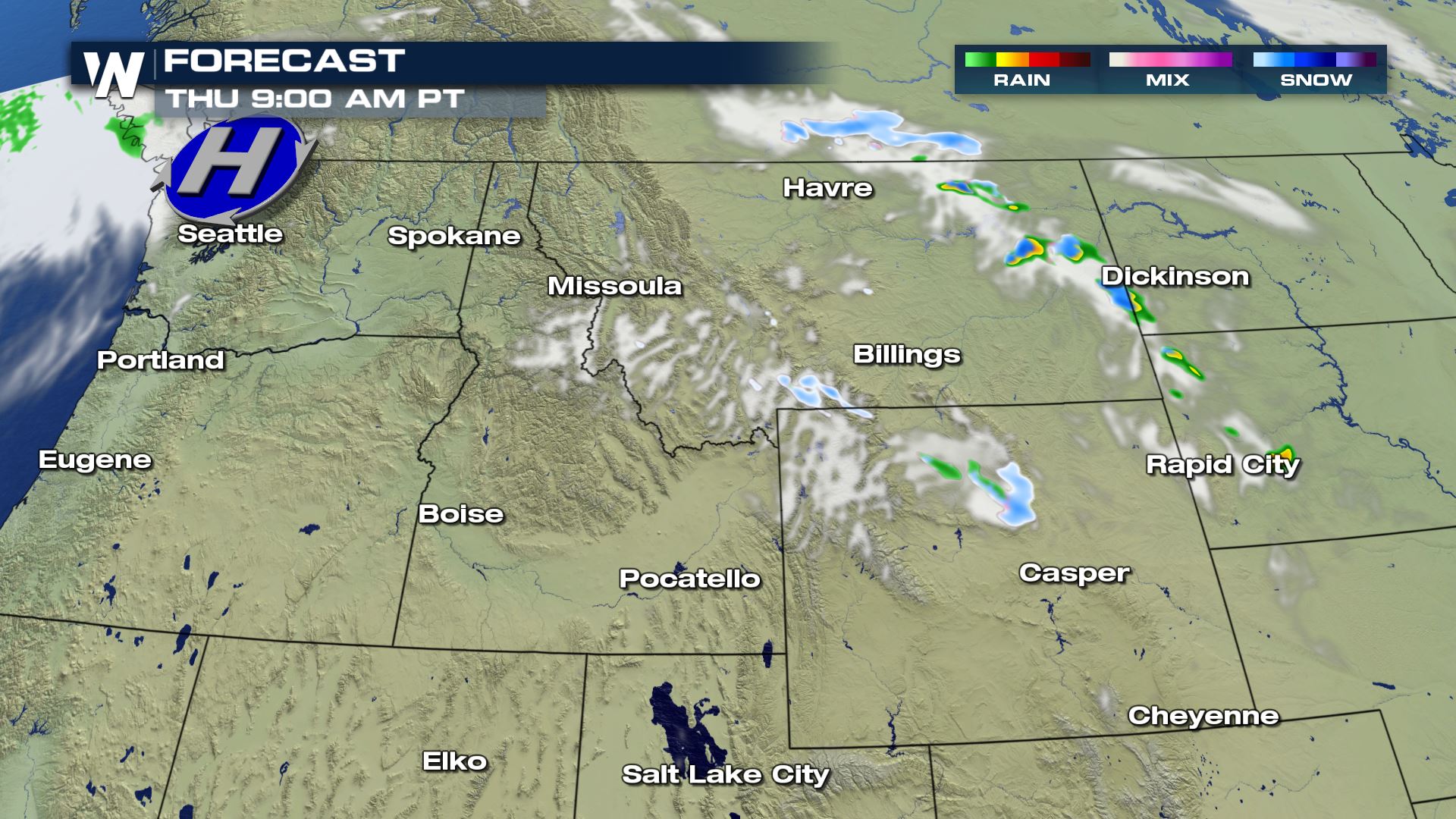
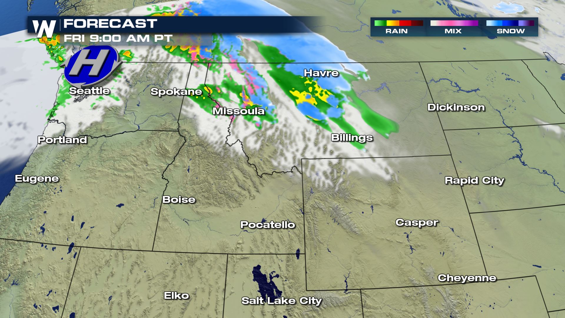
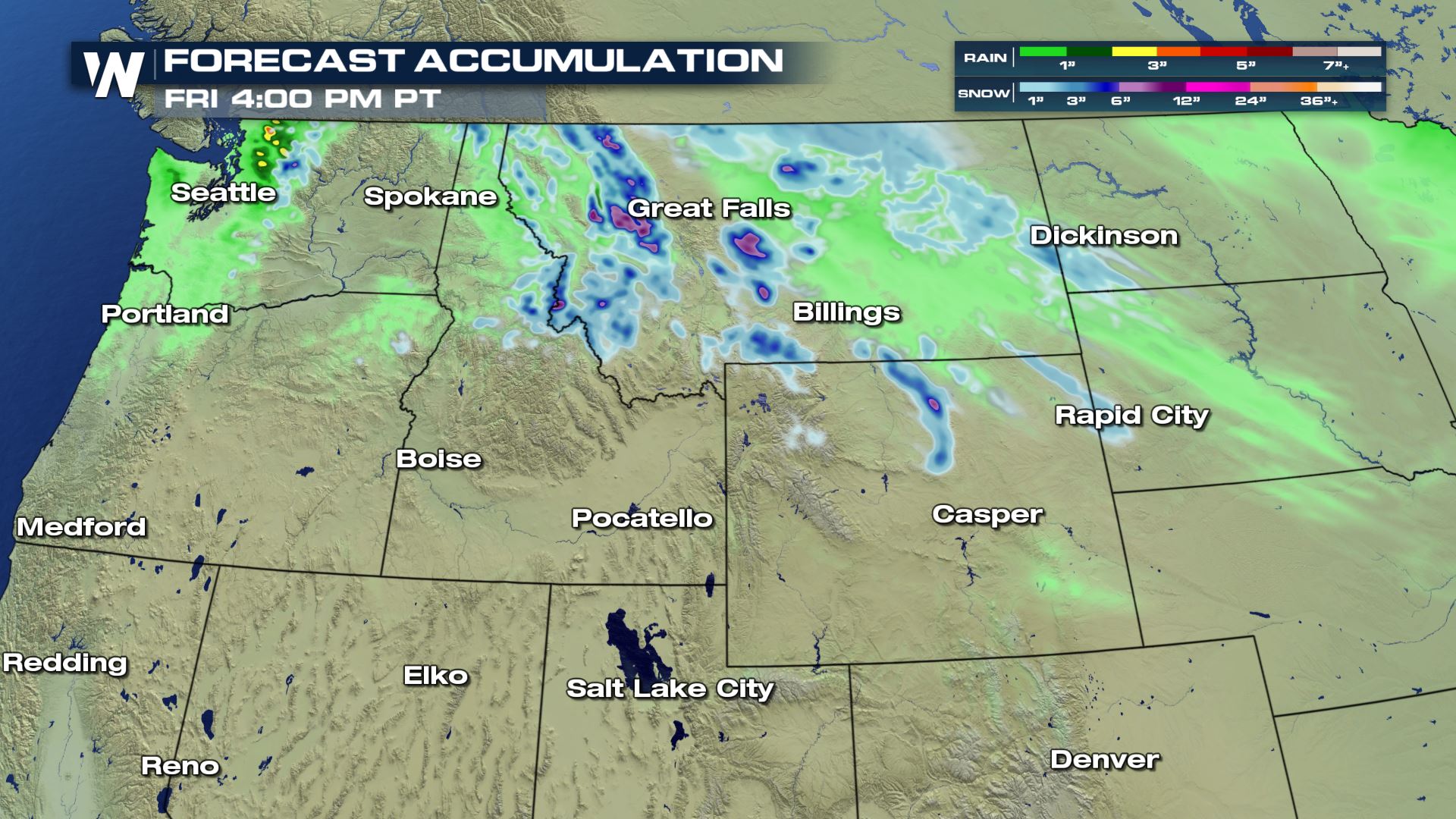
 Moisture in the form of rain and snow showers will taper off through the day on Wednesday with the heaviest of precipitation already behind us. However another batch of rain and snow will arrive later this week. Take a look:
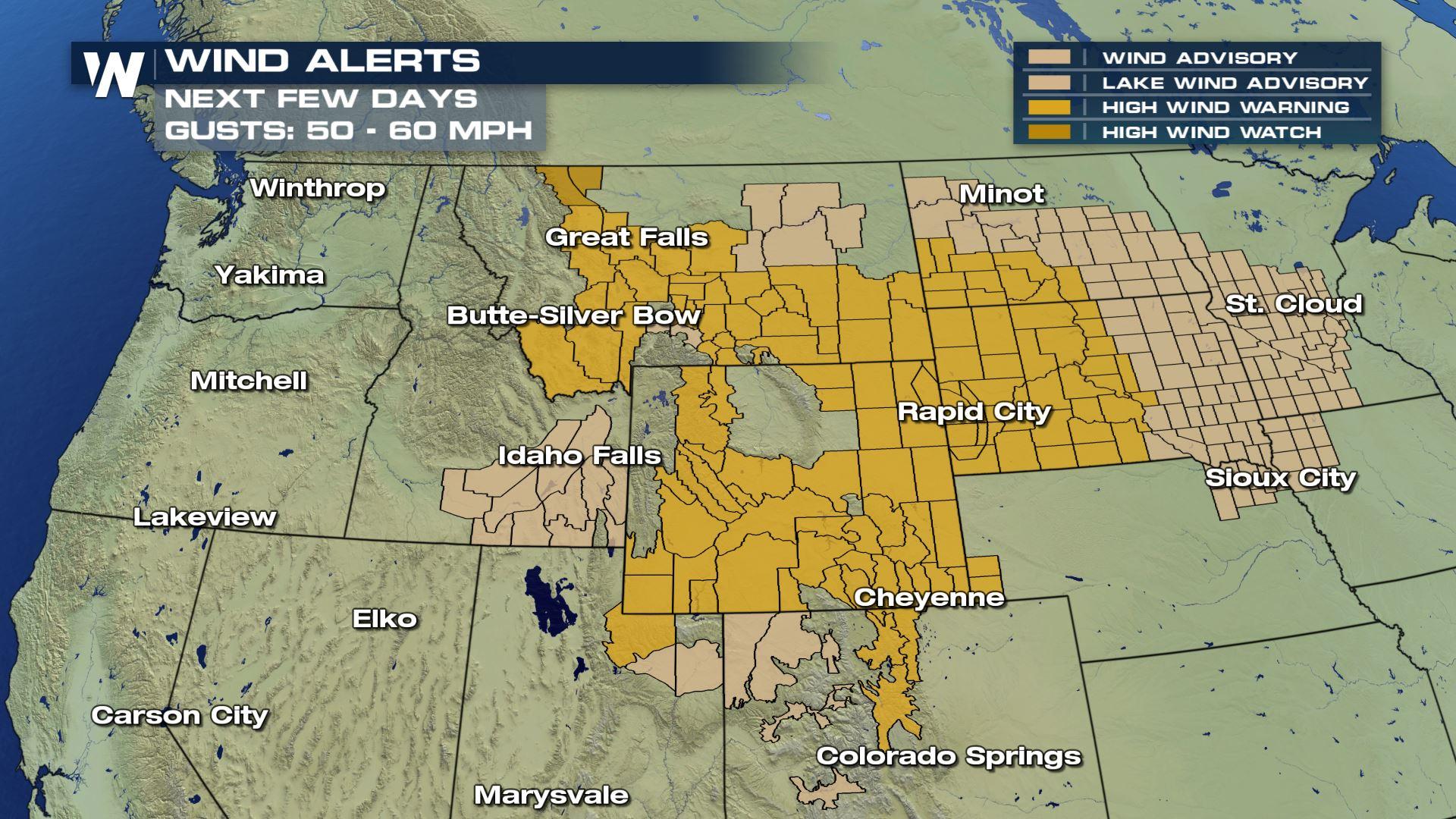
 Unfortunately, the wind will continue to be robust through the end of the week. As each cold front passes through, wind gusts may reach up to 60 mph! Since we have already observed wind gusts up to 100 mph this week in Colorado, locally higher gusts will be possible.
 Burn bans are in effect due to the dry and windy weather, while fire weather warnings have been issued too. Check your local National Weather Service Office and Emergency Management agency for more information. Join us at :50 past the hour, every hour for updates on the Western region forecast.
24-Hour Maximum Wind Gusts as of Wednesday
- Berthoud Pass, Colorado: 104 mph
- Arlington, WY: 81 mph
- Cameron Pass, CO: 73 mph
- Big Sky, MT: 71 mph
- Craters of Moon, ID: 70 mph
- Hodges, MT: 64 mph
Moisture in the form of rain and snow showers will taper off through the day on Wednesday with the heaviest of precipitation already behind us. However another batch of rain and snow will arrive later this week. Take a look:
Unfortunately, the wind will continue to be robust through the end of the week. As each cold front passes through, wind gusts may reach up to 60 mph! Since we have already observed wind gusts up to 100 mph this week in Colorado, locally higher gusts will be possible.
Burn bans are in effect due to the dry and windy weather, while fire weather warnings have been issued too. Check your local National Weather Service Office and Emergency Management agency for more information. Join us at :50 past the hour, every hour for updates on the Western region forecast.All Weather News
More
Fronts Continue To Spark Severe Weather Across the Plains
A cold front that brought record lows to the
18 Jul 2025 10:40 PM

Extreme Heat Impacts for the East Coast & South
Extreme heat continues to impact several area
18 Jul 2025 10:05 PM

Flooding Threat Remains Elevated in the East
A cold front pushing through the Eastern Seab
18 Jul 2025 9:10 PM

EF-2 Firenado from the Deer Creek Fire in Utah
A fire tornado was spotted near La Sal, Utah
18 Jul 2025 7:30 AM

Tropical System Brings Flood Risk to the Central Gulf
Time has run out for notable tropical develop
18 Jul 2025 3:05 AM

Heavy Rain, Flooding Threat Returns to Florida
Keep the rain boots handy in Florida - heavy
13 Jul 2025 12:50 PM

Severe Storm Risk Pushes into the Great Lakes, Ohio Valley
Friday was another busy day with severe weath
12 Jul 2025 8:00 PM