Rain & Snow For The Northern Rockies

Top Stories
14 May 2025 12:40 AM
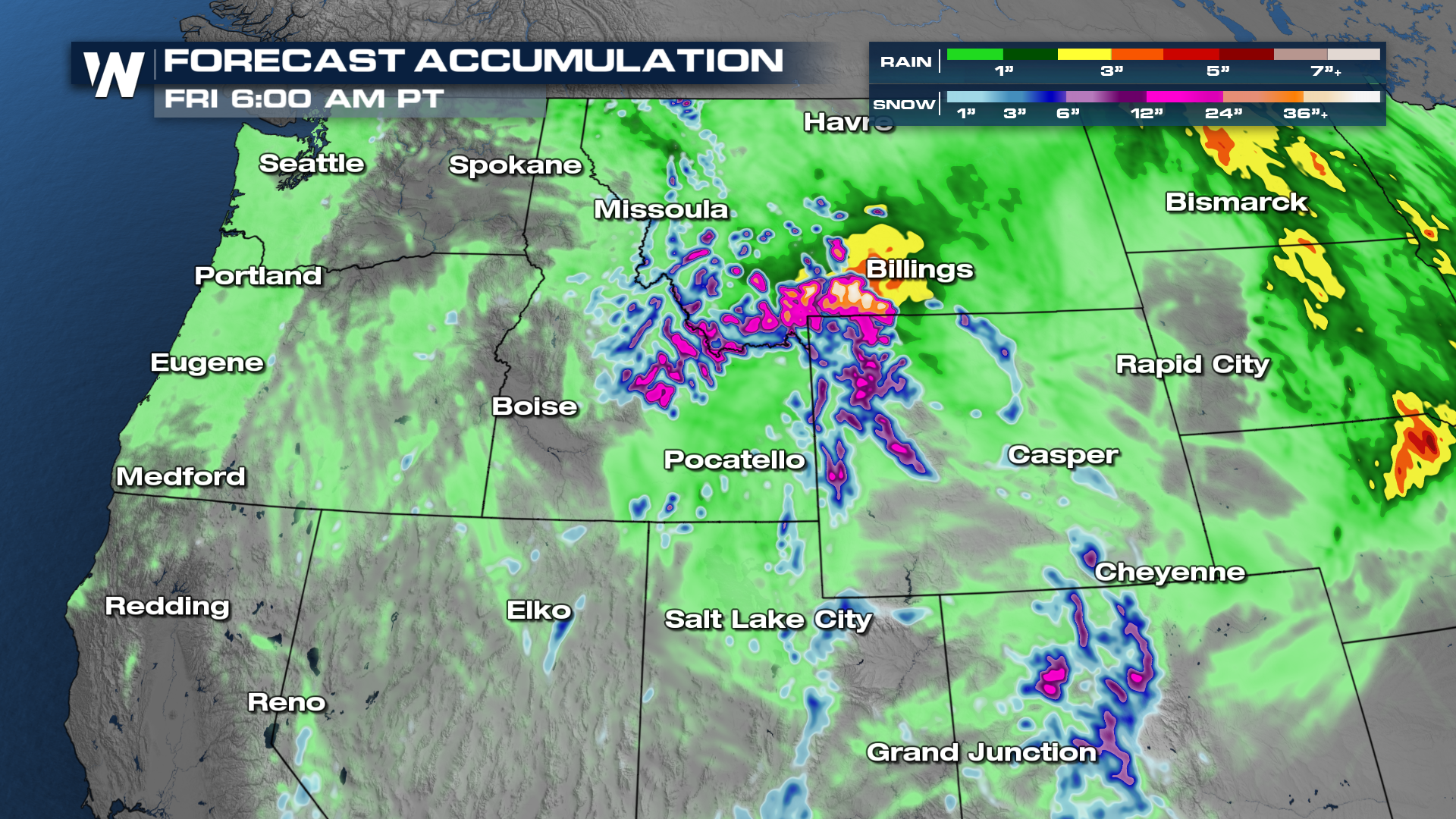
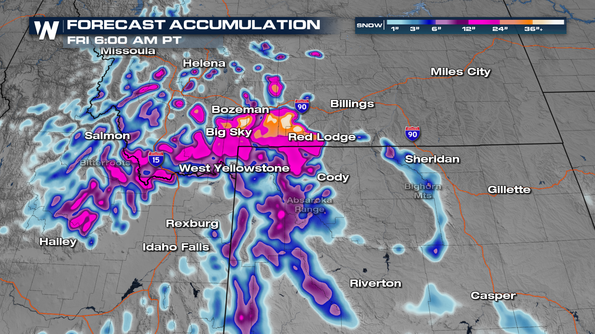
ABOVE - Winter is hanging on for the Northern Rockies with winter weather alerts remaining in place through Wednesday, May 14th. Winter Storm Warnings (in pink) are in place for snowfall totals up to 3 feet above 7000 feet and winds gusting as high as 30 mph.
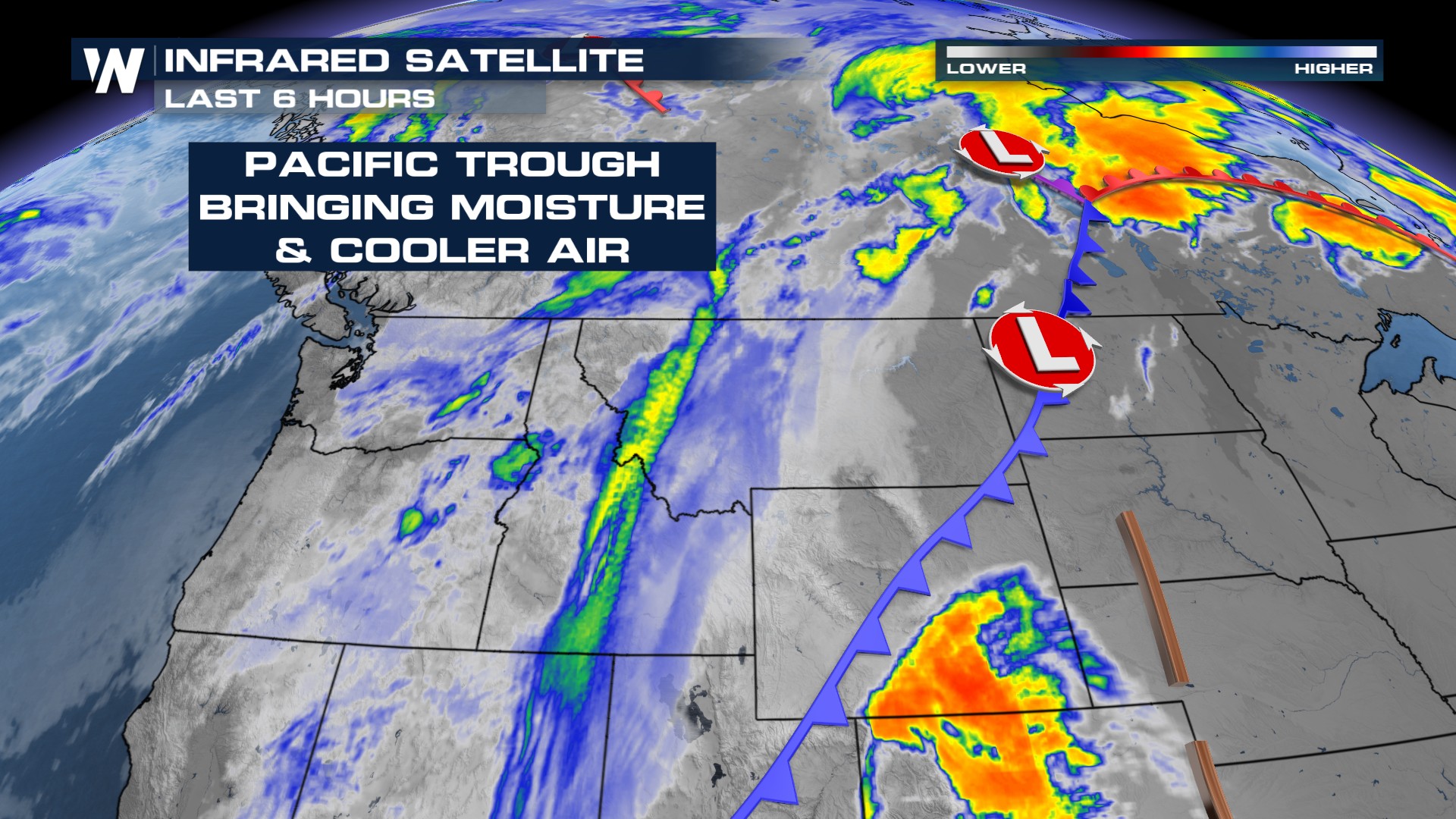
What's causing this? A storm system moving through the Rockies will deliver rain, thunderstorms, and snow through Wednesday, May 14th.
 Timing
Scattered development looks to favor the afternoon hours for many spots, but snow will carry on for the higher elevations through Wednesday.
The rain/snow line will run about 7500-8000ft. The higher elevations could get 6-12 inches of snow accumulation.
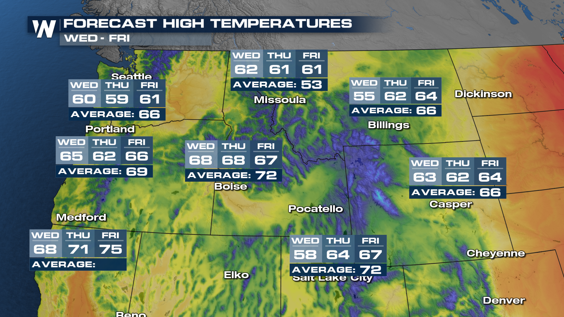
 This storm system will also deliver cooler temps.
 Stay with WeatherNation for the latest!
All Weather News
More
Wildfire Outbreak in the Pacific Northwest
SPOKANE, WA - On Saturday, August 1st, the Ol
3 Aug 2026 1:55 AM

More Storms for the East Through Monday
A low-pressure system that moved through the
3 Aug 2026 1:50 AM


After Reaching Category 5, Genevieve Weakens in the Pacific
PacificGenevieve formed last Friday south of
3 Aug 2026 12:30 AM

Flooding, Severe Storms Target the Midwest Again
After an active week of storms across the nor
1 Aug 2026 1:40 AM

Flooding Risk Increases as Heavy Rain Targets the Tri-State Area
Tuesday, heavy rainfall moved across the Nort
30 Jul 2026 12:25 AM

Severe Weather: Energy From the Midwest Now in the Southeast
UPPER MIDWEST - Through Monday, dangerous tor
29 Jul 2026 10:30 PM