Severe Storms Possible in the Northeast Today

Special Stories
10 Oct 2020 4:40 PM
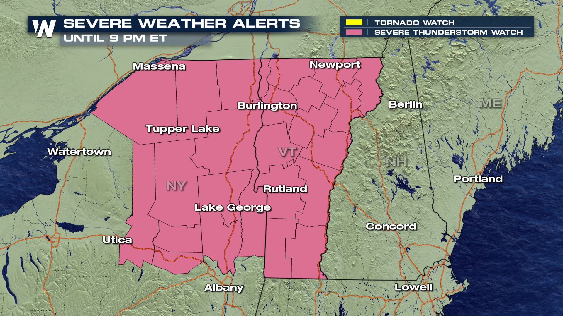
With ongoing severe thunderstorm warnings, a severe thunderstorm watch has been issued for northern New York and Vermont until 9 PM ET Saturday for damaging wind gusts up to 70 mph and isolated large hail up to 1" in diameter.
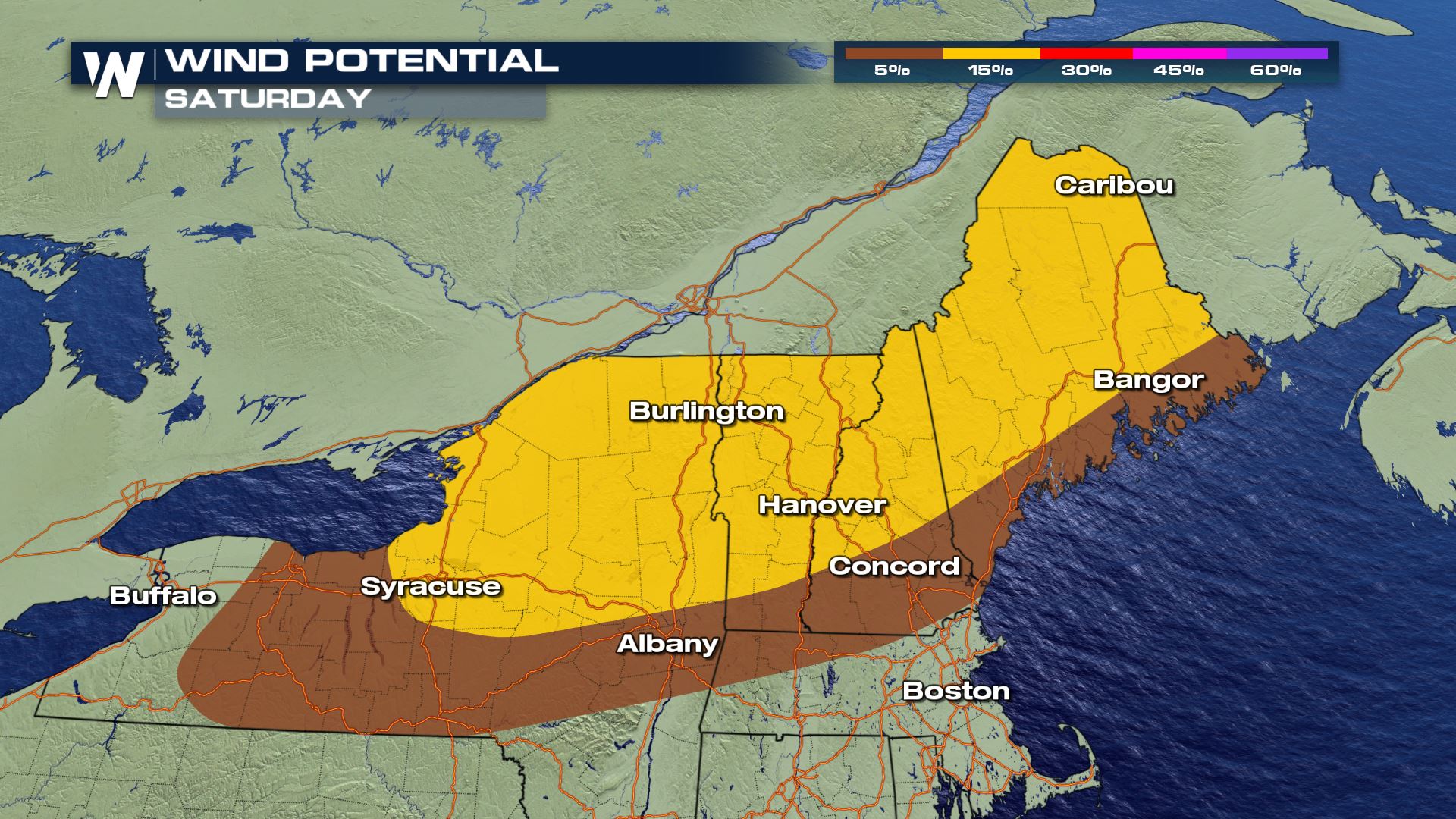
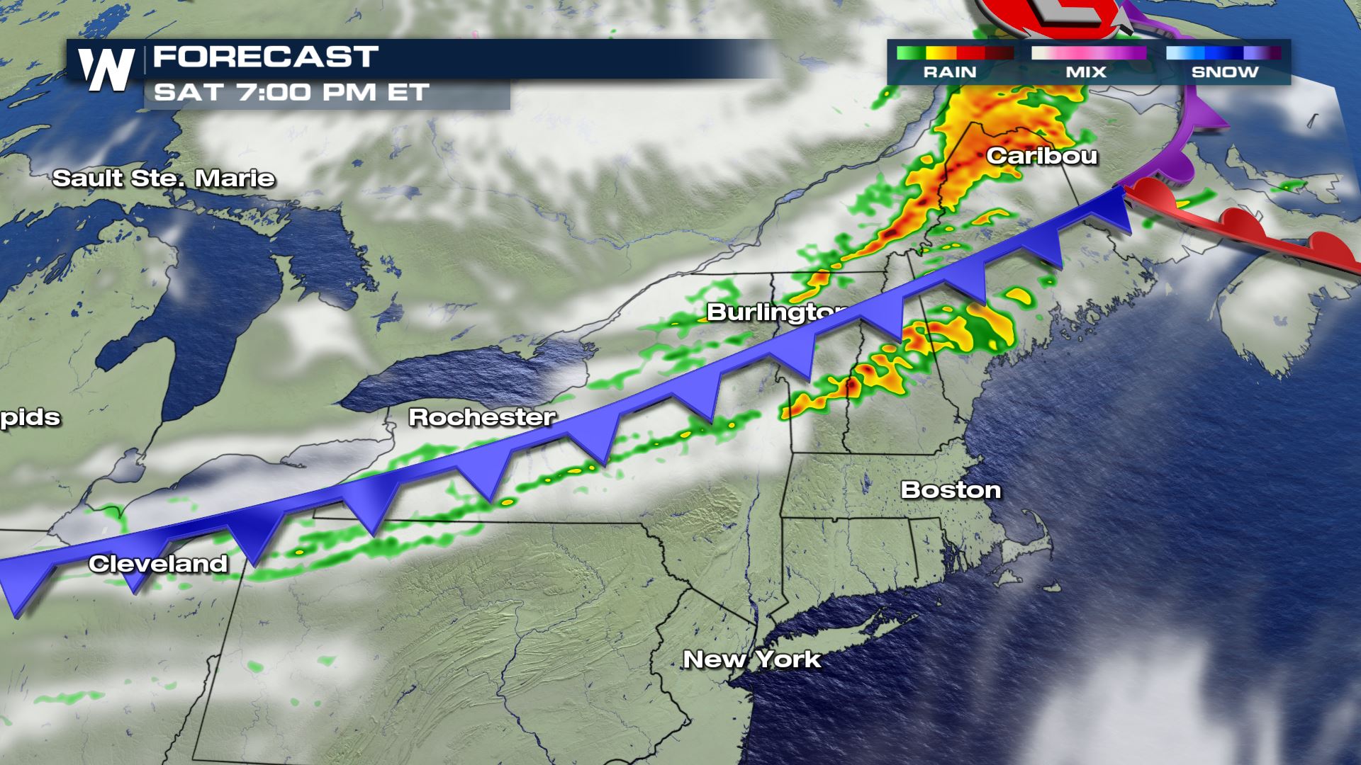
 As an upper level trough moving through Canada and the Great Lakes amplifies today and a quick-moving surface cold front moves in, New York and New England states have a risk for severe storms this Saturday, especially during the afternoon hours.
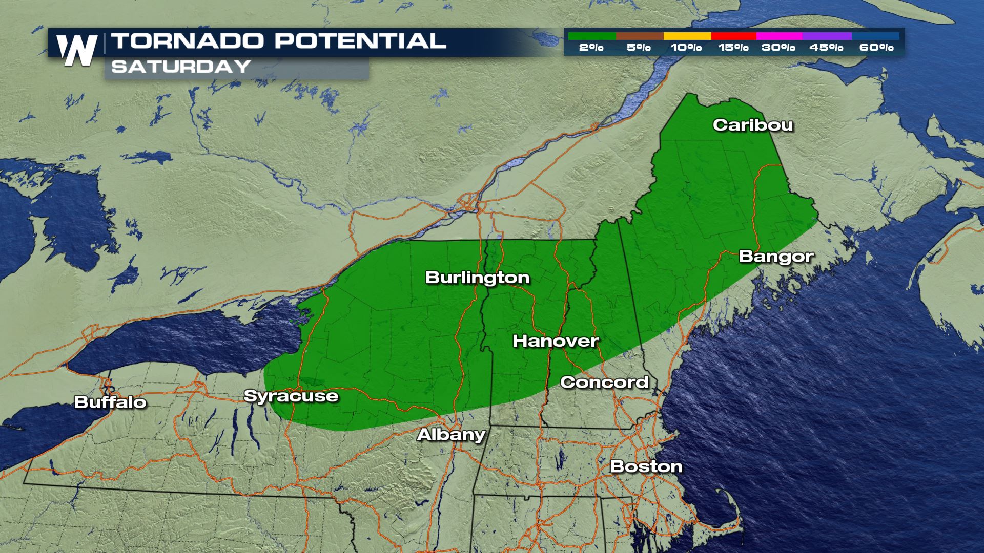
In addition to these forcing mechanisms there will be enough low level moisture in addition with daytime heating to help bring in storms with the risk of damaging winds and some possible spin-up tornadoes (QLCS) embedded within the line of storms.
As an upper level trough moving through Canada and the Great Lakes amplifies today and a quick-moving surface cold front moves in, New York and New England states have a risk for severe storms this Saturday, especially during the afternoon hours.
In addition to these forcing mechanisms there will be enough low level moisture in addition with daytime heating to help bring in storms with the risk of damaging winds and some possible spin-up tornadoes (QLCS) embedded within the line of storms.
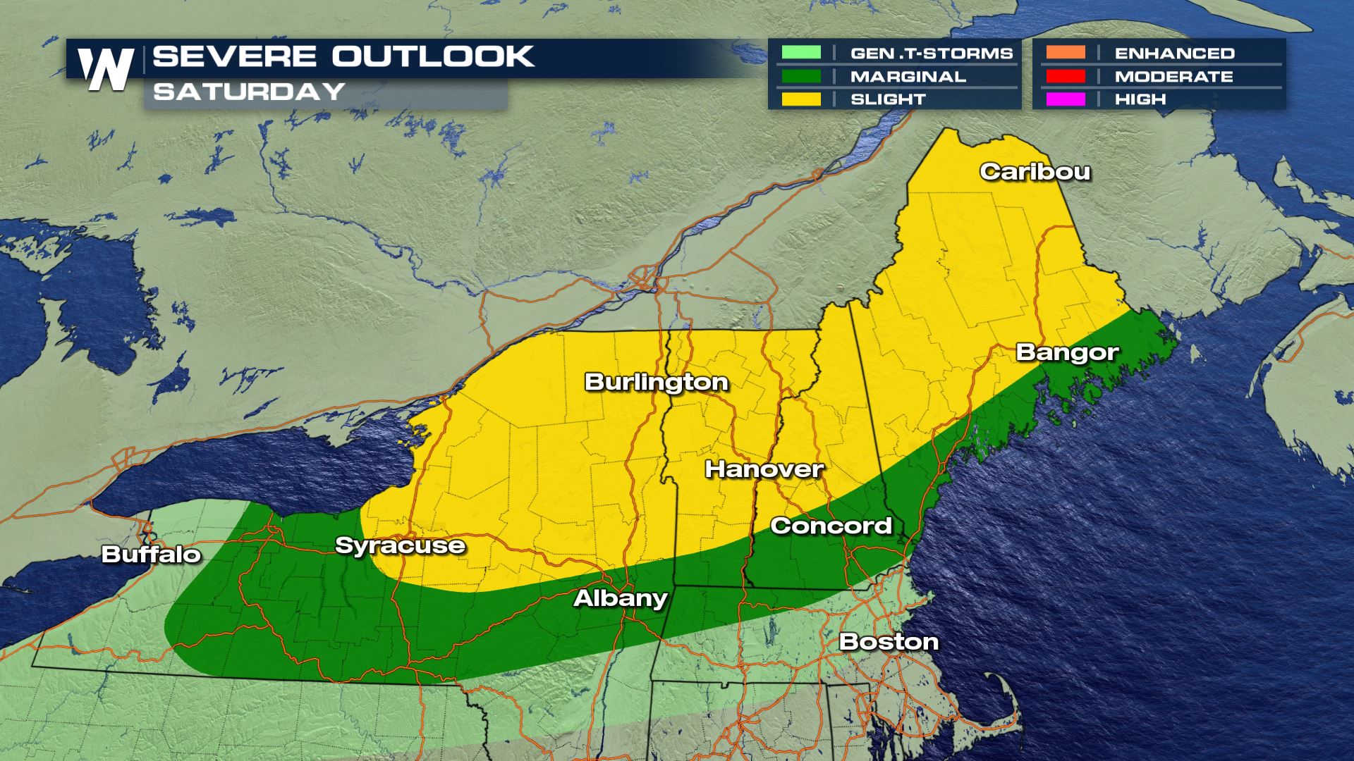
 As we monitor potential organization along the cold front, if a line of storms forms with some shear and rotation in the atmosphere we will have to monitor the brief spin-up tornado threat.
 WeatherNation will keep you updated throughout the weekend on the potential of severe thunderstorms.
As an upper level trough moving through Canada and the Great Lakes amplifies today and a quick-moving surface cold front moves in, New York and New England states have a risk for severe storms this Saturday, especially during the afternoon hours.
In addition to these forcing mechanisms there will be enough low level moisture in addition with daytime heating to help bring in storms with the risk of damaging winds and some possible spin-up tornadoes (QLCS) embedded within the line of storms.
Saturday Severe Outlook
As we monitor potential organization along the cold front, if a line of storms forms with some shear and rotation in the atmosphere we will have to monitor the brief spin-up tornado threat.
Forecast
Ongoing storms will track along the cold front and move off into the Atlantic by tonight.
WeatherNation will keep you updated throughout the weekend on the potential of severe thunderstorms.
All Weather News
More
Wildfire Outbreak in the Pacific Northwest
Conditions have been incredibly dry out west.
2 Aug 2026 1:30 PM

After Reaching Category 5, Genevieve Weakens in the Pacific
PacificGenevieve formed on last Friday south
2 Aug 2026 1:25 PM

More Storms for the East Sunday and Monday
A low-pressure system crashing through the Mi
2 Aug 2026 1:25 PM


Flooding, Severe Storms Target the Midwest Again
After an active week of storms across the nor
1 Aug 2026 1:40 AM

Flooding Risk Increases as Heavy Rain Targets the Tri-State Area
Tuesday, heavy rainfall moved across the Nort
30 Jul 2026 12:25 AM

Severe Weather: Energy From the Midwest Now in the Southeast
UPPER MIDWEST - Through Monday, dangerous tor
29 Jul 2026 10:30 PM