Weekend Severe Storms Update
Top Stories
8 Jun 2019 8:35 AM
Severe storms are in the forecast again this weekend, and also the threat for flooding and flash flooding.
There'a a Slight Risk for dangerous storms from parts of Minnesota and continuing all the way down the Plains into parts of Western Texas.
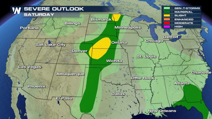 The greatest potential for development remains over parts of the central Great Plains and the Red River.
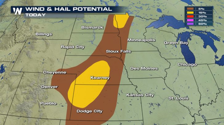
Large hail and damaging winds will be the biggest concerns in this region.
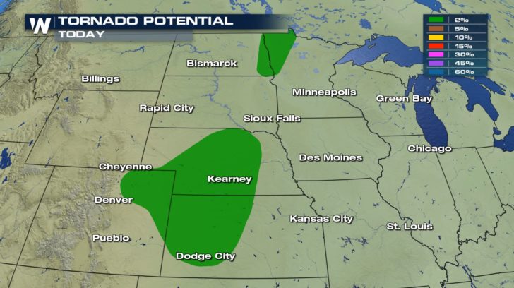
 However, we cannot rule out tornadoes with any severe storms that do develop, especially as we head into this evening along the front/dryline.
 The timing of storms will come in two rounds -- the first will be along the cold front this afternoon and evening.
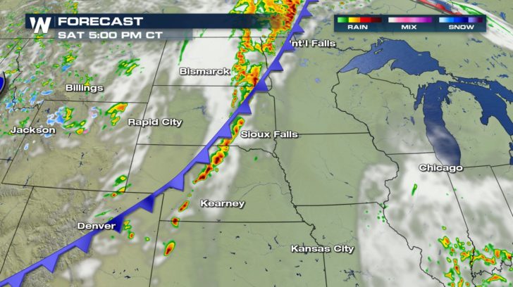 The next round is expected to pop up late tonight and overnight into the early morning hours.
Make sure to have a way to get warnings BEFORE you go to sleep whether it's a NOAA weather radio or our app on your phone.
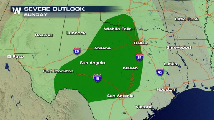
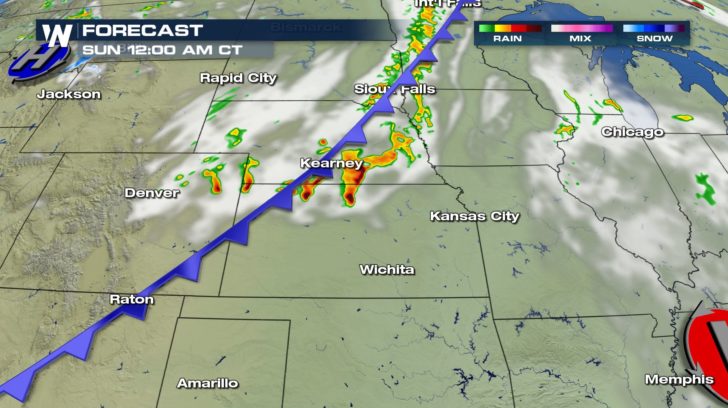 The southern end of this same front will produce the threat of isolated severe storms across parts of Texas and Oklahoma on Sunday.
Damaging winds, hail, and even a couple of tornadoes are not out of the question with any storms that form.
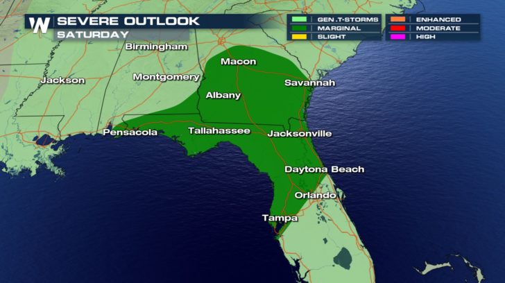
 There's also a possibility today across the southeast from Tampa, FL, up toward Macon, GA.
 Storms are expected to continue this afternoon and evening across the southeast.
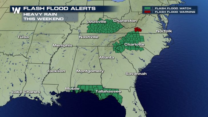
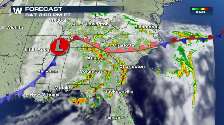 In addition to the severe weather threat this weekend, any of the storms that do form have the potential for flash flooding.
Always remember to turn around, don't drown!
 For WeatherNation, I'm Meteorologist Meredith Garofalo
 The greatest potential for development remains over parts of the central Great Plains and the Red River.
Large hail and damaging winds will be the biggest concerns in this region.
 However, we cannot rule out tornadoes with any severe storms that do develop, especially as we head into this evening along the front/dryline.
 The timing of storms will come in two rounds -- the first will be along the cold front this afternoon and evening.
 The next round is expected to pop up late tonight and overnight into the early morning hours.
Make sure to have a way to get warnings BEFORE you go to sleep whether it's a NOAA weather radio or our app on your phone.
 The southern end of this same front will produce the threat of isolated severe storms across parts of Texas and Oklahoma on Sunday.
Damaging winds, hail, and even a couple of tornadoes are not out of the question with any storms that form.
 There's also a possibility today across the southeast from Tampa, FL, up toward Macon, GA.
 Storms are expected to continue this afternoon and evening across the southeast.
 In addition to the severe weather threat this weekend, any of the storms that do form have the potential for flash flooding.
Always remember to turn around, don't drown!
 For WeatherNation, I'm Meteorologist Meredith Garofalo
All Weather News
More