Sunday Severe Weather Outlook

Special Stories
18 Jul 2020 11:30 AM
Welcome to the weekend! Before you unload the week and kick it into Weekend Mode, give this article a quick two minute read so you know what weather to expect.
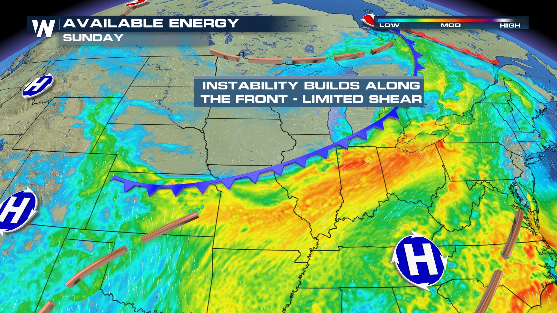
First, it's going to be a hot and steamy weekend for many with high temperatures surging to 90 to 95 degrees with a heat index (feels-like temperature) of 100 to 105 degrees! We wouldn't be surprised if a couple locales feel as hot as 110 degrees this weekend. Please take it easy in the heat and remember: Water, water, water! Stay hydrated. Because it will be so hot and steamy this weekend, the atmosphere will be energized with a lot of potential energy to use. An advancing cold front will help spark storms this weekend.
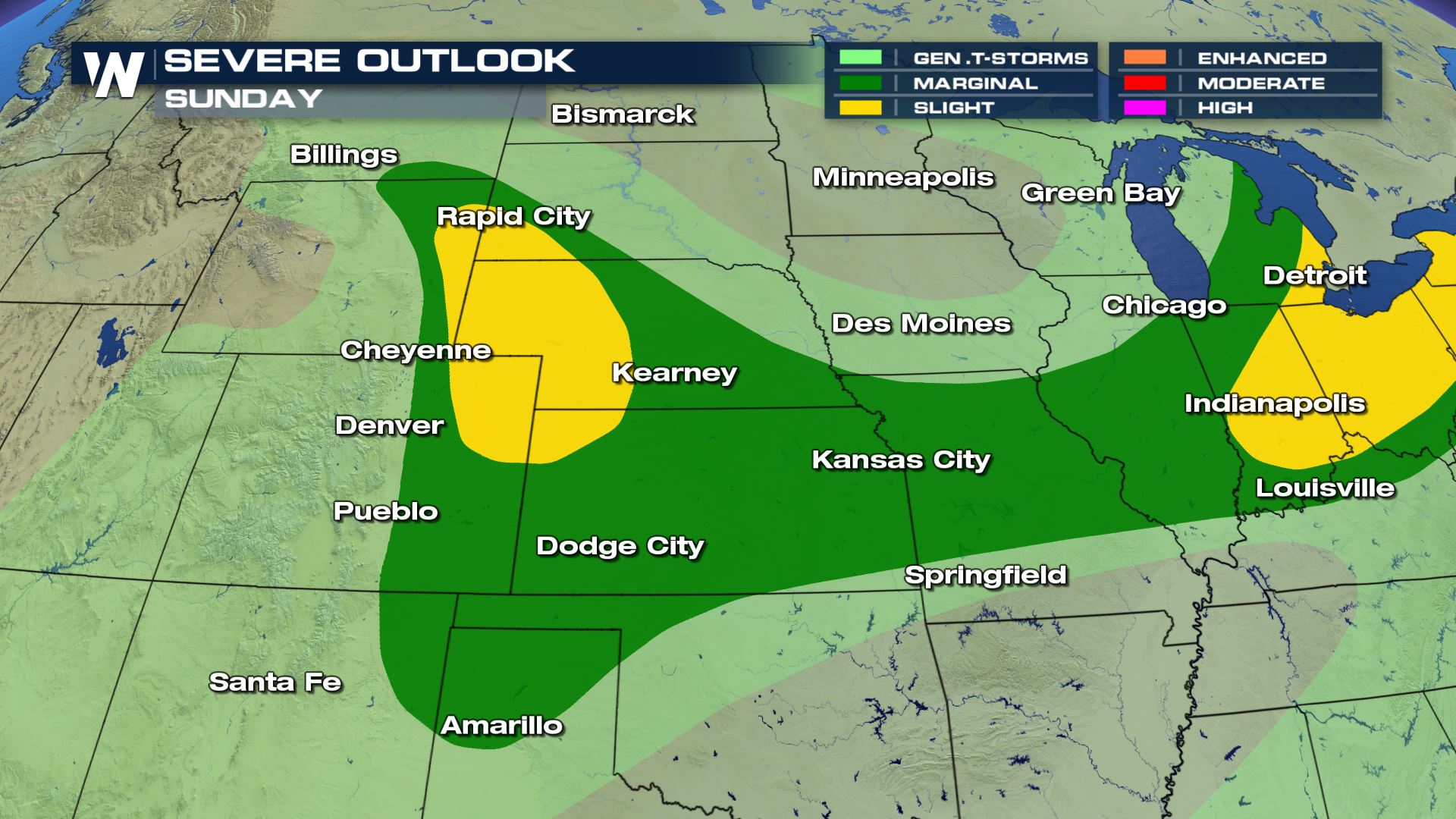
Here are some estimations of when and where the storms will be this weekend:
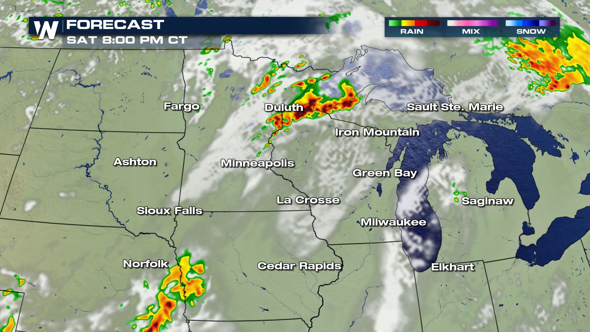
 Some of these thunderstorms will move through during the overnight hours Saturday into Sunday, so please be mindful of that and where you are in relation to the activity.
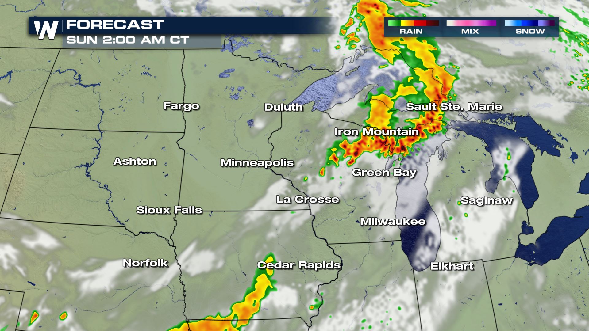
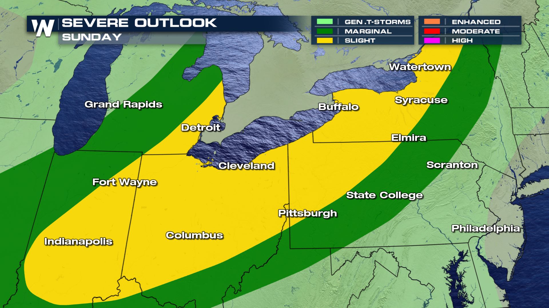
 On Sunday, the front will move southeast and spark more showers and thunderstorms.
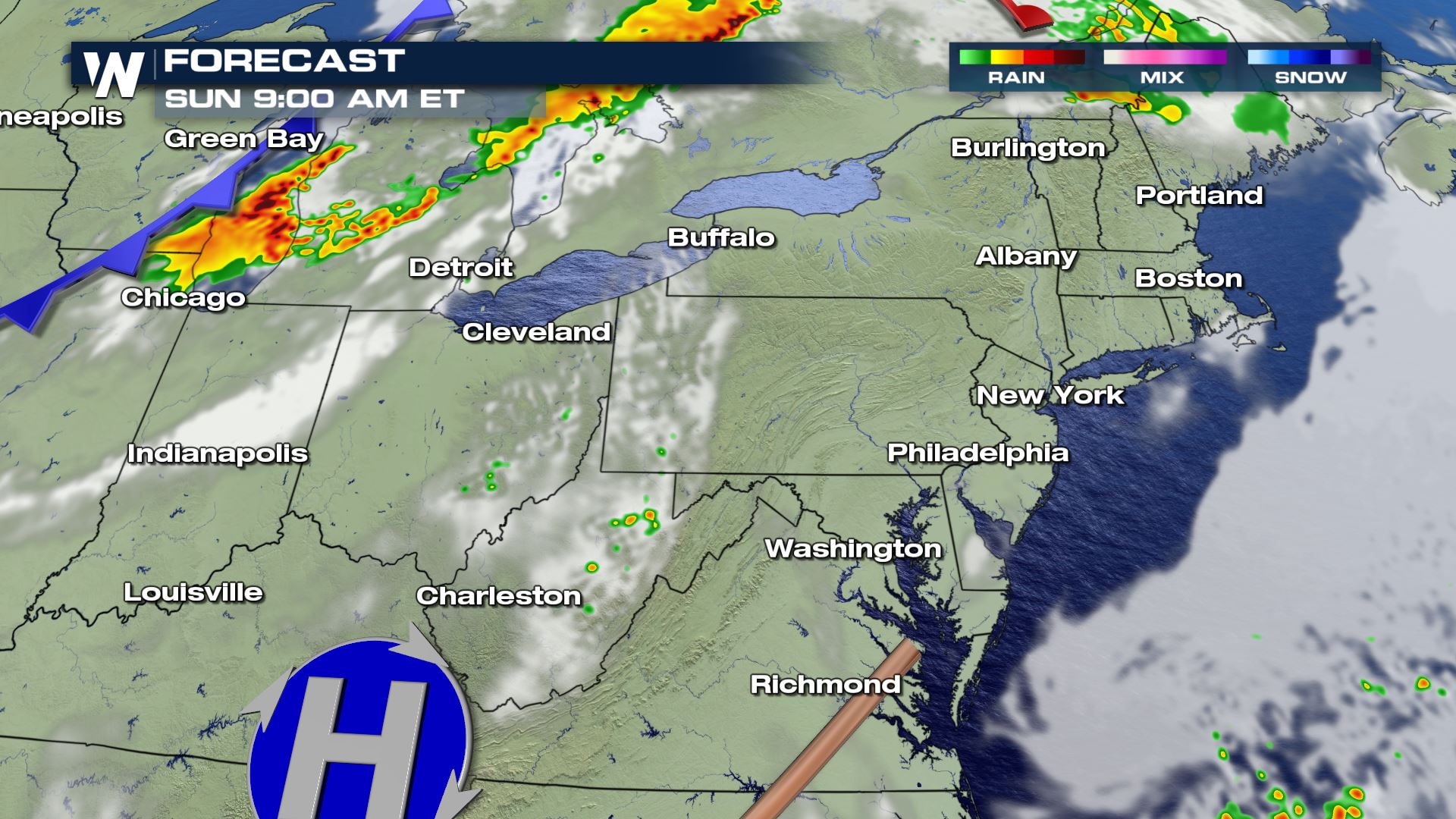
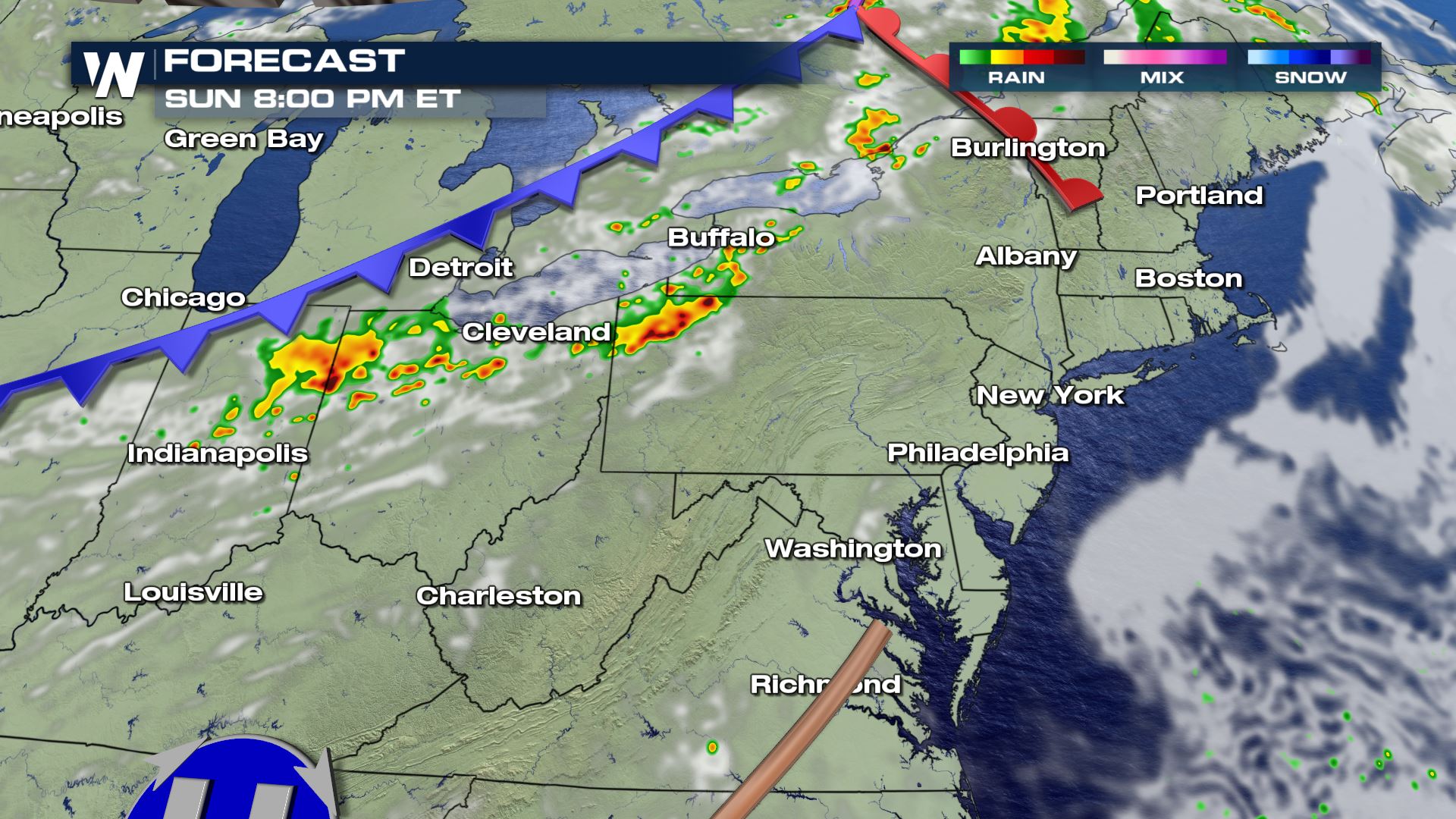
 Here are a couple of snapshots for Sunday's forecast regarding the approximate timing and location of these thunderstorms. Note: There may be a couple of rounds of storms, some left over from Saturday night and more developing later on Sunday evening.
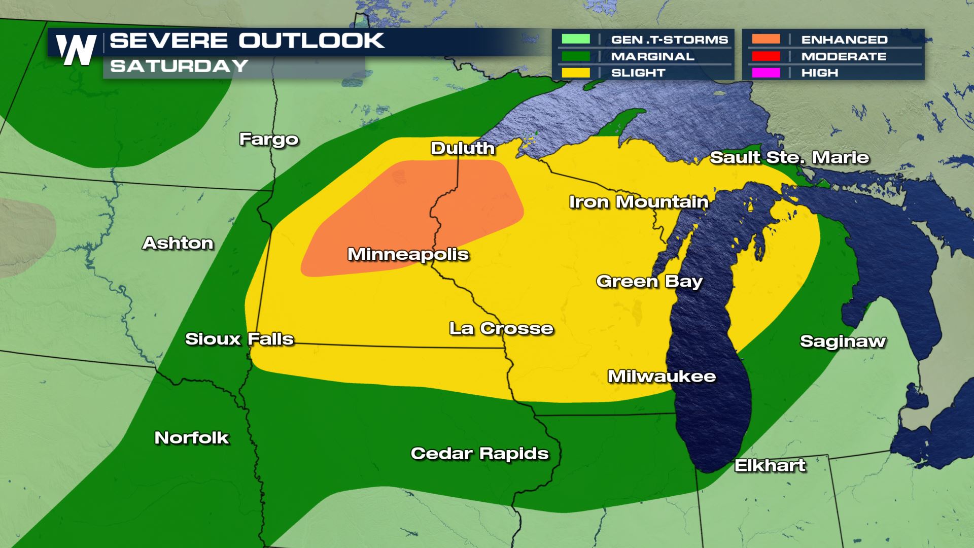
 The boundary, separating very hot and humid air from cooler/drier air, will help spark additional showers and thunderstorms on Sunday afternoon and Sunday night.
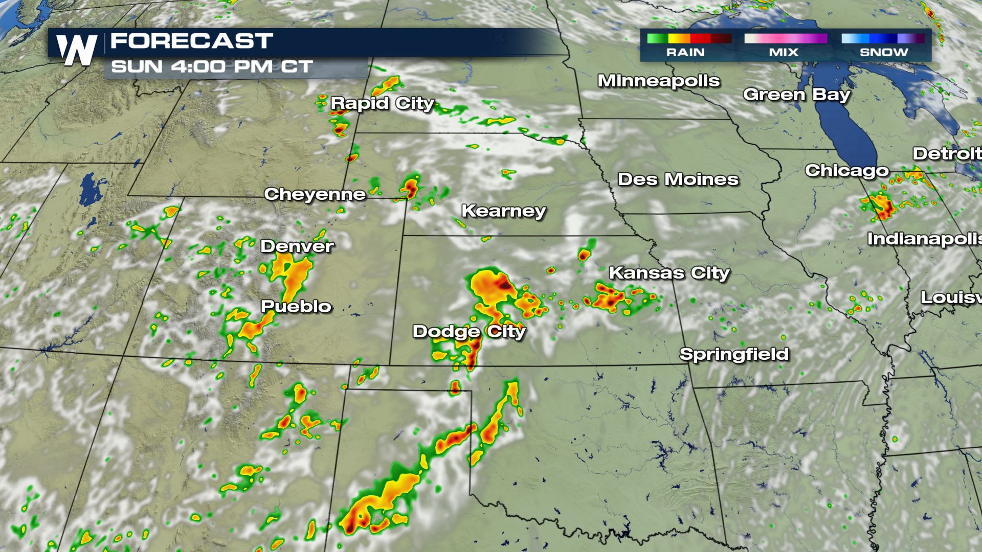
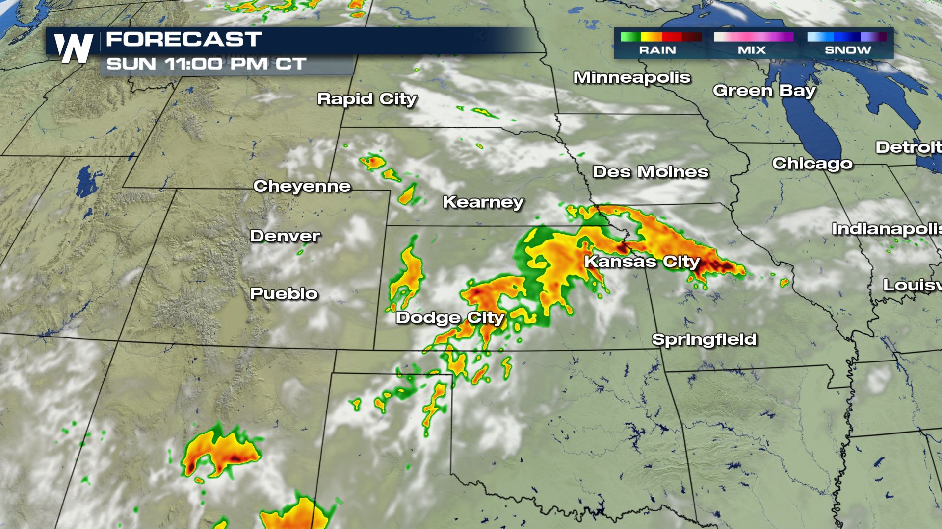 Since it will be so humid, these summer storms will be packed with heavy rainfall. Look for a quick one to three inches of rain, which may cause a few areas of flooding.
We hope this brief article gave you a clearer picture of what to expect this weekend. We will update you with our forecast as the weekend rolls along.
Since it will be so humid, these summer storms will be packed with heavy rainfall. Look for a quick one to three inches of rain, which may cause a few areas of flooding.
We hope this brief article gave you a clearer picture of what to expect this weekend. We will update you with our forecast as the weekend rolls along.
Some of these thunderstorms will move through during the overnight hours Saturday into Sunday, so please be mindful of that and where you are in relation to the activity.
On Sunday, the front will move southeast and spark more showers and thunderstorms.
Here are a couple of snapshots for Sunday's forecast regarding the approximate timing and location of these thunderstorms. Note: There may be a couple of rounds of storms, some left over from Saturday night and more developing later on Sunday evening.
The boundary, separating very hot and humid air from cooler/drier air, will help spark additional showers and thunderstorms on Sunday afternoon and Sunday night.
Since it will be so humid, these summer storms will be packed with heavy rainfall. Look for a quick one to three inches of rain, which may cause a few areas of flooding.
We hope this brief article gave you a clearer picture of what to expect this weekend. We will update you with our forecast as the weekend rolls along.All Weather News
More
Fronts Continue To Spark Severe Weather Across the Plains
A cold front that brought record lows to the
18 Jul 2025 10:40 PM

Extreme Heat Impacts for the East Coast & South
Extreme heat continues to impact several area
18 Jul 2025 10:05 PM

Flooding Threat Remains Elevated in the East
A cold front pushing through the Eastern Seab
18 Jul 2025 9:10 PM

EF-2 Firenado from the Deer Creek Fire in Utah
A fire tornado was spotted near La Sal, Utah
18 Jul 2025 7:30 AM

Tropical System Brings Flood Risk to the Central Gulf
Time has run out for notable tropical develop
18 Jul 2025 3:05 AM

Heavy Rain, Flooding Threat Returns to Florida
Keep the rain boots handy in Florida - heavy
13 Jul 2025 12:50 PM

Severe Storm Risk Pushes into the Great Lakes, Ohio Valley
Friday was another busy day with severe weath
12 Jul 2025 8:00 PM