Blizzard Warnings for Big Sky Country
Special Stories
27 Apr 2019 7:00 AM
Blizzard conditions will take shape across the High Plains and Big Sky country for portions of Montana and the Dakotas through the weekend.
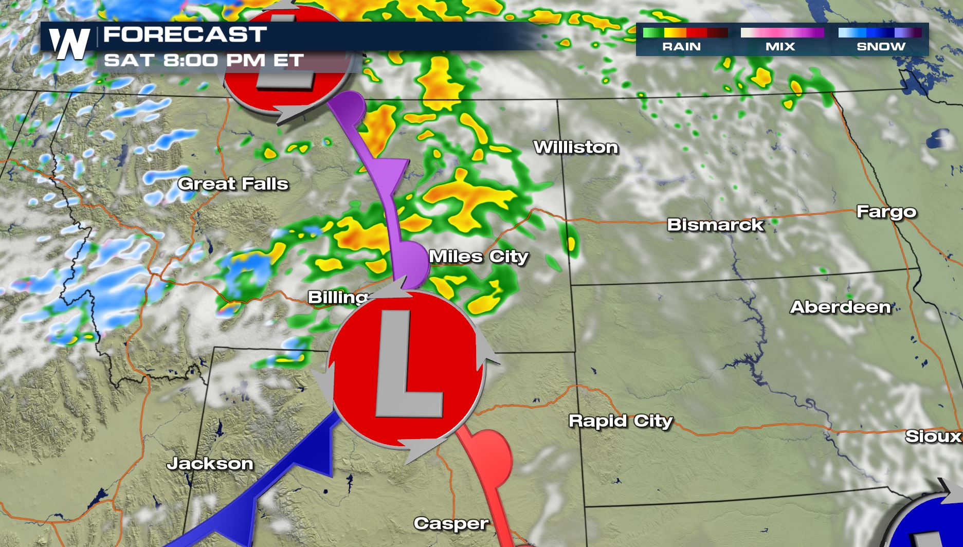
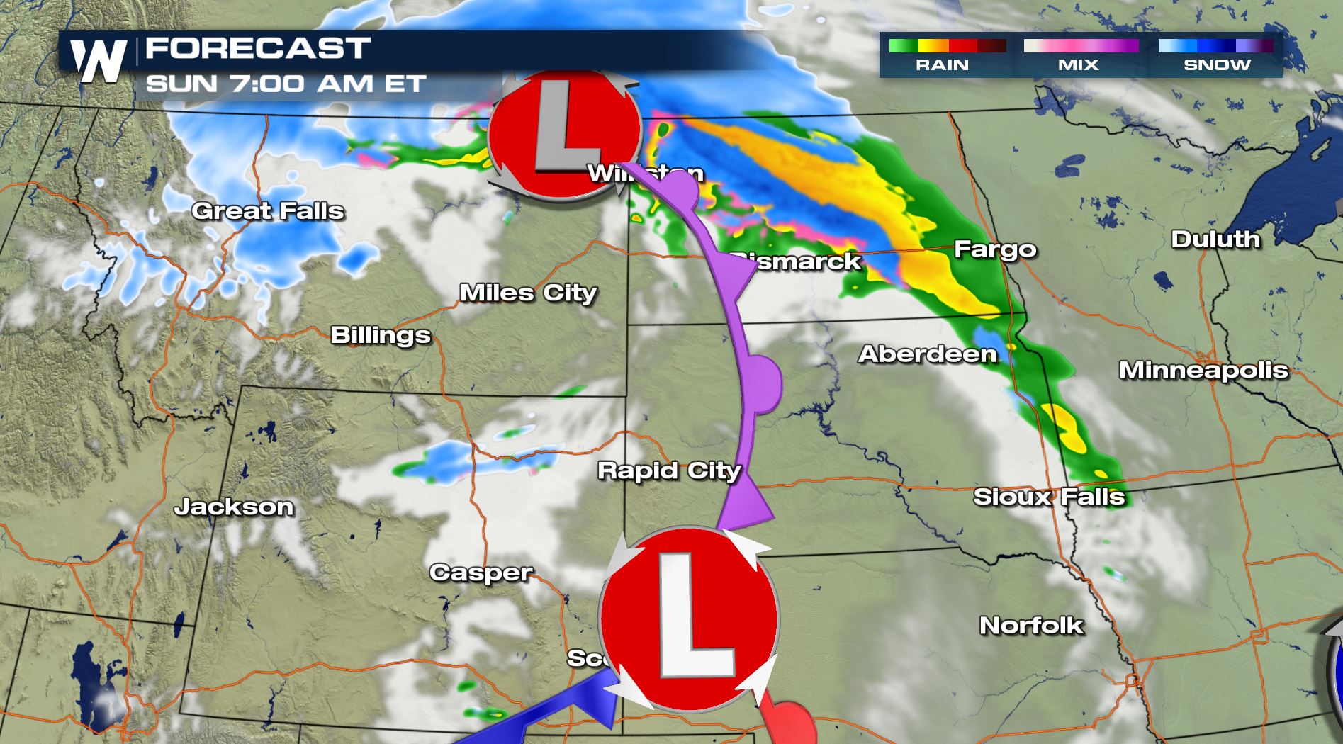
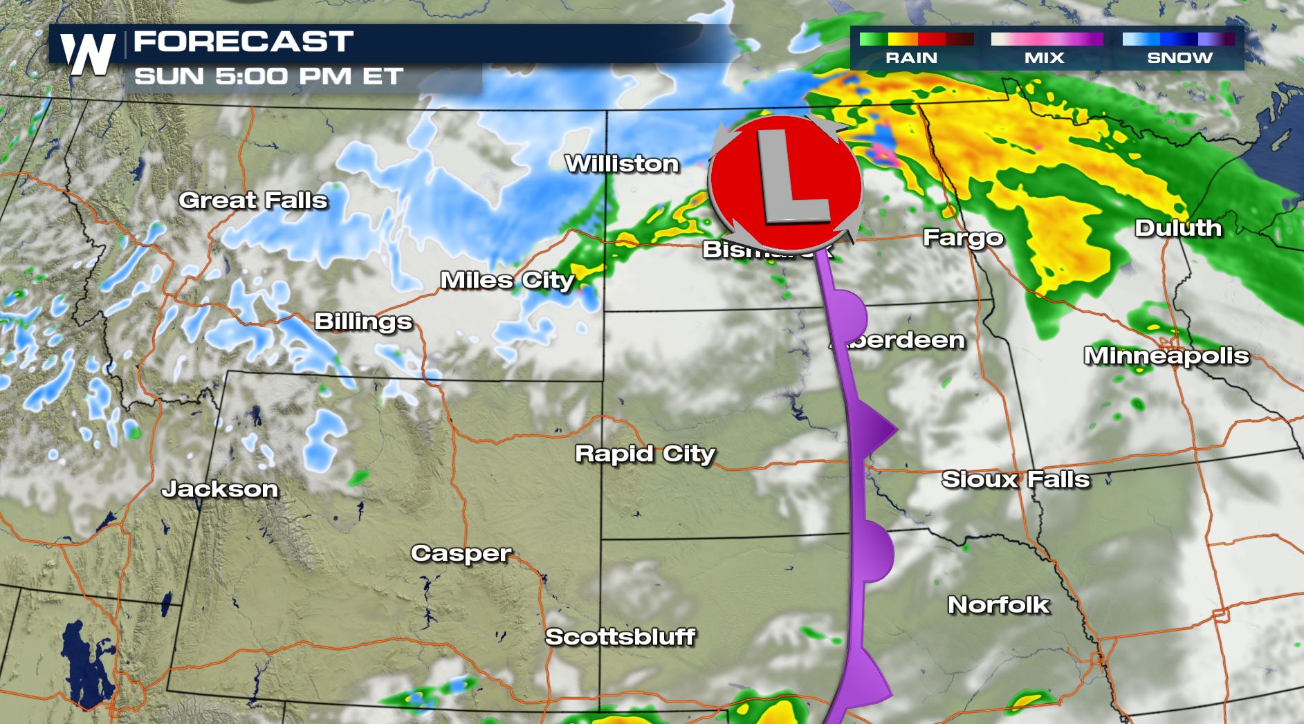
Low pressure dives down into Montana this weekend, with much cooler temperatures, snow, and blustery winds returning for the area. The timing likely begins Saturday, with accumulating snow later in the evening and Sunday. Unsettled weather will continue overnight and into Sunday as moisture fills into the region.
[Related article: What is a blizzard?]
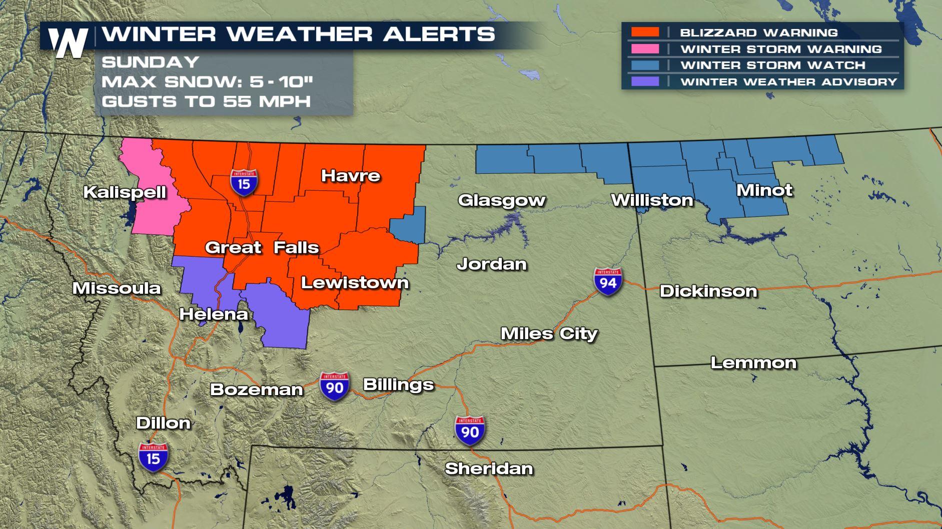
Blizzard warnings and winter storm warnings have been issued for parts of Montana -blizzard watches now span into North Dakota as well. Travel will become difficult Sunday into Monday.
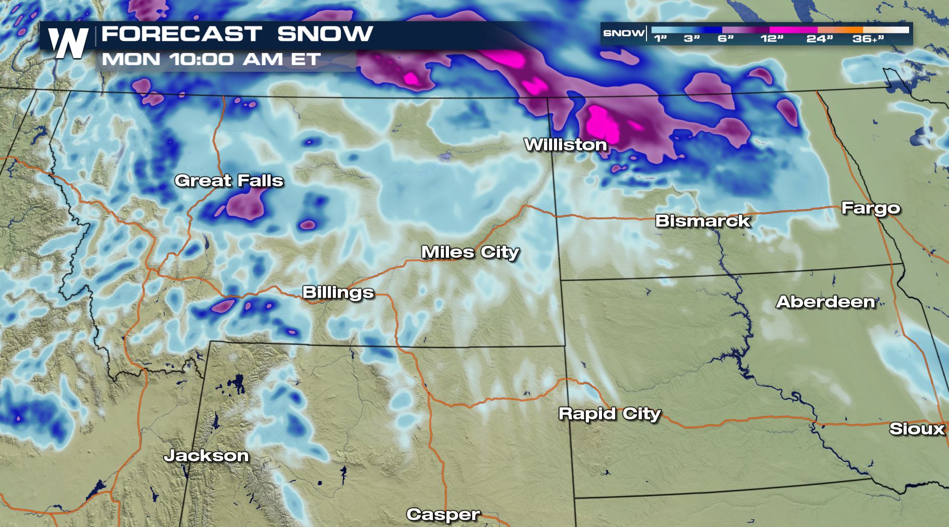 Snow amounts won't be overly impressive, anywhere from generally 2-5" in lower elevations, with as much as 10" over higher terrain. But, what will make conditions worse will be the addition of high and gusty winds.
Winds could gust as high as 45-60 mph at the height of the storm, which will greatly reduce visibility. This is the primary concern in the blizzard warning area.
The National Weather Service in Great Falls, MT tweeted out their main threat highlights through the storm
https://twitter.com/NWSGreatFalls/status/1122068505006891009
Snow amounts won't be overly impressive, anywhere from generally 2-5" in lower elevations, with as much as 10" over higher terrain. But, what will make conditions worse will be the addition of high and gusty winds.
Winds could gust as high as 45-60 mph at the height of the storm, which will greatly reduce visibility. This is the primary concern in the blizzard warning area.
The National Weather Service in Great Falls, MT tweeted out their main threat highlights through the storm
https://twitter.com/NWSGreatFalls/status/1122068505006891009
 Stay with WeatherNation as we track this Spring blast of snow and wind!
Snow amounts won't be overly impressive, anywhere from generally 2-5" in lower elevations, with as much as 10" over higher terrain. But, what will make conditions worse will be the addition of high and gusty winds.
Winds could gust as high as 45-60 mph at the height of the storm, which will greatly reduce visibility. This is the primary concern in the blizzard warning area.
The National Weather Service in Great Falls, MT tweeted out their main threat highlights through the storm
https://twitter.com/NWSGreatFalls/status/1122068505006891009
TIMING
Stay with WeatherNation as we track this Spring blast of snow and wind!All Weather News
More
Wildfire Outbreak in the Pacific Northwest
SPOKANE, WA - On Saturday, August 1st, the Ol
3 Aug 2026 1:55 AM

More Storms for the East Through Monday
A low-pressure system that moved through the
3 Aug 2026 1:50 AM


After Reaching Category 5, Genevieve Weakens in the Pacific
PacificGenevieve formed last Friday south of
3 Aug 2026 12:30 AM

Flooding, Severe Storms Target the Midwest Again
After an active week of storms across the nor
1 Aug 2026 1:40 AM

Flooding Risk Increases as Heavy Rain Targets the Tri-State Area
Tuesday, heavy rainfall moved across the Nort
30 Jul 2026 12:25 AM

Severe Weather: Energy From the Midwest Now in the Southeast
UPPER MIDWEST - Through Monday, dangerous tor
29 Jul 2026 10:30 PM